 Block
Nichols, Missouri
22 topographic sheets cover this place, the earliest surveyed in 1884 and the latest in 1996. It stands in Springfield Township. It lies in ZIP code area 65802. It stands on North Fork Nichols Branch. The Survey maps it on the Springfield quadrangle.
Topographic sheets covering this place
9 surveys from 22 printed sheetsMatched by testing this settlement's coordinate against the published boundary of every sheet in the United States Geological Survey's historical collection. Each opens the scanned sheet at the Survey.
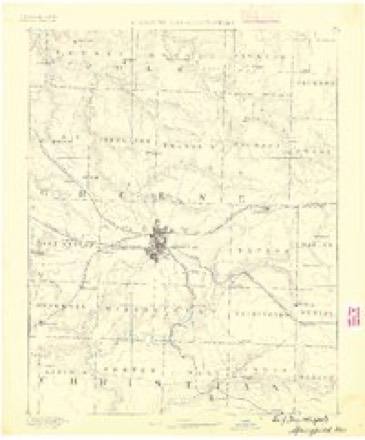
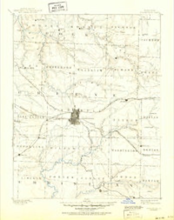
- 1884 USGS Springfield quadrangle1:125000
- 1886 USGS Springfield quadrangle1:125000, 5 printings
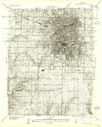
- 1935 USGS Springfield quadrangle1:24000, 2 printings
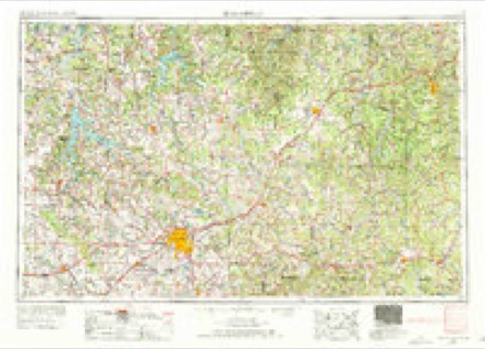
- 1954 USGS Springfield quadrangle1:250000, 6 printings
- 1958 USGS Springfield quadrangle1:250000
- 1959 USGS Springfield quadrangle1:250000
- 1960 USGS Springfield quadrangle1:24000, 4 printings
- 1982 USGS Springfield quadrangle1:100000
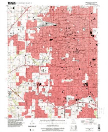
- 1996 USGS Springfield quadrangle1:24000
In the county-history sources
41,758 words on this townshipPersonal Reminiscences and Fragments of the Early History of Springfield and Greene County, Missouri : Related by Pioneers and Their Descendants at Old Settlers' Dinners Given at the Home of Capt. Martin J. Hubble, March 31, 1907, 1908, 1909, 1910, 1911, published 1914; Greene County, Missouri : 1916, published 1916 has no passage naming this settlement, which was common for smaller places. Its township is covered in full.
The chapter on Springfield Township covers the township.
Read the chapter on Springfield Township - 41,758 words.
Fires near this place
15 since 1997Regional context, not property-specific evidence. The federal wildfire occurrence database lists 15 fires within 5 miles of Nichols between 1997 and 2020, burning about 196 acres in total. None started naturally. 1 was recorded as arson. Distance is straight-line from the map coordinates, so a fire counted here may appear on a neighbouring settlement's page as well.
| Reported cause | Fires |
|---|---|
| Debris and open burning | 6 |
| Missing data/not specified/undetermined | 4 |
| Equipment and vehicle use | 2 |
| Smoking | 2 |
| Arson/incendiarism | 1 |
The most recent of them, most recent first, with the day each was reported and the service that recorded it.
| Date | Cause | Size | Reported by | Name on the report |
|---|---|---|---|---|
| 9 September 2011 | Missing data/not specified/undetermined | 1.0 acres | Missouri Department of Conservation | not named |
| 4 September 2011 | Missing data/not specified/undetermined | 1.0 acres | Missouri Department of Conservation | not named |
| 10 September 2011 | Debris and open burning | 5.0 acres | Missouri Department of Conservation | not named |
| 31 August 1997 | Debris and open burning | 1.0 acres | Missouri Department of Conservation | not named |
| 31 July 1997 | Smoking | 1.0 acres | Missouri Department of Conservation | not named |
| 21 July 2011 | Equipment and vehicle use | 1.0 acres | Missouri Department of Conservation | not named |
| 20 July 2011 | Equipment and vehicle use | 1.0 acres | Missouri Department of Conservation | not named |
| 16 July 2011 | Debris and open burning | 1.0 acres | Missouri Department of Conservation | not named |
Settlements close enough to share some of these fires:
Mines and quarries near this place
10 of 15 shownRegional context, not property-specific evidence. The federal mineral resources record lists 15 workings within 5 miles of Nichols: 15 past producers. None of them still produces. What was taken out: Stone, Crushed/Broken. Distance is straight-line from the map coordinates, so a quarry counted here may appear on a neighbouring settlement's page as well.
| Where | Site | Commodity | Status | Recorded |
|---|---|---|---|---|
| Brown Quarry | Stone, Crushed/Broken | Past Producer | ||
| Denton Quarry | Stone, Crushed/Broken | Past Producer | ||
| Doling Park Quarry | Stone, Crushed/Broken | Past Producer | ||
| Marblehead Quarry | Stone, Crushed/Broken | Past Producer | ||
| Tindell Quarry | Stone, Crushed/Broken | Past Producer | ||
| Unknown | Stone, Crushed/Broken | Past Producer | ||
| Unknown | Stone, Crushed/Broken | Past Producer | ||
| Unknown | Stone, Crushed/Broken | Past Producer | ||
| Unknown | Stone, Crushed/Broken | Past Producer | ||
| Unknown | Stone, Crushed/Broken | Past Producer |
Storms near this place
60 of 71 shownRegional context, not property-specific evidence. The National Weather Service names Nichols in 71 storm reports between 2008 and 2025: 27 thunderstorm wind, 20 flash flood, 12 hail, 9 flood. No death or injury is recorded in these reports. Each account below is quoted exactly as the forecast office filed it, from the NOAA Storm Events Database, and each date opens the federal record of that event.
| When | Event | Place named | Harm | What the report says |
|---|---|---|---|---|
| July 2023 | Thunderstorm Wind | Nichols | $2,500,000 | Numerous trees and power lines were downed by high winds across the Springfield Metro. At lease 40 homes had trees on the roof causing shingle, gutter, vent, soffit and siding damage. Weather heads were pulled out or damaged on several homes. several fences were damages or destroyed by falling limbs and trees. At lease a dozen outbuilding were damages with one a total loss. In excess of a dozen vehicles were damaged by falling limbs and trees. As many 4 light poles were bent or down along with many power poles and lines. Around 15,500 homes were without power. |
| July 2023 | Thunderstorm Wind | Nichols | $250,000 | Multiple large trees, some at least 2 feet in diameter, were uprooted and laying across city streets. One uprooted tree damaged decking around a home, and other split and fell on a home causing minor roof and gutter damage. Numerous large limbs were down across the city from west to east, some falling on and damaging fences. One large limb fell on a pickup truck causing minor damage. Some power lines were downed by trees and limbs causing power outages as transformer blew. |
| June 2025 | Thunderstorm Wind | Nichols | $30,000 | Numerous large tree branches and powerlines were down in western Springfield. |
| December 2018 | Thunderstorm Wind | Nichols | $15,000 | Several power poles were reported down across US 160 south of Sunshine Street. |
| December 2018 | Thunderstorm Wind | Nichols | $12,000 | The 911 Center reported that several power poles were down across West Bypass south of Sunshine Street, blocking portions of West Bypass. |
| December 2018 | Thunderstorm Wind | Nichols | $12,000 | Shingle damage occurred to a roof and a section of fence was blown down near the 1500 block of South Quail Avenue. |
| July 2015 | Flash Flood | Nichols | $10,000 | Two water rescues occurred at Chestnut Expressway near Hazeltine Road underneath a railroad overpass. Water was up to 5 feet deep and up to the cars roof top. The road was impassable. |
| August 2012 | Thunderstorm Wind | Nichols | $5,000 | Several trees and large branches were knocked down across the city. |
| May 2020 | Flash Flood | Nichols | $2,000 | Thunderstorms produced heavy rainfall between 2 and 4 inches occurred across Greene County. West of Springfield, several feet of water was reported over Farm Road 146 at Wilsons Creek and at the Haseltine Branch near Farm Roads 140 and 115 closing the roads to traffic. On Chestnut Expressway near Haseltine Road, 2 vehicles were stalled in 2.5 feet of water. |
| March 2017 | Thunderstorm Wind | Nichols | $2,000 | A piece of roofing and siding were blown off at an apartment complex off West Bypass and Kearney Ave. A picture of this damage was on social media. |
| March 2017 | Thunderstorm Wind | Nichols | $2,000 | A large tree and power lines were blown down near Colgate and Division Street in Springfield. |
| July 2013 | Thunderstorm Wind | Nichols | $1,000 | A portion of a tree was blown down near the intersection of Tarkio and Dove Valley Roads. A picture via social media showed a trampoline destroyed by the gusty winds as well. |
| August 2012 | Thunderstorm Wind | Nichols | $1,000 | A large tree was blown down at a public golf course off Chestnutt Expressway. |
| May 2025 | Thunderstorm Wind | Nichols | $500 | Report of numerous tree limbs down. |
| April 2025 | Thunderstorm Wind | Nichols | - | The ASOS at the Springfield-Branson National airport measured a 64 mph wind gust. |
| April 2025 | Thunderstorm Wind | Nichols | - | Several large tree limbs were reported down. |
| April 2025 | Thunderstorm Wind | Nichols | - | The ASOS at the Springfield-Branson National Airport measured a 59 mph wind gust. |
| April 2025 | Flash Flood | Nichols | - | Wilsons and South Creeks reached flood stages in Southwest Springfield flooding several roads and low grounds. |
| April 2025 | Thunderstorm Wind | Nichols | - | Multiple trees were reported down. |
| June 2024 | Flash Flood | Nichols | - | Farm Road 146 had water over the roadway due to heavy rainfall. |
| July 2024 | Flash Flood | Nichols | - | Approximately a foot of water was over the road at Farm Road 146 and Farm Road 123. |
| April 2023 | Hail | Nichols | - | Quarter sized hail was reported via MPing. |
| April 2023 | Hail | Nichols | - | Quarter sized hail was reported via MPing. |
| April 2023 | Thunderstorm Wind | Nichols | - | The KSGF Springfield ASOS reported a wind gust of 62 mph. |
| April 2023 | Hail | Nichols | - | Quarter sized hail was reported via MPing. |
| April 2023 | Hail | Nichols | - | Quarter sized hail was reported via MPing. |
| May 2023 | Thunderstorm Wind | Nichols | - | Several large trees and large limbs were reported down across town. |
| August 2023 | Flash Flood | Nichols | - | Farm Roads 146 and 123 were flooded and impassable at Wilsons Creek. |
| May 2022 | Flood | Nichols | - | Farm Roads 146 and 123 at Wilson's Creek was flooded and impassable. |
| May 2022 | Thunderstorm Wind | Nichols | - | A large tree was reported down. |
| August 2022 | Flash Flood | Nichols | - | Wilsons Creek was reported out of its banks and flooding Farm Road 146 near Rutledge Wilson Farm. Additional heavy rainfall fell on the headwaters of the Jordan and Fassnight Creek basins. |
| March 2021 | Flood | Nichols | - | The low water crossing along Farm Roads 123 and 146 at Wilsons Creek was closed due to flooding. |
| December 2021 | Thunderstorm Wind | Nichols | - | The ASOS at the Springfield-Branson National Airport KSGF reported a peak wind gust of 61 mph. |
| January 2020 | Hail | Nichols | - | Quarter sized hail was reported by the Public. |
| January 2020 | Hail | Nichols | - | Quarter sized hail was reported via MPing. |
| May 2020 | Flash Flood | Nichols | - | Wilsons Creek at Farm Road 146 near Rutledge Park had at least six inches of water over the roadway. |
| October 2019 | Heavy Rain | Nichols | - | The ASOS station at KSGF Springfield recorded a 24 hour rainfall total of 2.88 inches. |
| October 2019 | Heavy Rain | Nichols | - | The Mesonet station EW8935 at Springfield reported 2.00 inches of rainfall. |
| May 2019 | Flash Flood | Nichols | - | Water was reported over the road on Hazeltine Road. |
| September 2018 | Heavy Rain | Nichols | - | The Mesonet station CHNM7, reported a 24 rain total of 2.68 inches. |
| April 2017 | Flash Flood | Nichols | - | The intersection of Farm Road 146 and Farm Road 123 near Wilson Creek was impassable. |
| September 2016 | Flash Flood | Nichols | - | Wilson's Creek flooded over the road at Farm Roads 146 and 123. |
| October 2016 | Flood | Nichols | - | The low water crossing at the intersection of Farm Road 123 and 146 near Rutledge-Wilson Farm Community Park was flooded and impassable. |
| March 2015 | Hail | Nichols | - | Half dollar sized hail fell at the NWS office. |
| April 2015 | Thunderstorm Wind | Nichols | - | A tree with a 3 foot diameter was blown down. |
| April 2015 | Thunderstorm Wind | Nichols | - | Several small trees were blown down and reported on Facebook. |
| July 2015 | Flash Flood | Nichols | - | Farm Road 140 at Miller Road on the west side of Springfield was flooded and impassable. |
| July 2015 | Flash Flood | Nichols | - | Water was over the road along Highway EE at the White Chapel Cemetery. |
| July 2015 | Flash Flood | Nichols | - | Farm Road 140 at Miller Road west of Springfield was flooded. |
| July 2015 | Flash Flood | Nichols | - | Water was over the road along Highway EE at the White Chapel Cemetery. |
| November 2015 | Flood | Nichols | - | Water was reported over the roadway and bridge at Farm Road 156. The intersection of Farm Road 146 and Farm Road 123 was flooded and impassable. |
| May 2013 | Flash Flood | Nichols | - | Wilson Creek flooded the intersection of Farm Road 146 and Farm Road 123. |
| July 2013 | Flash Flood | Nichols | - | Water was over Farm Road 146 at Wilsons Creek just west of Rutledge Wilson Farm. |
| October 2012 | Thunderstorm Wind | Nichols | - | A trailer was blown over on its side at the FED EX facility on the southeast side of the airport. |
| October 2012 | Thunderstorm Wind | Nichols | - | Off duty NWS Employee estimated that wind gusts were up to 65 on the west side of Springfield. |
| October 2012 | Thunderstorm Wind | Nichols | - | Large tree limbs were blown down on Page Street. |
| October 2012 | Flash Flood | Nichols | - | An off duty meteorologist with KSPR relayed to the NWS that the intersection of Farm Roads 146 and 123 near Wilson Farm was flooded and impassable. It was estimated that the water was 3 to 4 feet over the roadway. |
| August 2012 | Thunderstorm Wind | Nichols | - | A storm spotter estimated wind gusts up to 70 mph on the northwest side of town near I-44 and Kearney Street. |
| September 2012 | Flood | Nichols | - | The low water crossing at County Road 123 on Wilson Creek was flooded. |
| September 2012 | Flood | Nichols | - | The low water crossing at County Road 146 on Wilson Creek was flooded. |
Nearest settlements
The eight closest, with where each one stands in the county. Distances are straight-line, computed from the Geographic Names Information System coordinates.
| Map | Place | Distance | Sheets |
|---|---|---|---|
| Haseltine | 1.4 miles | 21 | |
| Ritter | 3.4 miles | 21 | |
| Springfield | 3.4 miles | 22 | |
| Elwood | 3.7 miles | 21 | |
| Mascot | 4.6 miles | 20 | |
| Brookline | 4.9 miles | 21 | |
| Roseville | 6.1 miles | 20 | |
| Battlefield | 6.1 miles | 22 |
Provenance
This settlement is recorded in the Geographic Names Information System as feature 735748. The sheet list is computed by point-in-boundary test against the United States Geological Survey's historical topographic inventory. Both are works of the United States government and carry no copyright under 17 U.S.C. 105.
Wildfire. Short, Karen C. 2022. Spatial wildfire occurrence data for the United States, 1992-2020 [FPA_FOD_20221014]. 6th Edition. Fort Collins, CO: Forest Service Research Data Archive. https://doi.org/10.2737/RDS-2013-0009.6 Collected with United States Government funding and usable without additional permissions or fees.
Mines and quarries. USGS Mineral Resources Data System (MRDS) https://mrdata.usgs.gov/mrds/ A work of the United States government, no copyright under 17 U.S.C. 105.
Storms. NOAA National Centers for Environmental Information, Storm Events Database https://www.ncei.noaa.gov/stormevents/ A work of the United States government, no copyright under 17 U.S.C. 105. Narratives are quoted verbatim from the National Weather Service report and are not edited or summarised.