 Block
Battlefield, Missouri
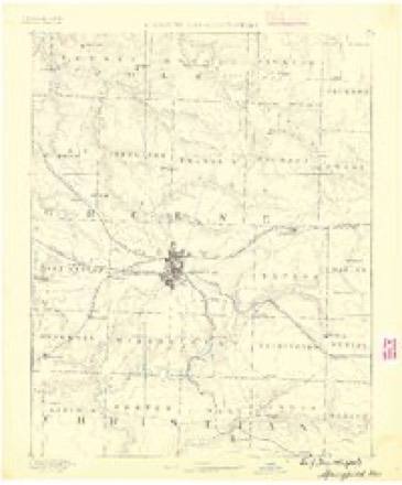
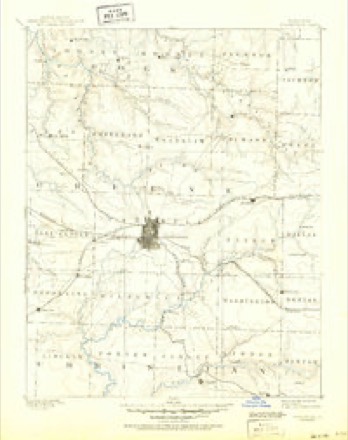
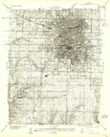
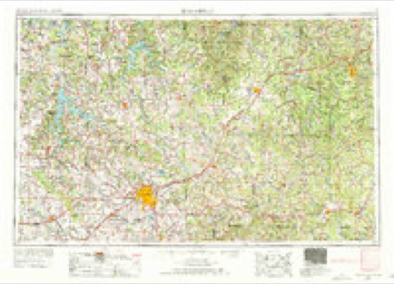
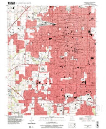
22 topographic sheets cover this place, the earliest surveyed in 1884 and the latest in 1996. It stands in Battlefield A Township. It lies in ZIP code area 65619. It stands on Rountree Branch. The Survey maps it on the Springfield quadrangle.
Topographic sheets covering this place
9 surveys from 22 printed sheetsMatched by testing this settlement's coordinate against the published boundary of every sheet in the United States Geological Survey's historical collection. Each opens the scanned sheet at the Survey.
- 1884 USGS Springfield quadrangle1:125000
- 1886 USGS Springfield quadrangle1:125000, 5 printings
- 1935 USGS Springfield quadrangle1:24000, 2 printings
- 1954 USGS Springfield quadrangle1:250000, 6 printings
- 1958 USGS Springfield quadrangle1:250000
- 1959 USGS Springfield quadrangle1:250000
- 1960 USGS Springfield quadrangle1:24000, 4 printings
- 1982 USGS Springfield quadrangle1:100000
- 1996 USGS Springfield quadrangle1:24000
Fires near this place
12 since 1992Regional context, not property-specific evidence. The federal wildfire occurrence database lists 12 fires within 5 miles of Battlefield between 1992 and 2011, burning about 45 acres in total. None started naturally. 4 were recorded as arson. Distance is straight-line from the map coordinates, so a fire counted here may appear on a neighbouring settlement's page as well.
| Reported cause | Fires |
|---|---|
| Debris and open burning | 4 |
| Arson/incendiarism | 4 |
| Missing data/not specified/undetermined | 2 |
| Equipment and vehicle use | 1 |
| Smoking | 1 |
The most recent of them, most recent first, with the day each was reported and the service that recorded it.
| Date | Cause | Size | Reported by | Name on the report |
|---|---|---|---|---|
| 3 September 2011 | Debris and open burning | 2.0 acres | Missouri Department of Conservation | not named |
| 7 July 2005 | Missing data/not specified/undetermined | under an acre | Wilson's Creek National Battlefield | WELDON 05 |
| 27 July 2011 | Equipment and vehicle use | 30 acres | Wilson's Creek National Battlefield | DRAGGER |
| 9 April 2000 | Arson/incendiarism | under an acre | Wilson's Creek National Battlefield | ROAD 182 |
| 14 March 1996 | Arson/incendiarism | 1.1 acres | Wilson's Creek National Battlefield | BEETLE |
| 1 March 1994 | Arson/incendiarism | 2.0 acres | Missouri Department of Conservation | not named |
| 26 February 2006 | Debris and open burning | 1.5 acres | Wilson's Creek National Battlefield | LOGAN 06 |
| 2 February 1992 | Smoking | 2.0 acres | Missouri Department of Conservation | not named |
Settlements close enough to share some of these fires:
Mines and quarries near this place
6 within 5 milesRegional context, not property-specific evidence. The federal mineral resources record lists 6 workings within 5 miles of Battlefield: 6 past producers. None of them still produces. What was taken out: Stone, Crushed/Broken, Iron. Distance is straight-line from the map coordinates, so a quarry counted here may appear on a neighbouring settlement's page as well.
| Where | Site | Commodity | Status | Recorded |
|---|---|---|---|---|
| Studley Mine - Pit 1 | Iron | Past Producer | ||
| Unknown | Iron | Past Producer | ||
| Brown Quarry | Stone, Crushed/Broken | Past Producer | ||
| Unknown | Stone, Crushed/Broken | Past Producer | ||
| Unknown | Stone, Crushed/Broken | Past Producer | ||
| Unknown | Stone, Crushed/Broken | Past Producer |
Storms near this place
60 of 113 shownRegional context, not property-specific evidence. The National Weather Service names Battlefield in 113 storm reports between 1995 and 2026: 52 thunderstorm wind, 26 hail, 15 heavy rain, 9 flash flood. The reports record 2 deaths and 17 injuries. Each account below is quoted exactly as the forecast office filed it, from the NOAA Storm Events Database, and each date opens the federal record of that event.
| When | Event | Place named | Harm | What the report says |
|---|---|---|---|---|
| May 2003 | Tornado (F3) | Battlefield | 1 killed, 12 hurt, $14,700,000 | no account filed |
| June 2025 | Thunderstorm Wind | Battlefield | 1 killed, $15,000 | A large tree was blown over due to high winds and landed on top of a vehicle in Battlefield. There was one fatality in the vehicle. |
| March 2006 | Tornado (F2) | Battlefield | 4 hurt, $650,000 | This tornado is a continuation of the Christian and Lawrence County tornado. The tornado tracked across extreme southern Springfield causing damage to approximately 27 homes. None of the homes or structures were completely destroyed. The tornado quickly became weaker and only produced intermittent tree damage from Highway 65 over to the Webster County line. |
| June 2025 | Thunderstorm Wind | Battlefield | 1 hurt, $30,000 | A fireworks tent was blown over in Battlefield. One person was treated for minor injuries. |
| December 2015 | Flash Flood | Battlefield | $5,000,000 | Farm Road 174 and Oakwood Street to Farm Road 174 and Route ZZ was impassable due to high water. Nearly all low water crossings were under water and impassable. Approximately 630 homes and 16 business sustained water damage. Numerous roads, bridges, and culverts across the county sustained damage from the water. There were at least 120 water rescues across the county. There was an estimate of up to 500 problem spots on local roads will need repairs. A local car dealership in Republic was flooded by high water with numerous cars affected. This storm report will contain the damage estimates for the entire county during this event. |
| May 2020 | Hail | Battlefield | $2,000,000 | A severe thunderstorm producing hail from nickle size to as large as 2.25 inches moved across southern Greene County which included the towns of Battlefield, Southern portions of Springfield, Galloway and areas west of Rogersville. Numerous homes and vehichles suffered minor to moderate damage from the swath of hail. Several car dealerships were impacted as the storm moved across south Springfield. |
| February 2009 | Tornado (EF1) | Battlefield | $350,000 | A National Weather Service storm survey revealed that an EF-1 tornado intermittently caused damage to around one dozen homes and businesses across south and central Springfield. This tornado initially touched down near the intersection of Scenic and Republic Road, and ended near St. Johns Hospital. |
| April 2016 | Thunderstorm Wind | Battlefield | $200,000 | There was minor to moderate roof damage to multiple homes off of Shawnee Drive and Village Terrace Drive. |
| April 2016 | Tornado (EF0) | Battlefield | $100,000 | A NWS storm survey revealed that an EF-0 tornado damaged a few homes on the southwest side of Springfield in the town of Battlefield. There was damage to roofs, gutters, and awnings. The tornado was a brief touchdown. |
| June 2015 | Flood | Battlefield | $100,000 | The Rivercut Golf Course was closed for several days due to severe flooding of the course and buildings. Several buildings associated with the golf course were flooded. The Connie Morris Golf Learning Center sustained water damage with the floors, baseboards, and lower walls. The maintenance building had about two feet of water. There was complete destruction of a bridge at the course's sixth hole. The golf course had damage and river debris to some of the fairways and greens. |
| July 2018 | Thunderstorm Wind | Battlefield | $35,000 | A report of a large 2 foot diameter tree that fell and landed on a home was received via amateur radio. No injuries occurred but significant damage to the home occurred. The time was based on radar. |
| July 1995 | Thunderstorm Wind | Battlefield | $25,000 | no account filed |
| October 2019 | Thunderstorm Wind | Battlefield | $20,000 | Building and tree damage was reported on Farm Road 115 south of Battlefield. |
| June 2005 | Thunderstorm Wind | Battlefield | $20,000 | Squall line thunderstorms produced 70 knot straight line winds over Battlefield. An off duty National Weather Service Meteorologist measured this gust from his anemometer. Several homes across the area received minor structural damage. |
| October 2019 | Tornado (EF0) | Battlefield | $18,000 | This is the continuation of the EF-0 tornado that initially touched down in Christian County. The tornado continued briefly to the east after crossing into Green County along West Blue Springs Road and caused damage to a home along Highway FF. The home sustained damage to the roof, gutters, and vinyl siding. The tornado lifted shortly thereafter. After crossing into Greene County the tornado was on the ground for half a mile and about 1 minute. The tornado was on the ground for a total length of 4.75 miles, 7 minutes, and maximum wind of 85 miles per hour. |
| August 2018 | Thunderstorm Wind | Battlefield | $15,000 | A 36 inch diameter tree fell through the roof of a home on West Farm Road 182 causing moderate damage. |
| June 2025 | Thunderstorm Wind | Battlefield | $10,000 | Two power poles snapped, and partially leaning into the road near Brookline. |
| April 2016 | Thunderstorm Wind | Battlefield | $10,000 | There was shingles blown off about a dozen homes. One home had some decking peeled off. |
| June 2015 | Flood | Battlefield | $10,000 | Two men were rescued from high water of the James River near Twin Bridges Road and Farm Road 143. They were trying to rescue farm animals. They lost 4 horses and 6 cows in the flood waters. |
| January 2008 | Thunderstorm Wind | Battlefield | $10,000 | High winds associated with a rear flank downdraft downed power lines across Blue Springs Road. Minor siding and roof damage was also reported to homes just north of the city hall. |
| July 2018 | Thunderstorm Wind | Battlefield | $8,000 | A large tree branch was reported through the roof of house near Plainview road and Farm Road 137. The report was received via social media. |
| June 2025 | Thunderstorm Wind | Battlefield | $5,000 | Large tree limbs down and two uprooted trees on pickup and garage. |
| July 2014 | Thunderstorm Wind | Battlefield | $5,000 | Several large trees and large branches were broken and blown down along Plainview Road in south Springfield. |
| August 2006 | Thunderstorm Wind | Battlefield | $5,000 | Severe thunderstorm wind gusts downed several power lines near the community of Battlefield. |
| June 2018 | Thunderstorm Wind | Battlefield | $4,000 | A large maple tree fell onto a house damaging the roof and side. Some hickory trees had the tops broken off along in the same area. |
| November 1998 | Thunderstorm Wind | Battlefield | $4,000 | no account filed |
| June 2025 | Thunderstorm Wind | Battlefield | $3,000 | A tree was blocking part of Sunrise street in a couple of locations, traffic lights out in several locations along Kansas Expressway. Power lines down on Scenic, across road. |
| June 2025 | Thunderstorm Wind | Battlefield | $2,000 | A large tree was down blocking both lanes of West Battlefield. |
| July 2018 | Thunderstorm Wind | Battlefield | $2,000 | Multiple shingles were blown off a house in Village Terrace. |
| July 2014 | Thunderstorm Wind | Battlefield | $2,000 | A large tree was across Weaver Road and power lines were blown down. |
| June 2025 | Thunderstorm Wind | Battlefield | $1,000 | A 24 inch tree down near Battlefield. |
| June 2025 | Thunderstorm Wind | Battlefield | $1,000 | Large limbs down in south Springfield. |
| May 2013 | Thunderstorm Wind | Battlefield | $1,000 | A tree was snapped off above ground and landed on an outbuilding. |A picture of the tree was received via social media. |
| April 2026 | Flood | Battlefield | - | A creek was flowing out of its banks and flooding the fields around it including water reaching a home. |
| April 2026 | Flood | Battlefield | - | Water from stream along the road was beginning to flow onto the road. |
| May 2025 | Heavy Rain | Battlefield | - | Storm total rainfall amount of 4.98 inches from May 23 through May 27. |
| July 2024 | Heavy Rain | Battlefield | - | The Mesonet station BATM7 at Battlefield Elementary school measured a 12-hour rainfall total of 4.01 inches. |
| May 2024 | Heavy Rain | Battlefield | - | Rainfall of 2.25 inches was reported as the three hour total. |
| July 2024 | Heavy Rain | Battlefield | - | The Wilson Creek Mesonet station SPWM7 measured 4.10 inches of storm total rainfall. |
| June 2023 | Thunderstorm Wind | Battlefield | - | Large limbs up to 8 inches in diameter were downed by high winds. |
| May 2022 | Flash Flood | Battlefield | - | A successful water rescue was performed on South Farm Road 115 at Wilson's Creek. |
| March 2021 | Flood | Battlefield | - | The gauge at Wilsons Creek reached flood stage and water was impacting low areas along the Creek. Water was reported as still rising. |
| March 2020 | Hail | Battlefield | - | Quarter sized hail was reported. |
| October 2019 | Heavy Rain | Battlefield | - | The CoCoRaHS station mo-gr-74 near Springfield reported 2.31 inches of rainfall. |
| October 2019 | Thunderstorm Wind | Battlefield | - | Several large 10-12 inch limbs were reported down. |
| October 2019 | Thunderstorm Wind | Battlefield | - | A large tree was broken near the base. |
| October 2019 | Thunderstorm Wind | Battlefield | - | Several medium to large limbs were reported down. |
| June 2018 | Hail | Battlefield | - | Half Dollar size hail was reported by the public along with a few small limbs down. |
| December 2018 | Thunderstorm Wind | Battlefield | - | The MESONET Station D5746, in Battlefield recorded a winds gust of 68 mph. |
| August 2018 | Thunderstorm Wind | Battlefield | - | Several large tree limbs were reported down near the intersection of West Bypass and Republic Road. The report was received via social media. |
| July 2018 | Thunderstorm Wind | Battlefield | - | Two large 10 diameter trees were snapped. |
| June 2017 | Thunderstorm Wind | Battlefield | - | Several large tree limbs were blown down. |
| May 2017 | Thunderstorm Wind | Battlefield | - | A large tree was blown down on Cox Road across from Wanda Gray Elementary. |
| May 2017 | Thunderstorm Wind | Battlefield | - | The Battlefield Fire Department reported multiple trees were blown down across the city. |
| March 2016 | Hail | Battlefield | - | Quarter size hail was reported at Weaver and Scenic Road. |
| June 2016 | Thunderstorm Wind | Battlefield | - | Several trees and large tree limbs were blown down in southwest Springfield. |
| June 2015 | Flash Flood | Battlefield | - | Water was reported over the road at Farm Road 182 and Farm Road 115 on the west side of Battlefield. |
| June 2015 | Heavy Rain | Battlefield | - | In Battlefield, 7.93 inches of rainfall was reported in the last 24 hours and 11.94 inches was reported in the past few days. |
| July 2015 | Flood | Battlefield | - | The intersection of Farm Road 141 and Farm Road 190 was flooded from the James River. |
| July 2015 | Flash Flood | Battlefield | - | The bridge near the intersection of Farm Road 141 and Farm Road 190 was flooded due to the James River. |
Nearest settlements
The eight closest, with where each one stands in the county. Distances are straight-line, computed from the Geographic Names Information System coordinates.
Provenance
This settlement is recorded in the Geographic Names Information System as feature 1965007. The sheet list is computed by point-in-boundary test against the United States Geological Survey's historical topographic inventory. Both are works of the United States government and carry no copyright under 17 U.S.C. 105.
Wildfire. Short, Karen C. 2022. Spatial wildfire occurrence data for the United States, 1992-2020 [FPA_FOD_20221014]. 6th Edition. Fort Collins, CO: Forest Service Research Data Archive. https://doi.org/10.2737/RDS-2013-0009.6 Collected with United States Government funding and usable without additional permissions or fees.
Mines and quarries. USGS Mineral Resources Data System (MRDS) https://mrdata.usgs.gov/mrds/ A work of the United States government, no copyright under 17 U.S.C. 105.
Storms. NOAA National Centers for Environmental Information, Storm Events Database https://www.ncei.noaa.gov/stormevents/ A work of the United States government, no copyright under 17 U.S.C. 105. Narratives are quoted verbatim from the National Weather Service report and are not edited or summarised.