 Block
Rucker, Missouri
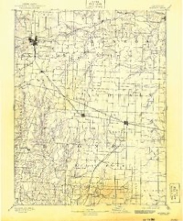
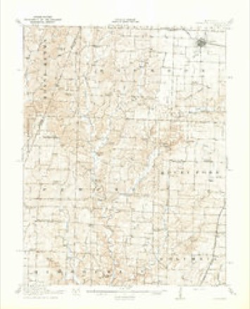
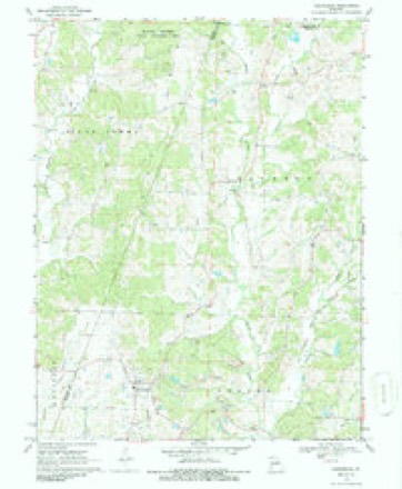
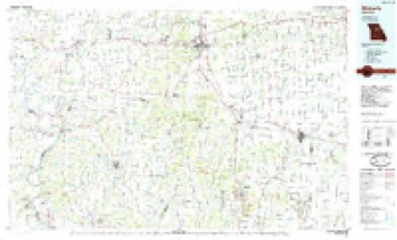
19 topographic sheets cover this place, the earliest surveyed in 1890 and the latest in 1985. It stands in Bourbon Township. It lies in ZIP code area 65243. The Survey maps it on the Harrisburg quadrangle.
Topographic sheets covering this place
8 surveys from 19 printed sheetsMatched by testing this settlement's coordinate against the published boundary of every sheet in the United States Geological Survey's historical collection. Each opens the scanned sheet at the Survey.
- 1890 USGS Moberly quadrangle1:125000, 6 printings
- 1917 USGS Sturgeon quadrangle1:62500, 3 printings
- 1953 USGS Moberly quadrangle1:250000
- 1954 USGS Moberly quadrangle1:250000, 3 printings
- 1957 USGS Moberly quadrangle1:250000
- 1960 USGS Moberly quadrangle1:250000
- 1969 USGS Harrisburg quadrangle1:24000, 2 printings
- 1985 USGS Moberly quadrangle1:100000, 2 printings




What happened here
An account from the chapter on Bourbon township. The inset identifies its exact source book and publication year.
The Shroyer Murder Case
A most horrible and at the same time a most interesting case of murder occurred in this township in the fall of 1876. The particulars, here given are taken from the Sturgeon Leader of August 5, 1882. The editor of the Leader, Mr. T. S. Carter, is better informed concerning the facts in the case than any other person, and was promi nent in cansino; the arrest of the alleo-ed murderer : -
In the county-history sources
30,463 words on this townshipHistory of Boone County, Missouri. Written and Comp. from the Most Authentic Official and Private Sources; Including a History of Its Townships, Towns, and Villages. Together with a Condensed History of Missouri; the City of St. Louis ... Biographical Sketches and Portraits of Prominent Citizens .., published 1882 names this settlement in its chapter on Bourbon Township. These are the passages that mention it, exactly as the scans read.
Again it is alleged that the first building erected entirely in the town was built by E. S. Hawkins for Smith & Burks and used by them as a store. This building, it is said, was completed before the one framed by John F. Fisher, but this point is one hard to decide. Mr. Hawkins lived near Sturgeon before the town was laid out. This building went up in the fall of 1856, the y^ear the town was laid out. The first brick house in town was commenced by J. S. Loekridge. He was afterward joined by Maj. John F. Rucker, and they completed it. It is claimed that this was also the first brick house in the township. The first male child born in the town was David A. Mayer, son of Daniel and Ann Eliza Mayer, who was born November 11, 1857. The first female child was Mary A. Murphy, born June 16, 1857. She was a daughter of Michael and Mary Murphy, and is now Mrs. J. A. Dyer, of Centralia.
The first company of Federal soldiers in town was a battalion of the Third Iowa Infantry, Col. Williams commanding. These soldiers came in July, 1861, but did not stay long, remaining only a few hours. The second body of troops that came was the Fourteenth Illinois Infantry, Col. John M. Palmer,^ This regiment was stationed here for a short time, and was succeeded by a company of Merrill's Horse, Second Missouri Cavalry. Then came a company of militia from Boonville, followed by another company of Krekel's militia from St. Charles. In December, 1861, came Col. Birge's Western Sharpshooters, who, in connection with Col. Glover's Third Missouri Cavalry, fought Col. Dorsey's Confederates at Mt. Zion church, December 28. Then followed a battalion of Iowa volunteers, the number of the regiment not being remembered.
From Sturgeon, Gen. Prentiss, at the head of a battalion of Birge's Sharpshooters, and of Col. J. M. Glover's Third Missouri Cavalry, set out to attack Dorsey's troops at Mt. Zion, as before narrated. While Birge's men occupied the place some of them, who were printers, took charge of the JSfews office and issued a number of the paper gotten up by and to please themselves. This paper gave an alleged truthful account of the Mt. Zion fight, of a skirmish over on Young's creek, in Monroe county, etc., and indulged in much boasting of the prowess of the boys in blue and a corresponding depreciation of the valor of the Confederates.
Machine-read from a century-old scan, so expect the errors a machine makes: misspelled names, dropped words, stray characters.
Read the whole chapter on Bourbon Township - it names this place 27 more 27 times.
Fires near this place
5 since 1999Regional context, not property-specific evidence. The federal wildfire occurrence database lists 5 fires within 5 miles of Rucker between 1999 and 2002, burning about 16 acres in total. None started naturally. None was recorded as arson. Distance is straight-line from the map coordinates, so a fire counted here may appear on a neighbouring settlement's page as well.
| Reported cause | Fires |
|---|---|
| Debris and open burning | 3 |
| Recreation and ceremony | 1 |
| Missing data/not specified/undetermined | 1 |
The most recent of them, most recent first, with the day each was reported and the service that recorded it.
| Date | Cause | Size | Reported by | Name on the report |
|---|---|---|---|---|
| 16 September 2001 | Debris and open burning | 3.0 acres | Missouri Department of Conservation | not named |
| 21 August 1999 | Debris and open burning | 1.0 acres | Missouri Department of Conservation | not named |
| 23 February 2002 | Debris and open burning | 7.0 acres | Missouri Department of Conservation | not named |
| 7 November 1999 | Missing data/not specified/undetermined | 4.0 acres | Missouri Department of Conservation | not named |
| 28 October 2001 | Recreation and ceremony | 1.0 acres | Missouri Department of Conservation | not named |
Settlements close enough to share some of these fires:
Mines and quarries near this place
4 within 5 milesRegional context, not property-specific evidence. The federal mineral resources record lists 4 workings within 5 miles of Rucker: 4 past producers. None of them still produces. What was taken out: Stone, Crushed/Broken. Distance is straight-line from the map coordinates, so a quarry counted here may appear on a neighbouring settlement's page as well.
| Where | Site | Commodity | Status | Recorded |
|---|---|---|---|---|
| Boone Quarries - Plant # 2 | Stone, Crushed/Broken | Past Producer | ||
| Unknown - Limestone | Stone, Crushed/Broken | Past Producer | ||
| Unknown - Ls. | Stone, Crushed/Broken | Past Producer | ||
| Unknown - Ls. | Stone, Crushed/Broken | Past Producer |
Storms near this place
7 since 2008Regional context, not property-specific evidence. The National Weather Service names Rucker in 7 storm reports between 2008 and 2021: 5 flash flood, 1 flood, 1 hail. The reports record 1 death. Each account below is quoted exactly as the forecast office filed it, from the NOAA Storm Events Database, and each date opens the federal record of that event.
| When | Event | Place named | Harm | What the report says |
|---|---|---|---|---|
| September 2008 | Flood | Rucker | 1 killed | An additional two to three inches of rain, from the remnants of Hurricane Ike, fell onto already saturated soils causing flooding. Numerous roads remained flooded and numerous creeks were well out of their banks due to the heavy rainfall. One woman drowned in flood waters on the east side of Columbia. Her and a friend had stopped to help someone who had been swept off Clark Lane into Hominy Creek. Against the advise of the friend, the woman attempted to help rescue the man and she was swept away. |
| June 2021 | Flash Flood | Rucker | - | Another round of heavy rain fell across Boone County, less than 12 hours after the flash flood event from June 24th through the morning hours of June 25th, where up to 7 inches of rain fell. Up to an additional 2 to 3 inches fell causing another round of flash flooding across the county. Numerous roads were flooded. One water rescue due to swift water took place about 3 miles northeast of Murry. Another swift water rescue occurred about 2 miles northeast of Easley where two occupants of a vehicle were trapped by the flood waters. Two vehicles were stuck in swift water from Rocky Fork Creek on North Creekland Drive, just north of intersection with East Calvert Hill Road, so the occupants had to be rescued. Three miles northeast of McBaine, water was flooding a residence, so fire fighters had to rescue the two occupants and their dog. A section of road was washed out about 5 miles east southeast of Harrisburg. No injuries were reported. |
| August 2019 | Flash Flood | Rucker | - | Up to 7 inches of rain fell in about a 5 hour period causing flash flooding in northern Boone County. Numerous roads were flooded. On the south side of Centralia, the intersection of Route Z and Gano Chance Road was flooded. |
| April 2017 | Flash Flood | Rucker | - | Between 3 and 6 inches of rain fell causing flash flooding. Numerous roads were flooded including Route V northwest of Hallsville. About 3 miles north of Ashland, a water rescue had to be performed at Angel Lane and U.S. Highway 63. |
| May 2009 | Flash Flood | Rucker | - | Up to four inches of rain fell in a short amount of time causing flash flooding. Numerous roads were flooded including Paris Road a little south of U.S. Highway 63, Vandiver Road east of the intersection with Paris Road, Highway 124 between U.S. Highway 63 and Hallsville, and the intersection of Thomas Hill Road and Highway V south of Sturgeon. |
| September 2008 | Flash Flood | Rucker | - | Up to two inches of rain fell in a short amount of time on already saturated soils causing flash flooding. Numerous roads were flooded including Route V at Tucker School Road and Thomas Hill Road. In McBaine, two homes and one business were flooded due to several creeks in the area coming out of their banks. |
| May 2012 | Hail | Rucker | - | no account filed |
Nearest settlements
The eight closest, with where each one stands in the county. Distances are straight-line, computed from the Geographic Names Information System coordinates.
| Map | Place | Distance | Sheets |
|---|---|---|---|
| Rileysburg | 3.3 miles | 19 | |
| Minnie | 3.7 miles | 19 | |
| Bourbon | 5.3 miles | 19 | |
| Riggs | 5.5 miles | 19 | |
| Harrisburg | 6.7 miles | 19 | |
| Sturgeon | 7.0 miles | 19 | |
| Petersburg (historical) | 7.3 miles | 19 | |
| Perche (historical) | 7.4 miles | 19 |
Elsewhere
Matched on this settlement's Geographic Names Information System number rather than its name, so it cannot be a different place of the same name in another state.
| Wikipedia article on Rucker | An encyclopaedic summary. Its text is share-alike, so it is linked here rather than copied. |
| Wikidata item Q16894650 | The structured record the population and elevation above come from. Public domain (CC0). |
Provenance
This settlement is recorded in the Geographic Names Information System as feature 741220. The sheet list is computed by point-in-boundary test against the United States Geological Survey's historical topographic inventory. Both are works of the United States government and carry no copyright under 17 U.S.C. 105.
Wildfire. Short, Karen C. 2022. Spatial wildfire occurrence data for the United States, 1992-2020 [FPA_FOD_20221014]. 6th Edition. Fort Collins, CO: Forest Service Research Data Archive. https://doi.org/10.2737/RDS-2013-0009.6 Collected with United States Government funding and usable without additional permissions or fees.
Mines and quarries. USGS Mineral Resources Data System (MRDS) https://mrdata.usgs.gov/mrds/ A work of the United States government, no copyright under 17 U.S.C. 105.
Storms. NOAA National Centers for Environmental Information, Storm Events Database https://www.ncei.noaa.gov/stormevents/ A work of the United States government, no copyright under 17 U.S.C. 105. Narratives are quoted verbatim from the National Weather Service report and are not edited or summarised.