Block
From the record
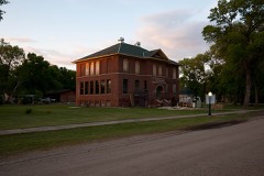
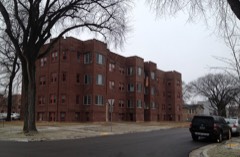
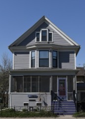
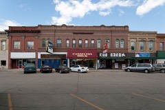
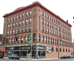
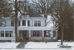
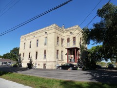
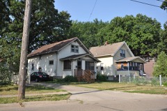
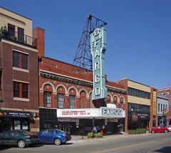
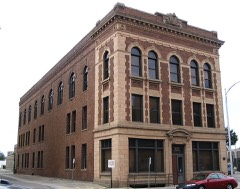
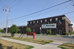
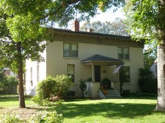
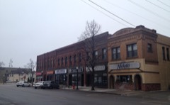
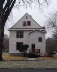
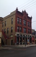
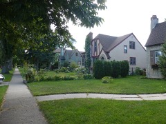
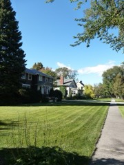
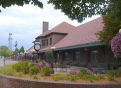
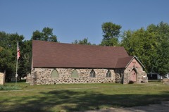
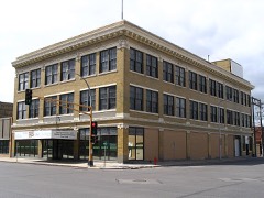
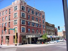
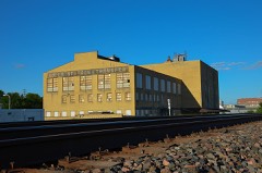
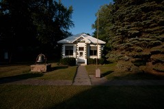
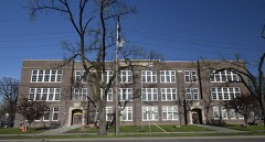
38 National Register listings published here.
Sources: the National Register database, National Park Service
85 topographic sheets cover 55 settlements here, and 38 properties are on the National Register of Historic Places.
38 National Register listings published here.
Sources: the National Register database, National Park Service
Every property in this county listed on the National Register of Historic Places, with the year it was listed and the federal nomination document.
Every wildfire the federal occurrence database records inside this county: 142 of them, burning about 1,429 acres. None started naturally and 6 were recorded as arson. Each settlement page carries the fires within five miles of it.
| Reported cause | Fires |
|---|---|
| Debris and open burning | 68 |
| Missing data/not specified/undetermined | 38 |
| Smoking | 9 |
| Equipment and vehicle use | 8 |
| Arson/incendiarism | 6 |
| Railroad operations and maintenance | 6 |
| Recreation and ceremony | 3 |
| Power generation/transmission/distribution | 2 |
| Other causes | 1 |
| Fireworks | 1 |
The five largest, by the area the report gives. Three of them were set deliberately.
| Date | Cause | Size | Reported by | Name on the report |
|---|---|---|---|---|
| 11 May 2002 | Smoking | 648 acres | Valley City Wetland Management District | KRAUS |
| 15 November 2001 | Debris and open burning | 225 acres | Valley City Wetland Management District | ALICE4 |
| 8 April 2005 | Arson/incendiarism | 76 acres | Valley City Wetland Management District | ALICE WPA |
| 17 November 1999 | Arson/incendiarism | 47 acres | Valley City Wetland Management District | UTKE2 |
| 15 May 2000 | Debris and open burning | 43 acres | Valley City Wetland Management District | ALICE |
| 1 June 2020 | Missing data/not specified/undetermined | 25 acres | North Dakota State Forest Service | HURLEY CONTROL BURN |
| 13 November 1996 | Arson/incendiarism | 25 acres | Valley City Wetland Management District | MUELLER |
| 29 April 2001 | Debris and open burning | 25 acres | Valley City Wetland Management District | ALICE2 |
Every settlement page carries the fires within five miles of it - see the settlement index below.
The NOAA Storm Events Database holds 1,139 reports for this county, causing 15 deaths, 117 injuries and about $281,301,980 in recorded property damage. Each settlement page carries the reports that name it.
| Kind of event | Reports |
|---|---|
| Hail | 494 |
| Thunderstorm Wind | 418 |
| Tornado | 109 |
| Flash Flood | 50 |
| Funnel Cloud | 34 |
| Flood | 24 |
| Heavy Rain | 6 |
| Lightning | 4 |
The most serious of them, by death, then injury, then recorded damage. The accounts are quoted exactly as the forecast office filed them.
| When | Event | Place named | Harm | What the report says |
|---|---|---|---|---|
| June 1957 | Tornado (F5) | not stated | 10 killed, 103 hurt, $25,000,000 | no account filed |
| June 2025 | Tornado (EF4) | Elizabeth | 3 killed | This large and violent tornado initially began in Ransom county 3 miles SSW Enderlin. It crossed into Cass county approximately 3 miles east of Enderlin. EF-4 damage occurred just north of Highway 46 at two farmsteads where devastating damage occurred to both houses and seven outbuildings were destroyed. On the eastern farmstead, one farmhouse was leveled with the debris swept from its foundation and scattered downwind, leading to two fatalities. A lack of structural anchoring was noted at this location. Trees around the farmstead were also debarked, and a few root balls were displaced. The farmstead to the west was leveled for all portions above ground as well. The home had been built into the side of the surrounding hill with some of the debris still piled up around the location. It was built with manufactured steel trusses above the garage, suggesting slightly higher grade construction than a typical residential house. Additionally, a large propane tank was moved across the north end of the property at this location. The tornado continued north, causing additional tree damage and eventually leveling another farm house, leading to one fatality at a farmstead near 51st St east of 139th Ave SE. As the tornado moved to the northwest, it bent over tall steel electrical transmission towers before making a curl to the south as it passed over the southern end of the Utke waterfowl production area. It then weakened and dissipated a mile to the southwest of the northernmost point in the tornados track. The tornado statistics for the Cass County portion of the track include: a length of 6.7 miles, a maximum width of 1000 yards, a maximum wind of 180 mph (EF-4), and a total of 3 fatalities. The tornado statistics for the Ransom County portion of the track include: a length of 5.4 miles, a maximum width of 1850 yards, a maximum wind of greater than 210 mph (EF-5), and 0 fatalities. Total track length between Ransom and Cass counties was 12.1 miles. Monetary damage estimates were not available. |
| July 1997 | Lightning | Davenport | 1 killed, 2 hurt | Lightning struck 3 workers in a sugarbeet field near Davenport. |
| April 2006 | Flood | Countywide | 1 killed, $1,340,000 | The Red River at Fargo/Moorhead rose above flood stage around 1 AM CST on March 30th and remained above flood stage until around 7 PM CST on April 19th. The river peaked at roughly 37.18 feet around 2 AM CST on April 5th. Unofficially, 37.18 feet would be the fifth highest modern-day river stage recorded. The third highest modern-day river stage of 891.35 feet MSL (unofficial) was recorded on the Sheyenne River at Harwood on April 3rd and the seventh highest was recorded at the West Fargo Diversion on April 3rd. Overland flooding also occurred in addition to the river flooding, with over 40 roads around the county closed due to flooding. One lane of southbound Interstate 29 was closed south of Horace due to high water. Flooding was extensive along the Wild Rice River south of Fargo, where 75 homes were threatened from Oxbow up to the southern edge of Fargo. No permanent flood protection existed along the south side of Fargo, as alternatives were still being debated. At the Interstate 29 Oxbow exit, water surrounded all sides of the interstate. In Oxbow, river water moved a deck, which ruptured a gas line and started a fire. Firefighters were able to put out the fire before it caused much damage. West of Fargo, the most problems occurred near the confluence of the Maple and Sheyenne Rivers. Several homes in that area were completely surrounded by water. The Maple River Golf Course, along the Maple River, reported the most water they had ever seen. In the city of Fargo itself, the typical low spots were quickly flooded. These spots included Elm Street, the 12th Avenue North Red River toll bridge, and along 2nd Street downtown. A temporary clay dike was built along 2nd Street North to protect a portion of the downtown area, including city hall. Temporary clay dikes were also built to protect the Rose Creek clubhouse and a nearby church. High school and college students helped to sandbag, as many schools gave them the option of attending school or helping out. Classes at Oak Grove were cancelled April 6th and 7th. The body of a homeless man was also found in the Red River north of Main Avenue on April 7th. To the north of Fargo, water backed up around Harwood, covering Interstate 29. The Interstate did stay open with red cones marking the way, but drivers had to slow way down. The Red River bridge from Gardner (ND) to Perley (MN) was closed due to flooding. After the spring flood of 1997, many communities along the Red River looked at ways to mitigate flood effects. For the Fargo area, many homes were bought out in low-lying or flood-prone areas. Some sections of permanent dikes were built in portions of the city. Although built prior to the 1997 flood, the Sheyenne River Diversion around the city of West Fargo resulted in little impact to that city. Problems were mitigated in the Oak Grove area due to the construction of a flood wall. Cass County received a Presidential Disaster Declaration for damages caused by spring flooding.In summary, the total public and private flood losses experienced within the Red River of the North basin through late March and April 2006 were likely in excess of $20 million. This includes the following amounts. For Minnesota state and local infrastructure (this total includes the damages listed for each county), $8.5 million. For North Dakota state and local infrastructure (this total includes the damages listed for each county), $8 million. For Federal agencies (USACE, USGS, and USCG), $1.5 million. For the transportation industry costs due to traffic diversions caused by prolonged road and bridge closures, $1.5 million. For personal property losses due to floodwaters surrounding more than 500 individual farmsteads and rural homesteads, $1.0 million. |
| August 1956 | Tornado (F3) | not stated | 8 hurt, $250,000 | no account filed |
| May 2017 | Thunderstorm Wind | Cotter | 2 hurt, $10,000 | A car was blown off Interstate 29 near Oxbow due to strong winds. The two occupants of the car were injured. |
| June 2003 | Thunderstorm Wind | Argusville | 1 hurt, $200,000 | Four tractor-trailer rigs were blown off Interstate 29 between mile posts 81 and 84. Traffic had to be rerouted for 1.5 hours while the vehicles were removed. |
| September 2019 | Thunderstorm Wind | Buffalo | 1 hurt | A semi truck was blown over by the wind near the Buffalo exit on Interstate 94. The damaged truck blocked part of the westbound lane for around 30 minutes. The truck driver suffered minor injuries. |
| June 2000 | Flash Flood | Fargo | $100,000,000 | A series of training thunderstorms brought heavy rain to the Fargo area. A total of 6.82 inches was reported at the ASOS site at the Fargo airport. 7.31 inches was reported by the official observer in north Moorhead. This is believed to be a new 24 hour rainfall record for the Fargo-Moorhead area. The heavy rain halted traffic, inundated storm sewers, and knocked out electricity and phones. 20,000 customers lost power when a power station was submerged. This knocked out power to those customers with sump pumps. A state of emergency was declared in the city at 3 am. At one point, 50 percent of the city streets were flooded. The major traffic arteries, Interstates 29 and 94, were flooded and closed for several days. The Fargodome sustained major damage when flooding along 19th Avenue North overflowed into th e parking lot and into the lower level of the building. 8 to 12 feet of water, roughly 51.8 million gallons, filled the bottom level. This was up to the first row of seats. There was an unconfirmed report of a man injured from a flying manhole cover that blew out from the force of the sewer line backup. Damage was particularly high at North Dakota State University, where nearly all 88 buildings took on water. Four feet of water in the campus library damaged the periodical section. The telephone and internet services for the campus was also disrupted. 54 percent of the residences in the city of Fargo had water damage. |
| July 1999 | Thunderstorm Wind | Fargo | $80,000,000 | Thunderstorms producing strong winds hit the Fargo area, causing widespread damage. On the north side of town, Hector Airport had winds in excess of 50 knots for 39 minutes, with a peak speed of 79 knots at 0642 CST. A dozen airplanes at Hector Airport were damaged, some landing upside down. Several hangers were also damaged. The NDSU station just west of campus reported a maximum wind speed of 51 knots. Power was knocked out to the ASOS unit at the airport for 2 days. 35,000 people in Fargo were without power for various times. Apartment buildings were hit particularly hard, with roof damage quite common. This was especially true in the West Acres area on the west side of Fargo. Huge chunks of roofs were blown off, exposing individual apartment units. A 48 unit apartment building under construction was completely blown down. One apartment garage blew off its foundation and into a parked car nearby. At NDSU, the Dairy Research Facility lost parts of its roof and a wall was blown in. Many stop lights, satellite dishes, and advertising signs were twisted or damaged. Several garages were also blown down. A seasonal greenhouse along 13th Avenue southwest was ripped apart. The JCPenney store at West Acres Shopping Center lost a portion of its roof, allowing the rain to damage some contents inside. Skateland, a roller-skating facility, had its roof torn halfway off, exposing its maplewood floor. The rain caused the floor to instantly warp. This business alone estimated damages at $1 million. Several extra large transmission poles just west of West Acres were also toppled. There were reports of some minor cuts to people, but nothing was officially confirmed. |
| September 2007 | Hail | Fargo | $30,000,000 | Baseball sized hail fell at the intersection of 19th Street and 33rd Avenue South. The large hail damaged many vehicles and homes. |
| June 2000 | Flash Flood | West Fargo | $5,000,000 | After 5 to 7 inches of rain fell across the West Fargo area, flash flooding occurred in low lying neighborhoods. The Meadow Ridge area suffered quite a bit of damage, with numerous basements flooded. Many streets and cars were also flooded. |
| July 1999 | Thunderstorm Wind | West Fargo | $5,000,000 | Strong winds hit the West Fargo area, knocking down trees, power lines, and signs. A motel on Main Avenue was damaged as well as numerous roofs. A block of storage sheds were blown apart, with debris damaging vehicles and apartments in the area. 4300 people were without power. At the West Fargo airport, a hanger was demolished, wrecking the Cessna 182 parked inside. A skydiver group who owned the hanger lost most of their equipment inside, some blowing over a half mile away. Some contents of the hanger were found inside a home to the east of the airport. This home had its roof torn off and windows blown in. This allowed some of the debris from the airport hanger to get inside the house. A fireworks tent was flattened, with most of the fireworks inside destroyed because of the rain. 55 power poles were knocked down in the West Fargo area, some snapped at ground level. Several motorhomes at the West Fargo Fairgrounds were overturned, with no injuries reported. A set of bleachers and a press box at the old West Fargo High School were also flattened. On Main Avenue, a 100,000 bushel grain bin was wrecked. |
| July 2007 | Thunderstorm Wind | Tower City | $2,500,000 | A six mile stretch of high voltage power towers was crumpled by a combination of downburst winds and at least one tornado through Central Hill Township. At least 28 steel four pole towers, operated by Western Area Power Administration, were destroyed. One tower in adjacent Barnes County was also destroyed. Extensive crop damage occurred across Hill and Howes Townships. |
| July 2007 | Tornado (EF2) | Tower City | $2,500,000 | The tornado plowed through wooden power poles and viciously ripped up mature trees over its damage path. The tornado also damaged a sturdy pole shed, where the sidewall was caved in and the roof and rafters were torn off. It tore the roof off and collapsed an older barn, then lifted and threw a well-built two car garage from its slab foundation. The tornado crumpled one steel, four footing, high voltage power tower. In combination with extreme downburst winds, the collapse of this first tower helped initiate the collapse of dozens more of these power towers. Peak winds were estimated at 130 mph. |
| June 1992 | Tornado (F0) | not stated | $2,500,000 | no account filed |
| June 2003 | Hail | Gardner | $1,250,000 | Wind driven hail caused partial crop damage over about 20 sections of farmland. |
| July 2010 | Thunderstorm Wind | West Fargo | $1,000,000 | A Squall Line with damaging downburst winds raked across West Fargo and into Fargo through the early morning hours. Winds flipped over two semi trailors parked near the fair grounds and completly tore off a large metal section of city garbage transfer station along U.S. Highway 10. Industrial business roofing damage and the movement of small machinery items in various lots indicated the occurence of one or more small surface eddies in the overall downburst pattern. |
| July 2007 | Thunderstorm Wind | Alice | $1,000,000 | The roof was torn off a machine shed, collapsing the building on the equipment inside. Debris was strewn downwind for one-half mile. A camper was also rolled over and destroyed. Extensive crop damage occurred in Clifton, Pontiac, and Highland Townships. |
| July 2007 | Thunderstorm Wind | Tower City | $1,000,000 | Widespread nickel to golfball sized hail and downburst winds affected much of Cornell and Tower City Townships. |
| July 2007 | Thunderstorm Wind | Buffalo | $1,000,000 | Two 5000 bushel steel grain bins were caved in by the winds and several trees were knocked down. The doors were blown off a machine shed. Extensive crop damage occurred across Buffalo Township. |
| July 2007 | Hail | Embden | $1,000,000 | A two foot deep drift of hail was left next to one home. Hail knocked out several windows at another home. Wind driven (70 mph) hail also damaged an extensive amount of cropland across the Howes, Gill, Eldred, and Walburg Townships. |
| July 2007 | Tornado (EF1) | Tower City | $1,000,000 | The tornado touched down on the northeast side of Tower City in Cass County and tracked to the south-southwest. In Tower City, the tornado ripped off a section from the roof of a house and tossed garden storage buildings and equipment. The tornado also blew a single car garage off its foundation and destroyed it. Several trees in town were damaged or blown down. Peak winds were estimated at 110 mph. |
| July 2007 | Thunderstorm Wind | Embden | $1,000,000 | A two mile section of aluminum high voltage power towers were crumpled by downburst winds and at least one tornado. The nine towers were operated by Minnkota Power Cooperative. Wind speeds likely exceeded 100 miles per hour based on utility company estimates. Extensive crop damage occurred across the Highland and Watson Townships. |
| April 2023 | Flood | Fargo | $951,000 | Fargo - Crest of 29.76 ft occurred on 4/22. Flooding extended into May.|NOTE: Damages dollar amount is for the entire county. Not separated by specific river basin or damage type. |
| April 2023 | Flood | Norpark | $951,000 | Mapleton gage (south of I-94), on the Maple River. Crested at 22.31 ft, on April 19th at 8:30.||NOTE: Damages dollar amount is for the entire county. Not separated by specific river basin or damage type. |
| April 2023 | Flood | Harwood | $951,000 | Harwood - Sheyenne River - Crest of 90.33 ft occurred on 4/22. A second crest of 84.15 ft occurred on May 11th, and is noted in May storm data.||NOTE: Damages dollar amount is for the entire county. Not separated by specific river basin or damage type. |
| April 2023 | Flood | Kindred | $951,000 | Kindred - Sheyenne River - Crest of 20.06 ft occurred on 4/22.|NOTE: Damages dollar amount is for the entire county. Not separated by specific river basin or damage type. |
| April 2023 | Flood | West Fargo | $951,000 | West Fargo - Sheyenne River - Crest of 21.06 ft occurred on 4/24. A second crest of 18.24 ft occurred on May 10th, which is included in the May storm data.||NOTE: Damages dollar amount is for the entire county. Not separated by specific river basin or damage type. |
| June 2017 | Thunderstorm Wind | Osgood | $750,000 | A high voltage electrical tower was bent over by extreme downburst winds. Numerous wooden power poles were snapped and trees were damaged in the area. |
| May 2011 | Tornado (EF2) | West Fargo | $750,000 | This tornado tracked northward and brushed the west edge of the industrial park of northwest Fargo and the east edge of Reiles Acres before lifting east of Harwood. The tornado was likely enshrouded in downburst winds and heavy rains for part of this track. Two guyed radio towers collapsed, several empty semi-trailers and travel trailers were flipped and thrown, steel wall and roofing panels were torn from industrial buildings, and numerous power poles and trees were snapped. peak winds were estimated at 135 mph. |
| May 2011 | Tornado (EF2) | Horace | $600,000 | This tornado tracked northward for about four miles and lifted near the Woodhaven Park in southwest Fargo. The tornado was likely enshrouded in downburst winds and heavy rain as it knocked down several wooden power poles and two metal truss power towers along its path. Sections of roofing were torn off of two apartment buildings. Many residences had tree, vehicle and roof damage. Peak wind were estimated at 135 mph. |
| June 2003 | Thunderstorm Wind | Tower City | $600,000 | Seven 80 foot tall 345 KV high voltage power transmission towers were blown down. |
| June 2003 | Thunderstorm Wind | Gardner | $534,000 | Three 80,000 bushel steel grain bins were caved in at the Gardner elevator complex. A small wooden barn was destroyed. Large trees were also blown down all over town. |
| July 2011 | Thunderstorm Wind | Fargo | $500,000 | Significant damage occurred to apartments in south Fargo, along Amber Valley Parkway. |
| June 2008 | Thunderstorm Wind | Fargo | $500,000 | The wind knocked down a tree onto a trailer home near 48th Street West and bent railroad crossing signs. |
| July 2007 | Thunderstorm Wind | Alice | $500,000 | Trees were uprooted at the Alice cemetery and tombstones were tipped over. |
| July 2007 | Hail | Page | $500,000 | Quarter size hail fell along with damaging winds. Extensive crop damage occurred across Ellsbury and Rochester Townships. |
| July 2007 | Hail | Page | $500,000 | Large branches were also blown down. Extensive crop damage occurred across Lake and Rich Townships. |
| July 2007 | Thunderstorm Wind | Buffalo | $500,000 | Major crop damage occurred in Cornell and Ayr Townships due to downburst winds and hail. Tree damage was also reported. A ND RWIS mesonet site at mile point 10 on highway 38 reported a 57 mph wind gust at 609 pm CST. |
| July 2004 | Tornado (F2) | Tower City | $500,000 | The tornado knocked down high voltage power lines and three metal towers north of Tower City. Several farm buildings were also damaged northeast of Tower City. |
| June 2000 | Flash Flood | Casselton | $500,000 | After 3 to 5 inches of rain fell on the Casselton area, flash flooding occurred. Roughly 40 percent of the homes sustained some sort of water damage, which equated to about 200 homes. |
| September 1997 | Hail | Fargo | $500,000 | The hailstorm hit several car dealerships along Interstate 29 in Fargo, causing damage to numerous cars and trucks. |
| June 2008 | Thunderstorm Wind | Fargo | $300,000 | The wind knocked down a medium sized tree across 6th Street and 1st Avenue North. Power lines were also blown down around town. |
| May 2011 | Tornado (EF1) | St Benedict | $250,000 | This tornado tracked for about two miles to the north-northeast and was likely enshrouded in downburst winds and heavy rains. The tornado flipped a parked semi trailer and tore out two large 40,000 bushel steel grain bins at one farmstead and spread debris downwind for a mile. Several trees were toppled onto rooftops in the community of St. Benedict. Peak winds were estimated at 100 mph. |
| July 2007 | Tornado (EF1) | Chaffee | $250,000 | This tornado yanked one aluminum high voltage power tower out of its steel footings and toppled several others. It snapped off mature oak and ash trees near the Maple River and snapped several wooden power poles at multiple road crossings across its path. The tornado continued into Ransom County, where it dissipated at 640 pm CST. Peak winds were estimated at 105 mph. |
| July 2007 | Tornado (EF2) | Embden | $250,000 | The tornado toppled a barn, severely injuring a horse. It tumbled farm outbuildings and toppled one high voltage power tower. The tower was made of steel and had four footings. Peak winds were estimated at 125 mph. |
| June 1998 | Flash Flood | West Fargo | $250,000 | 3 to 5 inches of rain fell in less than three hours, resulting in rapid flooding problems across West Fargo. Several parking lots and low areas filled with water, covering some cars. Water also covered a few streets and filled several basements with 3 1/2 feet of water. Power went out for most of West Fargo, causing sewer and sump pump failure. |
| June 1998 | Flash Flood | Fargo | $250,000 | 3 to 5 inches of rain fell in less than 3 hours across portions of Fargo. The Fargo airport reported 3.03 inches of rain. The western edge of the city was hit the hardest. The interchange between Interstates 29 and 94 was closed due to high water. Several garages in the basement levels of apartment buildings flooded. Major underpasses around the city also had to be closed. |
| June 1992 | Tornado (F1) | not stated | $250,000 | no account filed |
| July 1988 | Tornado (F1) | not stated | $250,000 | no account filed |
| August 1976 | Tornado (F1) | not stated | $250,000 | no account filed |
| August 1976 | Tornado (F1) | not stated | $250,000 | no account filed |
| May 1976 | Tornado (F1) | not stated | $250,000 | no account filed |
| June 1973 | Tornado (F3) | not stated | $250,000 | no account filed |
| May 1965 | Tornado (F2) | not stated | $250,000 | no account filed |
| May 1965 | Tornado (F2) | not stated | $250,000 | no account filed |
| May 1965 | Tornado (F2) | not stated | $250,000 | no account filed |
| June 1950 | Tornado (F3) | not stated | $250,000 | no account filed |
| July 2011 | Thunderstorm Wind | Osgood | $200,000 | Sections of yard fences were blown down between 36th and 40th avenues south. Numerous 3 to 5 inch diameter tree branches were broken down. |
The Survey's mineral resources record lists 1 working inside this county. It is closed or unrecorded. Each settlement page carries the workings within five miles of it.
| Commodity | Workings |
|---|---|
| Sand and Gravel, Construction | 1 |
The least common of them first, because a county's hundredth gravel pit says nothing its first ten did not.
| Where | Site | Commodity | Status | Recorded |
|---|---|---|---|---|
| Agnew Pit | Sand and Gravel, Construction | Unknown |
Named settlements recorded in the Geographic Names Information System, each with the topographic sheets covering it. Villages, hamlets and abandoned places alike. Each is shown with the nearest named watercourse or landform and the survey quadrangle it falls on.
Harwood township · 58042 · On Rush River · Argusville quadrangle
9 sheets, 1952 to 1984
Harwood city · 58042 · On Lower Branch Rush River · West Fargo North quadrangle
24 sheets, 1895 to 1989
Reed township · 58102 · On Maple River · West Fargo North quadrangle
24 sheets, 1895 to 1989
Stanley township · 58047 · On Wild Rice River · Hickson quadrangle
24 sheets, 1895 to 1989