 Block
From the record
22 National Register listings published here.
Sources: the National Register database, National Park Service
30 topographic sheets cover 19 settlements here, and 22 properties are on the National Register of Historic Places.
22 National Register listings published here.
Sources: the National Register database, National Park Service
Every property in this county listed on the National Register of Historic Places, with the year it was listed and the federal nomination document.
| Photograph | Property | Type | Listed | Reference |
|---|---|---|---|---|
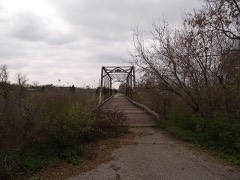 | Caledonia Bridge | structure | 1997 | 97000188 |
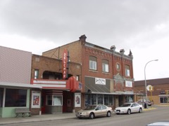 | Delchar Theater | building | 1985 | 85002831 |
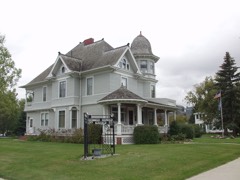 | Carl Ben Eielson House | building | 1977 | 77001031 |
| Ellingson Farm District | building | 1985 | 85002343 | |
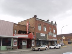 | First National Bank | building | 1985 | 85002906 |
 | First State Bank of Buxton | building | 1978 | 78001995 |
 | Goose River Bank | building | 1985 | 85002793 |
| Grandins' Mayville Farm District | district | 1985 | 85002905 | |
 | Great Northern Railway Depot | building | 1977 | 77001033 |
| Grinager Mercantile Building | building | 1985 | 85003354 | |
| Lucken Farm | district | 1986 | 86001049 | |
 | Lura Building | building | 1985 | 85002794 |
| Mayville Historic District | district | 1985 | 85002904 | |
 | Mayville Public Library | building | 1977 | 77001034 |
| Andres O. Ness House | building | 1977 | 77001032 | |
 | Norway Bridge | structure | 1997 | 97000192 |
 | Amos and Lillie Plummer House | building | 1996 | 95001488 |
 | Col. William H. Robinson House | building | 1977 | 77001035 |
 | Stomner House | building | 1979 | 79003728 |
 | Traill County Courthouse | building | 1980 | 80002928 |
 | Union Block | building | 1985 | 85003353 |
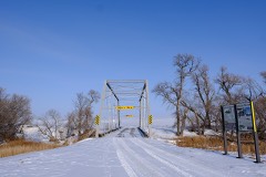 | Viking Bridge | structure | 1997 | 97000190 |
Every wildfire the federal occurrence database records inside this county: 17 of them, burning about 3,671 acres. None started naturally and none was recorded as arson. Each settlement page carries the fires within five miles of it.
| Reported cause | Fires |
|---|---|
| Debris and open burning | 15 |
| Railroad operations and maintenance | 1 |
| Missing data/not specified/undetermined | 1 |
The five largest, by the area the report gives. None of them was recorded as arson.
| Date | Cause | Size | Reported by | Name on the report |
|---|---|---|---|---|
| 4 November 2020 | Debris and open burning | 3,200 acres | North Dakota State Forest Service | MORGAN TOWNSHIP FIRE COUNTY ROAD 23 EAST |
| 5 May 2005 | Debris and open burning | 150 acres | North Dakota State Forest Service | not named |
| 8 April 2005 | Debris and open burning | 150 acres | North Dakota State Forest Service | not named |
| 20 November 1999 | Debris and open burning | 67 acres | Valley City Wetland Management District | GROVEN |
| 21 June 2012 | Debris and open burning | 30 acres | North Dakota State Forest Service | LEINING FARMSTEAD |
| 6 May 2013 | Debris and open burning | 25 acres | North Dakota State Forest Service | 13 |
| 6 May 2005 | Debris and open burning | 15 acres | North Dakota State Forest Service | not named |
| 7 April 2005 | Debris and open burning | 10 acres | North Dakota State Forest Service | not named |
Every settlement page carries the fires within five miles of it - see the settlement index below.
The NOAA Storm Events Database holds 407 reports for this county, causing no deaths, 1 injury and about $4,790,500 in recorded property damage. Each settlement page carries the reports that name it.
| Kind of event | Reports |
|---|---|
| Thunderstorm Wind | 178 |
| Hail | 150 |
| Tornado | 34 |
| Funnel Cloud | 16 |
| Flash Flood | 14 |
| Flood | 10 |
| Heavy Rain | 3 |
| Lightning | 2 |
The most serious of them, by death, then injury, then recorded damage. The accounts are quoted exactly as the forecast office filed them.
| When | Event | Place named | Harm | What the report says |
|---|---|---|---|---|
| June 2010 | Tornado (EF4) | Portland Jct | 1 hurt | The tornado tracked northward for nearly 9 miles to about 12 miles north of Mayville by 405 PM CDT and crossed into Grand Forks County. It then continued for another 8 miles to around 10 miles west of Thompson by 418 PM CDT, for a total track length of nearly 17 miles. Trees in shelterbelts and farmsteads were snapped, uprooted, or sheared off. One well constructed house near Holmes was completely swept from its foundation and destroyed. Peak winds were estimated at 185 mph. A farm shop about five and one-half miles north of Mayville was hit by the tornado, destroying the shop. A man inside survived with cuts on his hand. |
| August 2001 | Thunderstorm Wind | Hillsboro | $1,000,000 | A Davis system measured a 110 mph wind gust with sustained winds at 100 mph. 2,400 trees were blown down along with 23 miles of powerline. 27 National Guard members were called in to help the community. Road and business signs were folded over by the wind and some windows in town were blown in. 25 percent of the 200 homes in town were damaged. The courthouse dome was damaged and the local government communications tower was blown over. A 12x40 foot warehouse was blown down with its contents scattered. Minor damage occurred to 2 motorhomes in the city's westside RV park and campground. Several semi trucks were flipped over along Interstate 29 on the west edge of town. |
| July 2017 | Tornado (EF2) | Hatton Arpt | $750,000 | This multi-vortex tornado was wrapped in rain and hail for much of its path. It crossed Interstate 29 just north of the Taft elevators, then dove south-southeast to a point roughly 2.5 east-northeast of Hillsboro, where it curled to the northeast. The tornado snapped trees and destroyed several farm buildings along its path. Peak winds were estimated at 135 mph. |
| September 2019 | Flash Flood | Hillsboro | $250,000 | Streets, low spots, rivers, and basements were flooded by 4 to 9 inches of rain over a short duration of time. Cars that got stuck in the flood waters were abandoned where they stalled. Farm fields and access roads were also flooded. |
| July 2017 | Tornado (EF2) | Hillsboro Arpt | $250,000 | This tornado developed from the main mesocyclone as its predecessor roped out. It crossed the Red River and continued for another 5 miles in Minnesota, before ending around four miles east-southeast of Halstad at 711 pm CST. This tornado snapped H-pole power poles, crushed steel grain bins, snapped numerous oak and ash trees, and toppled a barn along its path. Peak winds were estimated at 130 mph. |
| July 1974 | Tornado (F2) | not stated | $250,000 | no account filed |
| June 1973 | Tornado (F3) | not stated | $250,000 | no account filed |
| June 1965 | Tornado (F2) | not stated | $250,000 | no account filed |
| June 2008 | Thunderstorm Wind | Mayville Arpt | $200,000 | The wind gust was measured at the Mayville Airport. The winds caused a three thousand gallon water tank to buckle. |
| July 2007 | Hail | Hillsboro | $200,000 | The Traill County Sheriff reported driving rain and large hail just west of Interstate 29 near Hillsboro. Strong wind gusts also uprooted a few trees and blew a door off a grain elevator. Crop damage also occurred across portions of Norway, Bloomfield, and Hillsboro Townships. |
| April 2006 | Flood | Countywide | $177,000 | The Red River at Halstad (MN) rose above flood stage around 4 PM CST on March 31st and remained above flood stage until around 3 AM CST on April 17th. The river peakedat roughly 39.31 feet around 8 PM CST on April 6th. Unofficially, 39.31 feet would be the third highest modern-day river stage recorded. Overland flooding also occurred in addition to the river flooding, with over 60 roads around the county closed due to flooding. Red River bridges at Shelly (MN), Hendrum (MN), Nielsville (MN), and Climax (MN) were all closed. This left the State Highway 200 bridge as the only open Red River bridge between Fargo/Moorhead and Grand Forks/East Grand Forks. After the spring flood of 1997, many communities along the Red River looked at ways to mitigate flood effects. In the Hillsboro area, several homes were bought out in low-lying or flood-prone areas. Traill County received a Presidential Disaster Declaration for damages caused by spring flooding.In summary, the total public and private flood losses experienced within the Red River of the North basin through late March and April 2006 were likely in excess of $20 million. This includes the following amounts. For Minnesota state and local infrastructure (this total includes the damages listed for each county), $8.5 million. For North Dakota state and local infrastructure (this total includes the damages listed for each county), $8 million. For Federal agencies (USACE, USGS, and USCG), $1.5 million. For the transportation industry costs due to traffic diversions caused by prolonged road and bridge closures, $1.5 million. For personal property losses due to floodwaters surrounding more than 500 individual farmsteads and rural homesteads, $1.0 million. |
| June 2009 | Tornado (EF1) | Buxton | $150,000 | A 60x120 foot diameter storage building was destroyed and roofing materials were peeled up on a potato warehouse. Several trees were snapped off. Peak winds were estimated at 95 mph. |
| August 2001 | Thunderstorm Wind | Hillsboro | $150,000 | 4 grain bins were destroyed, spilling 200,000 bushels of barley over U.S. Highway 81. The highway was closed to traffic until the grain could be moved. |
| July 2007 | Thunderstorm Wind | Mayville | $100,000 | A brick silo was blown over onto a parked farm truck. |
| July 2007 | Thunderstorm Wind | Blanchard | $100,000 | Two 5000 bushel grain bins were blown one-half mile. |
| June 2003 | Thunderstorm Wind | Hillsboro | $100,000 | Two tractor-trailer rigs were blown Interstate 29 between mile posts 93 and 94. |
| August 2001 | Thunderstorm Wind | Clifford | $100,000 | One 50,000 bushel grain bin was destroyed and 7 others were damaged. Many trees were uprooted. |
| April 2022 | Flash Flood | Hillsboro | $50,000 | Streets flooded to more than a foot deep at several intersections. |
| July 2008 | Thunderstorm Wind | Hillsboro | $50,000 | Strong winds blew apart baseball dugouts and damaged fencing at the baseball complex. |
| April 2019 | Flood | Hatton Arpt | $50,000 | no account filed |
| June 2008 | Thunderstorm Wind | Hatton | $30,000 | The wind knocked down many large tree branches. |
| May 1986 | Tornado (F1) | not stated | $25,000 | no account filed |
| August 1966 | Tornado | not stated | $25,000 | no account filed |
| July 2011 | Tornado (EF1) | Kelso | $20,000 | This tornado touched down briefly in a farmyard and tracked southward for about one-half mile before lifting. The tornado tore off part of the house eaves and numerous shingles. It also spread sections of a ground based solar collector around the farmyard. Only small branches were broken down in the poplar trees to the northeast of the farmyard. Peak winds were estimated at 95 mph. |
| June 2008 | Thunderstorm Wind | Hatton | $20,000 | A fifteen inch diameter tree was blown down by the wind gust. |
| August 2001 | Thunderstorm Wind | Hillsboro | $20,000 | 7 railroad cars were tipped over at the sugarbeet plant. |
| August 2001 | Thunderstorm Wind | Hillsboro | $20,000 | A crop dusting operation was damaged by the strong wind. One airplane sustained major damage. |
| August 2001 | Thunderstorm Wind | Cummings | $20,000 | A barn was destroyed by the strong wind. |
| August 2001 | Thunderstorm Wind | Galesburg | $20,000 | Trees were blown down and a grain elevator was damaged. One tree fell on a garage. |
| August 1994 | Thunderstorm Wind | Mayville | $20,000 | A radio station had it's roof partially blown off. Rain then damaged equipment inside. |
| June 2001 | Thunderstorm Wind | Taft | $15,000 | Strong winds destroyed a garage near Taft. One of the large beams that supported the garage was carried 50 feet and into the neighboring trailer home wall. |
| August 2001 | Thunderstorm Wind | Caledonia | $15,000 | A home under construction was flattened. |
| August 2001 | Thunderstorm Wind | Hillsboro | $15,000 | A church, built in the 1880s, lost its steeple to the strong wind. |
| August 2001 | Thunderstorm Wind | Clifford | $15,000 | A grain bin was lifted off its foundation and into a grain dryer. |
| June 2009 | Flash Flood | Reynolds | $10,000 | Fields and farm roads were flooded across portions of Stavanger, Ervin, Belmont, and Bingham Townships in northeast Traill County. Several county roads were washed out or blocked by flowing water. |
| August 2001 | Thunderstorm Wind | Mayville | $10,000 | A grain bin was torn from its foundation and blown a mile away. |
| August 2000 | Lightning | Kelso | $10,000 | Lightning struck a Chevrolet Blazer traveling northbound on Interstate 29, entering the vehicle through the radio antenna. The strike caused the vehicle to jump about a foot in the air. The tires blew out on one side of the vehicle, causing the driver to lose control. The strike killed the motor, cracked the front windshield, and left burn marks in different spots on the vehicle. The strike exited the vehicle through the four tires, and gouged holes in the interstate concrete. The ND DOT had to fill the one foot deep craters before traffic could resume normal operation. Neither of the two occupants were injured. |
| June 1999 | Thunderstorm Wind | Hillsboro | $10,000 | Trees were blown down in Hillsboro and a section of fence was snapped in two. A storage shed at the local golf course was also blown over. |
| June 2009 | Tornado (EF0) | Taft | $5,000 | Several trees were broken down in shelterbelts. Peak winds were estimated at 80 mph. |
| August 2002 | Thunderstorm Wind | Mayville | $5,000 | A 61 foot grain auger was blown over. |
| July 1999 | Thunderstorm Wind | Hillsboro | $5,000 | Trees and power lines were downed, knocking out power to 2882 customers. |
| July 1994 | Thunderstorm Wind | Clifford | $5,000 | Strong winds uprooted eight inch trees. ~ Steele County Pickert,04, 700CST,,,0,0,6,4,Hail (1.75) The hail did an estimated one million dollars damage to crops, vehicles, and buildings. |
| April 2013 | Flood | Buxton | $5,000 | no account filed |
| March 2009 | Flood | Hatton | $5,000 | no account filed |
| April 2009 | Flood | Hatton | $5,000 | no account filed |
| June 1953 | Tornado (F2) | not stated | $2,500 | no account filed |
| July 2001 | Thunderstorm Wind | Buxton | $2,000 | Numerous large trees were blown down. |
| July 2001 | Thunderstorm Wind | Mayville | $1,000 | Trees were blown down. |
| October 1997 | Thunderstorm Wind | Galesburg | $1,000 | Large trees were blown down. |
| July 2001 | Flash Flood | Reynolds | $500 | Basement flooding was reported in Reynolds. |
| July 2001 | Thunderstorm Wind | Buxton | $500 | A large tree was blown down. |
| July 2001 | Thunderstorm Wind | Hatton | $500 | Branches were blown down. |
| June 1999 | Thunderstorm Wind | Reynolds | $500 | no account filed |
| August 2025 | Tornado (EF1) | Hatton | - | This tornado developed about 2.8 miles east of Hatton and tracked northeast. It damaged a farmstead where the garage door of large shed was torn off, a tree was uprooted, and numerous large branches were broken. Numerous large tree branches snapped and uprooted along path as it tracked northeast crossed multiple shelterbelts. Time estimated from KVX radar. TDS observed on radar. Sentinel-2 high resolution satellite imagery reveals crop damage along the path. Maximum wind speed is estimated at 104 mph based on the tree damage. |
| August 2025 | Thunderstorm Wind | Cummings | - | Measured gust on NDAWN station 325679 Mayville ND. |
| August 2025 | Thunderstorm Wind | Mayville | - | Power lines down in Mayville. Winds estimated at 75 mph. Time estimated via radar. |
| August 2025 | Thunderstorm Wind | Buxton | - | At I-29 near Buxton, a semi was reported blown over by the public. The report was relayed by broadcast media. |
| June 2025 | Thunderstorm Wind | Kelso | - | NDAWN site reported a 78 mph wind gust 5 ENE Kelso. Mesonet station 324209 Hillsboro ND NDAWN. |
| June 2025 | Thunderstorm Wind | Preston | - | Mesonet observations confirmed a 74 mph wind gust 2 miles SE of Blanchard. Mesonet station DVI12057 Blanchard ND. |
| June 2025 | Thunderstorm Wind | Portland | - | Mesonet observations confirmed a 60 mph wind gust 1 mile west of Mayville. Mesonet station DVI06914 Mayville ND 1 W. |
The Survey's mineral resources record lists 4 workings inside this county. All of them still produce. Each settlement page carries the workings within five miles of it.
| Commodity | Workings |
|---|---|
| Sand and Gravel, Construction | 4 |
The least common of them first, because a county's hundredth gravel pit says nothing its first ten did not.
| Where | Site | Commodity | Status | Recorded |
|---|---|---|---|---|
| Brend Pit | Sand and Gravel, Construction | Producer | ||
| Buxton State Pit | Sand and Gravel, Construction | Producer | ||
| Jeffers Pit | Sand and Gravel, Construction | Producer | ||
| Jeffers Plant | Sand and Gravel, Construction | Producer |
Named settlements recorded in the Geographic Names Information System, each with the topographic sheets covering it. Villages, hamlets and abandoned places alike. Each is shown with the nearest named watercourse or landform and the survey quadrangle it falls on.
Portland city · 58274 · On South Branch Goose River · Mayville South quadrangle
9 sheets, 1952 to 1985