 Block
Holmes, North Dakota
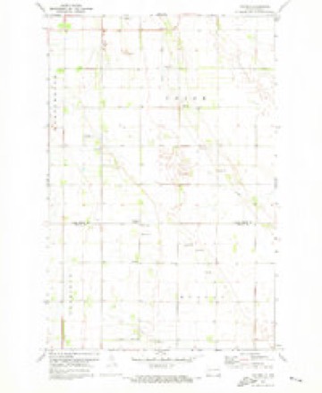
8 topographic sheets cover this place, the earliest surveyed in 1952 and the latest in 1985. It stands in Union Township. It lies in ZIP code area 58275. The Survey maps it on the Holmes quadrangle.
Topographic sheets covering this place
5 surveys from 8 printed sheetsMatched by testing this settlement's coordinate against the published boundary of every sheet in the United States Geological Survey's historical collection. Each opens the scanned sheet at the Survey.
- 1952 USGS Grand Forks quadrangle1:250000, 3 printings
- 1956 USGS Grand Forks quadrangle1:250000
- 1966 USGS Grand Forks quadrangle1:250000
- 1971 USGS Holmes quadrangle1:24000
- 1985 USGS Grand Forks quadrangle1:100000, 2 printings
Fires near this place
2 since 2016Regional context, not property-specific evidence. The federal wildfire occurrence database lists 2 fires within 5 miles of Holmes in 2016, burning about 201 acres in total. None started naturally. None was recorded as arson. Distance is straight-line from the map coordinates, so a fire counted here may appear on a neighbouring settlement's page as well.
| Reported cause | Fires |
|---|---|
| Debris and open burning | 1 |
| Equipment and vehicle use | 1 |
The most recent of them, most recent first, with the day each was reported and the service that recorded it.
| Date | Cause | Size | Reported by | Name on the report |
|---|---|---|---|---|
| 14 August 2016 | Equipment and vehicle use | 1.0 acres | North Dakota State Forest Service | 1 MILE S./7 MILES W. |
| 29 March 2016 | Debris and open burning | 200 acres | North Dakota State Forest Service | 2394 6TH AVE NE |
Mines and quarries near this place
2 within 5 milesRegional context, not property-specific evidence. The federal mineral resources record lists 2 workings within 5 miles of Holmes: 2 producers. All of them still produce. What was taken out: Sand and Gravel, Construction. Distance is straight-line from the map coordinates, so a quarry counted here may appear on a neighbouring settlement's page as well.
| Where | Site | Commodity | Status | Recorded |
|---|---|---|---|---|
| East Roader Pit & Plant | Sand and Gravel, Construction | Producer | ||
| Nygaard Sand & Gravel Pit | Sand and Gravel, Construction | Producer |
Storms near this place
34 since 1996Regional context, not property-specific evidence. The National Weather Service names Holmes in 34 storm reports between 1996 and 2025: 16 hail, 9 thunderstorm wind, 8 tornado, 1 funnel cloud. No death or injury is recorded in these reports. Each account below is quoted exactly as the forecast office filed it, from the NOAA Storm Events Database, and each date opens the federal record of that event.
| When | Event | Place named | Harm | What the report says |
|---|---|---|---|---|
| July 2001 | Thunderstorm Wind | Holmes | $500 | Branches were blown down. |
| August 2025 | Tornado (EF1) | Holmes | - | This brief QLCS tornado caused EF-1 damage to large cottonwood trees which were uprooted and snapped halfway up the truck. As it continued tracking northeast it caused crop damage and additional EF-1 damage to trees before lifting. Time estimated from KVX radar. TDS observed on radar. Sentinel-2 high resolution satellite imagery reveals crop damage. Max wind speed is estimated at 100 mph. |
| June 2018 | Thunderstorm Wind | Holmes | - | This damage was apparently caused by thunderstorm downburst winds. A large south facing shed door was blown in and over a third of the roofing was pealed off of a large 40x140 foot pole shed. Large tree branches were blown down, a small camper was flipped over, and a nearby small shed was blown down. Shop roofing was blown up to 300 yards to the northeast. Additional branch damage was noted across southern Union Township. |
| June 2018 | Thunderstorm Wind | Holmes | - | Extensive tree damage was reported. |
| June 2017 | Funnel Cloud | Holmes | - | This funnel cloud was seen reforming and moving toward Holmes. The funnel was viewed and reported from a point about 5 miles east of Northwood. |
| June 2017 | Tornado (EF0) | Holmes | - | No significant damage was found along this tornado track. Peak winds were estimated at 75 mph. |
| July 2017 | Hail | Holmes | - | Large hail and strong winds damaged crops across southern Pleasant View Township. |
| July 2016 | Hail | Holmes | - | The hail was accompanied by heavy rain and gusty winds. |
| June 2015 | Hail | Holmes | - | The hail fell at the intersection of county roads 15 and 13. |
| June 2015 | Tornado (EF2) | Holmes | - | Debris from this tornado was visible on radar. The tornado snapped numerous trees in shelterbelts and partially debarked others. Peak winds were estimated at 120 mph. |
| July 2014 | Thunderstorm Wind | Holmes | - | Widespread wind damaged was noted in shelterbelts across Union Township. Numerous large tree branches and limbs were broken down and an occasional tree trunk was snapped. |
| June 2012 | Tornado (EF1) | Holmes | - | This rope like tornado lasted for over four minutes and tracked due east for nearly two miles in the far northwest corner of Union Township. Several tree tops were snapped in field shelterbelts and at least one tree was uprooted near a farm shelterbelt. Peak winds were estimated at 90 mph. |
| July 2012 | Thunderstorm Wind | Holmes | - | Widespread and very strong winds blew through eastern Pleasant View Township. Numerous three to five inch diameter branches were broken down in shelterbelts. Screens and windows were blown out of a horse barn at one farmstead, with heavy rain flooding the interior. |
| July 2012 | Thunderstorm Wind | Holmes | - | Large eighteen inch diameter trees were snapped in west central Union Township, leaving three to four foot stumps. One 85 foot tall tree fell towards the west and took down a set of power lines which were fifty feet away. Lightning also started fires among the dry grasses and stumps. Winds and lightning were followed by areas of pea sized hail and brief heavy rains, though the rainfall was very patchy. |
| August 2010 | Tornado (EF2) | Holmes | - | A tornado struck a farmstead in southern Grand Forks County, damaging a large well constructed equipment shed. The tornado traveled over a shelterbelt along the west edge of the property causing considerable damage. Several pieces of farm equipment were moved and flipped. An empty grain bin was removed from its foundation and lofted 300 yards, with much of the bin landing in the northwest corner of the shelterbelt. |
| May 2010 | Hail | Holmes | - | An ARB observer reported the penny sized hail. |
| June 2010 | Tornado (EF4) | Holmes | - | This tornado began in Traill County about 3 miles north-northeast of Mayville at 349 PM CDT. The tornado crossed into Grand Forks County and tracked for an additional 8 miles to about 10 miles west of Thompson. The total track length was roughly 17 miles. One well constructed house near Holmes was completely swept from its foundation and destroyed along with several other farm buildings. Peak winds were estimated at 185 mph. |
| June 2010 | Thunderstorm Wind | Holmes | - | Numerous large trees were blown down or snapped in farmsteads by thunderstorm forward flank downdraft winds. |
| August 2007 | Hail | Holmes | - | The hail occurred in Holmes. |
| August 2007 | Hail | Holmes | - | This was an Atmospheric Resource Board report about 6 miles northeast of Hatton. |
| August 2006 | Thunderstorm Wind | Holmes | - | A utility company employee reported a one-half mile long path of distinct tree damage, including 6 to 7 inch diameter trees knocked down. |
| August 2006 | Thunderstorm Wind | Holmes | - | Numerous 50 foot tall cottonwood trees were blown down. |
| May 2005 | Tornado (F0) | Holmes | - | Intermittent touchdowns occurred in southwest Grand Forks county, from the Traill county line 2 miles northeast of Hatton to 5 miles west-southwest of Holmes. |
| June 2004 | Tornado (F1) | Holmes | - | An intermittent track was found from 2.5 miles north of Holmes to 6 miles east of Holmes. Numerous large trees were snapped off or uprooted in shelterbelts and farm yards. A large trampoline was thown over a house and demolished. Metal soffit, gutters, and shingles were torn off a second house. |
| July 2017 | Hail | Holmes | - | no account filed |
| August 2016 | Hail | Holmes | - | no account filed |
| June 2015 | Hail | Holmes | - | no account filed |
| June 2014 | Hail | Holmes | - | no account filed |
| May 2010 | Hail | Holmes | - | no account filed |
| May 2010 | Hail | Holmes | - | no account filed |
| August 2007 | Hail | Holmes | - | no account filed |
| August 2006 | Hail | Holmes | - | no account filed |
| June 2003 | Hail | Holmes | - | no account filed |
| August 1996 | Hail | Holmes | - | no account filed |
Nearest settlements
The eight closest, with where each one stands in the county. Distances are straight-line, computed from the Geographic Names Information System coordinates.
| Map | Place | Distance | Sheets |
|---|---|---|---|
| Thompson | 10.7 miles | 13 | |
| Merrifield | 13.4 miles | 13 | |
| Ojata (historical) | 14.0 miles | 16 | |
| Northwood | 14.4 miles | 8 | |
| Emerado | 14.5 miles | 16 | |
| Powell | 15.4 miles | 13 | |
| Arvilla | 17.5 miles | 15 | |
| Kempton | 18.3 miles | 11 |
Provenance
This settlement is recorded in the Geographic Names Information System as feature 1029501. The sheet list is computed by point-in-boundary test against the United States Geological Survey's historical topographic inventory. Both are works of the United States government and carry no copyright under 17 U.S.C. 105.
Wildfire. Short, Karen C. 2022. Spatial wildfire occurrence data for the United States, 1992-2020 [FPA_FOD_20221014]. 6th Edition. Fort Collins, CO: Forest Service Research Data Archive. https://doi.org/10.2737/RDS-2013-0009.6 Collected with United States Government funding and usable without additional permissions or fees.
Mines and quarries. USGS Mineral Resources Data System (MRDS) https://mrdata.usgs.gov/mrds/ A work of the United States government, no copyright under 17 U.S.C. 105.
Storms. NOAA National Centers for Environmental Information, Storm Events Database https://www.ncei.noaa.gov/stormevents/ A work of the United States government, no copyright under 17 U.S.C. 105. Narratives are quoted verbatim from the National Weather Service report and are not edited or summarised.