Block
From the record
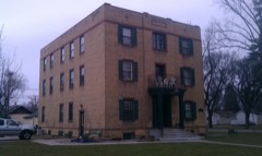
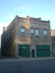
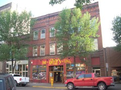
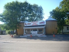
79 National Register listings published here.
Sources: the county history on the Internet Archive · the National Register database, National Park Service
53 topographic sheets cover 27 settlements here, and 79 properties are on the National Register of Historic Places.
79 National Register listings published here.
Sources: the county history on the Internet Archive · the National Register database, National Park Service
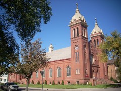
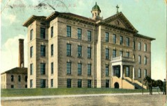
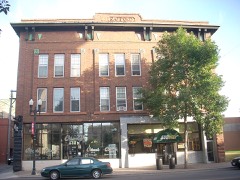
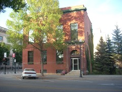
Every property in this county listed on the National Register of Historic Places, with the year it was listed and the federal nomination document.
Every wildfire the federal occurrence database records inside this county: 92 of them, burning about 6,442 acres. None started naturally and 5 were recorded as arson. Each settlement page carries the fires within five miles of it.
| Reported cause | Fires |
|---|---|
| Missing data/not specified/undetermined | 39 |
| Debris and open burning | 32 |
| Equipment and vehicle use | 7 |
| Railroad operations and maintenance | 7 |
| Arson/incendiarism | 5 |
| Fireworks | 2 |
The five largest, by the area the report gives. One of them was set deliberately.
| Date | Cause | Size | Reported by | Name on the report |
|---|---|---|---|---|
| 16 April 2002 | Missing data/not specified/undetermined | 5,500 acres | Devil's Lake Wetland Management District | MANVEL |
| 31 October 1994 | Debris and open burning | 280 acres | Devil's Lake Wetland Management District | AGNES MRSH |
| 29 March 2016 | Debris and open burning | 200 acres | North Dakota State Forest Service | 2394 6TH AVE NE |
| 4 August 2005 | Debris and open burning | 160 acres | North Dakota State Forest Service | not named |
| 11 October 2014 | Arson/incendiarism | 82 acres | Devil's Lake Wetland Management District | PENDER |
| 13 May 2013 | Debris and open burning | 25 acres | North Dakota State Forest Service | 19 |
| 9 October 2016 | Debris and open burning | 25 acres | North Dakota State Forest Service | 45 |
| 16 May 2018 | Debris and open burning | 16 acres | North Dakota State Forest Service | 2018-27 |
Every settlement page carries the fires within five miles of it - see the settlement index below.
The NOAA Storm Events Database holds 1,011 reports for this county, causing 4 deaths, 36 injuries and about $109,696,890 in recorded property damage. Each settlement page carries the reports that name it.
| Kind of event | Reports |
|---|---|
| Thunderstorm Wind | 400 |
| Hail | 391 |
| Tornado | 92 |
| Flash Flood | 54 |
| Funnel Cloud | 42 |
| Flood | 16 |
| Heavy Rain | 8 |
| Lightning | 7 |
| Wildfire | 1 |
The most serious of them, by death, then injury, then recorded damage. The accounts are quoted exactly as the forecast office filed them.
| When | Event | Place named | Harm | What the report says |
|---|---|---|---|---|
| June 2000 | Flash Flood | Larimore | 2 killed, $4,000,000 | After receiving 15 to 20 inches of rain over portions of western Grand Forks county, the area around Larimore quickly experienced flooding problems. During the rainfall, two men from the area decided to drive to Larimore to get something to eat. They drove into a washed out section of gravel road 30 feet deep with rushing water at the bottom. Both died in the crash about 7 miles west of Larimore. 600 feet of railroad bed washed away near Larimore, when two 3 foot diameter culverts washed out. 10 Burlington Northern-Santa Fe trains pass through this stretch daily as well as AMTRAK trains. At the Larimore Dam, water rose behind the dam and then overflowed the top. The water then cascaded 40 to 50 feet down the rocky cliffs below the dam, making it appear that the dam had failed. In the town of Larimore, water rose above the curbs. North of town, on the south branch of the Turtle River, water flowed 7 feet deep over the highway 18 bridge. |
| August 2007 | Tornado (EF4) | Northwood | 1 killed, 18 hurt, $50,000,000 | The tornado touched down about 2 miles west-southwest of Northwood. The tornado crossed the Goose River about a mile west-southwest of the Northwood airport and left a 200 yard wide stretch of downed trees in its wake. By the time it hit the airport, the ground track was one-third of a mile wide and growing wider. At this point the tornado was still visible outside the increasingly heavy rain. ||The tornado reached an incredible width of eight-tenths of a mile as it pushed through Northwood to the east-northeast. At this point it had multiple vortices embedded in the overall wedge shaped tornado. The strongest of these vortices appears to have scoured the ground and left broad circulation patterns of debris in the overall damage and debris field. Around this time the tornado likely became wrapped in heavy rain and would have been difficult to observe from a distance. The most extreme damage appeared to be in the northeast corner of the community.||Northwood, in southwest Grand Forks County, had a population of about 1000 people. 90 percent of the roughly 460 homes were damaged. One death occurred in a mobile home, with 18 other injuries reported. The death occurred in a trailer park on the north edge of town, where 19 total units were demolished.||Just to the east of the trailer park, in the area that sustained the extreme damage, three businesses were hit particularly hard. An agricultural company, the towns largest employer, had its buildings heavily damaged. A nearby construction company lost two large steel buildings and other equipment. Steel beams from the two steel buildings were twisted and tossed nearby. Finally, a car dealership lost 15 to 20 vehicles from its parking lot along highway 15. Many of these vehicles were damaged beyond recognition and tossed into nearby fields. One corn field to the north of highway 15 (across from the 3 businesses on the northeast side of town) had it stalks snapped off several inches from the root bases, with pieces of husked corn laying around.||Hangers and airplanes were also damaged at the airport. The local health center, school, supermarket, and grain elevator were damaged. Near the elevator, several rail cars were knocked off the tracks. Hundreds of trees were snapped, uprooted, or damaged. Power was also knocked out to many customers, but eventually was turned off (for safety reasons) to the entire town. A total of about 2600 truckloads of debris were hauled to the town landfill. In the days following the tornado, a Presidential Disaster Declaration was granted. |
| April 2006 | Flood | Countywide | 1 killed, $887,000 | The Red River at Grand Forks/East Grand Forks rose above flood stage around 4 PM CST on March 31st and remained above flood stage until around 6 PM CST on April 22nd. The river peaked at roughly 47.85 feet around 2 AM CST on April 6th. Unofficially, 47.85 feet would be the fifth highest modern-day river stage recorded. The Red Lake River crest actually arrived in the Grand Forks/East Grand Forks area prior to the Red River crest. Overland flooding also occurred in addition to the river flooding, with many roads around the county closed due to flooding. In the Minto area, U.S. Highway 81 was closed. The Red River bridge east of Thompson (ND) was closed due to flooding. In the city of Grand Forks, the Sorlie and the Point Red River bridges were also closed. This left the U.S. Highway 2 bridge as the only Red River crossing open in the county. Flooding problems occurred for about 50 homes at southeast edge of the city of Grand Forks, along Adams Drive and Lake Drive. A number of homes built close to the Red River were cutoff due to floodwaters, while others needed to be sandbagged. Also in Grand Forks, the permanent levee system (see below) was only about 85 percent complete. Therefore, some sections of temporary diking had to be done. Flood wall sections across Demers Avenue had to be installed. A 57 year-old Manvel woman drove into a flooded ditch at the Manvel Interstate 29 exit after work. After refusing assistance from a passing motorist, she attempted to walk home. She was later found drowned in a nearby flooded ditch. After the spring flood of 1997, many communities along the Red River looked at ways to mitigate flood effects. The permanent levee system constructed around Grand Forks got its first test and performed well. The English Coulee Diversion around the west and north sides of the city of Grand Forks also kept water out of the city as they were designed to do. Many low-lying or flood-prone neighborhoods close to the river were bought out and razed, which allowed the river to spread out into a wider channel through the city. Grand Forks County received a Presidential Disaster Declaration for damages caused by spring flooding.In summary, the total public and private flood losses experienced within the Red River of the North basin through late March and April 2006 were likely in excess of $20 million. This includes the following amounts. For Minnesota state and local infrastructure (this total includes the damages listed for each county), $8.5 million. For North Dakota state and local infrastructure (this total includes the damages listed for each county), $8 million. For Federal agencies (USACE, USGS, and USCG), $1.5 million. For the transportation industry costs due to traffic diversions caused by prolonged road and bridge closures, $1.5 million. For personal property losses due to floodwaters surrounding more than 500 individual farmsteads and rural homesteads, $1.0 million. |
| August 2001 | Thunderstorm Wind | Grand Forks | 12 hurt, $18,000,000 | The NWS Davis system measured a 101 mph wind gust. The strong wind resulted in many trees being blown down and a citywide state of emergency. Trees fell on vehicles, fences, and homes. The wind blew over traffic lights, signs, fences, and street lights. Over 50 streets in town were impassable as an estimated 3000 or more trees were flattened. 11,000 customers lost power with hundreds of power poles damaged. A 32 unit apartment building lost its roof and many homes had shingle damage. One home under construction was demolished and a semi truck was blown over. The city had to restrict water use because of the power loss. The University of North Dakota cancelled classes on the 9th. |
| August 1958 | Tornado (F3) | not stated | 2 hurt, $25,000 | no account filed |
| May 2001 | Hail | Grand Forks | 1 hurt, $10,000,000 | A male was hit in the head by a hailstone and required four stitches. Many homes and cars were damaged by the large hail, especially south of 32nd avenue south. |
| August 1994 | Thunderstorm Wind | Emerado | 1 hurt, $30,000 | no account filed |
| September 2003 | Lightning | Grand Forks | 1 hurt | A woman leaving work was struck by lightning as she walked to her car. She suffered no visible injuries, but was taken to the emergency room for observation. She later reported seizure-like muscle twitches. |
| August 2001 | Thunderstorm Wind | Grand Forks Afb | 1 hurt | Trees and powerlines were blown down on the base. |
| July 1996 | Hail | Grand Forks | $10,000,000 | no account filed |
| June 2000 | Flash Flood | Mc Canna | $4,000,000 | Flash flooding occurred around the McCanna area of western Grand Forks county, after 15 to 20 inches of rain fell. |
| June 2000 | Flash Flood | Arvilla | $4,000,000 | After receiving 15 to 20 inches of rain over portions of western Grand Forks county, the Turtle River rose to historic levels. At Arvilla, the Turtle River was a peaceful 2.04 feet June 12th at 11 pm. By June 13th at 2 pm, the river rose to 20.82 feet. Damage was especially high at the Turtle River State Park. Damages occurred at the main lodge, two year-round residences, the park office basement, parking lots, bridges, and roads. The park, at the height of the summer recreation season, was closed for several weeks while the mess was cleaned up. Preliminary damage estimates at the park came in at $500,000. |
| April 2023 | Flood | Grand Forks | $1,000,000 | East Grand Forks - Crest of 40.83 ft occurred on 4/24. Flooding extended into May.|NOTE: Damages dollar amount is for the entire county. Not separated by specific river basin or damage type. |
| June 2000 | Flash Flood | Mekinock | $1,000,000 | The town of Mekinock, population 200, was evacuated after 15 to 20 inches of rain fell upstream along the Turtle River. |
| June 2000 | Flash Flood | Honeyford | $1,000,000 | Flash flooding occurred around the town of Honeyford, as 15 to 20 inches of rain fell across portions of western Grand Forks county. |
| June 2000 | Flash Flood | Gilby | $1,000,000 | After receiving 15 to 20 inches of rain over portions of western Grand Forks county, flash flooding hit the town of Gilby. The flooding temporarily wiped out the drinking water supply for the 250 people of Gilby. Nearly all of the 100 homes in town had water in their basements. Just northeast of Gilby, two teenage boys were injured when they drove around a barracade and into water overflowing a county road. One broke a leg and the other injured his head. A 30-40 yard section of railroad track was washed out south of Gilby. Volunteers from the Grand Forks Air Force Base helped sandbag portions of the town. |
| June 2000 | Flash Flood | Johnstown | $1,000,000 | A bean warehouse took on water from the 15 to 20 inches of rain that fell across portions of western Grand Forks county. The beans expanded and then blew out a wall. |
| July 2002 | Flash Flood | Thompson | $500,000 | 6 to 8 inches of rain caused flooding problems over southeast Grand Forks county. Cole creek threatened a home southeast of Thompson. County roads 7 and 81 were closed due to high water levels. Many fields were flooded and roads were damaged. The county estimated $500,000 in damages. |
| September 2019 | Flash Flood | (Gfk)Grand Forks Int | $250,000 | Streets, low spots, rivers, basements, and underpasses were flooded by 4 to 9 inches of rain over a short duration of time. Numerous cars that got stuck in the flood waters were abandoned where they stalled. Interstate 29 was closed on the north end of Grand Forks due to high water levels, with traffic diverted around the closed segment. Farm fields and access roads were also flooded. |
| July 2002 | Flash Flood | Reynolds | $250,000 | 8 to 10 inches of rain fell over the Reynolds area, causing basement flooding and some basement walls to collapse. The coulee on the south side of town rapidly expanded, and threatened homes along it. The southwest ramp to Interstate 29 was closed due to high water. |
| July 2001 | Flash Flood | Grand Forks | $250,000 | Three inches of rain in nearly a half hour caused problems for portions of the city of Grand Forks. Widespread flooding was reported, with 2 to 4 feet of water on some city streets. Numerous vehicles were stalled in the high water. The Old Englestad Arena took on 4 1/2 feet of water and 20 other UND buildings reported some water damage. Water seepage occurred in several basements. |
| April 2002 | Wildfire | Manvel | $250,000 | no account filed |
| May 1978 | Tornado (F2) | not stated | $250,000 | no account filed |
| March 2020 | Flood | Arvilla | $150,000 | A rapid snowmelt and ice jams produced flooding along and near the Turtle River, south from the Turtle River State Park, through Mekinock and into Manvel. The Park Supervisor reported inundation of lower hiking trails and primitive campgrounds. Fields and access roads were flooded between Mekinock and Manvel. Grand Forks County Roads 11 and 5 were eventually closed at multiple locations, as flooding continued into April. |
| July 2020 | Flood | Emerado | $150,000 | Flood waters poured over the eastbound lanes of highway 2. Local fields and farm access roads were inundated. Some field erosion from overland flooding was noted across portions of Chester and Oakville townships. |
| August 2001 | Thunderstorm Wind | Grand Forks | $150,000 | A double circuit transmission line and 15 poles were damaged by the wind. |
| June 1998 | Flash Flood | Grand Forks | $150,000 | 1 to 3 inches of rain fell in less than two hours, quickly flooding low-lying areas around Grand Forks. Water was reported to be up to the bumpers of cars on some streets. Several streets and underpasses were closed due to high water. On the western edge of Grand Forks on US Highway 2, water flowed over the highway for about an hour. |
| July 2021 | Flash Flood | Mc Canna | $100,000 | Increased flooding developing in Hegland Township. Roads washing over in several locations and barricades going up. |
| June 2020 | Flash Flood | Emerado | $100,000 | Flooding was reported in Emerado, with water filled ditches and water against homes. Roughly 3 to 5 inches of rain had fallen. |
| June 1998 | Flash Flood | Emerado | $100,000 | 1 to 3 inches of rain fell in less than two hours, causing flooding problems around Emerado. Many fields were flooded. |
| May 1996 | Flash Flood | Grand Forks | $100,000 | no account filed |
| July 2012 | Lightning | Kelly | $80,000 | Lightning caused a house fire that led to a total structural loss. |
| April 2022 | Flash Flood | Grand Forks | $50,000 | Streets flooded to more than a foot deep at several intersections. |
| July 2020 | Flash Flood | Manvel | $50,000 | Streets and rural roads were flooded in and around Manvel. Fields, farmstead and homestead access roads were flooded in northern Ferry and Turtle River townships. The water lapped at garage doors and house foundations at some locations. |
| July 2020 | Flash Flood | Emerado | $50,000 | Flooding was reported in Emerado, with water filled ditches and water against homes. Roughly 3 to 10 inches of rain fell. |
| July 2020 | Flash Flood | Bolack | $50,000 | Street flooding was reported. The water was deep enough in spots to rise above the curbs. |
| July 2014 | Flash Flood | Larimore | $50,000 | Several sections of rural township roads were partially washed out in Larimore, Niagara, and Elm Grove townships in west central Grand Forks County. |
| June 1994 | Thunderstorm Wind | Northwood | $50,000 | Strong winds uprooted several trees, destroyed a camper, and blew over a 45 foot truck trailer. |
| April 2019 | Flood | Johnstown | $50,000 | no account filed |
| June 1994 | Thunderstorm Wind | Grand Forks Air Force | $50,000 | no account filed |
| August 2021 | Thunderstorm Wind | Bolack | $40,000 | Metal roof was torn from a business along Highway 2. Time was estimated based on radar and nearby sensor observations. |
| June 2005 | Thunderstorm Wind | Thompson | $30,000 | A semi was blown off Interstate 29 and into the median, one mile north of the Thompson exit. The driver was not injured. |
| June 2020 | Tornado (EF1) | Logan Center | $25,000 | This tornado began 4 miles north of Sharon, in Steele County, at 430 pm CDT. The tornado tracked for about 2 miles in Steele County, before it crossed into Grand Forks County, where the path continued for another 5 miles. The tornado blew out the back wall of a pole shed and also tore off some of its steel sheathing. It snapped or uprooted several cottonwood and pine trees in shelterbelts along its path. Peak winds were estimated at 95 mph. |
| July 1996 | Thunderstorm Wind | Grand Forks | $25,000 | no account filed |
| July 1982 | Tornado (F1) | not stated | $25,000 | no account filed |
| July 2018 | Thunderstorm Wind | (Rdr)Grand Forks Afb | $20,000 | A few trees were also blown down on GFAFB. Shigles and roof trim were blown off a house about one-quarter mile east of GFAFB along Highway 2. |
| July 2008 | Lightning | Grand Forks | $20,000 | Several lightning strikes were reported in the Grand Forks area, producing roofing and electrical system damage to homes. |
| July 2001 | Flash Flood | Grand Forks | $20,000 | Street flooding was reported in Grand Forks with a few stalled vehicles. Sewer backup occurred in the basement of one house. Underground parking lots were flooded. |
| June 2000 | Thunderstorm Wind | Grand Forks | $20,000 | High winds tore the roof off a metal building. The roof fell and damaged several parked cars and another building. |
| June 1999 | Flood | Grand Forks | $20,000 | A thunderstorm complex converged over the greater Grand Forks area, producing 1 to 3 inches of rain in about an hour. 1.65 inches of rain fell at the NWS on the west side of Grand Forks. Several streets were flooded and closed to traffic. The heavy rain and poor visibility may have contributed to a motorhome crash on Interstate 29, 2 miles south of Grand Forks. The driver and 5 passengers were taken to a hospital for treatment. |
| July 2021 | Flash Flood | Mc Canna | $15,000 | Overland flooding developed across central and northern portions of Hegland Township, with flood waters washing over farmyards and roadways in route to smaller coulees and into the Turtle River. |
| June 2009 | Flash Flood | Forest River Colony | $15,000 | State highway 32 was washed out just north of the intersection with county 1. Several other washouts occurred on county roads in Elkmont and Inkster Townships. |
| August 2001 | Thunderstorm Wind | Gilby | $15,000 | Many homes in Gilby had some sort of wind damage. The boards on an outdoor hockey rink were blown over. |
| August 2001 | Thunderstorm Wind | Northwood | $15,000 | Half the roof of a quonset was torn off along with its doors. Shingles were torn off the home and trees were blown down. |
| July 2021 | Flash Flood | Mc Canna | $10,000 | Report and video of water flowing over and washing out a county road. Posted via social media. |
| September 2017 | Thunderstorm Wind | Manvel | $10,000 | A large piece of metal sheet roofing from a neighbor's machine shed was torn off and hit the house, causing minor damage. An enclosed trailer was moved about ten feet and two trees were uprooted. |
| July 2014 | Flash Flood | Bolack | $10,000 | Two to four inches of rain fell in a little over an hour, quickly flooding streets and low lying areas in the city of Grand Forks. |
| May 2012 | Thunderstorm Wind | Arvilla | $10,000 | Several ash and oak trees up to 22 inches in diameter were snapped at the Turtle River State Park. |
| July 2004 | Tornado (F1) | Emerado | $10,000 | Many trees were severely damaged along a four mile path south of Emerado. Three trees fell on a granary 9.5 miles south of Emerado. |
| June 2002 | Thunderstorm Wind | Grand Forks | $10,000 | A 73 mph wind gust was measured by a Davis system on the south end of Grand Forks. Many trees were blown down and the temperature rose to 98 degrees at the same time. |
The Survey's mineral resources record lists 11 workings inside this county. 7 still produce and 4 are closed or unrecorded. Each settlement page carries the workings within five miles of it.
| Commodity | Workings |
|---|---|
| Sand and Gravel, Construction | 11 |
The least common of them first, because a county's hundredth gravel pit says nothing its first ten did not.
| Where | Site | Commodity | Status | Recorded |
|---|---|---|---|---|
| Butler Pit | Sand and Gravel, Construction | Producer | ||
| East Roader Pit & Plant | Sand and Gravel, Construction | Producer | ||
| East Roader Pit & Plant | Sand and Gravel, Construction | Unknown | ||
| Hegge Pit | Sand and Gravel, Construction | Producer | ||
| Hogan Pit | Sand and Gravel, Construction | Past Producer | ||
| Honeyford Pit & Plant | Sand and Gravel, Construction | Past Producer | ||
| Nodak Contracting Pit | Sand and Gravel, Construction | Producer | ||
| Nygaard Sand & Gravel Pit | Sand and Gravel, Construction | Producer | ||
| Slottrud Pit | Sand and Gravel, Construction | Producer | ||
| Walter Rakoozy Pit | Sand and Gravel, Construction | Producer | ||
| West Roader Pit & Plant | Sand and Gravel, Construction | Past Producer |
One book written about this county, cut here where the book itself is cut, at its printed chapters: 1 chapter in all. Every chapter is public domain, machine-read from the scan and reproduced complete. A chapter already given under one of the county's towns is not repeated in this list.
| Chapter | Length |
|---|---|
| The whole text | 62,590 words in 4 parts |
Named settlements recorded in the Geographic Names Information System, each with the topographic sheets covering it. Villages, hamlets and abandoned places alike. Each is shown with the nearest named watercourse or landform and the survey quadrangle it falls on.
The vanished settlements of Grand Forks County: the places named above that are no longer on the map.