 Block
Alto, New Mexico
11 topographic sheets cover this place, the earliest surveyed in 1955 and the latest in 2004. It stands in the Ruidoso census division. It lies in ZIP code area 88345. It lies near Gilmore Canyon. The Survey maps it on the Angus quadrangle. It stands 7,313 feet above sea level.
Research this city
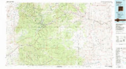
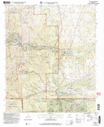
Topographic sheets covering this place
6 surveys from 11 printed sheetsMatched by testing this settlement's coordinate against the published boundary of every sheet in the United States Geological Survey's historical collection. Each opens the scanned sheet at the Survey.
- 1955 USGS Roswell quadrangle1:250000, 3 printings
- 1958 USGS Roswell quadrangle1:250000
- 1962 USGS Roswell quadrangle1:250000
- 1963 USGS Angus quadrangle1:24000, 4 printings
- 1984 USGS Ruidoso quadrangle1:100000
- 2004 USGS Angus quadrangle1:24000
Fires near this place
253 since 1992Regional context, not property-specific evidence. The federal wildfire occurrence database lists 253 fires within 5 miles of Alto between 1992 and 2020, burning about 8,312 acres in total. 67 started naturally. 8 were recorded as arson. Distance is straight-line from the map coordinates, so a fire counted here may appear on a neighbouring settlement's page as well.
| Reported cause | Fires |
|---|---|
| Natural | 67 |
| Recreation and ceremony | 57 |
| Missing data/not specified/undetermined | 56 |
| Debris and open burning | 24 |
| Equipment and vehicle use | 18 |
| Misuse of fire by a minor | 9 |
| Arson/incendiarism | 8 |
| Power generation/transmission/distribution | 7 |
| Smoking | 4 |
| Other causes | 2 |
| Fireworks | 1 |
The most recent of them, most recent first, with the day each was reported and the service that recorded it.
| Date | Cause | Size | Reported by | Name on the report |
|---|---|---|---|---|
| 5 September 2020 | Recreation and ceremony | under an acre | Lincoln National Forest | 120 CAMPFIRE |
| 29 September 2020 | Recreation and ceremony | under an acre | Lincoln National Forest | SKYLINE |
| 28 September 1994 | Missing data/not specified/undetermined | under an acre | New Mexico State Forestry Division | PASO |
| 27 September 1992 | Missing data/not specified/undetermined | 1.0 acres | New Mexico State Forestry Division | DAM |
| 2 September 2020 | Recreation and ceremony | under an acre | Lincoln National Forest | DRY MILLS |
| 2 September 2002 | Natural | under an acre | Lincoln National Forest | RUFUS |
| 10 September 2007 | Natural | under an acre | Lincoln National Forest | CREST TRAIL |
| 10 September 1994 | Missing data/not specified/undetermined | under an acre | New Mexico State Forestry Division | SUN |
Settlements close enough to share some of these fires:
Mines and quarries near this place
8 within 5 milesRegional context, not property-specific evidence. The federal mineral resources record lists 8 workings within 5 miles of Alto: 4 unknowns, 2 past producers, 2 prospects. None of them still produces. What was taken out: Sand and Gravel, Construction, Silver, Gold, Lead, Copper, Zinc. Distance is straight-line from the map coordinates, so a quarry counted here may appear on a neighbouring settlement's page as well.
| Where | Site | Commodity | Status | Recorded |
|---|---|---|---|---|
| Mccrory Prospect | Lead | Prospect | ||
| Rock No 1 | Copper, Silver | Prospect | ||
| Silver Contact Claims 1980's | Silver, Gold, Lead, Copper, Zinc | Past Producer | 1900, 1905, 1939 | |
| Silver Plume Mine | Silver, Gold, Copper | Unknown | ||
| Tom's Gravel Pit | Stone, Crushed/Broken | Past Producer | 1992 | |
| Bonito Canyon | Sand and Gravel, Construction | Unknown | ||
| Graham Mine | Sand and Gravel, Construction | Unknown | ||
| Materials Pit | Sand and Gravel, Construction | Unknown |
Storms near this place
57 since 1997Regional context, not property-specific evidence. The National Weather Service names Alto in 57 storm reports between 1997 and 2025: 28 flash flood, 14 hail, 8 debris flow, 2 thunderstorm wind. The reports record 3 deaths and 3 injuries. Each account below is quoted exactly as the forecast office filed it, from the NOAA Storm Events Database, and each date opens the federal record of that event.
| When | Event | Place named | Harm | What the report says |
|---|---|---|---|---|
| July 2025 | Debris Flow | Alto | 3 killed, $50,000,000 | Extremely heavy rainfall from slow moving thunderstorms resulted in catastrophic flash flooding and destructive debris flows on and downstream of the South Fork burn scar. Debris flows and a record rise on the Rio Ruidoso from 1.43 feet to 20.24 feet in approximately 30 minutes overtopped bridges and roads, pushed some houses off their foundations and down canyons and hillsides, forced power outages, and resulted in water and sewer services. These extremely high flows destroyed the horse racetrack at Ruidoso Downs. Swift water teams rescued 65 individuals from homes, RV trailers, vehicles and from flood waters and debris flows. Up to 150 families and 400 homes were believed to be impacted and damaged. Tragically, three deaths were reported, including two young children when flood waters and debris flows overwhelmed and destroyed their RV. The parents of these children ended up being hospitalized due to suffering serious injuries while trying to save their children from the floodwaters. Two family dogs were also lost in the floodwaters. A federal disaster declaration was issued by the president two days after the catastrophic flash flooding to help free up federal funds and assistance for recovery efforts. |
| July 1997 | Lightning | Alto | 2 hurt | Two golf course employees were dazed by a near-miss lightning strike. Both suffered temporary hearing lose and sonic shock. |
| July 2013 | Flash Flood | Alto | 1 hurt | Emergency Manager relayed that Bonito Lake Rd. near Bonito Lake was washed out. Storm cell was stationary over area for nearly one and a half hours before it dissipated. Rain gauges across the burn scar area reported rainfall amounts ranging from 0.70-1.50 during this time. A car was washed off the road in flooding location with one occupant needing rescue. |
| March 2002 | Wildfire | Alto | $5,000,000 | no account filed |
| June 2024 | Debris Flow | Alto | $500,000 | Heavy rain totaling 1.48 inches at the Cow Mountain RAWS station and radar estimated to be higher than 2 inches over the recent South Fork burn scar produced life threatening and extremely dangerous debris flows down Cedar Creek just north of Ruidoso. This torrent raged through town overtopping several bridges and crossings including, Mechem Road (NM Highway 48), Paradise Canyon Road, Cree Meadows Road, and Wiley Road. The debris flow also overtopped a small dam near Cree Meadows Road. Fire crews were pulled out of sensitive areas due to the threat of heavy rains and an evacuation order was issued for the Village of Ruidoso just after 4pm MDT. Some people became trapped in their vehicle along Paradise Canyon Road, requiring swift water rescue. This one swift water rescue was one of a total of 26 swift water rescues for the day caused by the flash flooding and debris flow that occurred across the Village of Ruidoso. Miraculously, there were no reports of injuries or fatalities. Damage is an estimate based on cars and road crossings being involved. |
| July 2025 | Flash Flood | Alto | $250,000 | Heavy rains over the South Fork and Salt burn scars in and around Ruidoso resulted in burn scar flash flooding. Flash flooding was reported along multiple portions of Cedar Creek and the Rio Ruidoso, including at Mechem Dr., Brady and Porr Roads, Country Club Road, Robin Road and River Trail, a bridge at Eagle Road, Gavilan Canyon Road, and along U.S. Highway 70 in Hollywood. Spring Canyon Road was washed out and made impassable. Fast moving water was reported over all roads in the Cherokee Village Mobile Home park where a confirmed gas leak was reported alongside a successful swift water rescue of an adult woman. An unknown number of other swift water rescues were conducted in Hollywood. Flash flooding overtopped the bridge on the access road to the Ruidoso Downs racetrack, and flooded the horse tunnel and Spaghetti Flats north and east of the racetrack. Damage is an estimate. |
| August 2022 | Flash Flood | Alto | $75,000 | Heavy rain on the McBride burn scar caused flash flooding along Gavilan Canyon Road near the intersection of Eagle Creek Canyon Road in Ruidoso. Damages are estimated. |
| July 2025 | Flash Flood | Alto | $50,000 | Heavy rains resulted in high water levels along the Rio Bonito and along Sandesta Dr., entering homes in the area. Damage is an estimate. |
| July 2024 | Flash Flood | Alto | $50,000 | Rainfall amounts of 0.50 to 1.50 inches fell on the South Fork burn scar west of downtown Ruidoso during the early afternoon hours. This rainfall resulted in more burn scar flash flooding and debris flows across neighborhoods in Alto and Ruidoso. The Cherokee Mobile Village along U.S. Highway 70 at the Lincoln and Otero County line was evacuated due to flash flooding. Mechem Dr. became impassible again due to Cedar Creek overflowing its banks and rushing over the roadway. Heavy flows along Cedar Creek caused Mechem Dr. to become impassable, washed out a part of Musket Ball Dr. and brought debris flow over Cree Meadows Drive. Flooding of the Rio Ruidoso resulted in the closure of Gavilan Canyon Road and the evacuation of the Gavilan Mobile Home Park. Debris flow on the Rio Ruidoso destroyed a culvert on the eastern end of the Ruidoso Downs racetrack. Water and debris flow reported west of Alto making NM 532 impassable. Fortunately, no reports of significant water rises were received downstream of the water breach at Ruidoso Downs. Culvert and trailer park damage cost is an estimate. |
| July 2022 | Flash Flood | Alto | $50,000 | The Lincoln County emergency manager reported that an estimated 1.5 inches over the McBride burn scar caused flooding of Lower Eagle Creek with water, mud, and debris over Eagle Creek Road which is also known as New Mexico State Highway 120. Many 6 to 18 inch diameter boulders flowed over the roadway along with large segments of burned timber. Damages are estimated. |
| June 2012 | Flash Flood | Alto | $50,000 | Three hundred yards of forest service road 107 washed out between Runnels Stables on northwest end of Little Bear burn scar and Bonito Lake. Debris over the roadway from George Washington Canyon to Bonito Lake. Culverts along forest service road 107 also washed out. |
| July 2025 | Flash Flood | Alto | $25,000 | Heavy rains over the South Fork and Salt burn scars near Ruidoso produced flash flooding. Water and debris overflowed U.S. Highway 70 at Sudderth Dr. and Ruidoso Downs, White Mountain Dr., Gavilan Canyon Rd. from Alto Cafe to Meander, and Alpine Village Road. The Cherokee Mobile Home village was evacuated with swiftwater rescues performed there, and at Big-O Tires and on Friedenbloom Drive. Damage is an estimate. |
| August 2022 | Flash Flood | Alto | $25,000 | The Lincoln County emergency manager reported that hours of light, steady rainfall with totals of 1 to 2.5 inches caused burn scar flash flooding on the McBride burn scar near Ruidoso. All of Gavilan Canyon was flooded. Damages are estimated. |
| July 2024 | Flash Flood | Alto | $20,000 | Rainfall amounts of around half an inch over the South Fork burn scar resulted in more flash flooding across the Upper Canyon and Brady Canyon neighborhoods west of downtown Ruidoso. Runoff on the burn scar resulted in flash flooding on the Rio Ruidoso resulting in road closures along and near the banks of the river, including White Mountain and Sunny Slope Drive, Brady Canyon Road and Mechem from Cedar Creek, and Gavilan Canyon Road. Property damage is an estimate. |
| July 2012 | Flash Flood | Alto | $20,000 | Narrow stream channels quickly rose with water levels reaching a depth of 4 feet. the flood waters moved debris and boulders the size of car tires 10 to 15 feet downstream. Culverts were compromised in the Eagle Creek residential area with numerous roads washed out, especially along Forest Road 127A. Paved roads in the area were less impacted. |
| July 2020 | Flash Flood | Alto | $10,000 | Hiking trails and a road were washed out west of Bonito Lake due to heavy rainfall over the Little Bear burn scar from 2012. Hikers and campers in the area were evacuated. Fortunately, there were no injuries. Damage amounts are estimated for repairs to the roadway. |
| August 2020 | Flash Flood | Alto | $10,000 | A stationary thunderstorm over the Little Bear burn scar produced flash flooding near Bonito Lake. Rocks, mud, and debris that had built up in the area was washed out onto nearby roads. Damage amounts are estimated for culverts and one roadway. |
| July 2015 | Flash Flood | Alto | $10,000 | A significant wash out with debris near Orchard Campground west of Bonito Lake. A couple places along highway 107 were impassable due to flowing water and debris. Marthas Canyon was the hardest hit. |
| June 2024 | Flash Flood | Alto | $5,000 | Heavy rain on the McBride burn scar resulted in flash flooding with mud and ash off the hillsides roughly between NM 48 and Eagle Creek Road, and a second area along Gavilan Canyon road by Meander Drive was washed out with debris over the roadway. Both sections of Gavilan Canyon Road were closed. A water main break also occurred that exacerbated the situation. Damage is an estimate based on clearing the debris on the roadway. |
| August 2024 | Flash Flood | Alto | $2,000 | Flash flooding and debris flows on the Rio Ruidoso in the Upper Canyon area along Main Road was relayed by Emergency Management and was seen on a USGS camera. Debris piled up and clogged some culverts along Main Road in Ruidoso. Another debris flow from this same heavy rain event resulted in the closure of Gavilan Canyon Bridge near Hollywood. Overall, the debris flows stayed within the banks of the Rio Ruidoso and did not overwhelm any of the main bridges in Ruidoso. Damage cost is an estimate based on cleanup costs of the clogged culverts. |
| September 2012 | Flash Flood | Alto | $2,000 | Large rocks and boulders were washed over portions of Forest Road 107 making it impassable. Maintenance crews were dispatched to remove rocks and clear the road. Rainfall amounts of nearly one inch were reported near the area where the flash flooding took place. |
| July 2013 | Hail | Alto | $1,000 | The hail resulted in damage to automobiles, including broken windshields. |
| August 2013 | Flash Flood | Alto | $1,000 | Fast flowing water and rocks over Forest Service Road 107 beneath Washington canyon to the west of Bonito Lake. |
| July 2010 | Flash Flood | Alto | $1,000 | Large rocks were swept onto State Route 48, one mile south of Alto, by rushing water. |
| August 2025 | Debris Flow | Alto | - | Heavy rainfall on the South Fork burn scar resulted in flash flooding and debris flow across roadways on and downstream of the burn scar. Debris flow was observed in multiple sections across Alpine Village Road, Cedar Creek Drive, Gavilan Canyon Road, Ash and Brady Canyon Road, White Mountain Drive at Mechem Drive and Geroge McCarthy Drive. This resulted in the closures of these roadways for a few hours in the mid to late afternoon. Finally, water in the Rio Ruidoso was observed overtopping the bridge at Gavilan Canyon Road just north of Sudderth Drive. |
| August 2025 | Debris Flow | Alto | - | Heavy rainfall over the Blue 2 burn scar resulted in four reported locations of thick mud and debris washed out over the Bonito Lake Road up from Bonito Lake. |
| August 2025 | Debris Flow | Alto | - | Brief heavy rainfall over the South Fork burn scar resulted in some flowing water and debris flow across Gavilan Canyon Road. |
| August 2025 | Debris Flow | Alto | - | Thunderstorms on the Ruidoso area burn scars resulted in flash flooding and debris flows on and downstream of the burn scars. Debris flow on Gavilan Canyon Road made the roadway impassible with a car containing an individual trapped in the debris. Thankfully, rescue crews were able to get the occupant out of the vehicle and debris flow. |
| August 2025 | Debris Flow | Alto | - | Slow moving thunderstorms developed over the McBride burn scar back building east over the South Fork burn scar. Heavy rainfall rates first resulted in flash flooding on the McBride burn scar with debris flow resulting in the closure of Gavilan Canyon Road between Hull Road and Warrior Drive and Gavilan Canyon Road at Meander Drive. Debris flows and flash flooding then quickly occurred on the South Fork burn scar resulting in the closure of many roads including White Mountain Drive at Warren Tucker Drive, Alpine Village Road at University, Brady Canyon Road at Ponderosa Drive, Ash Drive, and Mechem Drive, Cree Meadows Drive, Sudderth Drive and Mechem Drive intersection, and Paradise Canyon Drive at Hull Road and Leon Farrar. The flash flooding and debris flows resulted in vehicles rushing down the road on Sunny Slope Drive and a water rescue of one male. |
| June 2024 | Debris Flow | Alto | - | Flash flooding and a debris flow was reported in Eagle Creek within the new South Fork burn area crossing NM Highway 532 (Ski Run Road) between mile markers 2 and 3. This debris flow was reported to have reached the Alto Reservoir, overtopping the diversion channel. The Cow Mountain RAWS near the headwaters of Eagle Creek recorded 1.48 inches of total rainfall this day. Damage from this individual event is unknown. However, there were more impactful debris flows and flash flooding within the South Fork burn scar further south and through Ruidoso. |
| June 2024 | Flash Flood | Alto | - | Heavy rains over the new South Fork burn scar resulted in flash flooding along Cedar Creek that raged through the Innsbrook Village near NM Highway 48. An NWS Employee also recorded flash flooding along Cedar Creek down to Paradise Canyon Drive. Damage is unknown, and may be more related to the South Fork Wildfire. |
| June 2024 | Hail | Alto | - | An NWS employee down in the Sacramento Mountains just west of Alto reported two inch hail from a slow moving severe thunderstorm. |
| June 2024 | Flash Flood | Alto | - | Heavy rain caused flash flooding along Eagle Creek and debris flow over State Highway 532. |
| June 2024 | Flash Flood | Alto | - | Heavy rain caused flash flooding within the Blue 2 burn scar upstream of Bonito Lake. |
| June 2024 | Flash Flood | Alto | - | Raging waters on Cedar Creek overtopped its banks in spots, resulting in the closure of Paradise Canyon Road near Hull Road. Muskat Ball Drive at Cedar Creek was impassable due to flooding with medium to heavy debris. County Road 127A (Upper Eagle Creek Road) was impassible with medium to heavy debris along the road. Alto Lake also flooded over a short time. |
| August 2024 | Flash Flood | Alto | - | The local Fire Department reported flooding near the junction of Alpine Village Road and NM Highway 48 just south of Alto, NM. |
| August 2024 | Flash Flood | Alto | - | A fast moving storm developed over the South Fork burn scar, quickly moving east and producing 0.84 of rainfall over the McBride burn scar. Flash flooding was reported over roadways at University Dr. and Mechem Dr., Gavilan Canyon Rd. at several locations from Eagle Creek to east of Warrior Dr., and on Paradise Road. Debris was reported over the road at Prospect Rd. and Gavilan Canyon Road. While road closures were reported there were no reports of damage, injuries or casualties. |
| July 2021 | Hail | Alto | - | The Lincoln County emergency manager reported that dime to nickel size hail fell from a strong thunderstorm near Alto. |
| May 2019 | Thunderstorm Wind | Alto | - | A roof was partially torn off a home in Alto due to high winds from a dry microburst. No other homes in the area were affected. No injuries were reported. |
| May 2018 | Hail | Alto | - | Quarter size hail north of Alto. Several severe thunderstorms that moved over this area ended up producing at least 12 inches of hail to the east of Alto. |
| June 2017 | Hail | Alto | - | A brief storm produced hail up to the size of pennies in Alto. |
| July 2017 | Hail | Alto | - | Hail up to the size of quarters two miles east-southeast of Alto. |
| August 2014 | Heavy Rain | Alto | - | Heavy rainfall over the Little Bear burn scar produced a small rock slide that closed 1 lane of Ski Run Road. |
| September 2014 | Flash Flood | Alto | - | Mud and debris was reported on State Road 107 west of Bonito Lake. |
| September 2014 | Heavy Rain | Alto | - | HADS site located at Buck Mountain recorded 3.32 inches of rain. There was flooding reported just to the north during this same time. |
| July 2014 | Flash Flood | Alto | - | Considerable debris and logs were washed down a hillside onto Highway 37. No damage occurred to the roadway but created a significant mess and forced a temporary road closure. |
| September 2013 | Flood | Alto | - | Heavy rainfall over the Rio Bonito watershed led to a 23 feet rise in Bonito Lake. The lake rose from 22 feet below the spillway to 8 inches over the spillway. Emergency operations were in place due to significant concerns regarding a breach of the spillway. No breach occurred. Eagle Creek was out of banks and flooded a nearby playground along NM 48. |
| August 2013 | Flash Flood | Alto | - | Roads washed over and impassible below canyons in the Loma Grande subdivision. |
| June 2012 | Thunderstorm Wind | Alto | - | Strong wind gust reported at IRAWS 13. |
| July 2001 | Hail | Alto | - | One inch size hail accumulated to 6 inches deep in arroyos near Alto. |
| July 2014 | Hail | Alto | - | no account filed |
| July 2013 | Hail | Alto | - | no account filed |
| July 2013 | Hail | Alto | - | no account filed |
| July 2013 | Hail | Alto | - | no account filed |
| July 2013 | Hail | Alto | - | no account filed |
| August 2012 | Hail | Alto | - | no account filed |
| May 2007 | Hail | Alto | - | no account filed |
Nearest settlements
The eight closest, with where each one stands in the county. Distances are straight-line, computed from the Geographic Names Information System coordinates.
| Map | Place | Distance | Sheets |
|---|---|---|---|
| Sun Valley | 0.9 miles | 11 | |
| Sierra Vista | 1.0 miles | 11 | |
| Alpine Cellars Village | 1.8 miles | 10 | |
| Villa Madonna | 2.8 miles | 11 | |
| Angus | 3.3 miles | 11 | |
| Ponderosa Heights | 3.7 miles | 10 | |
| Bonito | 3.9 miles | 11 | |
| Ruidoso | 4.6 miles | 10 |
Elsewhere
Matched on this settlement's Geographic Names Information System number rather than its name, so it cannot be a different place of the same name in another state.
| Wikipedia article on Alto | An encyclopaedic summary. Its text is share-alike, so it is linked here rather than copied. |
| Wikidata item Q4736767 | The structured record the population and elevation above come from. Public domain (CC0). |
Provenance
This settlement is recorded in the Geographic Names Information System as feature 903117. The sheet list is computed by point-in-boundary test against the United States Geological Survey's historical topographic inventory. Both are works of the United States government and carry no copyright under 17 U.S.C. 105.
Wildfire. Short, Karen C. 2022. Spatial wildfire occurrence data for the United States, 1992-2020 [FPA_FOD_20221014]. 6th Edition. Fort Collins, CO: Forest Service Research Data Archive. https://doi.org/10.2737/RDS-2013-0009.6 Collected with United States Government funding and usable without additional permissions or fees.
Mines and quarries. USGS Mineral Resources Data System (MRDS) https://mrdata.usgs.gov/mrds/ A work of the United States government, no copyright under 17 U.S.C. 105.
Storms. NOAA National Centers for Environmental Information, Storm Events Database https://www.ncei.noaa.gov/stormevents/ A work of the United States government, no copyright under 17 U.S.C. 105. Narratives are quoted verbatim from the National Weather Service report and are not edited or summarised.