 Block
Ruidoso, New Mexico
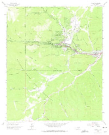
10 topographic sheets cover this place, the earliest surveyed in 1955 and the latest in 2004. It stands in the Ruidoso census division. It lies in ZIP code area 88345. It lies near Grindstone Canyon. The Survey maps it on the Ruidoso quadrangle. 7,679 people lived here at the 2020 count. It stands 6,729 feet above sea level.
Research this city
On record in Ruidoso
Buildings and businesses the archive holds for this place. Each opens its own page, with the source record it came from.
On the National Register 3 records
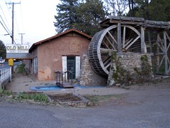 Old Dowlin Milllisted 2013
- New Mexico Military Institute Summer Camp, Main Buildinglisted 1983
- Ruidoso Lookout Towerlisted 1988
Population over time
2 figuresRuidoso fell from 8,029 to 7,679 between 2010 and 2020. These are the recorded population figures Wikidata holds for this place, reached through the Geographic Names Information System number this page is keyed on rather than by name, so they belong to this place and not to another of the same name. Most are census counts, but not all are: an early figure may be a founding or settlement estimate, and an estimate published within five years of a census is left out. The change column is computed, and is left blank where more than 20 years separate a figure from the one before it, because a gap that long is not a change between two counts.
| Year | People | Change |
|---|---|---|
| 2010 | 8,029 | |
| 2020 | 7,679 | -350 (-4%) |
Topographic sheets covering this place
6 surveys from 10 printed sheetsMatched by testing this settlement's coordinate against the published boundary of every sheet in the United States Geological Survey's historical collection. Each opens the scanned sheet at the Survey.
- 1955 USGS Roswell quadrangle1:250000, 3 printings
- 1958 USGS Roswell quadrangle1:250000
- 1962 USGS Roswell quadrangle1:250000
- 1963 USGS Ruidoso quadrangle1:24000, 3 printings
- 1984 USGS Ruidoso quadrangle1:100000
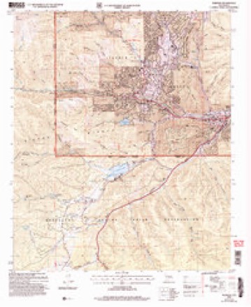
- 2004 USGS Ruidoso quadrangle1:24000
Photographs
8 of 10 photographs shown, 2018Taken for the Office of War Information and the Farm Security Administration, who photographed the country between 1935 and 1944. Works of United States government photographers, with no known restriction on use. Each opens its catalogue record.

Highsmith, Carol M, 2018. Library of Congress
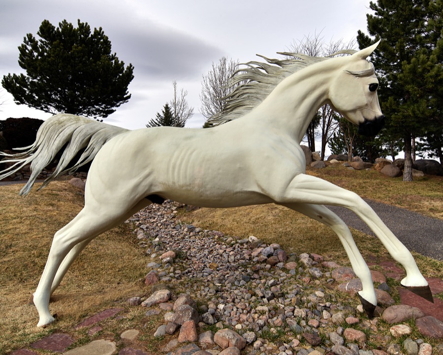
Highsmith, Carol M, 2018. Library of Congress

Highsmith, Carol M, 2018. Library of Congress
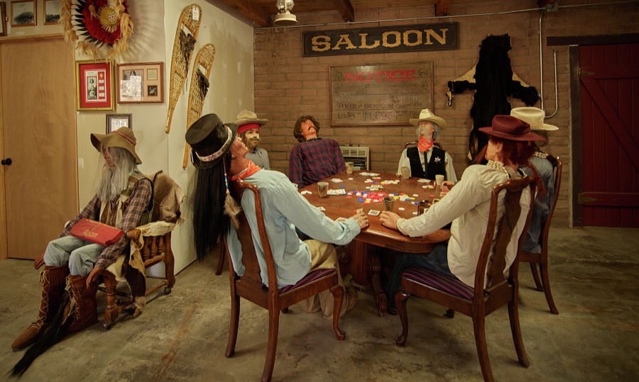
Highsmith, Carol M, 2018. Library of Congress
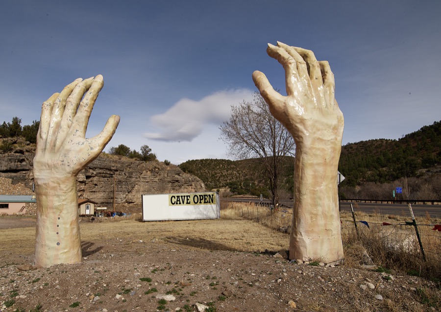
Highsmith, Carol M, 2018. Library of Congress

Highsmith, Carol M, 2018. Library of Congress
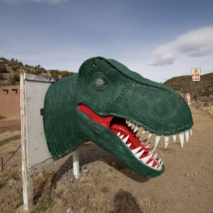
Highsmith, Carol M, 2018. Library of Congress

Highsmith, Carol M, 2018. Library of Congress
Every photograph of Lincoln County
Fires near this place
294 since 1992Regional context, not property-specific evidence. The federal wildfire occurrence database lists 294 fires within 5 miles of Ruidoso between 1992 and 2020, burning about 18,143 acres in total. 60 started naturally. 14 were recorded as arson. Distance is straight-line from the map coordinates, so a fire counted here may appear on a neighbouring settlement's page as well.
| Reported cause | Fires |
|---|---|
| Missing data/not specified/undetermined | 88 |
| Natural | 60 |
| Recreation and ceremony | 43 |
| Debris and open burning | 30 |
| Misuse of fire by a minor | 18 |
| Power generation/transmission/distribution | 14 |
| Arson/incendiarism | 14 |
| Equipment and vehicle use | 9 |
| Other causes | 7 |
| Smoking | 7 |
| Fireworks | 4 |
The most recent of them, most recent first, with the day each was reported and the service that recorded it.
| Date | Cause | Size | Reported by | Name on the report |
|---|---|---|---|---|
| 5 September 2020 | Recreation and ceremony | under an acre | Lincoln National Forest | 120 CAMPFIRE |
| 27 September 1992 | Missing data/not specified/undetermined | 1.0 acres | New Mexico State Forestry Division | DAM |
| 21 September 1997 | Equipment and vehicle use | under an acre | Mescalero Agency | PIDGEON |
| 2 September 2002 | Natural | under an acre | Lincoln National Forest | RUFUS |
| 5 August 1992 | Missing data/not specified/undetermined | under an acre | New Mexico State Forestry Division | MC CARTY |
| 5 August 1992 | Natural | under an acre | Lincoln National Forest | not named |
| 3 August 1999 | Debris and open burning | under an acre | Mescalero Agency | PALMER |
| 25 August 2015 | Recreation and ceremony | under an acre | Lincoln National Forest | PERK |
Settlements close enough to share some of these fires:
Mines and quarries near this place
10 within 5 milesRegional context, not property-specific evidence. The federal mineral resources record lists 10 workings within 5 miles of Ruidoso: 6 unknowns, 1 prospect, 1 past producer, 1 occurrence. 1 still produces. What was taken out: Sand and Gravel, Construction, Stone, Lead, Stone, Crushed/Broken. Distance is straight-line from the map coordinates, so a quarry counted here may appear on a neighbouring settlement's page as well.
| Where | Site | Commodity | Status | Recorded |
|---|---|---|---|---|
| Mccrory Prospect | Lead | Prospect | ||
| Mescalero Gypsum Deposit | Gypsum-Anhydrite | Occurrence | Gypsum | |
| State Hwy Pit No 60-76-S | Stone | Unknown | ||
| Tom's Gravel Pit | Stone, Crushed/Broken | Past Producer | 1992 | |
| Beavers Pit & Crusher | Sand and Gravel, Construction | Producer | ||
| Graham Mine | Sand and Gravel, Construction | Unknown | ||
| Jim Strong Pit | Sand and Gravel, Construction | Unknown | ||
| Materials Pit | Sand and Gravel, Construction | Unknown | ||
| Materials Pit | Sand and Gravel, Construction | Unknown | ||
| Materials Pit | Sand and Gravel, Construction | Unknown |
Storms near this place
45 since 1996Regional context, not property-specific evidence. The National Weather Service names Ruidoso in 45 storm reports between 1996 and 2025: 25 flash flood, 9 hail, 4 debris flow, 3 heavy rain. No death or injury is recorded in these reports. Each account below is quoted exactly as the forecast office filed it, from the NOAA Storm Events Database, and each date opens the federal record of that event.
| When | Event | Place named | Harm | What the report says |
|---|---|---|---|---|
| June 2024 | Debris Flow | Ruidoso | $10,000,000 | Heavy rains over the recent South Fork burn area totaling up to 1.48 inches at the Cow Mountain RAWS and estimate by radar to have surpassed 2 inches caused flash flooding heavy debris flows along the Rio Ruidoso. This torrent impacted several bridges and water crossings including, N. Eagle Drive, Grindstone Canyon Road, Country Club Drive. Numerous homes were impacted with a total of 26 swift water rescues stretched across the Rio Ruidoso and Cedar Creek drainages through the Village of Ruidoso. Fire crews were pulled out of sensitive areas due to the threat of heavy rains and an evacuation order was issued for the Village of Ruidoso shortly after 4pm MDT. The debris flow eventually reached downstream past the Village of Ruidoso to the Ruidoso Downs Track overtopping the edge of the facility and flowing out over the track. For reference, the Ruidoso Downs Track was constructed over the Rio Ruidoso. Miraculously there were no reports of injuries or fatalities. Damage is an estimate based extent and limited information. |
| May 2000 | Wildfire | Ruidoso | $2,000,000 | no account filed |
| July 2024 | Flash Flood | Ruidoso | $750,000 | Multiple rounds of heavy rainfall from thunderstorms impacted the South Fork and Salt Fire burn scars for a second day in a row. This resulted in exacerbated flash flooding and debris flow in the same locations along the Rio Ruidoso. A house near downtown Ruidoso was reported to have been pushed 10 feet due to flash flooding. A busted water line and gas leak were also reported in the area. An SUV with 3 occupants inside floated down the Rio Ruidoso. Thankfully, all 3 occupants were rescued. The worst impacts from this episode of flash flooding and debris flow occurred on U.S. Highway 70 in Hollywood. The highway and its various intersections, including Mechem Drive and Sudderth Drive were shut down. Fast and heavy debris flow resulted in a road collapse near the Sudderth Dr. and U.S. Highway 70 intersection. The debris flowing down U.S. Highway 70 at one point included a large shipping container. Property damage cost is an estimate. |
| July 2021 | Flash Flood | Ruidoso | $750,000 | Heavy rain along the Rio Ruidoso caused water to overflow its banks which resulted in flash flooding alongside the river. Several bridges, such as the Main Road Bridge, Gavilan Canyon Bridge, and the Eagle Bridge were overtopped and damaged. The McDaniel Bridge in Upper Canyon was completely destroyed. The City of Ruidoso opened a community center for displaced residents and visitors. Damages are estimated for the structural damage done to the bridges. The New Mexico Governor declared a state of emergency for Lincoln County as a result of the significant flooding. |
| July 2024 | Flash Flood | Ruidoso | $500,000 | Heavy rainfall from thunderstorms on the South Fork and Salt Fire burn scars resulted in flash flooding and debris flows across the Upper Canyon and Brady Canyon neighborhoods along the Rio Ruidoso. A bridge on Main Road at McDaniel Road was washed from the debris flow and runoff. Video on social media showed the roof of a house along with other household debris sliding down the Rio Ruidoso upper canyon among fast moving water. Additionally, a woman was trapped in a tree due to high rushing water. Runoff from the rainfall moved downstream through the Rio Ruidoso exceeding its banks and impacting the Fern Trail and Paradise Canyon near downtown Ruidoso. Several car and water rescues were conducted in this area. The Riverside RV Park in Hollywood along the banks of the Rio Ruidoso was completely flooded out. Another video on social media showed the Rio Ruidoso at Ruidoso Downs Racetrack and Casino out of its banks flooding the horse racetrack. Additionally, crews with excavators are seen digging up dirt along the banks of the Rio Ruidoso at the racetrack cleaning up prior flash flood damage. Thankfully, no injuries or fatalities were reported from the catastrophic flash flooding. Property damage cost is an estimate. |
| September 2001 | Flash Flood | Ruidoso | $500,000 | no account filed |
| July 2025 | Flash Flood | Ruidoso | $250,000 | Heavy rainfall fell over the South Fork burn scar near Ruidoso, with on gage measuring 2.14 inches. Flash flooding produced water over roadways and bridges along Cedar Creek at Mechem Drive, Cree Meadows Bridge and Drive, Innsbrook Drive, Starlite Road, White Mountain Drive, Gavilan Canyon Road, Warren Tucker Drive, Reese Drive, Musketball Drive, and Geneva Road. Three swift water rescues were conducted off Gunpowder Trail and Spring Canyon Road. A video was shared of what appears to be a mobile home washed away down Cedar Creek along Paradise Canyon Drive. The Rio Ruidoso crested to 12.68 feet in minor flood stage at 12:40pm MST, reaching out of its banks in numerous locations. Flash flooding impacted as far down Rio Ruidoso as the Ruidoso Downs Race Track. |
| July 2024 | Flash Flood | Ruidoso | $100,000 | Heavy thunderstorms on the South Fork burn scar resulted in another round of burn scar flash flooding, debris flow and severe property damage across the Upper Canyon and Brady Canyon neighborhoods along Mechem Drive west of downtown Ruidoso. Bridge 2 at Main Road and Fox Road became impassible due to flooding. Debris flows resulted in arching powerlines over the flood water at Brady Canyon. An SUV was trapped against a tree due to flood waters just north of Brady Canyon Road. There was a rescue of two juveniles from a house at Meander Drive and Paradise Canyon Drive. Runoff from the flash flooding resulted in the Rio Ruidoso to instantly rise to major flood stage and a new record level of 15.80 feet. This resulted in more flash flooding at the Ruidoso Downs Casino horse racetrack. Flash flooding caused damage to the racetrack, two bridges near the entrance of the facility, and in the barn area. After this latest instance of flash flooding, officials decided to shut down the horse racetrack for the remainder of the summer season and move upcoming scheduled races to Albuquerque. Thankfully, no injuries or fatalities were reported from this instance of burn scar flash flooding. Property damage is an estimate. |
| July 2024 | Flash Flood | Ruidoso | $100,000 | A late evening batch of moderate to heavy showers passed over the complex of burn scars in and around Ruidoso producing a half inch to one inch of rainfall in the area. Catastrophic flash flooding occurred, focusing through Cedar Creek and the Rio Ruidoso after 11pm MDT. Flood waters overtopping bridges and roadways were reported in several areas including Mechem Dr. at Brady Canyon Dr., U.S. Highway 70 at Cedar Creek, and Paradise Canyon Road at Cedar Creek. Evacuations were ordered from the Upper Canyon area to areas along the Rio Ruidoso from west of town through to mobile home areas near Hollywood along U.S. Highway 70. Several swift water rescues were conducted, including for two vehicles trapped in water near Johnson Rd., an elderly resident who was unable to evacuate on Brady Canyon Dr., and one resident trapped on one side of a bridge at Paradise Rd. and Foothill Rd. that was overtopped by water. Cherokee Mobile Home Park sustained damage with water flowing beneath mobile homes. Home damage was reported along Brady Canyon Dr. from the elderly couple who needed assistance evacuating. A culvert on Cedar Creek above the ranger station was completely torn out and washed out onto the roadway. Rises on the Rio Ruidoso at the Hollywood gage spiked from 1.58 feet to 8.16 feet within 90 minutes before waters started to recede. |
| June 2025 | Flash Flood | Ruidoso | $75,000 | Burn scar flash flooding off the South Fork and Salt burn scars that ran along the Rio Ruidoso from the Upper Canyon down to Hollywood. High water was reported over multiple roadways along the Rio Ruidoso, notably along Ebarb Dr. and Johnson Rd., Mechem Dr., Main Bridge 2, N. Grindstone Canyon Rd., Country Club Dr., Gavilan Canyon Rd., Eagle Dr. Bridge, Sudderth Drive. The McDaniel Bridge in the Upper Canyon area, a small water crossing, was destroyed. Damage is an estimate based on washed out culverts and the destroyed McDaniel Bridge. |
| July 2025 | Flash Flood | Ruidoso | $50,000 | Heavy rain from slow moving storms on the South Fork and McBride burn scars resulted in flash flooding on and downstream of the burn scars. Several roads along and crossing the Rio Ruidoso were closed due to the resultant flash flooding and debris flow in the river. This included Mechem Drive, Ebarb Drive at Main Road and West Redwood Road, Fern Trail at Terrance and Grindstone, Eagle Bridge on Eagle Road, Gavilan Bridge on Gavilan Canyon Road in Hollywood, Cree Meadows at Country Club and Heath, Robin Road, Hull Road, and Paradise Canyon Road. The floodwaters and debris flow washed away a vehicle on Porr Drive. No information was known on if any occupants were in the vehicle at the time. Another vehicle was stuck in flood waters at Apache Hills Drive and Grant Drive. Finally, 2 to 3 inches of water entered a home on Ash Drive. |
| July 2025 | Flash Flood | Ruidoso | $20,000 | Heavy rains over the South Fork and Salt burn scars resulted in burn scar flash flooding in the Ruidoso area, including near schools. Flash flooding was reported in multiple areas along roads and highways including White Mountain Dr., Hull Rd., Mechem Dr., Paradise Canyon Dr. just north of Sudderth Dr., Perk Canyon Dr., and along Main Road. The access road to the Ruidoso Downs racetrack was once again overtopped. The Fire Department assisted in a swift water rescue of an occupied vehicle being pushed by flood waters. Damage is an estimate, and there are no reports of injuries or fatalities. |
| June 2025 | Flash Flood | Ruidoso | $10,000 | Heavy rain on the South Fork burn scar resulted in flash flooding and flowing water across Ebarb Dr. from Perk Canyon along with Brady Canyon Rd. and Ponderosa Dr. The flash flooding continued downstream with a dumpster floating down Rio St. and Grindstone Canyon Rd. and flowing water closing Johnson & Main Rd. Large debris was reported at the 300 block of Cedar Creek. Water was also observed reaching the bridge at Two Rivers. Finally, flooding was observed at the Riverside RV Park near Gavilan Canyon Rd. and Sudderth Dr. |
| September 2025 | Flash Flood | Ruidoso | $10,000 | Rainfall over the South Fork burn scar resulted in flash flooding that washed out a low water crossing along Maple Drive through Brady Canyon. |
| September 2025 | Debris Flow | Ruidoso | $10,000 | Heavy rain from thunderstorms over the South Fork burn scar produced water and debris in Cedar Creek flowing over the bridge at Brady Canyon Road and Ponderosa Drive before moving across Mechem Drive at Brady Canyon Road, shutting down Mechem Drive. Water and debris in Cedar Creek continued downstream moving over the road at Cree Meadows and Country Club Drive and Paradise Canyon Drive at Starlite Road and Hull Road, closing these roads. Video from social media showed floodwaters and debris flows swiftly going around a house along the banks of the Rio Ruidoso at the first bridge on Main Road in the Upper Canyon neighborhood. The Rio Ruidoso was observed flowing over the bridge at Country Club Drive and Eagle Drive resulting in the closure of these two roadways. Finally, the floodwater and debris flow in the Rio Ruidoso overwhelmed culverts under the western part of the Ruidoso Downs racetrack eventually moving across the racetrack itself. |
| December 2023 | Thunderstorm Wind | Ruidoso | $10,000 | Winds blew down large tree branches onto a house. Wind speed is an estimate based on the large tree branch broken causing damage. |
| June 2024 | Debris Flow | Ruidoso | $2,000 | Slow moving storms developed over the burn scars near Ruidoso with an estimated 4 to 6 inches of rainfall on the eastern half of the Salt burn scar. Flash flooding and debris flow raged down drainages along U.S. Highway 70 to the Ruidoso Hospital and intersection with Sudderth Road. The NM National Guard reported conducting 45 swift water rescues through the day and early evening, including an unknown number at the Rainbow Lake RV Park on Carrizozo Canyon Road. Roads were also impassable at Brady Canyon Rd., Porr Dr., Leon Farrar Dr., University Dr. and Mechem Dr., among others. Video was captured of the torrent of flood waters and debris flow sweeping a dumpster and multiple vehicles down U.S. Highway 70, including a semi-truck. An evacuation was ordered for the Upper Canyon area of Ruidoso. Miraculously, there were no reports of injury or fatalities. Damage is an estimate. |
| August 2023 | Flash Flood | Ruidoso | $500 | Floodwaters carried significant amounts of mud, rocks, and debris across Mescalero Lane along the Rio Ruidoso west of Ruidoso. There was minor damage to an access gate. |
| June 2025 | Flash Flood | Ruidoso | - | Emergency management reports the closure of the bridge at Main Rd. and Fox Drive over the Rio Ruidoso from burn scar flash flooding off the South Fork burn scar. |
| July 2025 | Flash Flood | Ruidoso | - | Heavy rain on the South Fork burn scar from slow moving thunderstorms during the early afternoon hours resulted in another round of flash flooding across roads and neighborhoods on and downstream of the burn scar. This resulted in Main Road at bridge 2 to become impassable, and the closure of Ebarb Drive and Porr Drive due to 3-6 inches of flowing water over the road. Additionally, the runoff and debris flow continued downstream on the Rio Ruidoso with the river overtopping the bridge at Gavilan Canyon Road just north of Sudderth Drive in Hollywood. |
| July 2025 | Flash Flood | Ruidoso | - | Heavy rain from thunderstorms over the South Fork burn scar resulted in some minor water rises in the Rio Ruidoso with some water coming off the Upper Canyon and putting debris over Main Road by main bridge 2. Some debris on Cedar Creek Drive at Musket Ball Drive and near Mechem Drive resulted in a brief closure of the road to allow for crews to clean up the roadway. |
| July 2025 | Flash Flood | Ruidoso | - | Heavy rain over the South Fork burn scar resulted in floodwaters overtopping Main Road Bridge 2. A swiftwater rescue was also conducted at Sleepy Hollow Bridge. |
| July 2025 | Debris Flow | Ruidoso | - | Moderate to heavy rain on the Ruidoso area burn scars resulted in some flash flooding and debris across and downstream of the burn scars, especially along the Rio Ruidoso and Cedar Creek. Water was reported overtopping Cedar Creek Drive near Sam Tobias Campground, Mechem Drive at Brady Canyon Road, Gavilan Canyon Road north of Sudderth Drive (Highway 70) and Sudderth Drive itself in Hollywood. Some debris flow with a 3 foot wall of mud was also observed on Main Road at McDaniel Drive along with possible evidence of a landslide off Flume Ridge. |
| July 2025 | Flash Flood | Ruidoso | - | Another round of thunderstorms on the South Fork and McBride burn scars resulted in flash flooding and debris flows on and downstream of the burn during the evening hours. Water and debris were observed flowing near Flume Canyon Drive, Mecham and White Mountain Drive, Warren Tucker and White Mountain Drive, and on Gavilan Canyon Road at Eagle Creek Road and between Janet and Edwards Drive. |
| June 2025 | Flash Flood | Ruidoso | - | Heavy rain from thunderstorms over the South Fork and Blue 2 burn scar resulted in flash flooding and debris flows of 6 to 8 inches on North Loop, Main Road, and Brady Canyon Road in the Upper Canyon area just west of downtown Ruidoso. Some flowing water and debris flow was also observed on Ski Run Road and Highway 48 near the Alto Reservoir. |
| July 2024 | Tornado (EFU) | Ruidoso | - | The Ruidoso emergency manager forwarded a video of a landspout in the Upper Canyon area. The time, length and width of landspout estimated based on derived radar products and video footage. |
| July 2024 | Flash Flood | Ruidoso | - | Emergency manager reported Brady Canyon Dr. and Ponderosa Dr. were closed due to water flowing over the roadway, caused by burn scar flash flooding. |
| September 2024 | Flash Flood | Ruidoso | - | Rainfall amounts superseding 0.60 inches resulted in burn scar flash flooding off the South Fork and McBride burn scars. Water over the road at Paradise Canyon Dr. and Hull Road resulted in a closure of the roadway. Water and debris was also reported over Friedenbloom Drive. |
| August 2024 | Flash Flood | Ruidoso | - | Storms over the South Fork burn scar resulted in flash flooding in the Upper Canyon neighborhood including Johnson Road and Main Road requiring the closing of Main Road at Bridge 1. High flows in the Rio Ruidoso eventually flowed downstream resulting in water flowing across North Eagle Drive. Ruidoso Municipal Schools were put under a shelter in place notice while the flash flood warning was in effect. |
| August 2024 | Flash Flood | Ruidoso | - | Brief heavy rainfall of 0.20 over the South Fork burn scar resulted in flash flooding and road closures over portions of Brady Canyon Road from South Oak Drive to Mechem Drive. |
| August 2024 | Flash Flood | Ruidoso | - | Locally heavy rainfall estimated to be near two inches per hour over the South Fork burn scar resulted in flash flooding along the Rio Ruidoso. Water over Bridge 2 on Main Road in Ruidoso was reported. Water over roadways was reported elsewhere in Ponderosa Heights, and near Alpine Village. |
| August 2019 | Heavy Rain | Ruidoso | - | Two public weather stations in Ruidoso reported rainfall rates near 10 inches per hour from a strong thunderstorm moving slowly east through the area. One station picked up 3.48 inches of rainfall in less than one hour, which fortunately only led to minor flooding on the Rio Ruidoso. |
| July 2017 | Hail | Ruidoso | - | Hail up to the size of nickels on the south and east side of Ruidoso. |
| July 2013 | Funnel Cloud | Ruidoso | - | The Lincoln County Emergency Manager relayed a report from the Capitan Police Dept. Chief of a well-defined funnel cloud just north of Capitan. |
| May 2012 | Hail | Ruidoso | - | Quarter size hail reported 2 miles southeast of Ruidoso. |
| August 2001 | Flash Flood | Ruidoso | - | Brief heavy rain caused strong runoff into Carrizo Creek below the Trap and Skeet burn area and then moved north into Ruidoso with street flooding. Some sandbagging was done to prevent curb overflow from reaching local businesses. |
| May 2008 | Hail | Ruidoso | - | no account filed |
| June 2007 | Hail | Ruidoso | - | no account filed |
| June 2007 | Hail | Ruidoso | - | no account filed |
| September 2006 | Hail | Ruidoso | - | no account filed |
| August 2006 | Heavy Rain | Ruidoso | - | no account filed |
| August 2006 | Heavy Rain | Ruidoso | - | no account filed |
| August 2005 | Hail | Ruidoso | - | no account filed |
| September 1996 | Hail | Ruidoso | - | no account filed |
| July 1996 | Hail | Ruidoso | - | no account filed |
Nearest settlements
The eight closest, with where each one stands in the county. Distances are straight-line, computed from the Geographic Names Information System coordinates.
| Map | Place | Distance | Sheets |
|---|---|---|---|
| Ponderosa Heights | 1.0 miles | 10 | |
| Hollywood | 2.1 miles | 10 | |
| Alpine Cellars Village | 3.1 miles | 10 | |
| Ruidoso Downs | 3.6 miles | 9 | |
| Alto | 4.6 miles | 11 | |
| Sierra Vista | 5.4 miles | 11 | |
| Sun Valley | 5.6 miles | 11 | |
| Villa Madonna | 6.8 miles | 11 |
Elsewhere
Matched on this settlement's Geographic Names Information System number rather than its name, so it cannot be a different place of the same name in another state.
| Wikipedia article on Ruidoso | An encyclopaedic summary. Its text is share-alike, so it is linked here rather than copied. |
| Wikidata item Q2380585 | The structured record the population and elevation above come from. Public domain (CC0). |
Provenance
This settlement is recorded in the Geographic Names Information System as feature 923668. The sheet list is computed by point-in-boundary test against the United States Geological Survey's historical topographic inventory. Both are works of the United States government and carry no copyright under 17 U.S.C. 105.
Wildfire. Short, Karen C. 2022. Spatial wildfire occurrence data for the United States, 1992-2020 [FPA_FOD_20221014]. 6th Edition. Fort Collins, CO: Forest Service Research Data Archive. https://doi.org/10.2737/RDS-2013-0009.6 Collected with United States Government funding and usable without additional permissions or fees.
Mines and quarries. USGS Mineral Resources Data System (MRDS) https://mrdata.usgs.gov/mrds/ A work of the United States government, no copyright under 17 U.S.C. 105.
Storms. NOAA National Centers for Environmental Information, Storm Events Database https://www.ncei.noaa.gov/stormevents/ A work of the United States government, no copyright under 17 U.S.C. 105. Narratives are quoted verbatim from the National Weather Service report and are not edited or summarised.