 Block
Hollywood, New Mexico
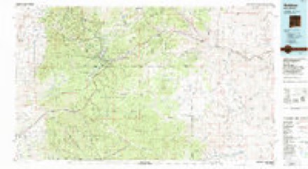
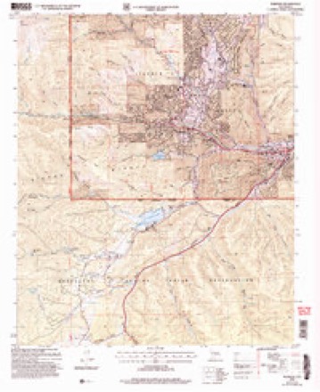
10 topographic sheets cover this place, the earliest surveyed in 1955 and the latest in 2004. It stands in the Ruidoso census division. It lies in ZIP code area 88345. It lies near Gavilan Canyon. The Survey maps it on the Ruidoso quadrangle.
Topographic sheets covering this place
6 surveys from 10 printed sheetsMatched by testing this settlement's coordinate against the published boundary of every sheet in the United States Geological Survey's historical collection. Each opens the scanned sheet at the Survey.
- 1955 USGS Roswell quadrangle1:250000, 3 printings
- 1958 USGS Roswell quadrangle1:250000
- 1962 USGS Roswell quadrangle1:250000
- 1963 USGS Ruidoso quadrangle1:24000, 3 printings
- 1984 USGS Ruidoso quadrangle1:100000
- 2004 USGS Ruidoso quadrangle1:24000
Fires near this place
211 since 1992Regional context, not property-specific evidence. The federal wildfire occurrence database lists 211 fires within 5 miles of Hollywood between 1992 and 2020, burning about 17,452 acres in total. 51 started naturally. 11 were recorded as arson. Distance is straight-line from the map coordinates, so a fire counted here may appear on a neighbouring settlement's page as well.
| Reported cause | Fires |
|---|---|
| Missing data/not specified/undetermined | 68 |
| Natural | 51 |
| Recreation and ceremony | 29 |
| Debris and open burning | 20 |
| Arson/incendiarism | 11 |
| Power generation/transmission/distribution | 10 |
| Equipment and vehicle use | 7 |
| Misuse of fire by a minor | 7 |
| Other causes | 3 |
| Smoking | 3 |
| Fireworks | 2 |
The most recent of them, most recent first, with the day each was reported and the service that recorded it.
| Date | Cause | Size | Reported by | Name on the report |
|---|---|---|---|---|
| 5 September 2020 | Recreation and ceremony | under an acre | Lincoln National Forest | 120 CAMPFIRE |
| 27 September 1992 | Missing data/not specified/undetermined | 1.0 acres | New Mexico State Forestry Division | DAM |
| 21 September 1997 | Equipment and vehicle use | under an acre | Mescalero Agency | PIDGEON |
| 5 August 1992 | Missing data/not specified/undetermined | under an acre | New Mexico State Forestry Division | MC CARTY |
| 5 August 1992 | Natural | under an acre | Lincoln National Forest | not named |
| 25 August 2015 | Recreation and ceremony | under an acre | Lincoln National Forest | PERK |
| 21 August 2012 | Recreation and ceremony | under an acre | Lincoln National Forest | 120A |
| 21 August 2011 | Natural | under an acre | Lincoln National Forest | SMOKEY |
Settlements close enough to share some of these fires:
Mines and quarries near this place
10 within 5 milesRegional context, not property-specific evidence. The federal mineral resources record lists 10 workings within 5 miles of Hollywood: 7 unknowns, 1 past producer, 1 occurrence, 1 producer. 1 still produces. What was taken out: Sand and Gravel, Construction, Stone, Stone, Crushed/Broken, Gypsum-Anhydrite. Distance is straight-line from the map coordinates, so a quarry counted here may appear on a neighbouring settlement's page as well.
| Where | Site | Commodity | Status | Recorded |
|---|---|---|---|---|
| Mescalero Gypsum Deposit | Gypsum-Anhydrite | Occurrence | Gypsum | |
| State Hwy Pit No 60-76-S | Stone | Unknown | ||
| Tom's Gravel Pit | Stone, Crushed/Broken | Past Producer | 1992 | |
| Beavers Pit & Crusher | Sand and Gravel, Construction | Producer | ||
| Graham Mine | Sand and Gravel, Construction | Unknown | ||
| Hollywood Pit | Sand and Gravel, Construction | Unknown | ||
| Jim Strong Pit | Sand and Gravel, Construction | Unknown | ||
| Materials Pit | Sand and Gravel, Construction | Unknown | ||
| Materials Pit | Sand and Gravel, Construction | Unknown | ||
| Materials Pit | Sand and Gravel, Construction | Unknown |
Storms near this place
22 since 2008Regional context, not property-specific evidence. The National Weather Service names Hollywood in 22 storm reports between 2008 and 2025: 19 flash flood, 2 hail, 1 flood. The reports record 1 death. Each account below is quoted exactly as the forecast office filed it, from the NOAA Storm Events Database, and each date opens the federal record of that event.
| When | Event | Place named | Harm | What the report says |
|---|---|---|---|---|
| July 2008 | Flood | Hollywood | 1 killed, $25,000,000 | Widespread, serious flooding occurred from the upper canyon of the Rio Ruidoso downstream through the towns of Ruidoso, Hollywood and Ruidoso Downs as far east as Fox Caves. Flooding also occurred along the Rio Bonito from the dam at Bonito Lake downstream to State Road 48. Flooding was extensive in Ruidoso, not only along the Rio Ruidoso, Cedar Creek and other small streams, but also throughout the town from the 6 to 7 inches of rainfall that fell there. One man was killed when we was swept away by the raging Rio Ruidoso, but no other substantial injuries were reported. A total of 500 structures, including campers and mobile homes were damaged. Around 200 houses were damaged, and some were completely destroyed. At least 13 bridges were washed out and several cars were washed downstream. Several dozen recreational vehicles and campers were damaged at an RV park at Ruidoso Downs. |
| July 2022 | Flash Flood | Hollywood | $100,000 | The Lincoln County emergency manager reported flash flooding and debris flow from the McBride burn scar at Gavilan Canyon and Warrior Drive. This forced the closure of the roadway. Local law enforcement remarked that this flooding was worse than the event on July 20th. Damages are estimated. |
| August 2022 | Flash Flood | Hollywood | $50,000 | Heavy rain on the McBride burn scar caused flash flooding along Gavilan Canyon Road, near Warrior Drive. Damages are estimated. |
| July 2022 | Flash Flood | Hollywood | $50,000 | Heavy rain on the McBride burn scar caused flash flooding and debris flow within Gavilan Canyon. Photos shared by the Lincoln County emergency manager shows mud and debris across Gavilan Canyon Road which made the roadway impassable. Photos shared also depicted significant flooding and debris flow at the Gavilan Canyon Hideaway and Escape RV Park with mud and debris making roadways impassable. Damages are estimated. |
| June 2025 | Flash Flood | Hollywood | $30,000 | Flash flooding off the Salt burn scar coming out of Bear Canyon. Swift water rescues conducted at the Cherokee Mobile Home Park, the Elevate Hotel, and for three vehicles at the Otero Federal Credit Union. Flash flooding reported at the Twin Spruce RV park, U.S. Highway 70 and Sudderth Dr. and U.S. Highway 70 and mile mark 261 closed due to burn scar flash flooding. Damage is an estimate based on vehicles rescues. No injuries or fatalities reported. |
| September 2022 | Flash Flood | Hollywood | $20,000 | Localized heavy rainfall on Gavilan Ridge flowed downhill onto the McBride burn scar which caused flash flooding along Gavilan Canyon Road from Janet Drive northward to Airplane Canyon. Burn scar flash flooding resulted in rock and mud debris along the roadway. Damages are estimated. |
| June 2024 | Flash Flood | Hollywood | $10,000 | Water and debris completely covered Gavilan Canyon Road at the Gavilan Canyon Softball Field, making the road impassable. |
| August 2022 | Flash Flood | Hollywood | $10,000 | The Lincoln County emergency manager reported flash flooding on Gavilan Ridge within the McBride burn scar that forced road crews to clean up debris on area roadways. Damages are estimated. |
| August 2025 | Flash Flood | Hollywood | - | Runoff from heavy rainfall on the Salt burn scar resulted in about 1 foot of rushing water flooding grassland at the base of Bear Canyon, according to video from the Ruidoso emergency manager. |
| August 2025 | Flash Flood | Hollywood | - | Heavy rain from thunderstorms on the Salt burn scar resulted in flash flooding near U.S. Highway 70 and Dunagan Trail. |
| July 2025 | Flash Flood | Hollywood | - | Burn scar flash flooding off the Salt burn scar produced high water flows and culvert issues diverting water into the Cherokee Mobile home park that ran right up to people's homes. |
| July 2025 | Flash Flood | Hollywood | - | Flash flooding was observed off the Salt burn scar out of Bear Canyon to areas near Elk Lodge along U.S. Highway 70. |
| June 2024 | Flash Flood | Hollywood | - | NM State Emergency Operations Center relayed a report of flash flooding and mud slides along Gavilan Canyon Road within the McBride burn scar. |
| June 2024 | Flash Flood | Hollywood | - | Emergency management relayed reports of swift water rescues out of the Rio Ruidoso near Hollywood and at the River Ranch RV Park along U.S. Highway 70. Emergency management requested a flash flood emergency be issued along the Rio Ruidoso down to the Two Rivers Dam. There was an unknown number of people rescued. |
| August 2024 | Flash Flood | Hollywood | - | Locally heavy rainfall on the Salt burn scar resulted in flash flooding on secondary roads off U.S. Highway 70 and within the Cherokee Mobile Home Park. There were no reports of injuries, casualties or damage. |
| July 2023 | Flash Flood | Hollywood | - | Emergency management reported trees and rocks were carried by running water into the intersection of Gavilan Canyon Road and Warrior Drive. There were no reports of injuries, casualties, or damage to structures. |
| June 2023 | Hail | Hollywood | - | Nickel sized hail reported just south of Ruidoso. |
| August 2023 | Flash Flood | Hollywood | - | Flooding at Gavilan Canyon Road and Warrior Drive. County roads in the area were closed shortly after. Additionally, a USGS image in the area depicted significant debris flow. |
| September 2022 | Flash Flood | Hollywood | - | The Lincoln County emergency manager reported Gavilan Canyon Road near Janet Drive experienced flash flooding as heavy rain fell on the McBride burn scar. Damages are not known. |
| July 2020 | Hail | Hollywood | - | Various sources reported hail up to the size of quarters with a severe thunderstorm that tracked south through Alto and Ruidoso. |
| July 2018 | Flash Flood | Hollywood | - | Rainfall amounts just under two inches in less than one hour forced water and flood debris over a bridge near 328 Gavilan Canyon Road. Law enforcement noted that debris piled up in the river bed may have exacerbated flooding. |
| August 2012 | Flash Flood | Hollywood | - | A swift water rescue was conducted near Gavilan Canyon. |
Nearest settlements
The eight closest, with where each one stands in the county. Distances are straight-line, computed from the Geographic Names Information System coordinates.
| Map | Place | Distance | Sheets |
|---|---|---|---|
| Ruidoso Downs | 1.7 miles | 9 | |
| Ruidoso | 2.1 miles | 10 | |
| Ponderosa Heights | 3.0 miles | 10 | |
| Alpine Cellars Village | 4.6 miles | 10 | |
| Alto | 5.7 miles | 11 | |
| Sun Valley | 6.6 miles | 11 | |
| Sierra Vista | 6.7 miles | 11 | |
| Villa Madonna | 8.3 miles | 11 |
Provenance
This settlement is recorded in the Geographic Names Information System as feature 907032. The sheet list is computed by point-in-boundary test against the United States Geological Survey's historical topographic inventory. Both are works of the United States government and carry no copyright under 17 U.S.C. 105.
Wildfire. Short, Karen C. 2022. Spatial wildfire occurrence data for the United States, 1992-2020 [FPA_FOD_20221014]. 6th Edition. Fort Collins, CO: Forest Service Research Data Archive. https://doi.org/10.2737/RDS-2013-0009.6 Collected with United States Government funding and usable without additional permissions or fees.
Mines and quarries. USGS Mineral Resources Data System (MRDS) https://mrdata.usgs.gov/mrds/ A work of the United States government, no copyright under 17 U.S.C. 105.
Storms. NOAA National Centers for Environmental Information, Storm Events Database https://www.ncei.noaa.gov/stormevents/ A work of the United States government, no copyright under 17 U.S.C. 105. Narratives are quoted verbatim from the National Weather Service report and are not edited or summarised.