 Block
Whites City, New Mexico
12 topographic sheets cover this place, the earliest surveyed in 1945 and the latest in 1979. It stands in the Carlsbad census division. It lies in ZIP code area 88220. It lies near Bat Cave Draw. The Survey maps it on the Carlsbad Caverns quadrangle. 14 people lived here at the 2020 count. It stands 3,661 feet above sea level.
Population over time
2 figuresWhites City grew from 7 to 14 between 2010 and 2020. These are the recorded population figures Wikidata holds for this place, reached through the Geographic Names Information System number this page is keyed on rather than by name, so they belong to this place and not to another of the same name. Most are census counts, but not all are: an early figure may be a founding or settlement estimate, and an estimate published within five years of a census is left out. The change column is computed, and is left blank where more than 20 years separate a figure from the one before it, because a gap that long is not a change between two counts.
| Year | People | Change |
|---|---|---|
| 2010 | 7 | |
| 2020 | 14 | +7 (+100%) |
Topographic sheets covering this place
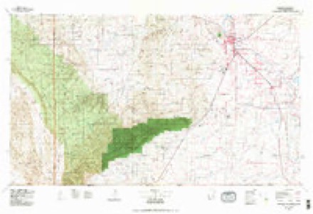
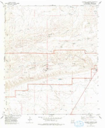
6 surveys from 12 printed sheetsMatched by testing this settlement's coordinate against the published boundary of every sheet in the United States Geological Survey's historical collection. Each opens the scanned sheet at the Survey.
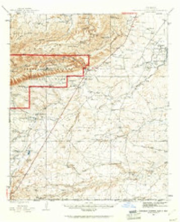
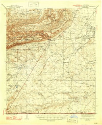
- 1945 USGS Carlsbad Caverns East quadrangle1:62500, 2 printings
- 1947 USGS Carlsbad Caverns East quadrangle1:62500
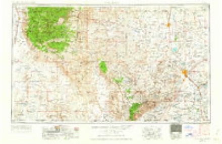
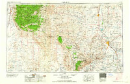
- 1954 USGS Carlsbad quadrangle1:250000, 3 printings
- 1958 USGS Carlsbad quadrangle1:250000, 2 printings
- 1979 USGS Carlsbad quadrangle1:100000, 2 printings
- 1979 USGS Carlsbad Caverns quadrangle1:24000, 2 printings
Fires near this place
60 since 1992Regional context, not property-specific evidence. The federal wildfire occurrence database lists 60 fires within 5 miles of Whites City between 1992 and 2019, burning about 605 acres in total. 25 started naturally. 1 was recorded as arson. Distance is straight-line from the map coordinates, so a fire counted here may appear on a neighbouring settlement's page as well.
| Reported cause | Fires |
|---|---|
| Natural | 25 |
| Missing data/not specified/undetermined | 20 |
| Equipment and vehicle use | 7 |
| Smoking | 3 |
| Fireworks | 2 |
| Other causes | 1 |
| Power generation/transmission/distribution | 1 |
| Arson/incendiarism | 1 |
The most recent of them, most recent first, with the day each was reported and the service that recorded it.
| Date | Cause | Size | Reported by | Name on the report |
|---|---|---|---|---|
| 7 September 1992 | Natural | under an acre | Carlsbad Caverns National Park | WHITECITY2 |
| 7 September 1992 | Natural | under an acre | Carlsbad Caverns National Park | WHITECITY1 |
| 25 September 1999 | Equipment and vehicle use | under an acre | Roswell Field Office | WHITESCITY |
| 14 September 2010 | Missing data/not specified/undetermined | 2.0 acres | Carlsbad Field Office | BOUNDS |
| 2 August 2014 | Equipment and vehicle use | under an acre | New Mexico State Forestry Division | CREOSOTE |
| 11 August 2011 | Natural | 5.0 acres | Carlsbad Field Office | RAIN |
| 9 July 2002 | Smoking | under an acre | Carlsbad Caverns National Park | ARKY |
| 5 July 1994 | Natural | under an acre | Carlsbad Caverns National Park | ARKY |
Mines and quarries near this place
3 within 5 milesRegional context, not property-specific evidence. The federal mineral resources record lists 3 workings within 5 miles of Whites City: 2 unknowns, 1 past producer. None of them still produces. What was taken out: Sand and Gravel, Construction, Bromine, Sodium, Gemstone. Distance is straight-line from the map coordinates, so a quarry counted here may appear on a neighbouring settlement's page as well.
| Where | Site | Commodity | Status | Recorded |
|---|---|---|---|---|
| Anna B Byrd | Gemstone | Unknown | ||
| Materials Pit | Sand and Gravel, Construction | Unknown | ||
| Ozark-Mahoning Co. Brine Wells | Bromine, Sodium | Past Producer | 1951, 1957 |
Storms near this place
48 since 1995Regional context, not property-specific evidence. The National Weather Service names Whites City in 48 storm reports between 1995 and 2025: 30 hail, 10 flash flood, 5 thunderstorm wind, 2 tornado. The reports record 1 death. Each account below is quoted exactly as the forecast office filed it, from the NOAA Storm Events Database, and each date opens the federal record of that event.
| When | Event | Place named | Harm | What the report says |
|---|---|---|---|---|
| September 2014 | Flash Flood | Whites City | 1 killed, $40,000 | Heavy rain fell across Eddy County and produced flash flooding near Whites City. Two vehicles were washed off of Whites City Road about 0.9 miles east northeast of Carlsbad Caverns Visitor Center. The two vehicles were trying to cross a low lying section of the road when the flood waters caused the vehicles to lose control. The driver of the first vehicle was able to get out of the vehicle. The driver of the second vehicle swam to safety. The passenger of the second vehicle was reported missing and the body was later found. This flooding resulted in one fatality. The cost of damage is a very rough estimate. |
| April 2004 | Flash Flood | Whites City | $2,000,000 | During the evening of April 3rd, a National Weather Service spotter reported Dark Canyon Road, five miles east of State Highway 137, was under seven feet of water. Additional flooding over southwestern portions of Carlsbad was reported by local law enforcement and the public. Just after midnight, early Sunday morning, U.S. Highway 285 became impassable due to flooding ten miles northwest of Carlsbad. Flooding along County Roads 658 and 672 southwest of Carlsbad resulted in several evacuations and helicopter rescues during the early morning hours on Sunday along Dark Canyon Draw. As late as Sunday afternoon, flooding of low-lying areas around Carlsbad continued along the Pecos River, as well as along Dark Canyon, Dagger, Rocky Arroyo, and Hackberry Draws.An Eddy County flood survey revealed that three different factors contributed to the record flooding in and near Carlsbad. Flood waters from Rocky Arroyo Draw fed into the Pecos River north of Avalon Reservoir. This flow along with heavy rainfall from thunderstorms resulted in a required release of water from the Avalon Reservoir. Radar estimated rainfall totals of three to four inches near and west of Avalon Reservoir between 900 PM MST on April 3rd through 100 AM MST on Sunday, April 4th. Releases from the reservoir began near 800 PM MST on April 3rd, with a measured peak rate of 14,800 cfs (cubic-feet per second) at around 400 AM MDT Sunday morning. This release of water eliminated the potential danger of a dam failure, but resulted in the washout of Callaway Drive just downstream from the release point on Avalon Reservoir. The second factor contributing to the record flooding was extremely high flow through the Dark Canyon Draw into downtown Carlsbad. Radar estimated rainfall totals of one to three inches over and southwest of Dark Canyon Draw during the evening and overnight hours of Saturday April 3rd. This rainfall led to catastrophic flash flooding along the Dark Canyon Draw from southwest portions of Carlsbad into the downtown area. A wall of water moved down Dark Canyon Draw at approximately 130 AM MST Sunday morning. The third factor that contributed to the flooding was the failure at several points of the Carlsbad Irrigation District (CID) canals. These CID channels, used primarily to irrigate area alfalfa fields, began failing due to runoff crossing perpendicular to the CID channels. This runoff was due to 8-12 inches of rainfall in the previous three days. Erosion of the channels began occurring due to the high volume of water flowing over them. As the channels finally failed, water flowed into adjacent neighborhoods. The community hardest hit by this runoff was the La Huerta neighborhood in northeastern Carlsbad. As a result of this flooding, 6 to 12 inches of water was left standing throughout most of the La Huerta area with higher amounts at isolated points. |
| August 2022 | Flash Flood | Whites City | $20,000 | Heavy rain resulted in flash flooding in Eddy County. A family in their vehicle was washed away at a low water crossing along Dark Canyon Road southwest of Carlsbad. They were rescued with no injuries. The cost of damage is a very rough estimate. |
| May 2008 | Hail | Whites City | $15,000 | An off duty police officer reported softball sized hail at the Washington Ranch. Windows were broken and the north side of a home was damaged as this storm moved through. |
| September 2017 | Hail | Whites City | $3,000 | A thunderstorm moved across Eddy County and produced hail damage twelve miles southwest of Whites City. The hail broke windows on four vehicles, a bedroom window and a skylight on a home, and tail lights and running lights on a camper. The cost of damage is a very rough estimate. |
| September 2014 | Flash Flood | Whites City | $3,000 | Heavy rain fell across Eddy County and produced flash flooding southwest of Carlsbad. Dark Canyon Road and County Road 408 were closed due to an estimated five feet of water over the road at Juniper Draw. The amount of damage is unknown so the cost of damage is a very rough estimate. |
| April 1999 | Hail | Whites City | $1,000 | Left-split storm from a cell over Culberson County, TX. Hail broke windows in a Highway Patrol car. |
| October 1998 | Thunderstorm Wind | Whites City | $1,000 | Thunderstorm winds blew down a sign near the entrance of Carlsbad Caverns National Park. |
| August 2016 | Flash Flood | Whites City | $500 | Heavy rain fell across Eddy County and produced flash flooding southwest of Carlsbad. Dark Canyon Arroyo was flooded with 20 to 25 foot deep water. The cost of damage is a very rough estimate. |
| September 2014 | Flood | Whites City | $500 | Heavy rains that occurred overnight as well as saturated soils lead to continued flooding of roads across Southern Eddy County. A couple of those road closures included Whites City Road, Dog Town Road, and McDonald Road. |
| September 2014 | Flash Flood | Whites City | $300 | Heavy rain fell across Eddy County and produced flash flooding near Whites City. Highway 62/180 was closed due to high water about 7 miles southwest of Whites City. The cost of damage is a very rough estimate. |
| June 2025 | Thunderstorm Wind | Whites City | - | The West Texas Mesonet station at Carlsbad Caverns NP measured a 69 mph wind gust. |
| June 2025 | Flash Flood | Whites City | - | Flash flooding was reported out of Carlsbad Caverns National Park. The park's staff evacuated the area. The time of occurrence is estimated by radar. No damages were reported. |
| October 2023 | Hail | Whites City | - | Golf ball size hail observed in Walnut Canyon in Carlsbad Caverns National Park. |
| June 2020 | Thunderstorm Wind | Whites City | - | A thunderstorm moved across Eddy County and produced a 61 mph wind gust near Whites City. |
| June 2017 | Thunderstorm Wind | Whites City | - | A thunderstorm moved across Eddy County and produced a 59 mph wind gust at the mesonet site three miles west of Whites City. |
| August 2016 | Flash Flood | Whites City | - | Rancher reported a six to seven foot wall of water down Dark Canyon Draw at County Road 408. |
| August 2016 | Flash Flood | Whites City | - | Dark Canyon Road/County Road 408 was closed due to flooding caused by heavy rainfall in the area. |
| May 2014 | Thunderstorm Wind | Whites City | - | A thunderstorm moved across Eddy County and produced a 60 mph wind gust ten miles south of Whites City. No damage was reported. |
| May 2014 | Hail | Whites City | - | A thunderstorm moved across Eddy County and produced golfball sized hail in Whites City. The hail was four inches deep on the road. No damage was reported. |
| April 2009 | Tornado (EF0) | Whites City | - | The public reported the first brief touchdown of this tornado at 1825 MST about 12 miles southeast of Whites City, NM. Here, there were 2 tree limbs found within the path of the tornado in addition to golf ball size hail associated with the storm. At 1842, a trained weather spotter from the local media reported a tornado about 10 miles south southwest of Malaga, NM. The position of the report was adjusted slightly according to radar. Please see the attached photos for images of the tornado. |
| March 2007 | Hail | Whites City | - | Penny to quarter size hail fell in Whites City. |
| April 2006 | Hail | Whites City | - | Nickel to quarter size hail fell in a swath from Whites City to Carlsbad. |
| May 2006 | Tornado (F0) | Whites City | - | A landspout tornado was reported over an open field north of Whites City. |
| October 2006 | Hail | Whites City | - | Marble to penny size hail accompanied gusty winds and rain in Whites City along U.S. 62/180. |
| August 2005 | Flash Flood | Whites City | - | The Eddy County Sheriff's Office reported flash flooding on many roads in Whites City. |
| October 2004 | Hail | Whites City | - | A spotter reported penny size hail along U.S. Highway 62/180 in southern Eddy County. The hail was ejected several miles north of the main precipitation core of an isolated supercell that propagated east along the Texas and New Mexico border. |
| September 2002 | Hail | Whites City | - | A severe thunderstorm developed rapidly over Whites City and produced nickel size hail. |
| June 1995 | Hail | Whites City | - | A slow-moving severe thunderstorm made Highway 137 impassable due to three feet of running water at Rocky Arroyo. Later dime-size hail was reported by the public lasting for nine minutes. |
| May 1995 | Hail | Whites City | - | A severe thunderstorm formed in southwestern Eddy County. The storm began its life moving northeastward but soon turned right and intensified. Reports received from SKYWARN personnel. |
| May 1995 | Hail | Whites City | - | A severe thunderstorm formed in southwestern Eddy County. The storm began its life moving northeastward, but soon turned right as it became a supercell. Reports received from SKYWARN personnel. |
| June 2022 | Hail | Whites City | - | no account filed |
| May 2018 | Hail | Whites City | - | no account filed |
| June 2014 | Hail | Whites City | - | no account filed |
| May 2014 | Hail | Whites City | - | no account filed |
| May 2012 | Hail | Whites City | - | no account filed |
| June 2009 | Hail | Whites City | - | no account filed |
| April 2009 | Hail | Whites City | - | no account filed |
| April 2009 | Hail | Whites City | - | no account filed |
| April 2009 | Hail | Whites City | - | no account filed |
| July 2009 | Hail | Whites City | - | no account filed |
| April 2009 | Hail | Whites City | - | no account filed |
| May 2008 | Hail | Whites City | - | no account filed |
| May 2008 | Hail | Whites City | - | no account filed |
| May 2008 | Hail | Whites City | - | no account filed |
| March 2007 | Hail | Whites City | - | no account filed |
| August 2005 | Hail | Whites City | - | no account filed |
| May 1997 | Hail | Whites City | - | no account filed |
Nearest settlements
The eight closest, with where each one stands in the county. Distances are straight-line, computed from the Geographic Names Information System coordinates.
| Map | Place | Distance | Sheets |
|---|---|---|---|
| Black River Village | 6.8 miles | 11 | |
| Harkey Crossing | 10.4 miles | 10 | |
| Lookout Crossing | 14.1 miles | 10 | |
| Lookout (historical) | 14.5 miles | 10 | |
| Four Forks | 14.8 miles | 12 | |
| Otis | 16.4 miles | 11 | |
| Malaga | 16.5 miles | 10 | |
| Loving | 16.7 miles | 11 |
Elsewhere
Matched on this settlement's Geographic Names Information System number rather than its name, so it cannot be a different place of the same name in another state.
| Wikipedia article on Whites City | An encyclopaedic summary. Its text is share-alike, so it is linked here rather than copied. |
| Wikidata item Q6167241 | The structured record the population and elevation above come from. Public domain (CC0). |
Provenance
This settlement is recorded in the Geographic Names Information System as feature 899991. The sheet list is computed by point-in-boundary test against the United States Geological Survey's historical topographic inventory. Both are works of the United States government and carry no copyright under 17 U.S.C. 105.
Wildfire. Short, Karen C. 2022. Spatial wildfire occurrence data for the United States, 1992-2020 [FPA_FOD_20221014]. 6th Edition. Fort Collins, CO: Forest Service Research Data Archive. https://doi.org/10.2737/RDS-2013-0009.6 Collected with United States Government funding and usable without additional permissions or fees.
Mines and quarries. USGS Mineral Resources Data System (MRDS) https://mrdata.usgs.gov/mrds/ A work of the United States government, no copyright under 17 U.S.C. 105.
Storms. NOAA National Centers for Environmental Information, Storm Events Database https://www.ncei.noaa.gov/stormevents/ A work of the United States government, no copyright under 17 U.S.C. 105. Narratives are quoted verbatim from the National Weather Service report and are not edited or summarised.