 Block
Bethany, Oklahoma
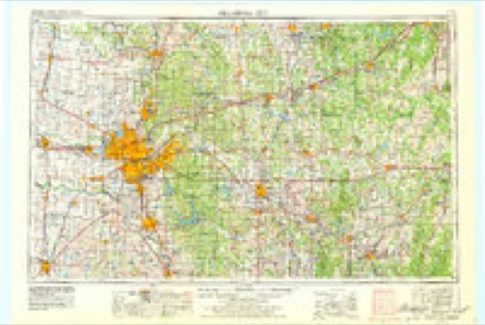
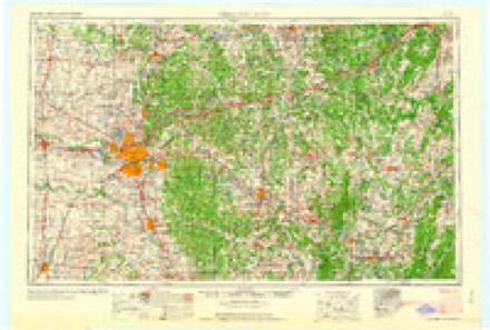
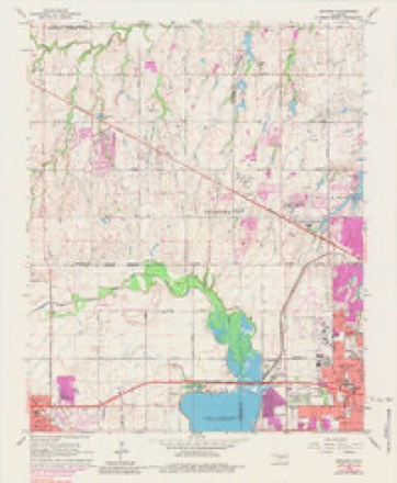
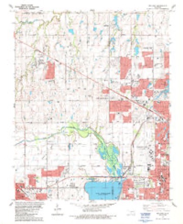
16 topographic sheets cover this place, the earliest surveyed in 1892 and the latest in 1995. It stands in the Oklahoma City Southwest census division. It lies in ZIP code area 73008. The Survey maps it on the Bethany quadrangle. 20,831 people lived here at the 2020 count. It stands 1,309 feet above sea level.
On record in Bethany
Buildings and businesses the archive holds for this place. Each opens its own page, with the source record it came from.
On the National Register within a mile 1 record
The National Register names another town for these. They stand within one mile of this settlement's coordinate.
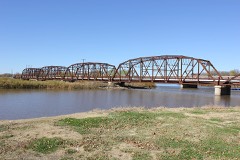 Lake Overholser Bridgelisted 2004 · 0.3 miles away
Population over time
2 figuresBethany grew from 19,051 to 20,831 between 2010 and 2020. These are the recorded population figures Wikidata holds for this place, reached through the Geographic Names Information System number this page is keyed on rather than by name, so they belong to this place and not to another of the same name. Most are census counts, but not all are: an early figure may be a founding or settlement estimate, and an estimate published within five years of a census is left out. The change column is computed, and is left blank where more than 20 years separate a figure from the one before it, because a gap that long is not a change between two counts.
| Year | People | Change |
|---|---|---|
| 2010 | 19,051 | |
| 2020 | 20,831 | +1,780 (+9%) |
Topographic sheets covering this place
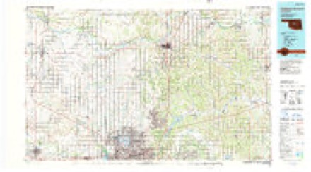
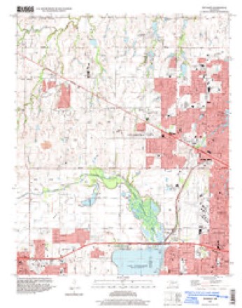
9 surveys from 16 printed sheetsMatched by testing this settlement's coordinate against the published boundary of every sheet in the United States Geological Survey's historical collection. Each opens the scanned sheet at the Survey.
- 1892 USGS Kingfisher quadrangle1:125000
- 1895 USGS Kingfisher quadrangle1:125000, 4 printings
- 1954 USGS Oklahoma City quadrangle1:250000
- 1957 USGS Oklahoma City quadrangle1:250000, 3 printings
- 1963 USGS Oklahoma City quadrangle1:250000
- 1966 USGS Bethany quadrangle1:24000, 3 printings
- 1986 USGS Bethany quadrangle1:24000
- 1990 USGS Oklahoma City North quadrangle1:100000
- 1995 USGS Bethany quadrangle1:24000
Mines and quarries near this place
10 of 13 shownRegional context, not property-specific evidence. The federal mineral resources record lists 13 workings within 5 miles of Bethany: 8 past producers, 5 producers. 5 still produce. What was taken out: Sand and Gravel, Construction, Clay. Distance is straight-line from the map coordinates, so a quarry counted here may appear on a neighbouring settlement's page as well.
| Where | Site | Commodity | Status | Recorded |
|---|---|---|---|---|
| Unknown Clay Pit | Clay | Past Producer | ||
| A-1 Pit | Sand and Gravel, Construction | Producer | ||
| Bill Hinkle Trucking Service | Sand and Gravel, Construction | Producer | ||
| Cecils Sandloading Service | Sand and Gravel, Construction | Producer | ||
| Fill Sand Pit | Sand and Gravel, Construction | Producer | ||
| Frazier Pit Pit #2 | Sand and Gravel, Construction | Past Producer | ||
| Patterson Sand Pit | Sand and Gravel, Construction | Past Producer | ||
| Pritners Dredge & Pit | Sand and Gravel, Construction | Producer | ||
| Unknown Sand Pit | Sand and Gravel, Construction | Past Producer | ||
| Unknown Sand Pit | Sand and Gravel, Construction | Past Producer |
Storms near this place
60 of 91 shownRegional context, not property-specific evidence. The National Weather Service names Bethany in 91 storm reports between 1993 and 2026: 51 hail, 24 thunderstorm wind, 11 flash flood, 3 tornado. The reports record 8 injuries. Each account below is quoted exactly as the forecast office filed it, from the NOAA Storm Events Database, and each date opens the federal record of that event.
| When | Event | Place named | Harm | What the report says |
|---|---|---|---|---|
| May 2003 | Tornado (F1) | Bethany | 8 hurt, $10,000,000 | This tornado began within the Bethany city limits and moved northeast before dissipating within Warr Acres city limits. This tornado which caused mostly F0 damage with pockets of high-end F1 damage tracked from near the intersection of Glade Avenue and Northwest 38th Street, across Northwest 50th Street and North Rockwell Avenue, and finally to Hammond Avenue and Northwest 59th Street. Most damage was in the F0 category to trees and roof shingles. Several pockets of F1 damage were noted embedded within the path, indicative of possible multiple-vortices. Most structures that received F1 damage were structures with susceptibilities to high wind. These included several churches, a self-storage facility, airport hangars at Wiley Post Airport, several warehouses, a few small homes, and several businesses. The tornado damaged approximately 70 airplanes and 40 hangers were damaged or destroyed at Wiley Post Airport. Many of the airplanes damaged were inside the hangers.A man suffered fatal injuries (indirect) in Warr Acres. An eighty year old man from Woodward, Oklahoma was visiting relatives in Warr Acres. He injured his head as he was seeking shelter and died from his injuries two days later. The structure he was in was not affected by the storm. |
| October 1998 | Lightning | Bethany | $200,000 | no account filed |
| May 2008 | Tornado (EF1) | Bethany | $100,000 | The tornado continued to move east-northeast from Canadian county. The tornado continued from the north side of Lake Overholser and crossed NW 39th street, damaging several bleachers next to the baseball field. Damage to trees was also noted at this location, with one tree falling on a gas plant. About 50 residents had to be evacuated due to the gas leak. An apartment complex was sustained some damage near NW 50th and Grove streets. Tree damage continued along the tornadoes path until it finally lifted near NW 60th and Meridian Avenue. One indirect injury was reported with the tornado. A Bethany woman broke her leg while she was running toward her storm shelter. No other injuries were reported. Monetary damages were estimated. |
| May 2001 | Thunderstorm Wind | Bethany | $100,000 | The roof of the YMCA sustained significant damage. Rain then fell on the gym floor destroying it. |
| July 2000 | Thunderstorm Wind | Bethany | $75,000 | Several airplanes and hangars were damaged at Wiley Post Airport. |
| October 2000 | Lightning | Bethany | $30,000 | Lightning struck a house on Briarcreek Drive causing a fire, which resulted in significant damage to the attic and upstairs. |
| May 2003 | Thunderstorm Wind | Bethany | $25,000 | Surrounding the multiple-vortex tornado that began 0.9 miles west-northwest of Bethany was a wider and much longer swath of straight-line wind damage from the rear-flank downdraft (RFD) with all damage blown from southwest to northeast. The RFD damage path began in Canadian County, 4.9 miles south-southwest of Yukon, and extended northeast until it ended near Lake Hefner. The swath of damage crossed the county line near Lake Overholser. The wind affected the south side of Lake Overholser including the south and east shoreline communities, then went across Woodlawn Park, surrounded the aforementioned tornado area, and finally dissipated northeast of Northwest Expressway and Meridian Avenue. Sporadic tree damage occurred during the last few miles of the path with more concentrated damage towards the beginning of the path in Oklahoma County. The RFD damage path was up to two miles wide at times. |
| August 2011 | Thunderstorm Wind | Bethany | $15,000 | Numerous fences and power poles were blown down. Monetary damages were estimated. |
| July 2023 | Flash Flood | Bethany | $10,000 | Vehicle submerged in floodwaters near the intersection of Reno Avenue and Meridian Avenue. |
| June 2013 | Thunderstorm Wind | Bethany | $10,000 | KOCO reported roof damage to Travelodge Motel at W Reno Ave. and S Meridian Ave. |
| June 2013 | Thunderstorm Wind | Bethany | $10,000 | Power pole and transformer taken down at Reno and Rockwell. |
| October 2007 | Thunderstorm Wind | Bethany | $10,000 | Windows were blown out by the high winds. A few power lines were also downed. Monetary damages were estimated. |
| August 2003 | Thunderstorm Wind | Bethany | $7,500 | Downburst winds caused damage to a Walmart near the intersection of Reno Avenue and North Rockwell Avenue. Winds moved some air conditioning units that were on the roof and caused roof damage. A gas line was ruptured causing a gas leak, which prompted the store to be evacuated. |
| June 2019 | Flash Flood | Bethany | $5,000 | Flooded car in intersection. |
| June 2007 | Flash Flood | Bethany | $5,000 | High water covered the road at Ski Island. Two females were rescued after driving into high water. Three other water rescues were successful around Oklahoma City. No injuries were reported. Monetary damages were estimated. |
| April 2016 | Thunderstorm Wind | Bethany | $4,000 | Winds damaged a Home Depot and caused roof damage to a storage unit. |
| March 2015 | Tornado (EF0) | Bethany | $1,000 | A small, short-lived tornado touched down south of NW 10th Street and Rockwell Avenue in western Oklahoma City. Two outbuildings were severely damaged and three houses suffered damage to roof shingles. |
| August 2007 | Thunderstorm Wind | Bethany | $500 | A 5-inch diameter tree limb was downed by the high winds at Council Road and 37th Street. Monetary damages were estimated. |
| June 1998 | Thunderstorm Wind | Bethany | $500 | Severe thunderstorm winds downed power lines. |
| March 2026 | Hail | Bethany | - | The event time is estimated based on radar observations. |
| March 2025 | Hail | Bethany | - | MPing report. Event time adjusted based on radar observations. |
| March 2025 | Hail | Bethany | - | MPing report. Event time adjusted based on radar observations. |
| March 2025 | Hail | Bethany | - | MPing report. Event time adjusted based on radar observations. |
| May 2025 | Hail | Bethany | - | Hailfall occurred near the intersection of Northwest 36th Street and Council Road. |
| May 2025 | Hail | Bethany | - | The report was relayed through mPING. |
| May 2025 | Hail | Bethany | - | A social media report near Mile Marker 145 along Interstate 40. |
| May 2025 | Hail | Bethany | - | The report was relayed through mPING. |
| May 2025 | Hail | Bethany | - | The report was relayed through mPING. |
| May 2025 | Hail | Bethany | - | The report was relayed through mPING. |
| May 2025 | Flash Flood | Bethany | - | A broadcast media livestream showed roadway flooding along a section of Rockwell Avenue. The location and event time are approximate. |
| October 2025 | Hail | Bethany | - | The report was relayed through mPING. |
| November 2024 | Thunderstorm Wind | Bethany | - | Public images submitted to the Oklahoma Department of Emergency Management show large tree limbs blown down. Event time is radar-estimated. |
| May 2024 | Hail | Bethany | - | MPing report. |
| May 2024 | Hail | Bethany | - | MPing report. |
| September 2023 | Hail | Bethany | - | MPing report. |
| July 2023 | Hail | Bethany | - | MPing report. |
| July 2023 | Hail | Bethany | - | MPing report. |
| July 2023 | Hail | Bethany | - | Phone call report. |
| August 2020 | Flash Flood | Bethany | - | Several vehicles stranded in high water at 39TH and Macarthur. |
| July 2020 | Flash Flood | Bethany | - | Car submerged in Bethany. |
| June 2019 | Flash Flood | Bethany | - | At the intersection of Reno Ave. |
| May 2018 | Flash Flood | Bethany | - | Route 66 in Bethany was closed due to flooding. |
| August 2013 | Flash Flood | Bethany | - | Water over westbound lanes of I-40 and May Ave. |
| July 2013 | Thunderstorm Wind | Bethany | - | KPWA measured a gust to 64 mph. |
| May 2013 | Hail | Bethany | - | The hail was reported at interstate 40 and Meridian. No damage was reported. |
| April 2013 | Hail | Bethany | - | Occurred at the intersection of NW 38th Ter. and Riverside Dr., lasting 10 minutes. |
| August 2011 | Thunderstorm Wind | Bethany | - | The wind gust was estimated at the intersection of Hefner and County Line Roads. |
| May 2010 | Hail | Bethany | - | The hail occurred near Council Road and NW 23rd Street. |
| June 2010 | Flash Flood | Bethany | - | A second round of heavy rainfall overspread much of Oklahoma county during the morning rush hour, with several locations receiving 5 to 9 inch rainfall totals in just a few hours. Numerous roadways across the metro were impassable due to several feet of water flowing over top of them. At least 60 swift water rescues occurred as a result of cars driving into flood waters and rapidly rising water into homes. A portion of Britton Road between Sooner Road and Air Depot Boulevard was washed out. Part of the dock along the Oklahoma River was washed away. All of the buildings at the Capital Complex reported water damage to some degree. Numerous other buildings, and dozens of residences were flooded. The worst residential damage occurred over the northern portion of Oklahoma City near the Logan county line, where several homes were flooded with over three feet of water, and most did not have flood insurance. Monetary damages were estimated at $5.5 million for Oklahoma county during the day (entered on the last Oklahoma county flash flooding entry). |
| January 2008 | Hail | Bethany | - | The hail was reported at Council Road and NW 36th Street. |
| March 2008 | Hail | Bethany | - | The hail was reported near NW 36th and Council Road. |
| March 2008 | Hail | Bethany | - | The hail was reported at NW 10th and Council Road. |
| March 2008 | Hail | Bethany | - | The hail was reported near NW 18th and Council Road. |
| October 2007 | Hail | Bethany | - | The hail was reported at Council Road and 36th Street. |
| April 2004 | Hail | Bethany | - | Hail was observed at 39th Street and Council Road. |
| April 2004 | Hail | Bethany | - | Hail was observed at the Wiley Post Airport (KPWA). |
| April 2004 | Hail | Bethany | - | Hail was observed at the intersection of 39th Street and Council Road. |
| August 2004 | Flash Flood | Bethany | - | At approximately 7:00 am CST, Eldon Lynn Park in Bethany, OK was inundated by flash flooding. City crews had to use water pumps later in the day to remove the floodwaters from the park. |
| May 2003 | Hail | Bethany | - | Hail was reported falling a half a mile east of Wiley Post Airport on 63rd Street. |
| July 2023 | Hail | Bethany | - | no account filed |
Nearest settlements
The eight closest, with where each one stands in the county. Distances are straight-line, computed from the Geographic Names Information System coordinates.
| Map | Place | Distance | Sheets |
|---|---|---|---|
| Warr Acres | 0.8 miles | 19 | |
| Woodlawn Park | 1.1 miles | 16 | |
| Nichols Hills | 4.9 miles | 19 | |
| The Village | 5.2 miles | 19 | |
| Britton | 6.3 miles | 19 | |
| Lillard Park | 6.5 miles | 19 | |
| Oklahoma City | 7.1 miles | 19 | |
| Wheatland | 8.4 miles | 18 |
Elsewhere
Matched on this settlement's Geographic Names Information System number rather than its name, so it cannot be a different place of the same name in another state.
| Wikipedia article on Bethany | An encyclopaedic summary. Its text is share-alike, so it is linked here rather than copied. |
| Wikidata item Q1924825 | The structured record the population and elevation above come from. Public domain (CC0). |
Provenance
This settlement is recorded in the Geographic Names Information System as feature 1090023. The sheet list is computed by point-in-boundary test against the United States Geological Survey's historical topographic inventory. Both are works of the United States government and carry no copyright under 17 U.S.C. 105.
Mines and quarries. USGS Mineral Resources Data System (MRDS) https://mrdata.usgs.gov/mrds/ A work of the United States government, no copyright under 17 U.S.C. 105.
Storms. NOAA National Centers for Environmental Information, Storm Events Database https://www.ncei.noaa.gov/stormevents/ A work of the United States government, no copyright under 17 U.S.C. 105. Narratives are quoted verbatim from the National Weather Service report and are not edited or summarised.