 Block
Warr Acres, Oklahoma
19 topographic sheets cover this place, the earliest surveyed in 1892 and the latest in 1995. It stands in the Oklahoma City Southwest census division. It lies in ZIP code area 73122. The Survey maps it on the Britton quadrangle. 10,452 people lived here at the 2020 count. It stands 1,312 feet above sea level.
On record in Warr Acres
Buildings and businesses the archive holds for this place. Each opens its own page, with the source record it came from.
On the National Register within a mile 1 record
The National Register names another town for these. They stand within one mile of this settlement's coordinate.
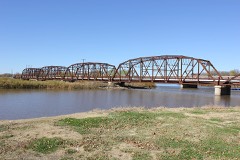 Lake Overholser Bridgelisted 2004 · 0.9 miles away
Population over time
2 figuresWarr Acres grew from 10,043 to 10,452 between 2010 and 2020. These are the recorded population figures Wikidata holds for this place, reached through the Geographic Names Information System number this page is keyed on rather than by name, so they belong to this place and not to another of the same name. Most are census counts, but not all are: an early figure may be a founding or settlement estimate, and an estimate published within five years of a census is left out. The change column is computed, and is left blank where more than 20 years separate a figure from the one before it, because a gap that long is not a change between two counts.
| Year | People | Change |
|---|---|---|
| 2010 | 10,043 | |
| 2020 | 10,452 | +409 (+4%) |
Topographic sheets covering this place
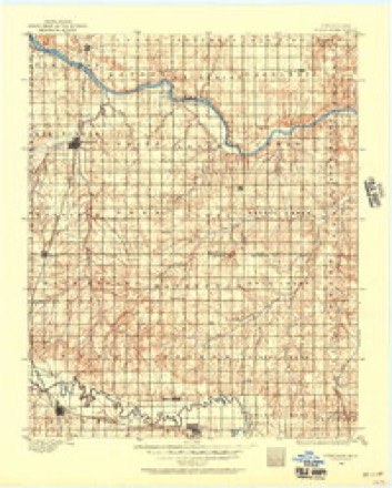
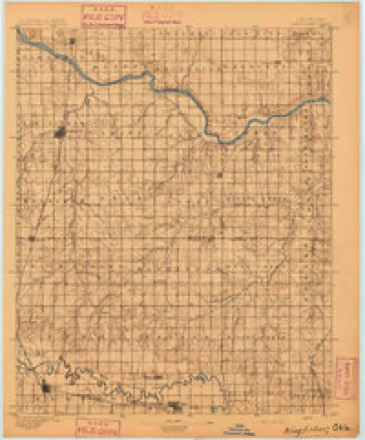
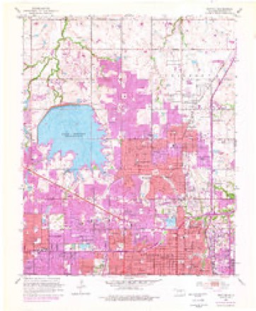
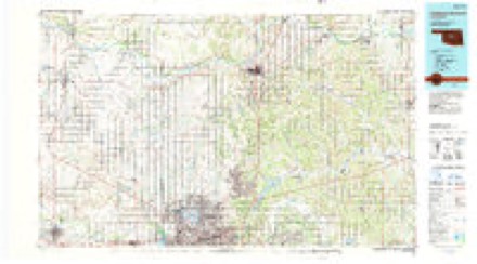
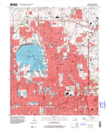
9 surveys from 19 printed sheetsMatched by testing this settlement's coordinate against the published boundary of every sheet in the United States Geological Survey's historical collection. Each opens the scanned sheet at the Survey.
- 1892 USGS Kingfisher quadrangle1:125000
- 1895 USGS Kingfisher quadrangle1:125000, 4 printings
- 1951 USGS Britton quadrangle1:24000, 6 printings
- 1954 USGS Oklahoma City quadrangle1:250000
- 1957 USGS Oklahoma City quadrangle1:250000, 3 printings
- 1963 USGS Oklahoma City quadrangle1:250000
- 1986 USGS Britton quadrangle1:24000
- 1990 USGS Oklahoma City North quadrangle1:100000
- 1995 USGS Britton quadrangle1:24000
Mines and quarries near this place
10 within 5 milesRegional context, not property-specific evidence. The federal mineral resources record lists 10 workings within 5 miles of Warr Acres: 6 past producers, 4 producers. 4 still produce. What was taken out: Sand and Gravel, Construction, Clay. Distance is straight-line from the map coordinates, so a quarry counted here may appear on a neighbouring settlement's page as well.
| Where | Site | Commodity | Status | Recorded |
|---|---|---|---|---|
| Unknown Clay Pit | Clay | Past Producer | ||
| A-1 Pit | Sand and Gravel, Construction | Producer | ||
| Bill Hinkle Trucking Service | Sand and Gravel, Construction | Producer | ||
| Cecils Sandloading Service | Sand and Gravel, Construction | Producer | ||
| Fill Sand Pit | Sand and Gravel, Construction | Producer | ||
| Patterson Sand Pit | Sand and Gravel, Construction | Past Producer | ||
| Unknown Sand Pit | Sand and Gravel, Construction | Past Producer | ||
| Unknown Sand Pit | Sand and Gravel, Construction | Past Producer | ||
| Unknown Sand Pit | Sand and Gravel, Construction | Past Producer | ||
| Unknown Sand Pit | Sand and Gravel, Construction | Past Producer |
Storms near this place
60 of 76 shownRegional context, not property-specific evidence. The National Weather Service names Warr Acres in 76 storm reports between 1994 and 2026: 39 hail, 19 thunderstorm wind, 12 flash flood, 3 flood. The reports record 7 deaths. Each account below is quoted exactly as the forecast office filed it, from the NOAA Storm Events Database, and each date opens the federal record of that event.
| When | Event | Place named | Harm | What the report says |
|---|---|---|---|---|
| May 2013 | Flash Flood | Warr Acres | 7 killed | Several individuals were swept under a roadway and killed while seeking shelter in a storm drain. No damage was reported. |
| May 2019 | Thunderstorm Wind | Warr Acres | $80,000 | A Quasi-Linear Convective System (QLCS) moved across Oklahoma City causing a large area of wind damage from just north of NW 10th Street and Meridian Avenue to near NE 34th Street and Santa Fe Avenue. Although most of the damage was from strong straight line winds, there were two distinct areas where damage was consistent with small tornadoes (see separate entries for these tornadoes). ||The damage was primarily to trees and fences across the area although a few houses had some roof damage. The swath of the damaging winds was up to 600 yards wide at some places. Some trees were uprooted, although the ground was also much wetter than usual with recent heavy rains. |
| May 2019 | Tornado (EF0) | Warr Acres | $20,000 | An area of damage consistent with a narrow QLCS tornado was found within a larger swath of damaging winds. This tornado developed near NW 11th Terrace and Warren Place and moved east along and just north of Liberty Avenue to just north of Liberty Avenue and Portland Avenue. Besides trees, damage was also observed to house roofs, porches and car ports with evidence of debris lofted. |
| August 2013 | Flash Flood | Warr Acres | $20,000 | Water over roadways at Northwest Expressway and Libby as well as other locations in Northwest Oklahoma City. |
| May 2003 | Tornado (F1) | Warr Acres | $20,000 | This brief nighttime tornado, within the Oklahoma City limits, was video taped by a storm chaser. The tornado began near the intersection of Northwest 57th Street and Sapulpa Avenue then moved northeast before dissipating just southwest of Hefner Parkway and Northwest Expressway. There was minor damage to fencing and aluminum car ports. Tree limbs were also downed. The heaviest damage was sustained at a restaurant just before the tornado dissipated. The restaurant's roof was damaged. |
| May 1996 | Lightning | Warr Acres | $20,000 | no account filed |
| August 2008 | Thunderstorm Wind | Warr Acres | $12,000 | Eight large trees were downed near NW 122nd Street and Macarthur Boulevard. The report was relayed by KWTV-9 TV. Monetary damages were estimated. |
| May 2019 | Flash Flood | Warr Acres | $10,000 | High water on roadway. Water almost up to windows of a vehicle. |
| May 2019 | Thunderstorm Wind | Warr Acres | $10,000 | Damage in area of NW 28TH and Nesbitt included two metal detached carports blown away, trees down, and one power pole or street light pole downed with a downed power line. |
| May 2019 | Flash Flood | Warr Acres | $10,000 | Firefighters rescued person trapped in vehicle in high water at NW 16th and Meridian. Water reported to be up to her car windows. |
| May 2003 | Thunderstorm Wind | Warr Acres | $10,000 | Straight-line winds associated with a rear-flank downdraft (RFD) caused an area of tree limb damage in the Nichols Hills area. The path of damage began near North Rotary Park and extended to about half a mile west of the Broadway Extension between Northwest 63rd Street and Wilshire Boulevard. The area of damage was a mile wide at times. |
| June 2011 | Hail | Warr Acres | $7,000 | In addition to the hail, wind speeds were estimated at 55 mph. Four car windows and six patio doors were broken by the hail. Monetary damages were estimated. |
| August 2019 | Thunderstorm Wind | Warr Acres | $5,000 | Trees downed around Independence and 40TH. |
| August 2019 | Thunderstorm Wind | Warr Acres | $5,000 | Several windows blown out of an office building. Time estimated. |
| August 2019 | Thunderstorm Wind | Warr Acres | $2,000 | Large tree uprooted in west OKC. Time estimated. |
| August 2011 | Thunderstorm Wind | Warr Acres | $2,000 | A few tree limbs and street signs were blown down. Monetary damages were estimated. |
| August 2021 | Thunderstorm Wind | Warr Acres | $1,000 | Power pole damage reported at NW 50TH and Meridian. |
| March 2026 | Hail | Warr Acres | - | The event time is estimated based on radar observations. |
| March 2026 | Hail | Warr Acres | - | The report was relayed through mPING. |
| March 2026 | Hail | Warr Acres | - | The report was relayed by a National Weather Service Meteorologist. |
| March 2026 | Hail | Warr Acres | - | Hailfall near the intersection of Northwest Expressway and Northwest 63rd Street. |
| March 2025 | Hail | Warr Acres | - | MPing report. |
| May 2025 | Hail | Warr Acres | - | The report was relayed through mPING. |
| May 2025 | Hail | Warr Acres | - | The report was relayed through mPING. The event time is adjusted based on radar observations. |
| May 2025 | Hail | Warr Acres | - | The report was relayed through mPING. |
| May 2025 | Hail | Warr Acres | - | The report was relayed through Spotter Network. |
| May 2025 | Hail | Warr Acres | - | The report was relayed through mPING. |
| August 2025 | Thunderstorm Wind | Warr Acres | - | A relayed image shows a large tree uprooted. The event time is estimated from radar observations. |
| October 2025 | Hail | Warr Acres | - | The report was relayed through mPING. |
| May 2024 | Hail | Warr Acres | - | MPing report. |
| May 2024 | Hail | Warr Acres | - | MPing report. |
| June 2023 | Thunderstorm Wind | Warr Acres | - | Social media image showing a 2436-inch diameter tree blown down. Time is radar estimated. |
| July 2023 | Flood | Warr Acres | - | Report of cars stranded and streets closed due to flooding. Time is estimated. |
| May 2021 | Flash Flood | Warr Acres | - | Flooding reported in several spots around the city. |
| October 2021 | Flash Flood | Warr Acres | - | Vehicle stalled in high water. |
| May 2019 | Flash Flood | Warr Acres | - | Flowing water over road near NW 36th Street and May. Video on twitter. |
| May 2019 | Thunderstorm Wind | Warr Acres | - | Tree damage. Roof damage to two houses when attached carports were torn loose. |
| June 2019 | Thunderstorm Wind | Warr Acres | - | Reported from Twitter. |
| June 2019 | Flash Flood | Warr Acres | - | I-44 was shut down by OHP around 29TH st. |
| October 2019 | Thunderstorm Wind | Warr Acres | - | Four to six inch diameter tree limbs down. 1-2 inch limbs scattered around neighborhood. Time estimated from radar. |
| September 2018 | Flood | Warr Acres | - | Water reported up to tops of tires at the intersection of 39th and Portland. Radar precipitation estimates in the area were less than half an inch. |
| September 2018 | Flash Flood | Warr Acres | - | Curb flooding and road closures near Hammond avenue. |
| June 2018 | Flash Flood | Warr Acres | - | Cars were stranded due to flooding. |
| April 2017 | Hail | Warr Acres | - | Reported via Mping. |
| July 2016 | Flash Flood | Warr Acres | - | Several roads had high water and became nearly impassable due to very heavy rainfall. |
| May 2015 | Flash Flood | Warr Acres | - | Over a foot of water at Northwest 31st Street and Portland Avenue. Water is also flooding Will Rogers park. |
| January 2013 | Hail | Warr Acres | - | The hail ranged in size from dime to quarter size and lasted several minutes. No damage was reported. |
| May 2013 | Hail | Warr Acres | - | The hail was reported at Hefner and Council roads. |
| July 2013 | Hail | Warr Acres | - | At Nw 63rd and Nw Expressway. |
| May 2013 | Thunderstorm Wind | Warr Acres | - | Another area of widespread wind damage occurred with a surge of wind from the tornadic storm across southwest Oklahoma City, from roughly Portland Avenue and Reno Avenue southeast to near SW 83rd Street and Walker Avenue. The most significant damage occurred near SW 79th Street and Western Avenue where winds estimated at 95 mph uprooted large trees and damaged a service station canopy. |
| April 2013 | Hail | Warr Acres | - | Reported between Meridian and MacArthur Blvd. on NW 50th St. |
| June 2011 | Hail | Warr Acres | - | The hail was reported near Lake Hefner Golf Course. |
| May 2010 | Hail | Warr Acres | - | Several cars received significant damage from the large hail near NW 63rd Street and Portland Avenue. |
| September 2010 | Thunderstorm Wind | Warr Acres | - | The wind gust was reported at Northwest Expressway and Meridian Avenue. |
| August 2008 | Flood | Warr Acres | - | Numerous city roads over the western half of Oklahoma City were closed to due to high water. |
| May 2022 | Thunderstorm Wind | Warr Acres | - | no account filed |
| April 2020 | Hail | Warr Acres | - | no account filed |
| April 2020 | Hail | Warr Acres | - | no account filed |
| April 2019 | Hail | Warr Acres | - | no account filed |
| August 2019 | Hail | Warr Acres | - | no account filed |
Nearest settlements
The eight closest, with where each one stands in the county. Distances are straight-line, computed from the Geographic Names Information System coordinates.
| Map | Place | Distance | Sheets |
|---|---|---|---|
| Bethany | 0.8 miles | 16 | |
| Woodlawn Park | 1.8 miles | 16 | |
| Nichols Hills | 4.2 miles | 19 | |
| The Village | 4.4 miles | 19 | |
| Britton | 5.5 miles | 19 | |
| Lillard Park | 6.6 miles | 19 | |
| Oklahoma City | 6.6 miles | 19 | |
| Wheatland | 8.8 miles | 18 |
Elsewhere
Matched on this settlement's Geographic Names Information System number rather than its name, so it cannot be a different place of the same name in another state.
| Wikipedia article on Warr Acres | An encyclopaedic summary. Its text is share-alike, so it is linked here rather than copied. |
| Wikidata item Q3240940 | The structured record the population and elevation above come from. Public domain (CC0). |
Provenance
This settlement is recorded in the Geographic Names Information System as feature 1099375. The sheet list is computed by point-in-boundary test against the United States Geological Survey's historical topographic inventory. Both are works of the United States government and carry no copyright under 17 U.S.C. 105.
Mines and quarries. USGS Mineral Resources Data System (MRDS) https://mrdata.usgs.gov/mrds/ A work of the United States government, no copyright under 17 U.S.C. 105.
Storms. NOAA National Centers for Environmental Information, Storm Events Database https://www.ncei.noaa.gov/stormevents/ A work of the United States government, no copyright under 17 U.S.C. 105. Narratives are quoted verbatim from the National Weather Service report and are not edited or summarised.