 Block
Guthrie, Oklahoma
10 topographic sheets cover this place, the earliest surveyed in 1892 and the latest in 1990. It stands in the Guthrie census division. It lies in ZIP code area 73044. It stands on Bird Creek. The Survey maps it on the Guthrie North quadrangle. 10,749 people lived here at the 2020 count. It stands 981 feet above sea level.
Research this city
On record in Guthrie
Buildings and businesses the archive holds for this place. Each opens its own page, with the source record it came from.
On the National Register 9 records
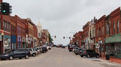 Guthrie Historic DistrictNational Historic Landmark · listed 1974
 Benedictine Heights Hospitallisted 2017
 Carnegie Librarylisted 1971
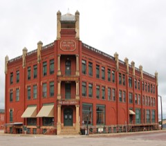 Co-Operative Publishing Company Buildinglisted 1973
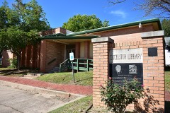 Excelsior Librarylisted 2016
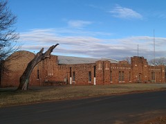 Guthrie Armorylisted 1994
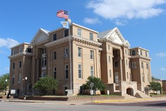 Logan County Courthouselisted 1984
 Scottish Rite Templelisted 1987
- St. Joseph Convent and Academylisted 1979
Surveyed buildings and structures 12 of 15 shown
- Capitol Park, 900 East Oklahoma Avenue, Guthriefederal building survey, 8 photographs
- Carnegie Library, 402 East Oklahoma Avenue, Guthriefederal building survey, 12 photographs
- Ferd-Heim Brewing Company, 424 West Oklahoma Avenue, Guthriefederal building survey, 1 photograph
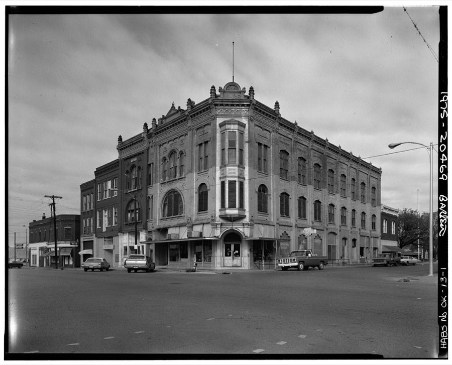
- Gray Brothers Block, 101 West Oklahoma Avenue, Guthriefederal building survey, 7 photographs
- Guthrie Historic District, Roughly bounded by Oklahoma Avenue on the north, Broad Street on the east, Harrison Avenue on the south, and the railroad tracks on the west, includes 301 Harrison Street, Guthriefederal building survey, 1 photograph
- Guthrie Waterworks, South Division Street in Mineral Wells Park, Guthriefederal building survey, 1 photograph
- Noble Avenue Viaduct, Spanning Cottonwood Creek and the Burlington Northern Santa Fe Railway (BNSF) tracks on Oklahoma State Highway 33 (Noble Avenue), Guthriefederal building survey, 1 photograph
- Oklahoma State Capitol, 301 East Harrison Avenue, Guthriefederal building survey, 1 photograph
- P. J. Heilman House, 401 East Cleveland Avenue, Guthriefederal building survey, 15 photographs
- Stapleton Block, 114 North Division Street, Guthriefederal building survey, 4 photographs
- State Capitol Company Building, 301 West Harrison Avenue, Guthriefederal building survey, 10 photographs
- Town of Guthrie, U.S. Route 77 & State Road 33, Guthriefederal building survey, 53 photographs
Population over time
2 figuresGuthrie grew from 10,191 to 10,749 between 2010 and 2020. These are the recorded population figures Wikidata holds for this place, reached through the Geographic Names Information System number this page is keyed on rather than by name, so they belong to this place and not to another of the same name. Most are census counts, but not all are: an early figure may be a founding or settlement estimate, and an estimate published within five years of a census is left out. The change column is computed, and is left blank where more than 20 years separate a figure from the one before it, because a gap that long is not a change between two counts.
| Year | People | Change |
|---|---|---|
| 2010 | 10,191 | |
| 2020 | 10,749 | +558 (+5%) |
Topographic sheets covering this place
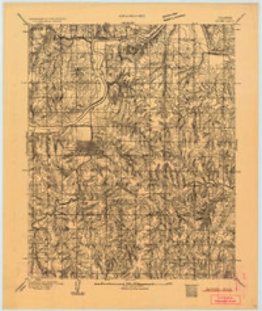
6 surveys from 10 printed sheetsMatched by testing this settlement's coordinate against the published boundary of every sheet in the United States Geological Survey's historical collection. Each opens the scanned sheet at the Survey.
- 1892 USGS Guthrie quadrangle1:62500
- 1954 USGS Oklahoma City quadrangle1:250000
- 1957 USGS Oklahoma City quadrangle1:250000, 3 printings
- 1963 USGS Oklahoma City quadrangle1:250000
- 1970 USGS Guthrie North quadrangle1:24000, 3 printings
- 1990 USGS Oklahoma City North quadrangle1:100000
Photographs
8 of 13 photographs shown,Taken for the Office of War Information and the Farm Security Administration, who photographed the country between 1935 and 1944. Works of United States government photographers, with no known restriction on use. Each opens its catalogue record.
Photographer not recorded. Library of Congress
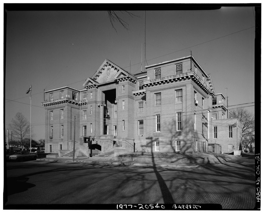
Photographer not recorded. Library of Congress
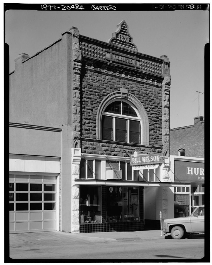
Photographer not recorded. Library of Congress
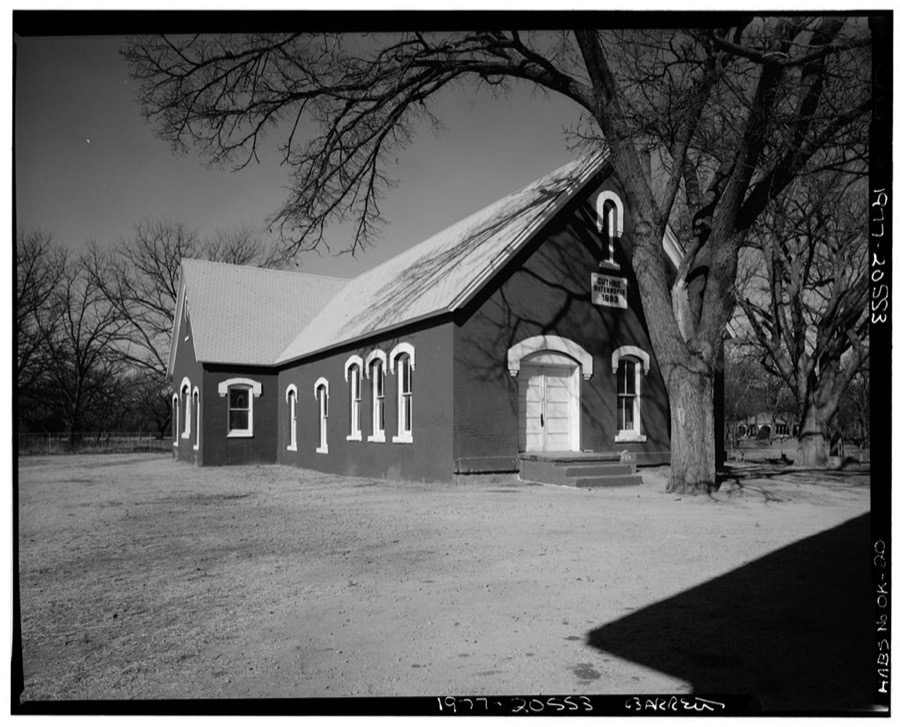
Photographer not recorded. Library of Congress

Photographer not recorded. Library of Congress
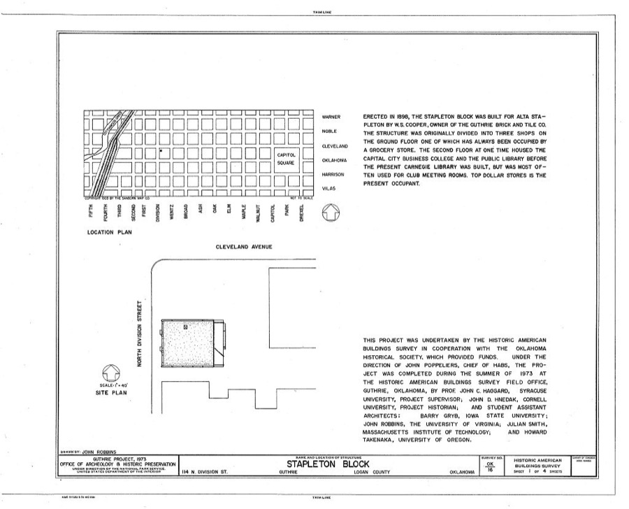
Photographer not recorded. Library of Congress
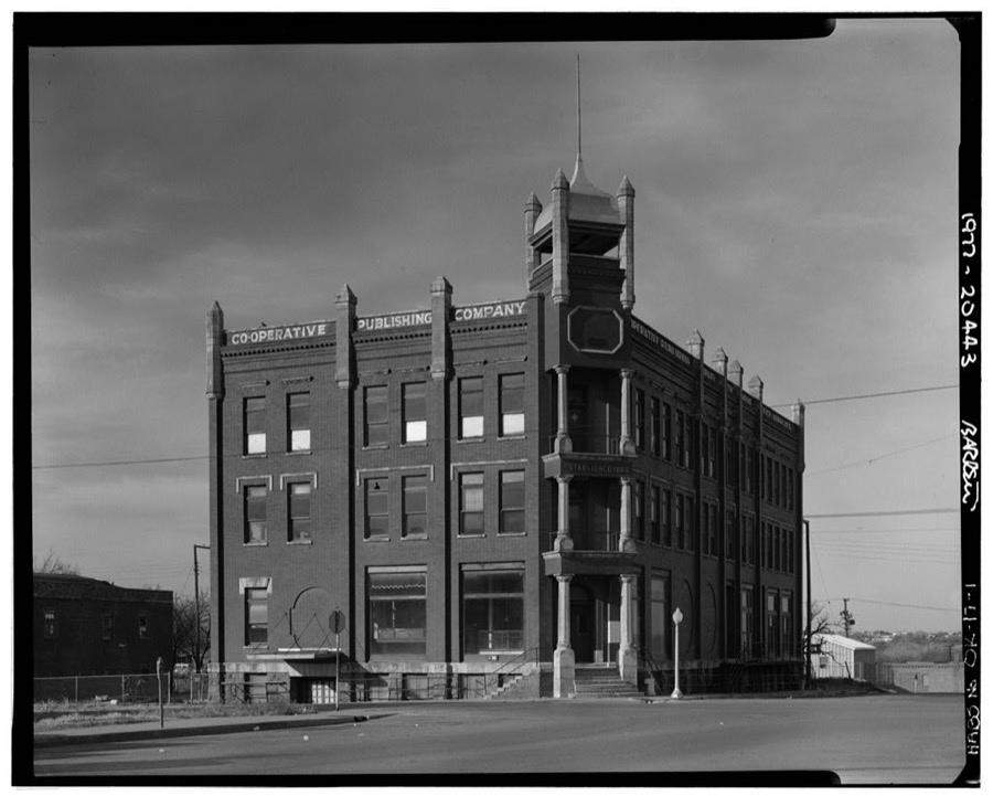
Photographer not recorded. Library of Congress
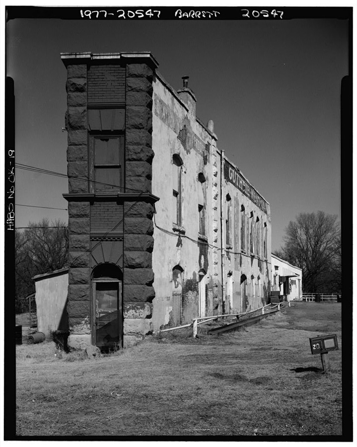
Photographer not recorded. Library of Congress
Every photograph of Logan County
Fires near this place
5 since 2000Regional context, not property-specific evidence. The federal wildfire occurrence database lists 5 fires within 5 miles of Guthrie between 2000 and 2015, burning about 7,096 acres in total. None started naturally. None was recorded as arson. Distance is straight-line from the map coordinates, so a fire counted here may appear on a neighbouring settlement's page as well.
| Reported cause | Fires |
|---|---|
| Missing data/not specified/undetermined | 5 |
The most recent of them, most recent first, with the day each was reported and the service that recorded it.
| Date | Cause | Size | Reported by | Name on the report |
|---|---|---|---|---|
| 19 September 2000 | Missing data/not specified/undetermined | 3,840 acres | Oklahoma Division of Forestry | OAKCLIFF |
| 18 January 2015 | Missing data/not specified/undetermined | 556 acres | Oklahoma Division of Forestry | I35 SHUTDOWN |
| 12 January 2014 | Missing data/not specified/undetermined | 400 acres | Oklahoma Division of Forestry | COLLEGE AVE. FIRE |
| 12 January 2014 | Missing data/not specified/undetermined | 1,300 acres | Oklahoma Division of Forestry | POST ROAD FIRE |
| 1 January 2006 | Missing data/not specified/undetermined | 1,000 acres | Oklahoma Division of Forestry | GUTHRIE FIRE |
Settlements close enough to share some of these fires:
Mines and quarries near this place
6 within 5 milesRegional context, not property-specific evidence. The federal mineral resources record lists 6 workings within 5 miles of Guthrie: 4 producers, 2 past producers. 4 still produce. What was taken out: Sand and Gravel, Construction. Distance is straight-line from the map coordinates, so a quarry counted here may appear on a neighbouring settlement's page as well.
| Where | Site | Commodity | Status | Recorded |
|---|---|---|---|---|
| Cary Sand Pit | Sand and Gravel, Construction | Producer | ||
| Dolese Sand Pit | Sand and Gravel, Construction | Producer | ||
| Dolese Sand Pit | Sand and Gravel, Construction | Producer | ||
| Unknown Sand Pit | Sand and Gravel, Construction | Past Producer | ||
| Unknown Sand Pit | Sand and Gravel, Construction | Producer | ||
| Unknown Sand Pit | Sand and Gravel, Construction | Past Producer |
Storms near this place
60 of 169 shownRegional context, not property-specific evidence. The National Weather Service names Guthrie in 169 storm reports between 1993 and 2026: 90 hail, 70 thunderstorm wind, 3 flash flood, 2 lightning. The reports record 6 injuries. Each account below is quoted exactly as the forecast office filed it, from the NOAA Storm Events Database, and each date opens the federal record of that event.
| When | Event | Place named | Harm | What the report says |
|---|---|---|---|---|
| September 1998 | Thunderstorm Wind | Guthrie | 5 hurt, $3,500,000 | no account filed |
| December 1999 | Tornado (F2) | Guthrie | 1 hurt, $275,000 | Refer to summary at end of Dec 2nd storm reports for more information. |
| August 2004 | Thunderstorm Wind | Guthrie | $1,500,000 | Numerous trees and power lines were downed along with structural damage to many buildings across town due to the strong winds. One home was destroyed and eleven received minor damage. An apartment received minor damage. Major damage was reported at seven businesses with fourteen receiving minor damage. One of those businesses was The Olde Towne Emporium which lost most of its roof. Several public buildings were damaged with the storage building for city vehicles being destroyed. Trees were also reported down on roadways and vehicles across town. |
| September 2000 | Wildfire | Guthrie | $750,000 | A large wild fire, believed to be intentionally set, developed about 9 miles south of Guthrie and consumed 35 homes before being extinguished 3 miles south of Guthrie. No injuries were reported. |
| August 2004 | Thunderstorm Wind | Guthrie | $250,000 | Numerous trees and power lines were downed along with some structural damage. |
| March 2008 | Thunderstorm Wind | Guthrie | $150,000 | Wind damage - some significant - occurred over parts of Logan county. The metal roof and garage door of the Crosstown Veterinary Services building in Guthrie were destroyed. Three homes were damaged, with one of the homes sustaining significant damage southwest of Guthrie. Several outbuildings were damaged, as well as an empty barn. A mobile home was heavily damaged near the Coyle area. Numerous trees and power lines were downed by the strong winds as well. The time of occurrence and monetary damage estimates were estimated. |
| January 2026 | Thunderstorm Wind | Guthrie | $25,000 | Farm outbuildings and fence posts were damaged by thunderstorm winds. The event time is estimated from radar observations. |
| June 2025 | Thunderstorm Wind | Guthrie | $25,000 | Multiple trees were blown down in the Cedar Valley RV Park, including one that landed on a fifth wheel travel trailer. The event time is estimated from radar observations. |
| July 2001 | Thunderstorm Wind | Guthrie | $20,000 | Two farm buildings, several trees, and a farm gate were damaged or destroyed. |
| September 2015 | Thunderstorm Wind | Guthrie | $18,000 | Metal shelter was blown down. Half a metal roof was torn off a house. Reports from social media. Timing estimated by emergency manager. |
| March 2000 | Thunderstorm Wind | Guthrie | $15,000 | Roof damage was reported to several homes and Ace Hardware; and trees, signs, and power lines were downed. |
| October 1998 | Thunderstorm Wind | Guthrie | $15,000 | no account filed |
| August 2016 | Thunderstorm Wind | Guthrie | $2,000 | Several trees and power lines were downed. |
| April 2010 | Hail | Guthrie | $2,000 | The hail cracked the windshield of a fire truck. Monetary damages were estimated. |
| September 2010 | Thunderstorm Wind | Guthrie | $2,000 | Several tree limbs were downed around town. Monetary damages were estimated. |
| July 2007 | Thunderstorm Wind | Guthrie | $1,500 | A large tree limb was blown down by the high wind. Monetary damages were estimated. |
| May 2007 | Thunderstorm Wind | Guthrie | $1,500 | At approximately 1.5 miles north of the intersection of Waterloo and Douglas, two garage doors were dented in and a large section of a cottonwood tree was ripped off. Monetary damages were estimated. |
| May 2003 | Thunderstorm Wind | Guthrie | $1,500 | A shed and fence were destroyed along Interstate 35. |
| August 1998 | Lightning | Guthrie | $1,000 | no account filed |
| June 2005 | Thunderstorm Wind | Guthrie | $750 | A large tree was down across the road near the intersection of Sooner Road and Forrest Hills. |
| September 1998 | Lightning | Guthrie | $500 | no account filed |
| November 1998 | Thunderstorm Wind | Guthrie | $500 | no account filed |
| June 1997 | Thunderstorm Wind | Guthrie | $10 | Numerous tree limbs were blown down. |
| October 1997 | Thunderstorm Wind | Guthrie | $10 | Severe thunderstorm winds blew the roof off a barn and downed trees. |
| June 2025 | Thunderstorm Wind | Guthrie | - | Trees were blown down and partially blocked the roadway near the intersection of Noble Avenue and 17th Street. The event time is estimated from radar observations. |
| June 2025 | Thunderstorm Wind | Guthrie | - | Trees were blown down, trapping individuals in a storm shelter. The location is approximate, and the event time is estimated from radar observations. |
| November 2025 | Hail | Guthrie | - | The report was relayed through mPING. |
| May 2024 | Thunderstorm Wind | Guthrie | - | A tree blown down near the intersection of Oklahoma Highway 105 and Douglas Boulevard. Time is radar estimated. |
| June 2024 | Thunderstorm Wind | Guthrie | - | Guthrie Municipal Airport (KGOK) observation. |
| May 2024 | Hail | Guthrie | - | MPing report. |
| May 2024 | Hail | Guthrie | - | MPing report. |
| April 2023 | Hail | Guthrie | - | MPing report. Hailfall likely occurred prior to report time (between 1700-1710 CST) based on radar evidence. |
| June 2023 | Thunderstorm Wind | Guthrie | - | Guthrie Municipal Airport (KGOK) observation. |
| August 2023 | Thunderstorm Wind | Guthrie | - | Guthrie Municipal Airport (KGOK) observation. |
| May 2021 | Thunderstorm Wind | Guthrie | - | Large tree limbs down over roadway. |
| May 2021 | Hail | Guthrie | - | Time radar estimated. |
| March 2020 | Thunderstorm Wind | Guthrie | - | Tree damage with a large limb across road. |
| April 2020 | Thunderstorm Wind | Guthrie | - | Estimated gust through broadcast media. |
| May 2019 | Flash Flood | Guthrie | - | Hwy 77 at Cimarron River bridge is closed on the south side of the bridge. |
| August 2019 | Thunderstorm Wind | Guthrie | - | Small sheet-metal shed destroyed. Time estimated. |
| July 2015 | Thunderstorm Wind | Guthrie | - | No damage reported. |
| March 2015 | Hail | Guthrie | - | Reported at interstate 35 and Highway 77. |
| April 2014 | Thunderstorm Wind | Guthrie | - | Minor damage to a home at Seward and Coaltrane. Time estimated from radar. |
| June 2013 | Thunderstorm Wind | Guthrie | - | Trained spotter estimated a gust to 60 mph. |
| August 2011 | Thunderstorm Wind | Guthrie | - | Trees 6 to 8 inches in diameter were blown down along with minor street sign damage. Monetary damage estimates were not available. |
| August 2011 | Thunderstorm Wind | Guthrie | - | Numerous trees were blown down and one power pole was snapped. Metal outbuildings were damaged as well. Monetary damage estimates were not available. |
| February 2009 | Hail | Guthrie | - | The hail was reported by KFOR-4 TV. |
| July 2009 | Thunderstorm Wind | Guthrie | - | Several trees, tree limbs, and power lines were downed from near 11th Street, west to Academy Road. Tree limb and power line damage was also reported near 15th Street and Noble Avenue. Monetary damage estimates were not available. |
| July 2009 | Hail | Guthrie | - | The hail was reported at Broad Street and Harrison Avenue. |
| November 2008 | Hail | Guthrie | - | The hail was reported at the intersection of Interstate 35 and Highway 33. |
| November 2008 | Hail | Guthrie | - | The hail covered the ground. |
| May 2008 | Flash Flood | Guthrie | - | High water covered numerous streets in Guthrie due to persistent heavy rainfall throughout the day. Other roads were closed around the county due to high water. Byrd creek also overflowed its banks. No damages were reported. |
| October 2007 | Hail | Guthrie | - | The hail covered the ground. |
| October 2007 | Hail | Guthrie | - | The hail covered the ground. |
| October 2007 | Hail | Guthrie | - | The hail covered the ground. |
| September 2005 | Thunderstorm Wind | Guthrie | - | The wind was measured near the intersection of Bryant Avenue and Waterloo Road at Imperial College. |
| September 2005 | Thunderstorm Wind | Guthrie | - | Wind was measured by the Oklahoma mesonet. |
| August 2004 | Thunderstorm Wind | Guthrie | - | Wind was measured by the Oklahoma mesonet. |
| August 2004 | Thunderstorm Wind | Guthrie | - | Wind was measured by the Oklahoma mesonet. |
| August 2004 | Thunderstorm Wind | Guthrie | - | Wind was measured by the Oklahoma mesonet. |
Nearest settlements
The eight closest, with where each one stands in the county. Distances are straight-line, computed from the Geographic Names Information System coordinates.
| Map | Place | Distance | Sheets |
|---|---|---|---|
| Lawrie | 5.4 miles | 10 | |
| Lakeview | 5.6 miles | 10 | |
| Seward | 6.5 miles | 10 | |
| Cedar Valley | 7.3 miles | 13 | |
| Indian Springs | 7.9 miles | 13 | |
| Navina | 9.0 miles | 13 | |
| Cimarron City | 9.4 miles | 13 | |
| Frost | 9.5 miles | 11 |
Elsewhere
Matched on this settlement's Geographic Names Information System number rather than its name, so it cannot be a different place of the same name in another state.
| Wikipedia article on Guthrie | An encyclopaedic summary. Its text is share-alike, so it is linked here rather than copied. |
| Wikidata item Q777577 | The structured record the population and elevation above come from. Public domain (CC0). |
Provenance
This settlement is recorded in the Geographic Names Information System as feature 1093447. The sheet list is computed by point-in-boundary test against the United States Geological Survey's historical topographic inventory. Both are works of the United States government and carry no copyright under 17 U.S.C. 105.
Wildfire. Short, Karen C. 2022. Spatial wildfire occurrence data for the United States, 1992-2020 [FPA_FOD_20221014]. 6th Edition. Fort Collins, CO: Forest Service Research Data Archive. https://doi.org/10.2737/RDS-2013-0009.6 Collected with United States Government funding and usable without additional permissions or fees.
Mines and quarries. USGS Mineral Resources Data System (MRDS) https://mrdata.usgs.gov/mrds/ A work of the United States government, no copyright under 17 U.S.C. 105.
Storms. NOAA National Centers for Environmental Information, Storm Events Database https://www.ncei.noaa.gov/stormevents/ A work of the United States government, no copyright under 17 U.S.C. 105. Narratives are quoted verbatim from the National Weather Service report and are not edited or summarised.