 Block
Seward, Oklahoma
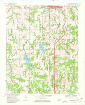
10 topographic sheets cover this place, the earliest surveyed in 1892 and the latest in 1990. It stands in the Guthrie census division. It lies in ZIP code area 73044. It stands on Spring Creek. The Survey maps it on the Guthrie South quadrangle. 26 people lived here at the 2020 count. It stands 1,017 feet above sea level.
Topographic sheets covering this place
6 surveys from 10 printed sheetsMatched by testing this settlement's coordinate against the published boundary of every sheet in the United States Geological Survey's historical collection. Each opens the scanned sheet at the Survey.
- 1892 USGS Guthrie quadrangle1:62500
- 1954 USGS Oklahoma City quadrangle1:250000
- 1957 USGS Oklahoma City quadrangle1:250000, 3 printings
- 1963 USGS Oklahoma City quadrangle1:250000
- 1970 USGS Guthrie South quadrangle1:24000, 3 printings
- 1990 USGS Oklahoma City North quadrangle1:100000
Fires near this place
1 since 2014Regional context, not property-specific evidence. The federal wildfire occurrence database lists 1 fire within 5 miles of Seward in 2014, burning about 3,250 acres in total. None started naturally. None was recorded as arson. Distance is straight-line from the map coordinates, so a fire counted here may appear on a neighbouring settlement's page as well.
| Reported cause | Fires |
|---|---|
| Missing data/not specified/undetermined | 1 |
The most recent of them, most recent first, with the day each was reported and the service that recorded it.
| Date | Cause | Size | Reported by | Name on the report |
|---|---|---|---|---|
| 4 May 2014 | Missing data/not specified/undetermined | 3,250 acres | Oklahoma Division of Forestry | GUTHRIE |
Settlements close enough to share some of these fires:
Mines and quarries near this place
3 within 5 milesRegional context, not property-specific evidence. The federal mineral resources record lists 3 workings within 5 miles of Seward: 2 past producers, 1 producer. 1 still produces. What was taken out: Sand and Gravel, Construction. Distance is straight-line from the map coordinates, so a quarry counted here may appear on a neighbouring settlement's page as well.
| Where | Site | Commodity | Status | Recorded |
|---|---|---|---|---|
| Unknown Sand Pit | Sand and Gravel, Construction | Producer | ||
| Unknown Sand Pit | Sand and Gravel, Construction | Past Producer | ||
| Unknown Sand Pit | Sand and Gravel, Construction | Past Producer |
Storms near this place
60 since 1994Regional context, not property-specific evidence. The National Weather Service names Seward in 60 storm reports between 1994 and 2026: 32 hail, 20 thunderstorm wind, 3 tornado, 3 flash flood. No death or injury is recorded in these reports. Each account below is quoted exactly as the forecast office filed it, from the NOAA Storm Events Database, and each date opens the federal record of that event.
| When | Event | Place named | Harm | What the report says |
|---|---|---|---|---|
| August 2019 | Tornado (EF1) | Seward | $150,000 | The tornado developed near the intersection of West Simpson Road and Kelley Avenue and moved south-southwest. Damage was relatively spotty along the track and consisted primarily of broken tree limbs and branches, along with some snapped and uprooted trees. The most significant structure damage was to a home southeast of Simmons Road and Santa Fe Avenue where a large portion of the roof was removed. The tornado crossed Waterloo Road into Oklahoma County, but dissipated quickly south of the county line.||Damage was also noted north and east of the tornado track, although evidence suggested this was the result of a large surge of straight line thunderstorm winds. |
| August 2024 | Lightning | Seward | $50,000 | House fire due a suspected lightning strike. |
| August 2024 | Lightning | Seward | $50,000 | House fire due to a suspected lightning strike. |
| August 2019 | Thunderstorm Wind | Seward | $5,000 | Trampoline pole as a projectile through a house. Twitter picture. |
| July 2009 | Thunderstorm Wind | Seward | $3,000 | A large tree was downed due to high winds near Guthrie Lake. Quarter-size hail was also reported at this location. Monetary damages were estimated. |
| December 1999 | Tornado (F1) | Seward | $3,000 | Refer to summary at end of Dec 2nd storm reports for more information. |
| December 1999 | Thunderstorm Wind | Seward | $1,000 | no account filed |
| December 1999 | Thunderstorm Wind | Seward | $200 | no account filed |
| March 2026 | Hail | Seward | - | The report was relayed through mPING. |
| May 2025 | Hail | Seward | - | The report was relayed through mPING. |
| June 2025 | Thunderstorm Wind | Seward | - | Guthrie (GUTH) Mesonet observation. |
| June 2025 | Thunderstorm Wind | Seward | - | Guthrie (GUTH) Mesonet observation. |
| May 2024 | Thunderstorm Wind | Seward | - | Estimated wind gust. Relayed by emergency management. |
| June 2023 | Thunderstorm Wind | Seward | - | Video showing a few large trees snapped along with numerous large (12+ inch diameter) tree limbs blown down. Time is radar estimated. |
| June 2023 | Thunderstorm Wind | Seward | - | A number of large trees were downed or damaged. Time is estimated. |
| June 2022 | Hail | Seward | - | Time estimate from radar. |
| May 2019 | Flash Flood | Seward | - | Water over road on Waterloo east of I-35. |
| October 2019 | Hail | Seward | - | From Mping. |
| May 2018 | Thunderstorm Wind | Seward | - | Tree damage near Simmons and Coltrane. Time estimated by radar. |
| April 2017 | Flash Flood | Seward | - | Road closed at Coaltrain and Covell due to high water. |
| April 2017 | Flash Flood | Seward | - | Flooding at Douglass and Waterloo road. |
| May 2017 | Hail | Seward | - | Reported via mping. |
| April 2016 | Thunderstorm Wind | Seward | - | No damage was reported. |
| March 2015 | Hail | Seward | - | No damage was reported. |
| June 2013 | Thunderstorm Wind | Seward | - | At Simmons Rd. and Midwest. |
| March 2013 | Hail | Seward | - | Hail fell near the intersection of Seward and Sooner Rd. |
| February 2009 | Tornado (EF2) | Seward | - | This tornado crossed into Logan County from Oklahoma County. An auto body repair shop just west of Broadway and Waterloo was completely destroyed. One man, near Broadway and Waterloo, was blown out of his home and carried across the street where he landed near a creek. A mobile home on the same property of this man was completely destroyed and the frame was turned on its side and slightly bent. Monetary damage estimates were not available. |
| March 2009 | Hail | Seward | - | The hail was reported near East Charter Oak Road and South Douglas Boulevard. |
| May 2009 | Hail | Seward | - | The hail was reported at the Seward Road exit on Interstate 35. |
| July 2009 | Hail | Seward | - | The hail covered the ground near the intersection of Sooner and Coleman Roads. |
| July 2009 | Hail | Seward | - | The hail was reported near Guthrie Lake. Tree damage was also reported at this location. |
| July 2009 | Hail | Seward | - | The hail was reported near Liberty Lake. |
| October 2007 | Hail | Seward | - | The hail was reported near County Line Road in Logan county. |
| April 2004 | Hail | Seward | - | Hail was reported covering the ground. |
| April 2023 | Hail | Seward | - | no account filed |
| August 2019 | Thunderstorm Wind | Seward | - | no account filed |
| May 2018 | Thunderstorm Wind | Seward | - | no account filed |
| May 2017 | Hail | Seward | - | no account filed |
| May 2017 | Hail | Seward | - | no account filed |
| May 2017 | Thunderstorm Wind | Seward | - | no account filed |
| May 2017 | Thunderstorm Wind | Seward | - | no account filed |
| April 2017 | Hail | Seward | - | no account filed |
| August 2015 | Hail | Seward | - | no account filed |
| March 2015 | Hail | Seward | - | no account filed |
| March 2015 | Hail | Seward | - | no account filed |
| May 2013 | Hail | Seward | - | no account filed |
| May 2012 | Thunderstorm Wind | Seward | - | no account filed |
| February 2009 | Hail | Seward | - | no account filed |
| May 2009 | Hail | Seward | - | no account filed |
| March 2008 | Thunderstorm Wind | Seward | - | no account filed |
| August 2005 | Thunderstorm Wind | Seward | - | no account filed |
| August 2004 | Hail | Seward | - | no account filed |
| August 1999 | Thunderstorm Wind | Seward | - | no account filed |
| September 1998 | Hail | Seward | - | no account filed |
| June 1998 | Hail | Seward | - | no account filed |
| June 1996 | Hail | Seward | - | no account filed |
| June 1995 | Hail | Seward | - | no account filed |
| April 1994 | Hail | Seward | - | no account filed |
| April 1994 | Hail | Seward | - | no account filed |
| April 1994 | Hail | Seward | - | no account filed |
Nearest settlements
The eight closest, with where each one stands in the county. Distances are straight-line, computed from the Geographic Names Information System coordinates.
| Map | Place | Distance | Sheets |
|---|---|---|---|
| Lakeview | 3.3 miles | 10 | |
| Navina | 3.8 miles | 13 | |
| Cedar Valley | 6.0 miles | 13 | |
| Guthrie | 6.5 miles | 10 | |
| Indian Springs | 8.1 miles | 13 | |
| Cimarron City | 8.7 miles | 13 | |
| Crescent Springs | 9.1 miles | 13 | |
| Lawrie | 11.5 miles | 10 |
Elsewhere
Matched on this settlement's Geographic Names Information System number rather than its name, so it cannot be a different place of the same name in another state.
| Wikipedia article on Seward | An encyclopaedic summary. Its text is share-alike, so it is linked here rather than copied. |
| Wikidata item Q7458170 | The structured record the population and elevation above come from. Public domain (CC0). |
Provenance
This settlement is recorded in the Geographic Names Information System as feature 1097931. The sheet list is computed by point-in-boundary test against the United States Geological Survey's historical topographic inventory. Both are works of the United States government and carry no copyright under 17 U.S.C. 105.
Wildfire. Short, Karen C. 2022. Spatial wildfire occurrence data for the United States, 1992-2020 [FPA_FOD_20221014]. 6th Edition. Fort Collins, CO: Forest Service Research Data Archive. https://doi.org/10.2737/RDS-2013-0009.6 Collected with United States Government funding and usable without additional permissions or fees.
Mines and quarries. USGS Mineral Resources Data System (MRDS) https://mrdata.usgs.gov/mrds/ A work of the United States government, no copyright under 17 U.S.C. 105.
Storms. NOAA National Centers for Environmental Information, Storm Events Database https://www.ncei.noaa.gov/stormevents/ A work of the United States government, no copyright under 17 U.S.C. 105. Narratives are quoted verbatim from the National Weather Service report and are not edited or summarised.