 Block
Tuttle, Oklahoma
15 topographic sheets cover this place, the earliest surveyed in 1893 and the latest in 1985. It stands in the Tuttle census division. It lies in ZIP code area 73089. The Survey maps it on the Tuttle quadrangle. 7,413 people lived here at the 2020 count. It stands 1,319 feet above sea level.
On record in Tuttle
Buildings and businesses the archive holds for this place. Each opens its own page, with the source record it came from.
On the National Register 1 record
- Silver City Cemeterylisted 2008
Population over time
2 figuresTuttle grew from 6,019 to 7,413 between 2010 and 2020. These are the recorded population figures Wikidata holds for this place, reached through the Geographic Names Information System number this page is keyed on rather than by name, so they belong to this place and not to another of the same name. Most are census counts, but not all are: an early figure may be a founding or settlement estimate, and an estimate published within five years of a census is left out. The change column is computed, and is left blank where more than 20 years separate a figure from the one before it, because a gap that long is not a change between two counts.
| Year | People | Change |
|---|---|---|
| 2010 | 6,019 | |
| 2020 | 7,413 | +1,394 (+23%) |
Topographic sheets covering this place
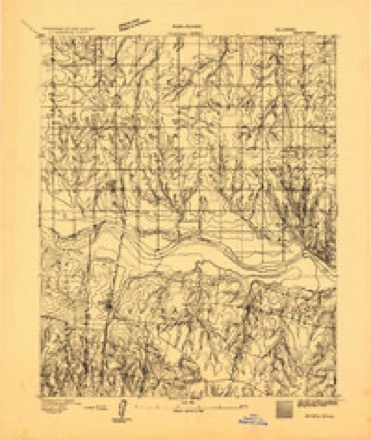
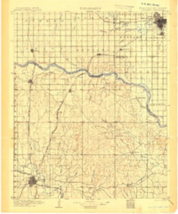
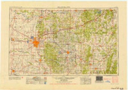
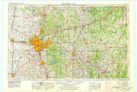
7 surveys from 15 printed sheetsMatched by testing this settlement's coordinate against the published boundary of every sheet in the United States Geological Survey's historical collection. Each opens the scanned sheet at the Survey.
- 1893 USGS Minco quadrangle1:62500
- 1904 USGS Chickasha quadrangle1:125000, 4 printings
- 1954 USGS Oklahoma City quadrangle1:250000
- 1957 USGS Oklahoma City quadrangle1:250000, 3 printings
- 1963 USGS Oklahoma City quadrangle1:250000
- 1966 USGS Tuttle quadrangle1:24000, 3 printings
- 1985 USGS Oklahoma City South quadrangle1:100000, 2 printings
Mines and quarries near this place
8 within 5 milesRegional context, not property-specific evidence. The federal mineral resources record lists 8 workings within 5 miles of Tuttle: 8 past producers. None of them still produces. What was taken out: Sand and Gravel, Construction. Distance is straight-line from the map coordinates, so a quarry counted here may appear on a neighbouring settlement's page as well.
| Where | Site | Commodity | Status | Recorded |
|---|---|---|---|---|
| Unknown Gravel Pit | Sand and Gravel, Construction | Past Producer | ||
| Unknown Gravel Pit | Sand and Gravel, Construction | Past Producer | ||
| Unknown Gravel Pit | Sand and Gravel, Construction | Past Producer | ||
| Unknown Gravel Pit | Sand and Gravel, Construction | Past Producer | ||
| Unknown Gravel Pit | Sand and Gravel, Construction | Past Producer | ||
| Unknown Gravel Pit | Sand and Gravel, Construction | Past Producer | ||
| Unknown Gravel Pit | Sand and Gravel, Construction | Past Producer | ||
| Unnamed Gravel Pits | Sand and Gravel, Construction | Past Producer |
Storms near this place
60 of 80 shownRegional context, not property-specific evidence. The National Weather Service names Tuttle in 80 storm reports between 1993 and 2026: 47 hail, 22 thunderstorm wind, 7 tornado, 4 flash flood. No death or injury is recorded in these reports. Each account below is quoted exactly as the forecast office filed it, from the NOAA Storm Events Database, and each date opens the federal record of that event.
| When | Event | Place named | Harm | What the report says |
|---|---|---|---|---|
| March 2002 | Thunderstorm Wind | Tuttle | $150,000 | Top layers of the southwest corner of the Tuttle High School roof were blown off, exposing about 10 rooms. Several heating and air conditioning units were also blown loose. The roof of the district's wrestling room, which is located about 100 yards to the east of the high school, was also damaged. |
| May 2015 | Hail | Tuttle | $50,000 | Damage to several vehicles and siding on one home. Damages estimated. |
| August 2023 | Thunderstorm Wind | Tuttle | $40,000 | A mobile home was removed from its blocks, rolled and destroyed. A large barn in the vicinity also had most of its roof removed. Time is radar estimated. |
| October 1998 | Thunderstorm Wind | Tuttle | $30,000 | no account filed |
| May 2025 | Flash Flood | Tuttle | $25,000 | Flooding occurred along roadways, extended into yards and approached at least one house in the community of Tuttle. A broadcast media chaser also reported roadway flooding along Cimarron Road south of the community. The event time is approximate. |
| May 2024 | Thunderstorm Wind | Tuttle | $20,000 | Social media image showing a camper trailer blown over, rolled, and destroyed by thunderstorm wind. Time is radar estimated. |
| March 2026 | Tornado (EF0) | Tuttle | $10,000 | Numerous storm chasers observed a brief tornado northwest of Tuttle. A television helicopter observed damage to chicken coops in the area, otherwise no other damage was reported. |
| April 2022 | Tornado (EF0) | Tuttle | $10,000 | A tornado touched down northwest of Tuttle, north of State Highway 37 and west of County Road 2890. The tornado moved northeast and then east causing roof damage to an outbuilding and tree damage near and south of Silver City Ridge Road before dissipating east of Richland Road. |
| May 2013 | Thunderstorm Wind | Tuttle | $10,000 | Wind damage occurred in and near Tuttle. Damage was reported to barns, trees, and at least one home suffered roof damage. |
| February 2023 | Tornado (EF0) | Tuttle | $5,000 | A tornado touched down south of County Road 1190 to the west of Tuttle, and moved northeast crossing the Canadian River into Canadian County. In Grady County, the tornado damaged trees and street signs. |
| July 2009 | Thunderstorm Wind | Tuttle | $3,000 | An outbuilding was damaged by strong winds. Monetary damages were estimated. |
| July 2018 | Thunderstorm Wind | Tuttle | $2,000 | Semi trailer blown over and a few trees damaged. Time estimated from nearby reports. |
| June 2007 | Thunderstorm Wind | Tuttle | $1,500 | A tree was blown down over the roadway near the Bridge Creek community. Monetary damages were estimated. |
| June 2011 | Thunderstorm Wind | Tuttle | $1,000 | Several tree limbs were downed on the west side of Tuttle. Monetary damages were estimated. |
| July 2002 | Thunderstorm Wind | Tuttle | $500 | A few homes had some shingles blown off their roof, and large tree limbs were downed. |
| July 2002 | Thunderstorm Wind | Tuttle | $500 | Large tree limbs were downed, and a business sign was blown over. |
| July 2000 | Thunderstorm Wind | Tuttle | $500 | Trees were downed near the intersection of Marigold and Highway 37. |
| March 2025 | Hail | Tuttle | - | MPing report. |
| March 2025 | Hail | Tuttle | - | MPing report. |
| May 2025 | Hail | Tuttle | - | The report was relayed through mPING. |
| May 2025 | Hail | Tuttle | - | An image was relayed. Hail size increased from quarter-size to tennis ball-size at this location between 1548 and 1551 LST. |
| June 2025 | Thunderstorm Wind | Tuttle | - | A personal weather station observation near the intersection of Cemetery Road and Bridge Road. The event time is estimated from radar observations. |
| May 2024 | Thunderstorm Wind | Tuttle | - | Multiple social media images showing trees uprooted. Time is radar estimated. |
| May 2024 | Thunderstorm Wind | Tuttle | - | Social media image showing a tree uprooted. Time is radar estimated. |
| June 2023 | Hail | Tuttle | - | Time is radar estimated. |
| June 2023 | Hail | Tuttle | - | MPing report. |
| June 2023 | Hail | Tuttle | - | MPing report. |
| May 2023 | Tornado (EFU) | Tuttle | - | Media and other storm chasers observed a tornado that moved north-northeast from about 4 miles south of Tuttle to about 2 miles southeast of Tuttle. No significant damage was reported in this area, and the specific path was estimated. |
| September 2023 | Hail | Tuttle | - | MPing report. |
| September 2023 | Hail | Tuttle | - | MPing report. |
| October 2021 | Thunderstorm Wind | Tuttle | - | Estimated severe wind gust. |
| July 2018 | Hail | Tuttle | - | Also reported 56 mph wind and power outages. |
| May 2016 | Flash Flood | Tuttle | - | About a foot of water covered highway 92 south of Tuttle. |
| June 2015 | Hail | Tuttle | - | No damage reported. |
| June 2015 | Hail | Tuttle | - | No damage reported. |
| May 2015 | Thunderstorm Wind | Tuttle | - | Severe winds up to 82 mph measured with half dollar sized hail. No damage information was available. |
| May 2015 | Tornado (EF0) | Tuttle | - | Videos from storm chasers and an NWS damage survey indicate a tornado developed about 4 miles east-northeast of Tuttle and moved southeast then east to about 2 miles northeast of Bridge Creek. Observed damage was confined to trees along the path. The end of the path likely overlapped with the north end of the damage path of the Bridge Creek tornado from earlier in the day. |
| May 2015 | Thunderstorm Wind | Tuttle | - | No damage was reported. |
| May 2015 | Tornado (EF0) | Tuttle | - | Chaser video and an NWS storm survey indicated that a tornado touched down about 3 miles southeast of Tuttle and moved south-southeast. Trees were uprooted (DOD 27, DI 3) and two homes sustained minor damage (DOD 2, DI 2-4). |
| May 2013 | Tornado (EF0) | Tuttle | - | Two storm chasers filmed a tornado to the northeast of Tuttle near the Canadian River. The tornado produced no known damage. |
| May 2012 | Thunderstorm Wind | Tuttle | - | No damage was reported. |
| July 2007 | Flash Flood | Tuttle | - | A bridge was inaccessible due to high water on County Road 1240, also called Golf Course Road. The road was closed from the county line to one mile west of the county line. |
| June 2005 | Hail | Tuttle | - | Hail was observed on Highway 92. |
| April 2003 | Hail | Tuttle | - | Hail was reported on Highway 37. |
| June 2003 | Hail | Tuttle | - | Hail was observed on Highway 4, four miles south of the intersection with Highway 37. |
| June 2023 | Hail | Tuttle | - | no account filed |
| June 2022 | Flash Flood | Tuttle | - | no account filed |
| May 2022 | Hail | Tuttle | - | no account filed |
| August 2020 | Hail | Tuttle | - | no account filed |
| April 2020 | Hail | Tuttle | - | no account filed |
| April 2019 | Hail | Tuttle | - | no account filed |
| August 2019 | Thunderstorm Wind | Tuttle | - | no account filed |
| May 2019 | Hail | Tuttle | - | no account filed |
| October 2016 | Hail | Tuttle | - | no account filed |
| October 2016 | Hail | Tuttle | - | no account filed |
| June 2015 | Hail | Tuttle | - | no account filed |
| May 2013 | Hail | Tuttle | - | no account filed |
| May 2012 | Hail | Tuttle | - | no account filed |
| May 2012 | Hail | Tuttle | - | no account filed |
| October 2011 | Hail | Tuttle | - | no account filed |
Nearest settlements
The eight closest, with where each one stands in the county. Distances are straight-line, computed from the Geographic Names Information System coordinates.
| Map | Place | Distance | Sheets |
|---|---|---|---|
| Sooner | 4.6 miles | 13 | |
| Bridge Creek | 5.6 miles | 16 | |
| Minco | 7.2 miles | 14 | |
| Amber | 9.7 miles | 13 | |
| Pocasset | 10.0 miles | 13 | |
| Middleberg | 13.4 miles | 13 | |
| Tabler | 17.0 miles | 13 | |
| Chickasha | 17.7 miles | 13 |
Elsewhere
Matched on this settlement's Geographic Names Information System number rather than its name, so it cannot be a different place of the same name in another state.
| Wikipedia article on Tuttle | An encyclopaedic summary. Its text is share-alike, so it is linked here rather than copied. |
| Wikidata item Q3240396 | The structured record the population and elevation above come from. Public domain (CC0). |
Provenance
This settlement is recorded in the Geographic Names Information System as feature 1099088. The sheet list is computed by point-in-boundary test against the United States Geological Survey's historical topographic inventory. Both are works of the United States government and carry no copyright under 17 U.S.C. 105.
Mines and quarries. USGS Mineral Resources Data System (MRDS) https://mrdata.usgs.gov/mrds/ A work of the United States government, no copyright under 17 U.S.C. 105.
Storms. NOAA National Centers for Environmental Information, Storm Events Database https://www.ncei.noaa.gov/stormevents/ A work of the United States government, no copyright under 17 U.S.C. 105. Narratives are quoted verbatim from the National Weather Service report and are not edited or summarised.