 Block
Union City, Oklahoma
14 topographic sheets cover this place, the earliest surveyed in 1893 and the latest in 1985. It stands in the El Reno census division. It lies in ZIP code area 73090. It stands on Arapaho Creek. The Survey maps it on the Union City quadrangle. 1,794 people lived here at the 2020 count. It stands 1,322 feet above sea level.
On record in Union City
Buildings and businesses the archive holds for this place. Each opens its own page, with the source record it came from.
On the National Register 1 record
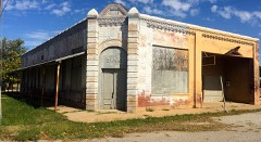 Richardson Buildinglisted 1983
Population over time
2 figuresUnion City grew from 1,645 to 1,794 between 2010 and 2020. These are the recorded population figures Wikidata holds for this place, reached through the Geographic Names Information System number this page is keyed on rather than by name, so they belong to this place and not to another of the same name. Most are census counts, but not all are: an early figure may be a founding or settlement estimate, and an estimate published within five years of a census is left out. The change column is computed, and is left blank where more than 20 years separate a figure from the one before it, because a gap that long is not a change between two counts.
| Year | People | Change |
|---|---|---|
| 2010 | 1,645 | |
| 2020 | 1,794 | +149 (+9%) |
Topographic sheets covering this place
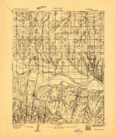
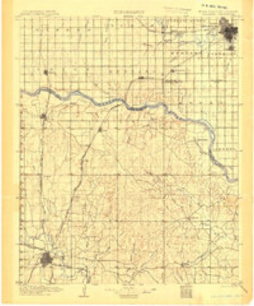
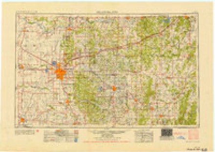
7 surveys from 14 printed sheetsMatched by testing this settlement's coordinate against the published boundary of every sheet in the United States Geological Survey's historical collection. Each opens the scanned sheet at the Survey.
- 1893 USGS Minco quadrangle1:62500
- 1904 USGS Chickasha quadrangle1:125000, 4 printings
- 1954 USGS Oklahoma City quadrangle1:250000
- 1957 USGS Oklahoma City quadrangle1:250000, 3 printings
- 1963 USGS Oklahoma City quadrangle1:250000
- 1966 USGS Union City quadrangle1:24000, 2 printings
- 1985 USGS Oklahoma City South quadrangle1:100000, 2 printings
Mines and quarries near this place
6 within 5 milesRegional context, not property-specific evidence. The federal mineral resources record lists 6 workings within 5 miles of Union City: 4 past producers, 2 producers. 2 still produce. What was taken out: Sand and Gravel, Construction, Clay. Distance is straight-line from the map coordinates, so a quarry counted here may appear on a neighbouring settlement's page as well.
| Where | Site | Commodity | Status | Recorded |
|---|---|---|---|---|
| Okla Brick Shale Pits | Clay | Producer | ||
| Oklahoma Brick Pit & Plant | Clay | Producer | ||
| Unknown Gravel Pit | Sand and Gravel, Construction | Past Producer | ||
| Unknown Gravel Pit | Sand and Gravel, Construction | Past Producer | ||
| Unknown Gravel Pit | Sand and Gravel, Construction | Past Producer | ||
| Unknown Shale Pit | Clay | Past Producer |
Storms near this place
60 of 62 shownRegional context, not property-specific evidence. The National Weather Service names Union City in 62 storm reports between 1994 and 2026: 31 hail, 17 tornado, 14 thunderstorm wind. No death or injury is recorded in these reports. Each account below is quoted exactly as the forecast office filed it, from the NOAA Storm Events Database, and each date opens the federal record of that event.
| When | Event | Place named | Harm | What the report says |
|---|---|---|---|---|
| June 1995 | Thunderstorm Wind | Union City | $5,000,000 | no account filed |
| June 1995 | Tornado (F1) | Union City | $500,000 | no account filed |
| February 2023 | Tornado (EF1) | Union City | $250,000 | This tornado touched down west of Tuttle in Grady County and moved into Canadian County to the southwest of Mustang. The tornado moved north-northeast dissipating west-northwest of Mustang. A number of homes and buildings were damaged, especially from SW 104th Street to SW 75th Street near Cimarron Road. The tornado dissipated near SW 44th Street and Richland Road. |
| May 2024 | Tornado (EF2) | Union City | $100,000 | Numerous chasers and spotters observed a tornado that touched down just southwest of SW 15th Street and Banner Road and moved northeast dissipating in far western Oklahoma City just southeast of Page Airport, or just northeast of Northwest 10th and Cimarron Road. A few houses suffered significant roof damage or had windows blown in, and a few outbuildings were damaged, but the damage was primarily to trees and power poles along the path.||For a while, this was the easternmost of three simultaneous tornadoes occurring in Canadian County. |
| May 2007 | Tornado (EF0) | Union City | $100,000 | A tornado formed near EW112 Road just east of Reformatory Road. Trees were knocked over or snapped on two properties. The most significant damage occurred near the intersection of EW111 Road and Reformatory Road where a wood and metal garage was essentially destroyed and a barn sustained some damage to a wall panel, however a car inside the garage suffered minimal damage. A grain bin was blown to the north, and power poles were pushed from upright in this area. Trees were damaged from this location to about 1 mile north-northwest. Monetary damages were estimated.| |
| January 2026 | Thunderstorm Wind | Union City | $50,000 | A swath of damaging winds occurred from just east of Union City to near the intersection of Southwest 44th Street and Banner Road. Several large outbuildings lost metal roof decking and trees were damaged. Both the wind path and event time are estimated. |
| September 2013 | Thunderstorm Wind | Union City | $10,000 | Several power poles blown down. Damages estimated. |
| May 2024 | Tornado (EF0) | Union City | $5,000 | This was the westernmost of what for a few minutes were three simultaneous tornadoes in Canadian County and was observed by a number of storm chasers and spotters. The tornado developed southeast of Southwest 15th Street and Alfadale Street, and it damaged a barn and blew a hay bale south-southeast along Southwest 15th Street. The tornado initially moved north or north-northeast before turning northwest and crossing US Highway 81 about a half mile north of Reno Avenue. Street signs were blown over along US-81 before the tornado dissipated west of the highway. |
| October 2022 | Tornado (EF0) | Union City | $5,000 | The tornado initially broke some tree branches along State Highway 152 between Gregory Road and Banner Road, then moved east-northeast producing more tree damage and roof damage on the north side of a residence on Richland Road north of SH-152. |
| July 2022 | Thunderstorm Wind | Union City | $5,000 | Roof damage to a barn and sheet metal wrapped around farm equipment. |
| October 2021 | Tornado (EF0) | Union City | $5,000 | A weak tornado from a QLCS (Quasi-Linear Convective System) produced a brief, weak tornado that damaged trees and two barns on the south and southeast side of Union City. |
| March 2015 | Thunderstorm Wind | Union City | $5,000 | Several trees blown down. |
| August 2007 | Tornado (EF0) | Union City | $5,000 | A tornado that developed in northeastern Caddo County moved north into Canadian County about 0.3 miles west of the Canadian/Caddo/Grady County intersection. The tornado moved north about one half mile damaging trees before dissipating. Monetary damages were estimated. |
| August 2007 | Tornado (EF1) | Union City | $5,000 | Tree damage continued as the tornado moved north from Grady County into Canadian County between Union City and Minco. The tornado moved just east of the immediate Union City area and then dissipated about a mile north of Union City. Monetary damages were estimated. |
| July 1994 | Thunderstorm Wind | Union City | $5,000 | Thunderstorms in central Oklahoma during the early morning hours on the 16th produced damaging winds. Thunderstorm winds downed large branches and overturned a mobile home in Union City. |
| May 2003 | Tornado (F1) | Union City | $2,500 | This brief tornado began 0.2 miles south of EW108 Road on Choctaw Road (NS283 Road) then moved east-northeast for half a mile before dissipating 0.6 miles west of Highway 81 on EW108 Road. A power pole was snapped, consistent with F1 damage, and two others blown over at the start of the path. Minor structural damage to a house was noted towards the end of the path. |
| May 2024 | Tornado (EF0) | Union City | $2,000 | An off-duty Storm Prediction Center meteorologist observed this tornado as one of three simultaneous tornadoes observed in Canadian County. This tornado is estimated to have touched down northwest of Southwest 15th Street and Manning Street and moved northeast. One home received some shingle damage along Reno Avenue between Manning Street and Banner Road. |
| August 2006 | Thunderstorm Wind | Union City | $1,000 | Power lines were downed at Highway 152 and Gregory Road. |
| March 2026 | Hail | Union City | - | The report was relayed through mPING. |
| May 2017 | Thunderstorm Wind | Union City | - | No damage reported. |
| July 2016 | Thunderstorm Wind | Union City | - | No damage reported. |
| May 2013 | Tornado (EF0) | Union City | - | One of two satellite tornadoes was observed rotating around the primary El Reno tornado by storm chasers and the RaXPol mobile research radar. |
| May 2012 | Tornado (EF0) | Union City | - | Storm chasers observed a small tornado to the west of Union City. Some light damage was reported near Reformatory Road to the south of southwest 74th Street. |
| October 2011 | Hail | Union City | - | Car windshields were shattered from the mail. |
| May 2010 | Tornado (EF0) | Union City | - | Tornado #C1. A tornado was observed and photographed by broadcast media and numerous citizens southwest of Yukon. No damage was reported and the path was estimated. |
| March 2008 | Hail | Union City | - | The hail was reported on Highway 81. |
| March 2008 | Hail | Union City | - | The hail was reported at Highway 52 and Banner Road. |
| July 2007 | Hail | Union City | - | Hail was reported 2 miles north of Highway 152. |
| August 2007 | Thunderstorm Wind | Union City | - | The wind gust was reported on hwy 81. |
| August 2007 | Thunderstorm Wind | Union City | - | The wind gust was reported off of HWY 81. |
| May 1999 | Tornado (F0) | Union City | - | Tornado B12. See summary at end of May 3rd storm reports. |
| May 1999 | Tornado (F0) | Union City | - | Tornado B13. See summary at end of May 3rd storm reports. |
| May 1999 | Tornado (F0) | Union City | - | Tornado B14. See summary at end of May 3rd storm reports. |
| June 1994 | Thunderstorm Wind | Union City | - | Thunderstorms in central and portions of southeast Oklahoma during the morning hours on the 19th produced damaging winds and damaging lightning. Thunderstorm winds destroyed a new hay barn six miles south-southeast of Amber, tore the roof off a barn five and one-half miles south-southeast of Amber and downed four-inch-diameter tree limbs one mile north of Union City. Three golfers seeking shelter from a thunderstorm under trees were struck by lightning. The lightning strike killed two men and injured the third. A siren was sounded around 1245 CST to warn the golfers of the approaching thunderstorm. (M53O)(M51O) Lightning killed five cows, three calves, and one bull just south of Calvin. |
| March 2026 | Hail | Union City | - | no account filed |
| July 2022 | Hail | Union City | - | no account filed |
| March 2013 | Hail | Union City | - | no account filed |
| May 2012 | Hail | Union City | - | no account filed |
| May 2010 | Hail | Union City | - | no account filed |
| January 2008 | Hail | Union City | - | no account filed |
| March 2008 | Hail | Union City | - | no account filed |
| March 2008 | Hail | Union City | - | no account filed |
| March 2008 | Hail | Union City | - | no account filed |
| August 2008 | Thunderstorm Wind | Union City | - | no account filed |
| April 2004 | Hail | Union City | - | no account filed |
| July 2004 | Hail | Union City | - | no account filed |
| June 2004 | Hail | Union City | - | no account filed |
| June 2003 | Hail | Union City | - | no account filed |
| June 2002 | Hail | Union City | - | no account filed |
| May 2001 | Hail | Union City | - | no account filed |
| May 2001 | Hail | Union City | - | no account filed |
| May 2001 | Hail | Union City | - | no account filed |
| October 2001 | Hail | Union City | - | no account filed |
| September 1999 | Hail | Union City | - | no account filed |
| May 1999 | Hail | Union City | - | no account filed |
| June 1995 | Thunderstorm Wind | Union City | - | no account filed |
| June 1995 | Hail | Union City | - | no account filed |
| April 1994 | Hail | Union City | - | no account filed |
| April 1994 | Hail | Union City | - | no account filed |
| April 1994 | Hail | Union City | - | no account filed |
Nearest settlements
The eight closest, with where each one stands in the county. Distances are straight-line, computed from the Geographic Names Information System coordinates.
| Map | Place | Distance | Sheets |
|---|---|---|---|
| Powers | 4.0 miles | 14 | |
| Banner | 9.7 miles | 13 | |
| El Reno | 9.7 miles | 13 | |
| Mustang | 11.5 miles | 18 | |
| Yukon | 12.4 miles | 13 | |
| Cheyenne and Arapaho Agency (historical) | 13.1 miles | 15 | |
| Cedar Lake | 13.4 miles | 9 | |
| Richland | 14.9 miles | 13 |
Elsewhere
Matched on this settlement's Geographic Names Information System number rather than its name, so it cannot be a different place of the same name in another state.
| Wikipedia article on Union City | An encyclopaedic summary. Its text is share-alike, so it is linked here rather than copied. |
| Wikidata item Q3470566 | The structured record the population and elevation above come from. Public domain (CC0). |
Provenance
This settlement is recorded in the Geographic Names Information System as feature 1099162. The sheet list is computed by point-in-boundary test against the United States Geological Survey's historical topographic inventory. Both are works of the United States government and carry no copyright under 17 U.S.C. 105.
Mines and quarries. USGS Mineral Resources Data System (MRDS) https://mrdata.usgs.gov/mrds/ A work of the United States government, no copyright under 17 U.S.C. 105.
Storms. NOAA National Centers for Environmental Information, Storm Events Database https://www.ncei.noaa.gov/stormevents/ A work of the United States government, no copyright under 17 U.S.C. 105. Narratives are quoted verbatim from the National Weather Service report and are not edited or summarised.