 Block
Yukon, Oklahoma
13 topographic sheets cover this place, the earliest surveyed in 1892 and the latest in 1990. It stands in the East Canadian census division. It lies in ZIP code area 73099. It stands on Shell Creek. The Survey maps it on the Richland quadrangle. 23,630 people lived here at the 2020 count. It stands 1,289 feet above sea level.
On record in Yukon
Buildings and businesses the archive holds for this place. Each opens its own page, with the source record it came from.
On the National Register 4 records
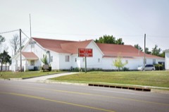 Czech Halllisted 1980
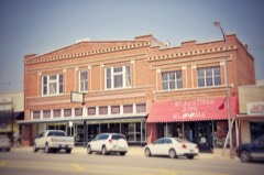 Mulvey Mercantilelisted 1982
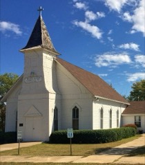 West Point Christian Churchlisted 1983
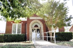 Yukon Public Librarylisted 1984
Population over time
2 figuresYukon grew from 22,709 to 23,630 between 2010 and 2020. These are the recorded population figures Wikidata holds for this place, reached through the Geographic Names Information System number this page is keyed on rather than by name, so they belong to this place and not to another of the same name. Most are census counts, but not all are: an early figure may be a founding or settlement estimate, and an estimate published within five years of a census is left out. The change column is computed, and is left blank where more than 20 years separate a figure from the one before it, because a gap that long is not a change between two counts.
| Year | People | Change |
|---|---|---|
| 2010 | 22,709 | |
| 2020 | 23,630 | +921 (+4%) |
Topographic sheets covering this place
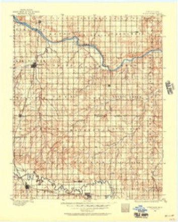
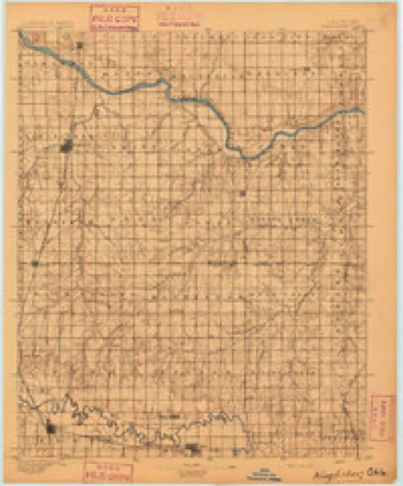
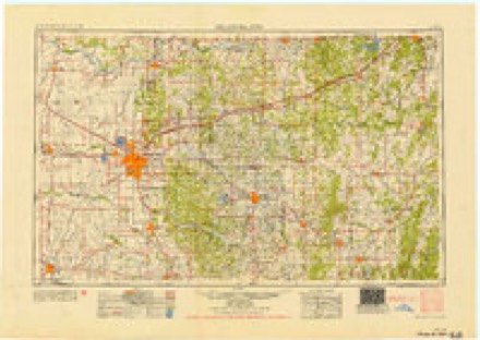
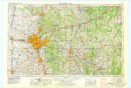
7 surveys from 13 printed sheetsMatched by testing this settlement's coordinate against the published boundary of every sheet in the United States Geological Survey's historical collection. Each opens the scanned sheet at the Survey.
- 1892 USGS Kingfisher quadrangle1:125000
- 1895 USGS Kingfisher quadrangle1:125000, 4 printings
- 1954 USGS Oklahoma City quadrangle1:250000
- 1957 USGS Oklahoma City quadrangle1:250000, 3 printings
- 1963 USGS Oklahoma City quadrangle1:250000
- 1972 USGS Richland quadrangle1:24000, 2 printings
- 1990 USGS Oklahoma City North quadrangle1:100000
Photographs
1 photograph, 2020Taken for the Office of War Information and the Farm Security Administration, who photographed the country between 1935 and 1944. Works of United States government photographers, with no known restriction on use. Each opens its catalogue record.

Highsmith, Carol M, 2020. Library of Congress
Fires near this place
1 since 2006Regional context, not property-specific evidence. The federal wildfire occurrence database lists 1 fire within 5 miles of Yukon in 2006, burning about 300 acres in total. None started naturally. None was recorded as arson. Distance is straight-line from the map coordinates, so a fire counted here may appear on a neighbouring settlement's page as well.
| Reported cause | Fires |
|---|---|
| Missing data/not specified/undetermined | 1 |
The most recent of them, most recent first, with the day each was reported and the service that recorded it.
| Date | Cause | Size | Reported by | Name on the report |
|---|---|---|---|---|
| 11 February 2006 | Missing data/not specified/undetermined | 300 acres | Oklahoma Division of Forestry | HEFNER |
Settlements close enough to share some of these fires:
Mines and quarries near this place
2 within 5 milesRegional context, not property-specific evidence. The federal mineral resources record lists 2 workings within 5 miles of Yukon: 1 producer, 1 past producer. 1 still produces. What was taken out: Sand and Gravel, Construction. Distance is straight-line from the map coordinates, so a quarry counted here may appear on a neighbouring settlement's page as well.
| Where | Site | Commodity | Status | Recorded |
|---|---|---|---|---|
| Unknown Sand and Gravel Pit | Sand and Gravel, Construction | Producer | ||
| Unknown Sand and Gravel Pit | Sand and Gravel, Construction | Past Producer |
Storms near this place
60 of 190 shownRegional context, not property-specific evidence. The National Weather Service names Yukon in 190 storm reports between 1993 and 2026: 110 hail, 46 thunderstorm wind, 20 flash flood, 7 tornado. The reports record 8 injuries. Each account below is quoted exactly as the forecast office filed it, from the NOAA Storm Events Database, and each date opens the federal record of that event.
| When | Event | Place named | Harm | What the report says |
|---|---|---|---|---|
| March 2007 | Tornado (EF2) | Yukon | 5 hurt, $500,000 | The tornado developed around 1505 CST near the intersection of NW 39th Street and Sara Road in western Oklahoma City, and moved north northeast. In this area several homes suffered roof and garage door damage. The tornado continued north along and just west of the Kilpatrick Turnpike. Significant damage was noted along NW 63rd Street, where a home was heavily damaged, several travel trailers and a boat were rolled and damaged. Several vehicles were also pushed by the wind.|Another area of significant damage was noted along Wilshire Blvd., just west of the Kilpatrick Turnpike. In this area a travel trailer was destroyed, with additional damage to a home and several outbuildings. Two people were directly injured in the travel trailer. In addition, several hardwood trees were snapped, indicative of EF2 damage.|The tornado appeared to have been at its widest toward the end of its path along Morgan Road just north of NW 122nd Street, and it was at this point along the path where the intensity appeared to have been at its highest. Several homes sustained significant roof and siding damage and several wooden power poles were snapped. A metal building was severely damaged. Just to the east of this location, three large electrical transmission towers were damaged. Spotty light damage continued a little further north before the tornado dissipated along Morgan Road north of Memorial Road at 1525 CST. Three additional people were directly injured on the Kilpatrick Turnpike. This EF2 tornado injured 5 people and caused an estimated half of a million dollars in damage. |
| August 2008 | Thunderstorm Wind | Yukon | 2 hurt, $50,000 | A microburst occurred over eastern Canadian county near Yukon. The estimated 60-70 mph winds caused damage, starting with a collision between an 18-wheeler and two cars on Interstate 40 at Czech Hall Road. In addition, a medium size tree was downed, and power lines were downed at I-40 and Mustang Road. Two passengers in the automobiles sustained minor injuries. Interstate 40 was closed because of the debris from approximately 1603 - 1812 CDT. Additional damage occurred near the Woodrun Village apartments at Mustang and Reno roads. Some large tree limbs were snapped, one large tree was partially uprooted before the roots snapped, and four successive power poles were downed. Monetary damages were estimated. |
| May 2013 | Tornado (EF2) | Yukon | 1 hurt, $20,000 | The storm damage survey and Doppler on Wheels mobile radar detected a long-lived anticyclonic tornado southwest of Yukon. Some structural damage was noted along with damage to trees. Damages estimated. |
| August 2007 | Flash Flood | Yukon | $800,000 | Highways 4 and 92 were closed due to high water. At 6:38 AM CDT, a motorist had to be rescued at Mustang Road and Wagner due the high water. Several other roads in town had to be closed as well due to the flooding. A bridge on Oak Street was severely damaged, requiring significant renovation. Also, extensive farm land was flooded on the north side of town. Two homes at Kingsway Court had 12-18 inches of water in them. Monetary damages were estimated. |
| May 2013 | Flash Flood | Yukon | $75,000 | Flooding along Sara Rd between SW 15th St. and 29th St. Several cars stranded or inundated. No injuries reported. Damages estimated. |
| August 2008 | Flood | Yukon | $75,000 | Widespread flooding occurred over eastern Canadian county, with the greatest flooding occurring from NW 23rd Street and Richland Avenue to Highway 66 and Banner Road. Five people were rescued by boat here, with three of those from their home and two from their cars. As much of four feet of water was standing over numerous other city and county roads, making them impassable. Monetary damages were estimated. |
| January 2005 | Lightning | Yukon | $75,000 | Lightning struck two oil tank batteries in the 600 block of Cemetery Road near Reno Avenue. The explosion could be felt and heard for miles. The resulting fire destroyed the batteries. |
| May 2013 | Tornado (EF0) | Yukon | $50,000 | An relatively long-lived weak tornado began northwest of SW 15th Street and Morgan Road in western Oklahoma City to the southeast of Yukon. The tornado moved just south of east for a little over 1.5 miles and into Oklahoma County. Damage to trees and power lines was noted, as well as very minor structural damage to some homes. Damages estimated. |
| May 2008 | Tornado (EF1) | Yukon | $50,000 | The tornado developed southwest of Main Street and Mustang Road on the east side of Yukon. The tornadic winds removed part of a residence's roof near this location. Sporadic damage to trees and fences were reported as the tornado moved east northeast toward the north side of Lake Overholser. The tornado continued moving east-northeast into Oklahoma county. Monetary damages were estimated. |
| May 1999 | Tornado (F1) | Yukon | $50,000 | Tornado B16. See summary at end of May 3rd storm reports. |
| July 2017 | Thunderstorm Wind | Yukon | $30,000 | A large tree was uprooted by winds, causing damage to a house, car, and boat. |
| April 1999 | Lightning | Yukon | $20,000 | Lightning started a large house fire in the 200 block of Klondike damaging the attic and parts of the roof. |
| September 1999 | Thunderstorm Wind | Yukon | $20,000 | no account filed |
| May 2003 | Thunderstorm Wind | Yukon | $15,000 | An area of straight-line winds associated with a rear-flank downdraft (RFD) caused an area of damage that began in Canadian County and ended near Lake Hefner in Oklahoma County. The RFD damage path went from just west of Frisco Road between Southwest 29th Street and Southwest 15th Street in Yukon, across Route 4 and Reno Avenue, then across the Xerox Factory, continuing to near the south side of Lake Overholser where it crossed the county line. For the first two to four miles sporadic tree damage occurred. The damage then increased across the area as the storm moved further northeast. The damage path was up to two miles wide at times. |
| September 1999 | Thunderstorm Wind | Yukon | $15,000 | no account filed |
| August 1999 | Thunderstorm Wind | Yukon | $12,000 | no account filed |
| May 2007 | Flash Flood | Yukon | $10,000 | A high water rescue was reported at SW 15th and Mustang Road. Water was also rising into home in the northern portions of Yukon. Monetary damages were estimated. |
| July 2006 | Thunderstorm Wind | Yukon | $10,000 | Two tractor-trailers were blown over near Interstate 40 and Cimarron Road. |
| August 2013 | Thunderstorm Wind | Yukon | $8,000 | Minor damage to fencing and outdoor furniture at I-40 and Morgan Rd. |
| July 2022 | Thunderstorm Wind | Yukon | $5,000 | Power pole downed. |
| July 2020 | Flash Flood | Yukon | $5,000 | At least three cars in high water on Mustang road near SW 11TH street with fire department rescuing the occupants. |
| June 2019 | Flash Flood | Yukon | $5,000 | Water was up to the hood of a truck. |
| July 2018 | Thunderstorm Wind | Yukon | $5,000 | A large maple tree was uprooted, partially falling onto a house. |
| July 2017 | Thunderstorm Wind | Yukon | $5,000 | Powerlines/poles downed between SW 15TH street and I-40. |
| July 2017 | Thunderstorm Wind | Yukon | $5,000 | Several power poles were snapped. |
| August 2005 | Thunderstorm Wind | Yukon | $2,500 | The front windows of a furniture store were blown out. |
| December 1999 | Lightning | Yukon | $2,500 | Lightning struck the carport roof of a real estate office on Mustang Road causing a small fire. |
| July 2017 | Thunderstorm Wind | Yukon | $1,000 | Numerous tree limbs snapped. Stockade fence damaged. |
| August 2005 | Thunderstorm Wind | Yukon | $1,000 | Several power poles downed. |
| July 2000 | Thunderstorm Wind | Yukon | $1,000 | Trees were downed, and an awning was damaged near Yukon Lumberyard. |
| June 1998 | Lightning | Yukon | $1,000 | Lightning struck a house and blew a hole in the roof. |
| August 2006 | Thunderstorm Wind | Yukon | $500 | Fence posts were damaged at the intersection of Cornwell and 10th Street. |
| August 2002 | Thunderstorm Wind | Yukon | $10 | Two inch diameter tree limbs were downed. |
| March 2026 | Hail | Yukon | - | The report was relayed through mPING. |
| March 2026 | Hail | Yukon | - | The report was relayed through mPING. |
| March 2026 | Hail | Yukon | - | The report was relayed through mPING. |
| March 2026 | Hail | Yukon | - | The report was relayed through mPING. |
| March 2026 | Hail | Yukon | - | The report was relayed through mPING. The event time was adjusted based on radar observations. |
| March 2026 | Hail | Yukon | - | The report was relayed through mPING. The event time was adjusted based on radar observations. |
| April 2026 | Hail | Yukon | - | The report was relayed through mPING. |
| May 2025 | Hail | Yukon | - | The event time is estimated from radar observations. |
| May 2025 | Hail | Yukon | - | The event time is adjusted based on radar observations. |
| June 2025 | Thunderstorm Wind | Yukon | - | Trees and tree limbs were blown down along Richland Road between Southwest 15th Street and Reno Avenue. The location is approximate, and the event time is estimated from radar observations. |
| June 2025 | Hail | Yukon | - | The report was relayed through mPING. |
| July 2025 | Flash Flood | Yukon | - | Significant flooding occurred in Hillcrest Park. The event time is approximate. |
| July 2025 | Flood | Yukon | - | Roadway flooding, including vehicles stalled in floodwaters, occurred near the intersection of Mustang Road and Southwest 15th Street. The event time is approximate. |
| July 2025 | Flash Flood | Yukon | - | Roadway flooding, with an estimated six to eight inches of running water, occurred along Reno Avenue between Cemetery Road and Czech Hall Road. The event time is approximate. |
| October 2025 | Hail | Yukon | - | The report was relayed through mPING. |
| May 2024 | Hail | Yukon | - | MPing report. |
| May 2024 | Hail | Yukon | - | MPing report. |
| May 2024 | Hail | Yukon | - | MPing report. |
| May 2024 | Hail | Yukon | - | MPing report. |
| May 2024 | Hail | Yukon | - | MPing report. |
| June 2023 | Hail | Yukon | - | MPing report. |
| April 2023 | Hail | Yukon | - | Relayed via social media. Time estimated via radar. |
| September 2023 | Hail | Yukon | - | MPing report. |
| September 2023 | Hail | Yukon | - | MPing report. |
| July 2023 | Hail | Yukon | - | MPing report. |
| July 2023 | Hail | Yukon | - | MPing report. |
| August 2022 | Flash Flood | Yukon | - | Up to a foot of water covering roadway. |
Nearest settlements
The eight closest, with where each one stands in the county. Distances are straight-line, computed from the Geographic Names Information System coordinates.
| Map | Place | Distance | Sheets |
|---|---|---|---|
| Banner | 4.6 miles | 13 | |
| Richland | 5.5 miles | 13 | |
| Mustang | 8.7 miles | 18 | |
| Piedmont | 9.4 miles | 14 | |
| El Reno | 10.4 miles | 13 | |
| Powers | 10.8 miles | 14 | |
| Union City | 12.4 miles | 14 | |
| Cheyenne and Arapaho Agency (historical) | 14.4 miles | 15 |
Elsewhere
Matched on this settlement's Geographic Names Information System number rather than its name, so it cannot be a different place of the same name in another state.
| Wikipedia article on Yukon | An encyclopaedic summary. Its text is share-alike, so it is linked here rather than copied. |
| Wikidata item Q2073642 | The structured record the population and elevation above come from. Public domain (CC0). |
Provenance
This settlement is recorded in the Geographic Names Information System as feature 1100067. The sheet list is computed by point-in-boundary test against the United States Geological Survey's historical topographic inventory. Both are works of the United States government and carry no copyright under 17 U.S.C. 105.
Wildfire. Short, Karen C. 2022. Spatial wildfire occurrence data for the United States, 1992-2020 [FPA_FOD_20221014]. 6th Edition. Fort Collins, CO: Forest Service Research Data Archive. https://doi.org/10.2737/RDS-2013-0009.6 Collected with United States Government funding and usable without additional permissions or fees.
Mines and quarries. USGS Mineral Resources Data System (MRDS) https://mrdata.usgs.gov/mrds/ A work of the United States government, no copyright under 17 U.S.C. 105.
Storms. NOAA National Centers for Environmental Information, Storm Events Database https://www.ncei.noaa.gov/stormevents/ A work of the United States government, no copyright under 17 U.S.C. 105. Narratives are quoted verbatim from the National Weather Service report and are not edited or summarised.