 Block
Block
Bloomingburg, Ohio
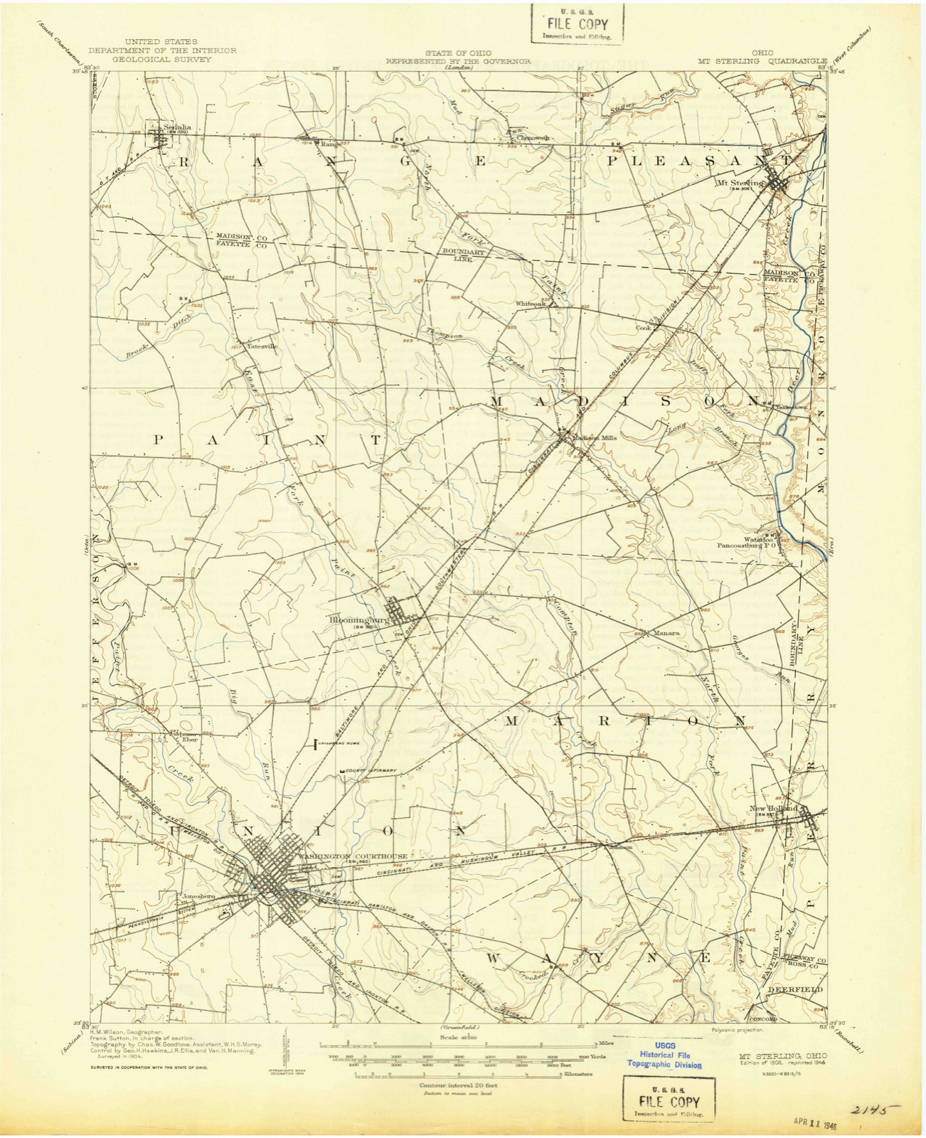
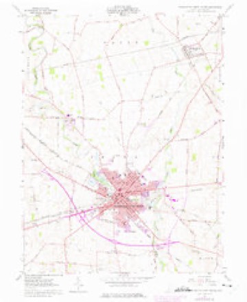
11 topographic sheets cover this place, the earliest surveyed in 1906 and the latest in 1986. It stands in Paint Township. It lies in ZIP code area 43106. The Survey maps it on the Washington Court House quadrangle. 878 people lived here at the 2020 count. It stands 994 feet above sea level.
Population over time
2 figuresBloomingburg fell from 938 to 878 between 2010 and 2020. These are the recorded population figures Wikidata holds for this place, reached through the Geographic Names Information System number this page is keyed on rather than by name, so they belong to this place and not to another of the same name. Most are census counts, but not all are: an early figure may be a founding or settlement estimate. The change column is computed, and is left blank where more than 20 years separate a figure from the one before it, because a gap that long is not a change between two counts.
| Year | People | Change |
|---|---|---|
| 2010 | 938 | |
| 2020 | 878 | -60 (-6%) |
Then and now
1906 to 1986The same ground, surveyed 80 years apart. Drag the handle to wipe between them. Both sheets are United States Geological Survey originals; neither has been altered.

Topographic sheets covering this place
11 sheetsMatched by testing this settlement's coordinate against the published boundary of every sheet in the United States Geological Survey's historical collection. Each opens the scanned sheet at the Survey.
- 1906 USGS Mt Sterling quadrangle1:62500
- 1947 USGS Columbus quadrangle1:250000
- 1961 USGS Columbus quadrangle1:250000
- 1961 USGS Washington Court House quadrangle1:24000
- 1961 USGS Washington Court House quadrangle1:24000
- 1961 USGS Washington Court House quadrangle1:24000
- 1962 USGS Columbus quadrangle1:250000
- 1967 USGS Columbus quadrangle1:250000
- 1967 USGS Columbus quadrangle1:250000
- 1986 USGS Springfield quadrangle1:100000
- 1986 USGS Springfield quadrangle1:100000







What happened here
An account from the chapter on Paint township, The inset identifies its exact source book and publication year.
A.Wae Witu The Sioux
In 1694, Count Frontenac, in a conference with the Western Indians, requested the Miamis of the Pepikokia band who resided on the Maramek, to remove and join the tribe which was located on the Saint Joseph, of Lake Michigan. The reason for this request, as stated by Frontenac himself, was, that he wished the different bands of the Miami confederacy to unite, " so as to be able to execute with greater facility the commands which he might issue." At that time the Iroquois were at war with Canada, and the French were endeavoring to persuade the western tribes to take up the tomahawk in their behalf.
In the county-history sources
222,402 words on this townshipHistory of Fayette County : Together with Historic Notes on the Northwest, and the State of Ohio, Gleaned from Early Authors, Old Maps and Manuscripts, Private and Official Correspondence, and All Other Authentic Sources, published 1881 names this settlement in its chapter on Paint Township. These are the passages that mention it, exactly as the scans read.
Going northward, leaving the Straits of Mackinaw, through which Lake Michigan discharges itself from the west, and the chain of Manitoulin Islands to the eastward, yet another river, the connecting link between Lake Huron and Superior, is reached. Its current is swift, and a mile below Lake Superior are the Falls, where the water leaps and tumbles down a channel obstructed by boulders and shoals, where, from time immemorial, the Indians of various tribes have "resorted on account of the abundance of fish and the ease with which they are taken. Previous to the year 1670 the river was called the Sault, that is, the rapids, or falls. In this year Fathers Marquette and Dablon founded here the mission of " St. Marie du Sault " (St. Mary of the Falls), from which the modern name of the river, St. Mary's, is derived. Kecently the United States have perfected the ship canal cut in solid rock, around the falls, through which the largest vessels can now pass, from the one lake to the other.
Passage source: History of Fayette County : Together with Historic Notes on the Northwest, and the State of Ohio, Gleaned from Early Authors, Old Maps and Manuscripts, Private and Official Correspondence, and All Other Authentic Sources, published 1881.
Michigan was the last of the lakes in order of discovery. The Hurons, christianized and dwelling eastward of Lake Huron, had been driven from their towns and cultivated fields by the Iroquois, and scattered about Mackinaw and the desolate coast of Lake Superior beyond, whither they were followed by their faithful pastors, the Jesuits, who erected new altars and gathered the remnants of their stricken followers about them; all this occurred before the fathers had acquired any definite knowledge of Lake Michigan. In their mission work for the year 16G6, it is referred to "as the Lake Illinouek, a great lal^e adjoining, or between, the lake of the Hurons and that of Green Bay, that had not [as then] come to their knowledge." In the Relation for the same year, it is referred to as " Lake Uleaouers," and Lake lUinioues, as yet unexplored, though much smaller than Lake Huron, and that the Outagamies [the Fox Lidians] call it Maehi-hi-gan-ing." Father Hennepin says : " The lake is called by the Lidians, 'Illinouek,' and by the French, 'lUinois,'" and that the "Lake Illinois, iu the native language, signiiies the 'Lake of Men." He also adds in the same paragraph, that it is called by the Miamis, " Mischigonong, that is, the great lake." Father Marest, in a letter dated at Kaskaskia, Illinois, IS'ovember 9, 1712, so often referred to on account of the valuable historical matter it contains, contracts the aboriginal name to Michigan, and is, perhaps, the first author who ever spelt it in the way that has become universal. He naively says, " that on the maps this lake has the name, without any authority, of the ^ Lake of the Illinois,' since the Illinois do not dwell in its neighborhood."
Passage source: History of Fayette County : Together with Historic Notes on the Northwest, and the State of Ohio, Gleaned from Early Authors, Old Maps and Manuscripts, Private and Official Correspondence, and All Other Authentic Sources, published 1881.
Perhaps none of the early settlers labored with more zeal in the interest of the new county, or enjoyed a greater influence than Colonel James Stewart. With his father he came from Maryland, his native state, in 1807. They purchased land in Eoss Connty - five hundred acres - in Marion Township, where George Fullerton now resides ; two hundred and fifty acres on the waters of Corapton's Creek, and two hundred and fifty acres adjoining the latter tract. They then returned to Maryland, and in 1809 came with the family and settled in Ross County, near Frankfort. In 1810 James came to this county and located on land adjoining Bloomingburg, where his son George now resides. In 1812 he was appointed colonel of a regiment which was made up of Fayette County men. They were ordered to the frontier and participated in several engagements. After the war he was appointed surveyor and was kept very bus}^ by purchasers of lands. His brother Eobert was the orio-iual director of the town of Washington, and upon his resignation the colonel was appointed to fill the vacancy.
Passage source: History of Fayette County : Together with Historic Notes on the Northwest, and the State of Ohio, Gleaned from Early Authors, Old Maps and Manuscripts, Private and Official Correspondence, and All Other Authentic Sources, published 1881.
Machine-read from a century-old scan, so expect the errors a machine makes: misspelled names, dropped words, stray characters.
Read the whole chapter on Paint Township - it names this place 25 more 25 times.
Fires near this place
1 since 2011Regional context, not property-specific evidence. The federal wildfire occurrence database lists 1 fire within 5 miles of Bloomingburg between 2011 and 2011, burning about 0 acres in total. None started naturally. None was recorded as arson. Distance is straight-line from the map coordinates, so a fire counted here may appear on a neighbouring settlement's page as well.
| Reported cause | Fires |
|---|---|
| Missing data/not specified/undetermined | 1 |
The most recent of them, most recent first, with the day each was reported and the service that recorded it.
| Date | Cause | Size | Reported by | Name on the report |
|---|---|---|---|---|
| 26 March 2011 | Missing data/not specified/undetermined | under an acre | Ohio Department of Natural Resources | not named |
Settlements close enough to share some of these fires:
Specimens collected near this place
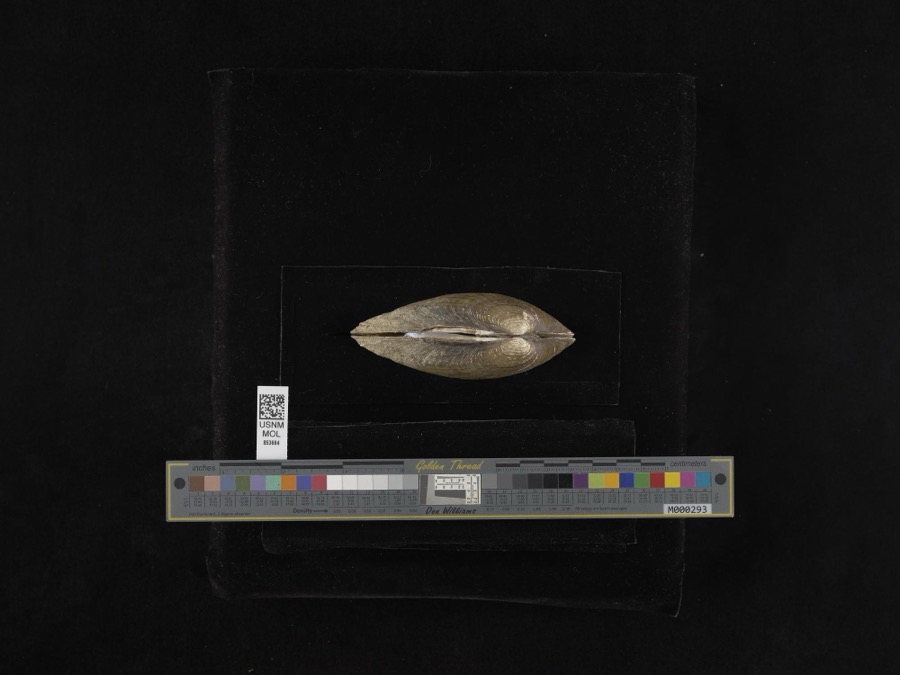
12 of 195 shownRegional context, not property-specific evidence. Museums hold 195 specimens collected within 10 miles of Bloomingburg between 1907 and 1974: 189 Animalia, 4 Plantae, 2 Fungi. 12 distinct Species records are shown. Collected by Bowles, P. (Pearl), Brubaker, J. A. & Higgins, Brubaker, J. A. & Link, B. and others. Each is a physical object with a catalogue number, and each entry opens the museum's record. This is what was collected and kept, not a survey of what lives here - nothing can be concluded from a species being absent.
| Image | Species | Year | Collected by | Where, as recorded |
|---|---|---|---|---|
 | Lampsilis radiata radiata (Gmelin, 1791) | 1965 | H. Althearn | Deer Creek, 3.8 Mile NNE Of Pancoastburg |
 | Accipiter cooperii (Bonaparte, 1828) | 1907 | Hegler, A. (Almer) | Fairview, Fayette, Ohio, USA |
 | Buteo jamaicensis borealis (Gmelin, 1788) | 1907 | Hegler, A. (Almer) | Fairview Sta., Fayette, Ohio, USA |
_2.jpg) | Buteo lagopus sanctijohannis (Gmelin, 1788) | 1907 | Hegler, A. (Almer) | Fairview Sta., Fayette, Ohio, USA |
 | Falco rusticolus obsoletus (J.F.Gmelin, 1788) | 1907 | Hegler, A. (Almer) | Washington C.H., Fayette, Ohio, USA |
| Tiphiidae | 1925 | Pallister, J. C. (John C.) | Madison, Fayette Co., Ohio, USA | |
 | Noturus miurus Jordan, 1877 | 1926 | Wickliff, E. L. (Edward L.) | water unknown, #10 Fayette Co, n/a, township n/a |
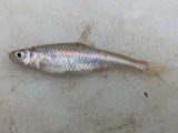 | Opsopoeodus emiliae Hay, 1881 | 1926 | Wickliff, E. L. (Edward L.) | Sugar Creek, near NE corner of Clinton County OH locality is approximate based off Fishes of Ohio distribution map |
 | Rana clamitans Latreille, 1801 | 1929 | Walker, C. F. (Charles F.) & Trautman, M. B. (Milton Bernard) | SW Wayne Twp., Fayette Co., Ohio |
 | Acris crepitans Baird, 1854 | 1930 | Walker, C. F. (Charles F.) & Trautman, M. B. (Milton Bernard) | SW Wayne Twp., Fayette Co., Ohio |
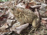 | Bufo americanus Holbrook, 1836 | 1930 | Walker, C. F. (Charles F.) | SW Wayne Twp., Fayette Co., Ohio |
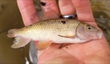 | Erimyzon oblongus (Mitchill, 1814) | 1930 | MB Trautman | North Fork of Paint Creek, Center of Madison Twp |
All 195 specimens within 10 miles, at the Global Biodiversity Information Facility.
Storms near this place
25 since 1995Regional context, not property-specific evidence. The National Weather Service names Bloomingburg in 25 storm reports between 1995 and 2018: 14 thunderstorm wind, 7 hail, 2 flash flood, 1 flood. The reports record 2 injuries. Each account below is quoted exactly as the forecast office filed it, from the NOAA Storm Events Database, and each date opens the federal record of that event.
| When | Event | Place named | Harm | What the report says |
|---|---|---|---|---|
| October 1999 | Thunderstorm Wind | Bloomingburg | 2 hurt, $50,000 | A downburst from a thunderstorm blew a mobile home on its side causing minor injuries to the two occupants. Trees and utility poles were also uprooted and knocked across main roads and railroad tracks. |
| May 2011 | Tornado (EF0) | Bloomingburg | $35,000 | A National Weather Service storm survey confirmed that a tornado touched down three miles west of Bloomingburg. Near the beginning of the path one barn was damaged and another barn was destroyed. Further along the path another barn was damaged due to the tornado. The estimated maximum wind speed based on damage was eighty miles per hour. |
| June 2010 | Thunderstorm Wind | Bloomingburg | $15,000 | Farm equipment was overturned, power poles were down, and trees were down due to damaging thunderstorm winds. One tree fell onto a home. |
| June 2008 | Hail | Bloomingburg | $15,000 | no account filed |
| July 2012 | Thunderstorm Wind | Bloomingburg | $10,000 | Multiple trees were downed in the area of Bloomingburg due to damaging thunderstorm winds. |
| January 2008 | Thunderstorm Wind | Bloomingburg | $10,000 | A small shed was blown onto a road near Bloomingburg. A tree fell onto a garage west of New Holland, producing minor damage to the roof and door. |
| July 2008 | Thunderstorm Wind | Bloomingburg | $6,000 | A tree was downed on a vehicle near the intersection of State Route 38 and Bloomingburg-New Holland Road, causing some minor damage. A power pole was downed on Old Springfield Road to the east of Washington Court House. |
| August 1998 | Thunderstorm Wind | Bloomingburg | $5,000 | Trees knocked down. |
| May 2018 | Thunderstorm Wind | Bloomingburg | $4,000 | A home sustained some roof damage. |
| July 2002 | Thunderstorm Wind | Bloomingburg | $3,000 | Trees were knocked down. |
| May 2001 | Flash Flood | Bloomingburg | $3,000 | Water was reported covering State Route 38 between Interstate 71 and Bloomingburg |
| July 1995 | Thunderstorm Wind | Bloomingburg | $3,000 | Large trees downed. |
| July 2011 | Thunderstorm Wind | Bloomingburg | $2,000 | Trees were reported down due to damaging thunderstorm winds. |
| June 2010 | Thunderstorm Wind | Bloomingburg | $2,000 | Trees and power poles were reported down due to damaging thunderstorm winds. |
| October 2006 | Hail | Bloomingburg | $2,000 | no account filed |
| May 2014 | Thunderstorm Wind | Bloomingburg | $1,000 | Several street signs were blown over and embedded into the ground due to thunderstorm winds. |
| January 2013 | Thunderstorm Wind | Bloomingburg | $1,000 | A tree was downed near Bloomingburg due to thunderstorm winds. |
| February 2009 | Thunderstorm Wind | Bloomingburg | $1,000 | no account filed |
| April 2017 | Flash Flood | Bloomingburg | - | High water was reported over the road near the intersection of U.S.62 and New Holland Rd. |
| June 2009 | Hail | Bloomingburg | - | Reports of three quarters of an inch to one inch hail came in from Bloomingburg to Washington Court House. |
| June 2006 | Flood | Bloomingburg | - | The intersection of State Routes 38 and 734 was flooded. |
| April 2011 | Hail | Bloomingburg | - | no account filed |
| April 2010 | Hail | Bloomingburg | - | no account filed |
| April 2010 | Hail | Bloomingburg | - | no account filed |
| June 2000 | Hail | Bloomingburg | - | no account filed |
Nearest settlements
The eight closest, with where each one stands in the county. Distances are straight-line, computed from the Geographic Names Information System coordinates.
| Map | Place | Distance | Sheets |
|---|---|---|---|
| Manara | 4.4 miles | 11 | |
| Madison Mills | 4.5 miles | 10 | |
| Olympia (historical) | 4.5 miles | 11 | |
| Eber | 4.6 miles | 11 | |
| Washington Oaks | 4.7 miles | 11 | |
| Kingfred (historical) | 4.9 miles | 11 | |
| Washington Court House | 5.3 miles | 11 | |
| Johnson | 5.3 miles | 11 |
Elsewhere
Matched on this settlement's Geographic Names Information System number rather than its name, so it cannot be a different place of the same name in another state.
| Wikipedia article on Bloomingburg | An encyclopaedic summary. Its text is share-alike, so it is linked here rather than copied. |
| Wikidata item Q885382 | The structured record the population and elevation above come from. Public domain (CC0). |
Provenance
This settlement is recorded in the Geographic Names Information System as feature 1064455. The sheet list is computed by point-in-boundary test against the United States Geological Survey's historical topographic inventory. Both are works of the United States government and carry no copyright under 17 U.S.C. 105.
Wildfire. Short, Karen C. 2022. Spatial wildfire occurrence data for the United States, 1992-2020 [FPA_FOD_20221014]. 6th Edition. Fort Collins, CO: Forest Service Research Data Archive. https://doi.org/10.2737/RDS-2013-0009.6 Collected with United States Government funding and usable without additional permissions or fees.
Specimens. Global Biodiversity Information Facility (GBIF), https://www.gbif.org/. Only records licensed CC0 or CC BY are used. Records licensed CC BY-NC are excluded because this site carries advertising. Images are checked individually and any whose licence is non-commercial, no-derivatives or unreadable is refused.
Storms. NOAA National Centers for Environmental Information, Storm Events Database https://www.ncei.noaa.gov/stormevents/ A work of the United States government, no copyright under 17 U.S.C. 105. Narratives are quoted verbatim from the National Weather Service report and are not edited or summarised.