 Block
Block
Bluffton, Ohio
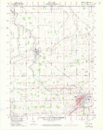
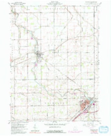
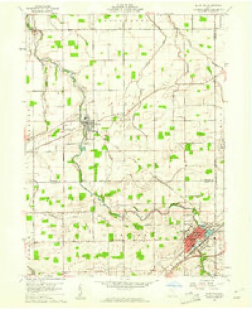
14 topographic sheets cover this place, the earliest surveyed in 1907 and the latest in 1986. It stands in Richland Township. It lies in ZIP code area 45817. It stands on Marsh Run. The Survey maps it on the Bluffton quadrangle. 3,967 people lived here at the 2020 count. It stands 833 feet above sea level.
Population over time
2 figuresBluffton fell from 4,125 to 3,967 between 2010 and 2020. These are the recorded population figures Wikidata holds for this place, reached through the Geographic Names Information System number this page is keyed on rather than by name, so they belong to this place and not to another of the same name. Most are census counts, but not all are: an early figure may be a founding or settlement estimate. The change column is computed, and is left blank where more than 20 years separate a figure from the one before it, because a gap that long is not a change between two counts.
| Year | People | Change |
|---|---|---|
| 2010 | 4,125 | |
| 2020 | 3,967 | -158 (-4%) |
Then and now
1907 to 1986The same ground, surveyed 79 years apart. Drag the handle to wipe between them. Both sheets are United States Geological Survey originals; neither has been altered.

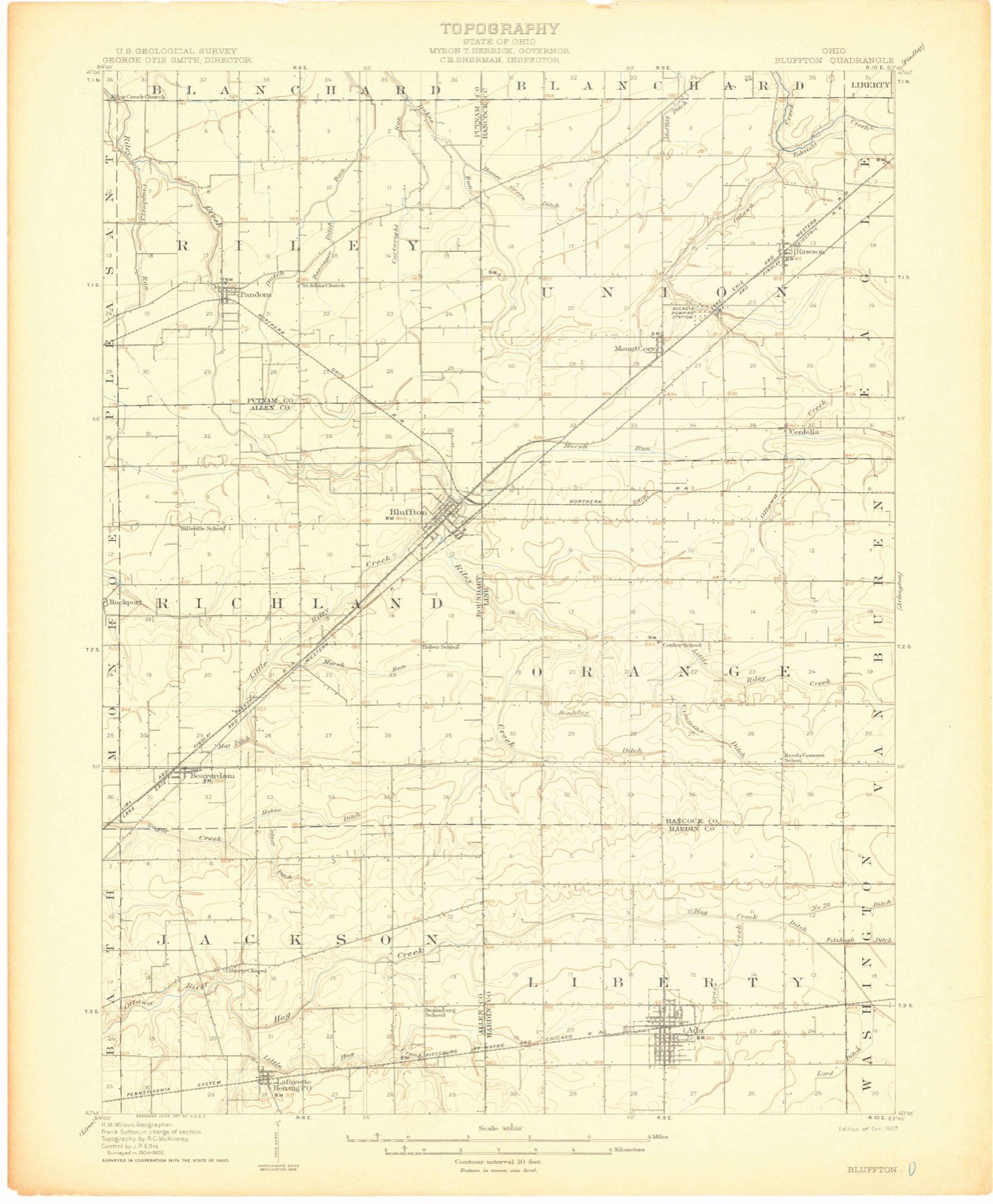
Topographic sheets covering this place
14 sheetsMatched by testing this settlement's coordinate against the published boundary of every sheet in the United States Geological Survey's historical collection. Each opens the scanned sheet at the Survey.
- 1907 USGS Bluffton quadrangle1:62500
- 1907 USGS Bluffton quadrangle1:62500
- 1907 USGS Bluffton quadrangle1:62500
- 1950 USGS Marion quadrangle1:250000
- 1960 USGS Bluffton quadrangle1:24000
- 1960 USGS Bluffton quadrangle1:24000
- 1960 USGS Bluffton quadrangle1:24000
- 1960 USGS Bluffton quadrangle1:24000
- 1962 USGS Marion quadrangle1:250000
- 1966 USGS Marion quadrangle1:250000
- 1966 USGS Marion quadrangle1:250000
- 1966 USGS Marion quadrangle1:250000
- 1986 USGS Marion quadrangle1:100000
- 1986 USGS Marion quadrangle1:100000








In the county-history sources
72,153 words on this townshipHistory of Allen County, Ohio. Containing a History of the County, Its Townships, Towns, Villages, Schools, Churches, Industries, Etc; Portraits of Early Settlers and Prominent Men; Biographies; History of the Northwest Territory; History of Ohio; Statistical and Miscellaneous Matter, Etc., Etc, published 1885 names this settlement in its chapter on Richland Township. These are the passages that mention it, exactly as the scans read.
The early schoolB of Bichland werw primitive in their oharaoter as well as teachiDg. William Bedding presided over a school of half a dozen pupils at Hilty's, while Benjamin Franklin Smith taught a few pupils in the Jog sohoolhouse on Little Biley Creek. After some years, the town was set off into school districts, and the system, now pursued, was adopted. The receipts for 1884 were $6, 131.47; the expenditures amounted to $4,845.8L There are ten school buildings valued at $14,100. Fourteen teachers are employed. The number of pupils enrolled is 940, 503 boys and 437 girls. In the Bluffton Special School District the receipts for 1884 amounted to (7,017.55, the expenditmres to $3,500,85. Number of pupils enrolled 402 - 212 boys and 190 girls. There is one school building valued at $15,000. Seven teachers are employed, of whom live are ladies.
Passage source: History of Allen County, Ohio. Containing a History of the County, Its Townships, Towns, Villages, Schools, Churches, Industries, Etc; Portraits of Early Settlers and Prominent Men; Biographies; History of the Northwest Territory; History of Ohio; Statistical and Miscellaneous Matter, Etc., Etc, published 1885.
Oerman Reformed Church {St John's) was organized in 1872, under Rev. A. SchencL The congregation used the Presbyterian Church as a place of worship up to 1881, when their church building was completed. The membership does not exceed 100. The pastor of Emanuel's German Reformed Church is also preacher in charge of St John's.
Passage source: History of Allen County, Ohio. Containing a History of the County, Its Townships, Towns, Villages, Schools, Churches, Industries, Etc; Portraits of Early Settlers and Prominent Men; Biographies; History of the Northwest Territory; History of Ohio; Statistical and Miscellaneous Matter, Etc., Etc, published 1885.
Equitable Aid Union was organized at Bloffton January 28, 1882, with the following members: M. S. Muma and wife, D. A. McComb and wife, O. E. Townsend and wife, J. J. Miller, Dr. Steingraver and wife, George Balentine and wife, John Wilson and wife, and W. V. Hutchins. D. A. McComb was first secretary and Dr. Steingraver, president. The membership is fourteen. The society is organized for the same objects as characterize other insurance societiea
Passage source: History of Allen County, Ohio. Containing a History of the County, Its Townships, Towns, Villages, Schools, Churches, Industries, Etc; Portraits of Early Settlers and Prominent Men; Biographies; History of the Northwest Territory; History of Ohio; Statistical and Miscellaneous Matter, Etc., Etc, published 1885.
Machine-read from a century-old scan, so expect the errors a machine makes: misspelled names, dropped words, stray characters.
Read the whole chapter on Richland Township - it names this place 107 more 107 times.
Specimens collected near this place
12 of 50 shownRegional context, not property-specific evidence. Museums hold 50 specimens collected within 10 miles of Bluffton between 1921 and 1961: 48 Animalia, 1 Plantae, 1 Fungi. 12 distinct Species records are shown. Collected by C. Nichols, , Beut. Coll., Huber, L. O. Gratz and others. Each is a physical object with a catalogue number, and each entry opens the museum's record. This is what was collected and kept, not a survey of what lives here - nothing can be concluded from a species being absent.
| Image | Species | Year | Collected by | Where, as recorded |
|---|---|---|---|---|
 | Mycena corticalis A.H.Sm. | 1941 | L. O. Gratz | Bluffton |
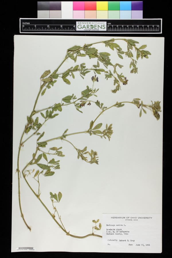 | Medicago sativa L. | 1961 | Robert H. Gray | 1 mile west of Lafayette. |
| Pteromalidae | 1921 | Huber | ||
 | Ambloplites rupestris (Rafinesque, 1817) | 1930 | Trautman, M. B. (Milton Bernard) & Foster, R. (Robert) | Ottawa River, within central Jackson township, near Lafayette, Jackson township |
 | Etheostoma nigrum Rafinesque, 1820 | 1930 | Trautman, M. B. (Milton Bernard) & Foster, R. (Robert) | Ottawa River, within central Jackson township, near Lafayette, Jackson township |
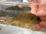 | Lepomis megalotis (Rafinesque, 1820) | 1930 | Trautman, M. B. (Milton Bernard) & Foster, R. (Robert) | Ottawa River, within central Jackson township, near Lafayette, Jackson township |
| Micropterus salmoides (Lacepède, 1802) | 1930 | Trautman, M. B. (Milton Bernard) & Foster, R. (Robert) | Ottawa River, within central Jackson township, near Lafayette, Jackson township | |
 | Notropis umbratilis (Girard, 1856) | 1930 | Trautman, M. B. (Milton Bernard) & Foster, R. (Robert) | Ottawa River, within central Jackson township, near Lafayette, Jackson township |
 | Notropis volucellus volucellus | 1930 | Trautman, M. B. (Milton Bernard) & Foster, R. (Robert) | Ottawa River, within central Jackson township, near Lafayette, Jackson township |
| Ameiurus melas melas (Rafinesque, 1820) | 1944 | Trautman, M. B. (Milton Bernard) & Myers, A. M. | Little Riley Creek, 2mi southwest of Bluffton, ~2.5 mi SW of Bluffton, Richland township | |
| Ameiurus natalis (Lesueur, 1819) | 1944 | Trautman, M. B. (Milton Bernard) & Myers, A. M. | Little Riley Creek, 2mi southwest of Bluffton, ~2.5 mi SW of Bluffton, Richland township | |
| Boleosoma nigrum nigrum (Rafinesque, 1820) | 1944 | Trautman, M. B. (Milton Bernard) & Myers, A. M. | Little Riley Creek, 2mi southwest of Bluffton, ~2.5 mi SW of Bluffton, Richland township |
All 50 specimens within 10 miles, at the Global Biodiversity Information Facility.
Mines and quarries near this place
2 within 5 milesRegional context, not property-specific evidence. The federal mineral resources record lists 2 workings within 5 miles of Bluffton: 1 past producer, 1 producer. 1 still produces. What was taken out: Limestone, General, Stone, Crushed/Broken. Distance is straight-line from the map coordinates, so a quarry counted here may appear on a neighbouring settlement's page as well.
| Where | Site | Commodity | Status | Recorded |
|---|---|---|---|---|
| Bluffton Stone Company | Stone, Crushed/Broken | Producer | ||
| Bluffton Stone Company Quarry | Limestone, General | Past Producer | Sedimentary |
Storms near this place
7 since 1997Regional context, not property-specific evidence. The National Weather Service names Bluffton in 7 storm reports between 1997 and 2023: 4 hail, 3 thunderstorm wind. No death or injury is recorded in these reports. Each account below is quoted exactly as the forecast office filed it, from the NOAA Storm Events Database, and each date opens the federal record of that event.
| When | Event | Place named | Harm | What the report says |
|---|---|---|---|---|
| June 2006 | Thunderstorm Wind | Bluffton | $60,000 | Barn destroyed on Sugar Creek Road. Thirty seven head of cattle were trapped in the barn, eight of which died. |
| August 2023 | Thunderstorm Wind | Bluffton | $1,000 | A photo on Twitter showed a few large tree limbs were down on Main Street in Bluffton. |
| July 2017 | Hail | Bluffton | - | Local media reported golf ball size hail. |
| July 1997 | Thunderstorm Wind | Bluffton | - | An observer reported a wind gust to 60 mph. |
| July 2017 | Hail | Bluffton | - | no account filed |
| April 2012 | Hail | Bluffton | - | no account filed |
| July 2012 | Hail | Bluffton | - | no account filed |
Newspapers printed here
0 digitised pages1 paper published in this town, digitised by the Library of Congress and free to read: 0 issues, 0 pages. Every page is searchable, so a name or a street can be looked for directly in what the town printed about itself at the time.
| Newspaper | Published |
|---|---|
| The Bluffton News | 1875 to Current |
What the paper printed
2,429 wordsFront pages of the local paper, read from the Library of Congress scans: 5 issues spread across its run from 1939 to 1959, 2,429 words in total. Each is reproduced on its own page, exactly as the recogniser returned it.
These pages read less well than anything else here, and the number is worth stating: about three words in four come through cleanly, against nine in ten for the building records. An 1896 broadsheet sets eight-point type in seven columns on microfilm, which is the hardest thing in this archive to read by machine. We tested our own recognisers against the Library's and they were not better, so the Library's text is what appears, with the wholly unreadable columns removed. Read it as a guide to what the paper covered, and follow the link to the scan before quoting anything.
| Issue | Paper | Length |
|---|---|---|
| 1939-01-05 | The Bluffton News | 186 words |
| 1939-04-13 | The Bluffton News | 471 words |
| 1939-07-13 | The Bluffton News | 717 words |
| 1939-09-14 | The Bluffton News | 488 words |
| 1959-12-31 | The Bluffton News | 567 words |
Nearest settlements
The eight closest, with where each one stands in the county. Distances are straight-line, computed from the Geographic Names Information System coordinates.
| Map | Place | Distance | Sheets |
|---|---|---|---|
| Rockport | 6.1 miles | 15 | |
| Beaverdam | 6.3 miles | 13 | |
| Beaver Dam Station | 6.3 miles | 13 | |
| Lafayette | 9.8 miles | 13 | |
| West Cairo | 11.1 miles | 15 | |
| Maysville | 11.2 miles | 16 | |
| Cairo | 11.3 miles | 15 | |
| Slabtown | 11.3 miles | 15 |
Elsewhere
Matched on this settlement's Geographic Names Information System number rather than its name, so it cannot be a different place of the same name in another state.
| Wikipedia article on Bluffton | An encyclopaedic summary. Its text is share-alike, so it is linked here rather than copied. |
| Wikidata item Q282552 | The structured record the population and elevation above come from. Public domain (CC0). |
Provenance
This settlement is recorded in the Geographic Names Information System as feature 1064461. The sheet list is computed by point-in-boundary test against the United States Geological Survey's historical topographic inventory. Both are works of the United States government and carry no copyright under 17 U.S.C. 105.
Specimens. Global Biodiversity Information Facility (GBIF), https://www.gbif.org/. Only records licensed CC0 or CC BY are used. Records licensed CC BY-NC are excluded because this site carries advertising. Images are checked individually and any whose licence is non-commercial, no-derivatives or unreadable is refused.
Mines and quarries. USGS Mineral Resources Data System (MRDS) https://mrdata.usgs.gov/mrds/ A work of the United States government, no copyright under 17 U.S.C. 105.
Storms. NOAA National Centers for Environmental Information, Storm Events Database https://www.ncei.noaa.gov/stormevents/ A work of the United States government, no copyright under 17 U.S.C. 105. Narratives are quoted verbatim from the National Weather Service report and are not edited or summarised.