 Block
Block
Louisville, Ohio
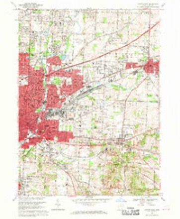
17 topographic sheets cover this place, the earliest surveyed in 1901 and the latest in 1994. It stands in Nimishillen Township. It lies in ZIP code area 44641. The Survey maps it on the Canton East quadrangle. 9,521 people lived here at the 2020 count. It stands 1,142 feet above sea level.
Population over time
2 figuresLouisville grew from 9,186 to 9,521 between 2010 and 2020. These are the recorded population figures Wikidata holds for this place, reached through the Geographic Names Information System number this page is keyed on rather than by name, so they belong to this place and not to another of the same name. Most are census counts, but not all are: an early figure may be a founding or settlement estimate. The change column is computed, and is left blank where more than 20 years separate a figure from the one before it, because a gap that long is not a change between two counts.
| Year | People | Change |
|---|---|---|
| 2010 | 9,186 | |
| 2020 | 9,521 | +335 (+4%) |
Then and now
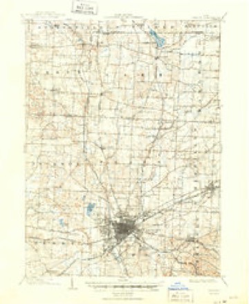
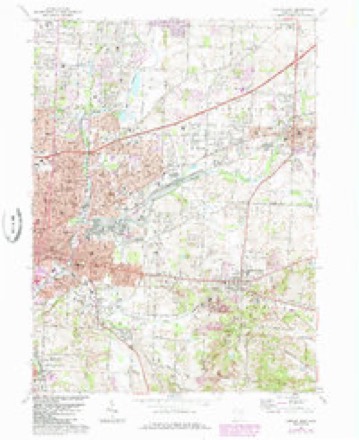
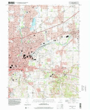
1901 to 1994The same ground, surveyed 93 years apart. Drag the handle to wipe between them. Both sheets are United States Geological Survey originals; neither has been altered.
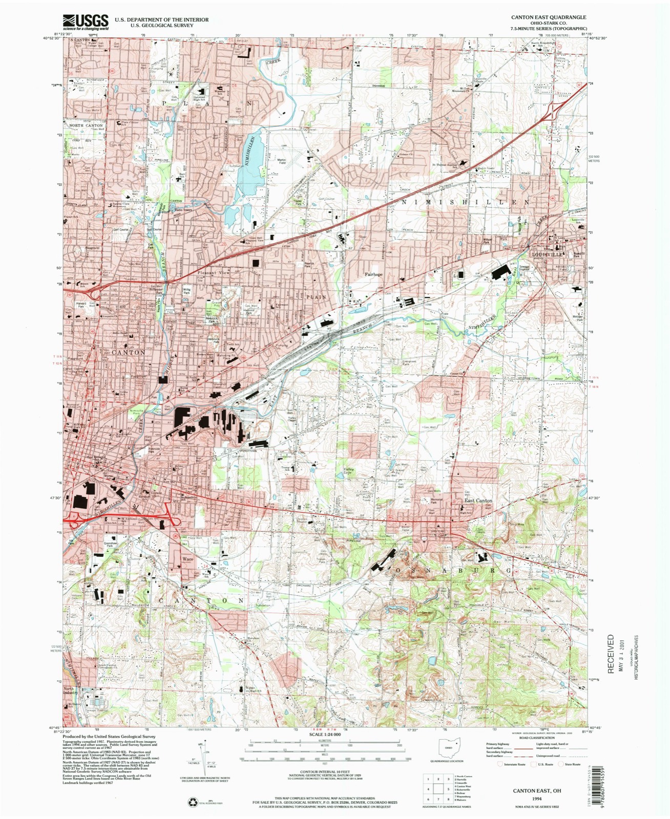
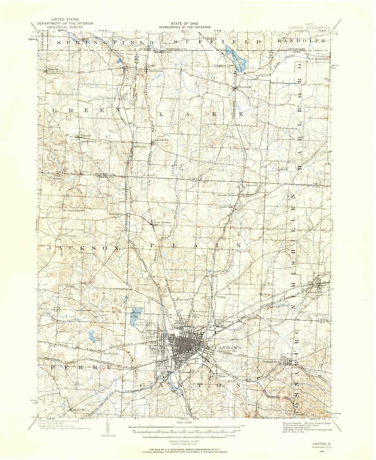
Topographic sheets covering this place
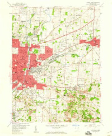
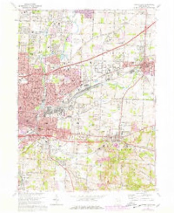
17 sheetsMatched by testing this settlement's coordinate against the published boundary of every sheet in the United States Geological Survey's historical collection. Each opens the scanned sheet at the Survey.
- 1901 USGS Canton quadrangle1:62500
- 1903 USGS Canton quadrangle1:62500
- 1903 USGS Canton quadrangle1:62500
- 1951 USGS Canton quadrangle1:250000
- 1953 USGS Canton quadrangle1:250000
- 1957 USGS Canton quadrangle1:250000
- 1957 USGS Canton quadrangle1:250000
- 1957 USGS Canton quadrangle1:250000
- 1958 USGS Canton East quadrangle1:24000
- 1962 USGS Canton quadrangle1:250000
- 1962 USGS Canton quadrangle1:250000
- 1967 USGS Canton East quadrangle1:24000
- 1967 USGS Canton East quadrangle1:24000
- 1967 USGS Canton East quadrangle1:24000
- 1986 USGS Canton quadrangle1:100000
- 1986 USGS Canton quadrangle1:100000
- 1994 USGS Canton East quadrangle1:24000







In the county-history sources
1,546 words on this townshipCombination Atlas Map of Stark County, Ohio, Compiled, Drawn and Published from Personal Examinations and Surveys, published 1875 names this settlement in its chapter on Nimishillen Township. These are the passages that mention it, exactly as the scans read.
Tho name ia of Indian origin, and probably commemorative of peculiarities of lands. Tbo depot of tho Pittsburg, Fort Wayne and Chicago Railroad, which traverses tho township, is built on the site of Loutzonheiser'a house. The old township records were destroyed, - an irretrievable loss. From Adam Lout- Ecnhoifcr, resident of Louisville since January 30, 1308, and the first born white in the township, we glean these fragments of its history.
Passage source: Combination Atlas Map of Stark County, Ohio, Compiled, Drawn and Published from Personal Examinations and Surveys, published 1875.
John Warner and brothers made a scttlemoDt in the northwest comer of tho township in 1807, and found good level agricultural lauds. John Eby, nn 1807 settler, put up a saw- and grist-mill on the Nimiahillcn, a mile and a half west of Louisville, in 1310, the first of the kind erected. The first sleom saw-mill was put up and run by Henry Hoover, on tho east lino of tho township. Its career wna brief; soon exploding, it killed John Reed, tho fireman. Henry Leah was killed at a raising by tho falling of a log, - the first death by accident in tho township.
Passage source: Combination Atlas Map of Stark County, Ohio, Compiled, Drawn and Published from Personal Examinations and Surveys, published 1875.
Machine-read from a century-old scan, so expect the errors a machine makes: misspelled names, dropped words, stray characters.
Read the whole chapter on Nimishillen Township - it names this place 3 more 3 times.
Fires near this place
1 since 2005Regional context, not property-specific evidence. The federal wildfire occurrence database lists 1 fire within 5 miles of Louisville between 2005 and 2005, burning about 30 acres in total. None started naturally. None was recorded as arson. Distance is straight-line from the map coordinates, so a fire counted here may appear on a neighbouring settlement's page as well.
| Reported cause | Fires |
|---|---|
| Debris and open burning | 1 |
The most recent of them, most recent first, with the day each was reported and the service that recorded it.
| Date | Cause | Size | Reported by | Name on the report |
|---|---|---|---|---|
| 14 April 2005 | Debris and open burning | 30 acres | Ohio Department of Natural Resources | not named |
Settlements close enough to share some of these fires:
Specimens collected near this place
12 of 246 shownRegional context, not property-specific evidence. Museums hold 246 specimens collected within 10 miles of Louisville between 1836 and 1975: 194 Animalia, 41 Plantae, 7 Fungi, 4 Unrecorded. 12 distinct Species records are shown. Collected by Anson A. Hinkley, Antonio, T., Armbruster, D. C. (Daniel C.) and others. Each is a physical object with a catalogue number, and each entry opens the museum's record. This is what was collected and kept, not a survey of what lives here - nothing can be concluded from a species being absent.
| Image | Species | Year | Collected by | Where, as recorded |
|---|---|---|---|---|
 | Carex granularis Muhl. ex Willd. | 1836 | Collector unknown | Canton |
 | Carex intumescens Rudge | 1836 | Collector unknown | Canton |
 | Ectopistes migratorius (Linnaeus, 1766) | 1875 | not recorded | No specific locality recorded. |
 | Archilochus colubris (Linnaeus, 1758) | 1885 | Bulley, R. H | Canton |
 | Dumetella carolinensis (Linnaeus, 1766) | 1885 | Bulley, R. H | Canton |
 | Hylocichla mustelina (Gmelin, 1789) | 1885 | Bulley, R. H | Canton |
 | Icterus galbula (Linnaeus, 1758) | 1885 | not recorded | Canton |
 | Melospiza georgiana (Latham, 1790) | 1885 | Bulley, R. H | Canton |
 | Molothrus ater ater (Boddaert, 1783) | 1885 | Bulley, R. H | Canton |
 | Picoides pubescens medianus (Swainson, 1832) | 1885 | Bulley, R. H | Canton |
 | Pooecetes gramineus (J.F.Gmelin, 1789) | 1885 | Bulley, R. H | Canton |
 | Regulus satrapa satrapa Lichtenstein, 1823 | 1885 | Bulley, R. H | Canton |
All 246 specimens within 10 miles, at the Global Biodiversity Information Facility.
Mines and quarries near this place
8 within 5 milesRegional context, not property-specific evidence. The federal mineral resources record lists 8 workings within 5 miles of Louisville: 6 past producers, 2 producers. 2 still produce. What was taken out: Sand and Gravel, Construction, Clay, Stone, Crushed/Broken. Distance is straight-line from the map coordinates, so a quarry counted here may appear on a neighbouring settlement's page as well.
| Where | Site | Commodity | Status | Recorded |
|---|---|---|---|---|
| Sme Quarry | Stone, Crushed/Broken | Producer | ||
| Motts and Dehoff Pit | Clay | Past Producer | Sedimentary | |
| Motts and Dehoff Pit | Clay | Past Producer | ||
| Stark Ceramics, Incorporated Pit | Clay | Past Producer | Sedimentary | |
| Columbus Road Pit | Sand and Gravel, Construction | Past Producer | Sedimentary | |
| Columbus Road Pit | Sand and Gravel, Construction | Producer | ||
| Diano Sand and Gravel Pit | Sand and Gravel, Construction | Past Producer | Sedimentary | |
| Diano Sand and Gravel Pit | Sand and Gravel, Construction | Past Producer |
Storms near this place
24 since 1996Regional context, not property-specific evidence. The National Weather Service names Louisville in 24 storm reports between 1996 and 2025: 13 hail, 6 thunderstorm wind, 4 flash flood, 1 lightning. No death or injury is recorded in these reports. Each account below is quoted exactly as the forecast office filed it, from the NOAA Storm Events Database, and each date opens the federal record of that event.
| When | Event | Place named | Harm | What the report says |
|---|---|---|---|---|
| August 2005 | Lightning | Louisville | $120,000 | A lightning strike caused a fire to start in the attic of a home, and caused major damage. No injuries were reported. |
| June 2018 | Flash Flood | Louisville | $75,000 | A thunderstorm with heavy rainfall moved over northeast Stark County between 730 and 830 pm. The storms forward motion slowed and it remained nearly stationary during the hour. The storm produced rainfall rates estimated at 3 inches per hour though no official rain gauges were available in the immediate vicinity of the storm. The storms heaviest rain fell over Louisville between N Chapel Street (Route 44) and Hwy 62. An apartment complex near Reno Drive sustained flood damage to 27 cars with some water into the lower level apartments. A small tributary to the East Branch of the Nimishillen Creek near Reno Drive came out of banks and damaged a bridge. Another apartment complex on Constitution Avenue was flooded resulting in water rescues around 845 pm through 930 pm. Four units flooded with up to 4 inches of water. Flood waters inundated the property of a few businesses on Constitution Avenue but did not inundate any of the buildings. The Main Street intersection in town was flooded at Constitution Avenue. The river gauge provided by the USGS measured a stage of 13.62 feet around 1120 PM in Louisville off of Constitution Avenue. |
| March 2019 | Thunderstorm Wind | Louisville | $10,000 | Several trees and power lines were blown down along Chapel Street near Louisville. |
| July 2008 | Hail | Louisville | $10,000 | Quarter size hail was observed. |
| July 2006 | Hail | Louisville | $5,000 | Hail ranging between dime and quarter size was observed. In Louisville, the hail accumulated around an inch before it ended. |
| June 2002 | Hail | Louisville | $5,000 | Nickel size hail was observed. |
| June 2002 | Hail | Louisville | $5,000 | Nickel size hail was reported. |
| June 2020 | Flash Flood | Louisville | $2,000 | A thunderstorm with heavy rain, peaking at an estimated 5 inches per hour around 7 PM with an estimated storm total rainfall around 1.75 inches in 30 minutes. The East Branch of the Nimishillen Creek came out of banks cresting at 13.11 feet in Louisville at moderate flood stage. Flooded roads include Main Street and Frana Clara. The Fire Chief reported water was inches from getting into the Gazebo apartments on Constitution Ave and it cut off access and flooded cars in the parking areas around the buildings. |
| May 2025 | Thunderstorm Wind | Louisville | - | Trees downed in Louisville. |
| October 2024 | Hail | Louisville | - | Hail up to penny-size in Louisville. |
| October 2024 | Hail | Louisville | - | Hail up to quarter-size in Louisville. |
| April 2020 | Thunderstorm Wind | Louisville | - | Trained spotter estimated 60 mph peak gust from thunderstorm in Louisville. |
| June 2020 | Thunderstorm Wind | Louisville | - | ODOT reported OH 44 closed between Easton Street and US 62 due to downed power lines about two miles north of Louisville. Spotter reported numerous tree branches snapped and six telephone poles downed in same area. Time estimated via radar. |
| July 2019 | Flash Flood | Louisville | - | Widespread flooding across Stark County. Flash flooding with rushing water over roads in Louisville, Hartville, Jackson Township, and North Canton. Numerous roads closed. SR 241 between Shuffel road and Strausser road is closed due 2 feet of water over the road. Price Park flooded in North Canton. A rain gage reported 2.17 inches in 30 minutes in Jackson Township. |
| June 2017 | Hail | Louisville | - | Trained spotters reported hail the size of walnuts. |
| May 2011 | Hail | Louisville | - | Thunderstorms produced nickel sized hail. |
| August 2008 | Hail | Louisville | - | Nickel size hail was reported. |
| June 2008 | Hail | Louisville | - | Nickel size hail was observed. |
| August 2007 | Hail | Louisville | - | Penny size hail was observed. |
| May 2002 | Thunderstorm Wind | Louisville | - | A 58 mph thunderstorm wind gust was measured. |
| April 2001 | Hail | Louisville | - | Dime size hail was reported. |
| October 2001 | Thunderstorm Wind | Louisville | - | A 60 mph thunderstorm wind gust was measured. |
| June 1998 | Hail | Louisville | - | no account filed |
| August 1996 | Flash Flood | Louisville | - | no account filed |
Nearest settlements
The eight closest, with where each one stands in the county. Distances are straight-line, computed from the Geographic Names Information System coordinates.
| Map | Place | Distance | Sheets |
|---|---|---|---|
| Belfort | 1.9 miles | 18 | |
| Fairhope | 2.2 miles | 17 | |
| Plain | 3.0 miles | 17 | |
| Lynn Center Park | 3.2 miles | 17 | |
| East Canton | 3.7 miles | 17 | |
| Harrisburg | 4.2 miles | 18 | |
| Pleasant View | 4.4 miles | 17 | |
| Pleasant View Village | 4.4 miles | 17 |
Elsewhere
Matched on this settlement's Geographic Names Information System number rather than its name, so it cannot be a different place of the same name in another state.
| Wikipedia article on Louisville | An encyclopaedic summary. Its text is share-alike, so it is linked here rather than copied. |
| Wikidata item Q1007057 | The structured record the population and elevation above come from. Public domain (CC0). |
Provenance
This settlement is recorded in the Geographic Names Information System as feature 1061447. The sheet list is computed by point-in-boundary test against the United States Geological Survey's historical topographic inventory. Both are works of the United States government and carry no copyright under 17 U.S.C. 105.
Wildfire. Short, Karen C. 2022. Spatial wildfire occurrence data for the United States, 1992-2020 [FPA_FOD_20221014]. 6th Edition. Fort Collins, CO: Forest Service Research Data Archive. https://doi.org/10.2737/RDS-2013-0009.6 Collected with United States Government funding and usable without additional permissions or fees.
Specimens. Global Biodiversity Information Facility (GBIF), https://www.gbif.org/. Only records licensed CC0 or CC BY are used. Records licensed CC BY-NC are excluded because this site carries advertising. Images are checked individually and any whose licence is non-commercial, no-derivatives or unreadable is refused.
Mines and quarries. USGS Mineral Resources Data System (MRDS) https://mrdata.usgs.gov/mrds/ A work of the United States government, no copyright under 17 U.S.C. 105.
Storms. NOAA National Centers for Environmental Information, Storm Events Database https://www.ncei.noaa.gov/stormevents/ A work of the United States government, no copyright under 17 U.S.C. 105. Narratives are quoted verbatim from the National Weather Service report and are not edited or summarised.