 Block
Block
New Carlisle, Ohio
13 topographic sheets cover this place, the earliest surveyed in 1904 and the latest in 1986. It stands in Bethel Township. It lies in ZIP code area 45344. It stands on West Fork Honey Creek. The Survey maps it on the New Carlisle quadrangle. 5,559 people lived here at the 2020 count. It stands 899 feet above sea level.
Population over time
2 figuresNew Carlisle fell from 5,785 to 5,559 between 2010 and 2020. These are the recorded population figures Wikidata holds for this place, reached through the Geographic Names Information System number this page is keyed on rather than by name, so they belong to this place and not to another of the same name. Most are census counts, but not all are: an early figure may be a founding or settlement estimate. The change column is computed, and is left blank where more than 20 years separate a figure from the one before it, because a gap that long is not a change between two counts.
| Year | People | Change |
|---|---|---|
| 2010 | 5,785 | |
| 2020 | 5,559 | -226 (-4%) |
Then and now
1904 to 1986The same ground, surveyed 82 years apart. Drag the handle to wipe between them. Both sheets are United States Geological Survey originals; neither has been altered.

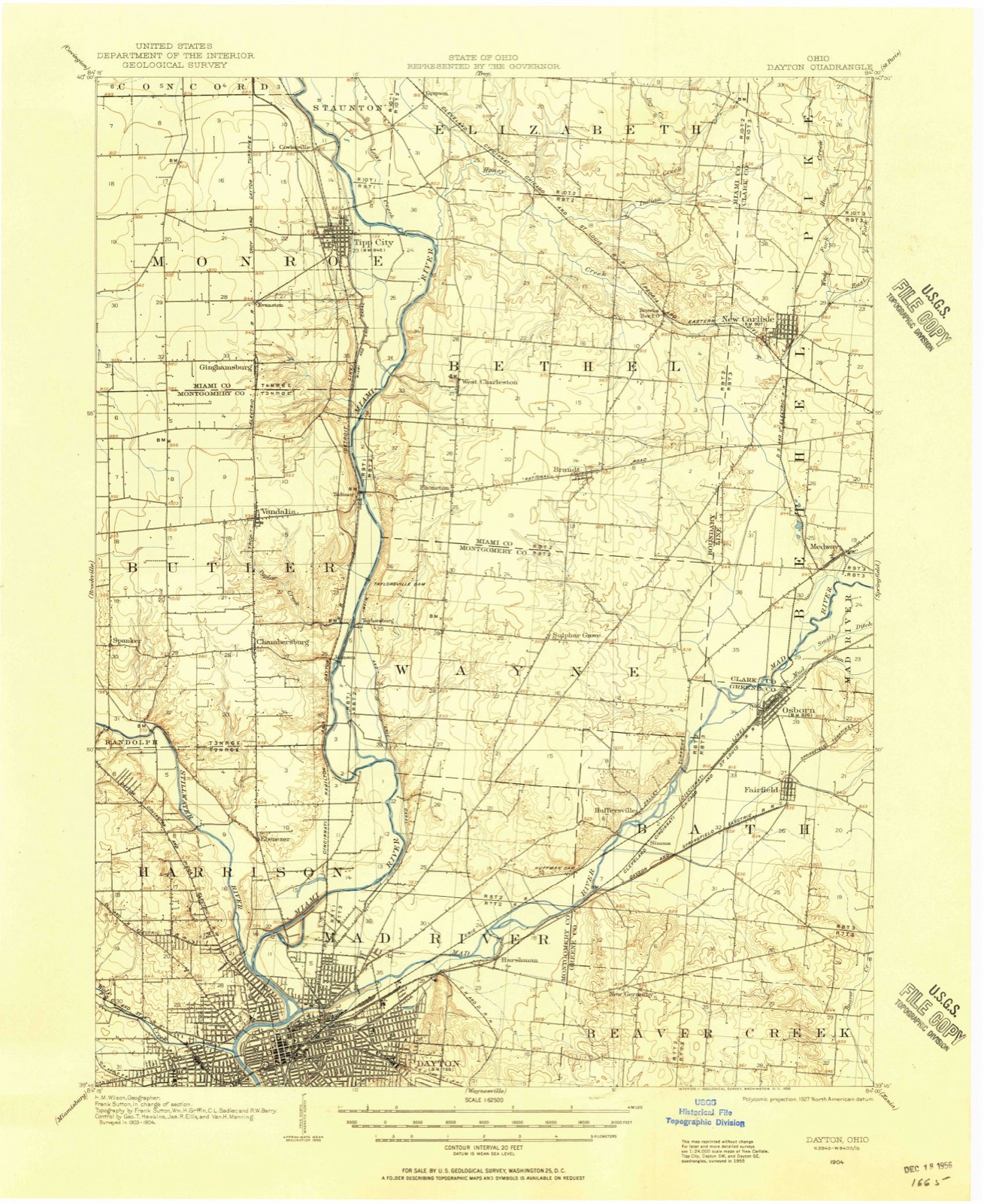
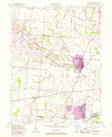
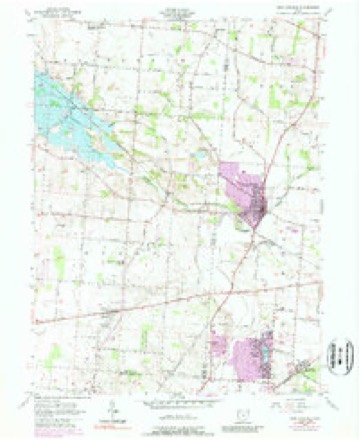
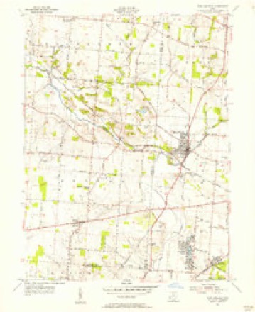
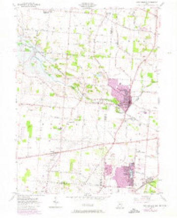
Topographic sheets covering this place
13 sheetsMatched by testing this settlement's coordinate against the published boundary of every sheet in the United States Geological Survey's historical collection. Each opens the scanned sheet at the Survey.
- 1904 USGS Dayton quadrangle1:62500
- 1906 USGS Dayton quadrangle1:62500
- 1906 USGS Dayton quadrangle1:62500
- 1953 USGS Cincinnati quadrangle1:250000
- 1953 USGS Cincinnati quadrangle1:250000
- 1953 USGS Cincinnati quadrangle1:250000
- 1955 USGS New Carlisle quadrangle1:24000
- 1955 USGS New Carlisle quadrangle1:24000
- 1955 USGS New Carlisle quadrangle1:24000
- 1955 USGS New Carlisle quadrangle1:24000
- 1957 USGS Cincinnati quadrangle1:250000
- 1986 USGS Dayton quadrangle1:100000
- 1986 USGS Dayton quadrangle1:100000






In the county-history sources
43,588 words on this townshipIllustrated Historical Atlas of Clark County, Ohio, published 1875; The History of Clark County Ohio,, published 1881 names this settlement in its chapter on Bethel Township. These are the passages that mention it, exactly as the scans read.
After w severe two hours! fight during the night, the men reached Harper's Ferry. 'The regiment camped fora time near New York and Brooklyn. September 6, they guard a train in Virginia, Oclober 10, they stund to urms all wight, and next day take pluce on the first line nem the Rappabunnock. November 7, they cornered and captured ao number of prisovers. Shelled at Brandy Station, acting vs train-guard, and fighting at Locust Grove, the men finally go into winter quarters at the Station. May 4, the regiment buving passed the Rupidan at Germania Ford, take position on the extreme right iu the Wilderness. They skirmish, charge, and, driving the enemy, hold bis works till dark, and then go back for ammunition. Ilere they lose ninelcen killed, eighty-cight wounded, and eleven missing. Next day they withstand artillery, and wt night fall buck, After several skirmishes, the 110th engage the one upon the banks of Mad River, the other on a tributary, and supplied a convenionce to the farmiug interest. James Leffel is imperfectly known as the inventor of the double turbine water-wheels, g0 extensively manufactured at Springfield, and generally demanded the world over. Personally the inyention was not lugrative, but his widow realizes fro this source u bandsome income. Sumuel Smith was w settler on the creek above Donnelsville in 1510, Ile was no eceentri¢ character. In 1808, Jacob Funderbaugh, of Virginia, bronght on a family of eight children, John, Daniel, and David Miller took up lands in tho north of the township. Dounelaville, a village of two or three hundred inhabitants, was laid out August 6, 1886, by James Donnels and Alwabam Smith, Reuben Miller being surveyor. Its growth waa rapid for Lwo or three years, and then ceased, The first house was moved from Lowry's paper-mill. Donunelg kept the first tavern, John Movorehonse the first store, and Wood tho first The Methodists erected here a church in 1842, was platted August 24, 1816, by Archibald Stoel, and the auknowledgment taken before Samuel Smith, a jnstive of the ponce. The first house was built ly Jacob Hersey, the proprietor of whut was culled the MeQueen Mill." also the first postmaster of the village. New Carlisle, a town of some hundred people, was formerly known as Monroe. It was laid out by Wim. M. Rayburn on July 25, 1818, John Cram beiag justice of the peace at the timu.
Passage source: Illustrated Historical Atlas of Clark County, Ohio, published 1875.
Hugh Wallace was born in Kentucky August 14, 1778; came to Bethel Township about 1798, and began working for David Lowry, with whom he stayed several years. He was married to Margaret Smith, who died in 1814, and he then married Eleanor Richison, who was born in the Northwest Territory in 1793, and had nine children, seven yet living. He was in the war of 1812, and died in 1864. His widow died in 1875.
Passage source: The History of Clark County Ohio,, published 1881.
Jacob Huffman, a native of Pennsylvania, settled in the eastern corner of the township in 1802. He died December 1, 1542, aged seventy-two years, and his wife Catharine, died in August, 1866, aged eighty years. They had ten children who grew up - five yet living, viz., Henry, Reuben, Martha, Rachael and Samuel. He built a fine stone house which is yet standing.
Passage source: The History of Clark County Ohio,, published 1881.
Machine-read from a century-old scan, so expect the errors a machine makes: misspelled names, dropped words, stray characters.
Read the whole chapter on Bethel Township - it names this place 18 more 18 times.
Specimens collected near this place
12 of 125 shownRegional context, not property-specific evidence. Museums hold 125 specimens collected within 10 miles of New Carlisle between 1897 and 1975: 100 Animalia, 9 Fungi, 8 Plantae, 7 Protozoa, 1 Unrecorded. 12 distinct Species records are shown. Collected by A. N. Leeds, A. R. Gaufin, A.R. Gaufin, H.H. Ross and others. Each is a physical object with a catalogue number, and each entry opens the museum's record. This is what was collected and kept, not a survey of what lives here - nothing can be concluded from a species being absent.
| Image | Species | Year | Collected by | Where, as recorded |
|---|---|---|---|---|
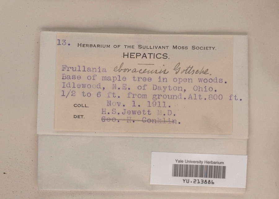 | Frullania eboracensis Gottsche | 1911 | Henry S. Jewett | Idlewood, northeast of Dayton, 0.5 to 6 ft. from ground |
 | Ceratiomyxa fruticulosa var. arbuscula (Berk. & Broome) Nann.-Bremek., 1975 | 1897 | Thaxter, R. | USA, Florida, Cocoanut Grove |
 | Mermis Dujardin, 1842 | 1897 | F. Johnston | New Carlisle |
 | Bombus pensylvanicus (De Geer, 1773) | 1903 | not recorded | New Carlisle |
 | Bombus impatiens Cresson, 1863 | 1916 | not recorded | Durbin |
 | Fissidens osmundoides Hedw. | 1929 | E. C. Leonard | Dibert Woods, 1.25 miles southeast of Thackery |
 | Parexoglossum hubbsi Trautman, 1931 | 1930 | M. Trautman | Ohio, Mad River, Clark County |
| Carychium exiguum (Say, 1822) | 1934 | not recorded | Enon | |
| Gastrocopta armifera (Say, 1821) | 1934 | Andren | Enon | |
| Gastrocopta contracta (Say, 1822) | 1934 | Archer, Allan | Enon | |
| Gymnostomum recurvirostrum Hedw. | 1934 | A. N. Leeds | 5 mi. W of Springfield | |
| Hymenostylium curvirostre Mitt. | 1934 | A. N. Leeds | Stony Creek, 5 mi. W of Harrisonville |
All 125 specimens within 10 miles, at the Global Biodiversity Information Facility.
Mines and quarries near this place
4 within 5 milesRegional context, not property-specific evidence. The federal mineral resources record lists 4 workings within 5 miles of New Carlisle: 4 past producers. None of them still produces. What was taken out: Sand and Gravel, Construction. Distance is straight-line from the map coordinates, so a quarry counted here may appear on a neighbouring settlement's page as well.
| Where | Site | Commodity | Status | Recorded |
|---|---|---|---|---|
| New Carlisle Sand and Gravel Pit | Sand and Gravel, Construction | Past Producer | Sedimentary | |
| New Carlisle Sand and Gravel Pit | Sand and Gravel, Construction | Past Producer | Sedimentary | |
| New Carlisle Sand and Gravel Pit | Sand and Gravel, Construction | Past Producer | ||
| New Carlisle Sand and Gravel Pit | Sand and Gravel, Construction | Past Producer |
Storms near this place
37 since 1994Regional context, not property-specific evidence. The National Weather Service names New Carlisle in 37 storm reports between 1994 and 2025: 26 thunderstorm wind, 8 hail, 1 flash flood, 1 flood. No death or injury is recorded in these reports. Each account below is quoted exactly as the forecast office filed it, from the NOAA Storm Events Database, and each date opens the federal record of that event.
| When | Event | Place named | Harm | What the report says |
|---|---|---|---|---|
| April 2000 | Thunderstorm Wind | New Carlisle | $50,000 | A thunderstorms produced very strong winds across the southwestern part of the county. A spotter measured a wind gust to 91 mph in Medway. Many trees and power lines were downed in this largely rural area. |
| April 2011 | Tornado (EF0) | New Carlisle | $25,000 | The tornado touched down near a cemetery where several trees were snapped or uprooted in this area. Further to the northeast, an RV dealership on the east side of New Carlisle experienced damage when a roof was partially lifted off the building. Two by four roof support beams were driven into the ground. In this same area, large debris was blown into a public pool complex. Snapped trees and power poles were also found in this area. Maximum estimated wind speeds based on damage were around 70 miles per hour. |
| April 2011 | Thunderstorm Wind | New Carlisle | $15,000 | Numerous trees were reported down, an awning and door were ripped off a building, and roof and siding damage occurred to a residence due to damaging thunderstorm winds. |
| August 2003 | Thunderstorm Wind | New Carlisle | $15,000 | Several hangars at Barnhart Memorial Airport sustained minor damage. A windmill was destroyed. |
| August 2009 | Thunderstorm Wind | New Carlisle | $12,000 | A tree was down on a house in New Carlisle. New Carlisle also receive penny size hail. Trees were also down in the Medway area. |
| December 2006 | Thunderstorm Wind | New Carlisle | $7,000 | Trees were downed across the western part of the county. |
| December 2013 | Thunderstorm Wind | New Carlisle | $5,000 | Scattered trees were reported down in the western portions of Clark County due to thunderstorm winds. |
| March 2011 | Flood | New Carlisle | $5,000 | Roads were flooded due to heavy rainfall. |
| June 2001 | Thunderstorm Wind | New Carlisle | $5,000 | A thunderstorm produced strong winds which caused roof damage at a treatment plant. Trees were also downed in the western part of the county. |
| June 2001 | Flash Flood | New Carlisle | $5,000 | Thunderstorms produced heavy rain which caused high water on roads. |
| November 1996 | Thunderstorm Wind | New Carlisle | $5,000 | no account filed |
| July 2022 | Thunderstorm Wind | New Carlisle | $4,000 | A power pole was downed on North Main Street. |
| September 2011 | Thunderstorm Wind | New Carlisle | $4,000 | Multiple trees were down and siding was torn off a mobile home due to damaging thunderstorm winds. The spotter estimated the wind gust. |
| August 2007 | Thunderstorm Wind | New Carlisle | $4,000 | Numerous trees and power poles were downed across Bethel Township. A tree fell across Dille Road. |
| July 2025 | Thunderstorm Wind | New Carlisle | $3,000 | Several trees were downed. |
| May 2022 | Thunderstorm Wind | New Carlisle | $3,000 | A few trees were downed. |
| June 2013 | Thunderstorm Wind | New Carlisle | $3,000 | Trees and wires were reported down in the area of New Carlisle due to thunderstorm winds. |
| May 2011 | Thunderstorm Wind | New Carlisle | $3,000 | Roof damage was sustained to a chicken house due to damaging thunderstorm winds. |
| July 2003 | Thunderstorm Wind | New Carlisle | $3,000 | Trees were downed. |
| July 1999 | Thunderstorm Wind | New Carlisle | $3,000 | Numerous trees downed. |
| July 1997 | Thunderstorm Wind | New Carlisle | $3,000 | Trees downed. |
| June 2008 | Hail | New Carlisle | $3,000 | no account filed |
| July 2025 | Thunderstorm Wind | New Carlisle | $2,000 | Two large trees were downed near the intersection of New Carlisle Pike and McKees Mill Run. |
| July 2011 | Thunderstorm Wind | New Carlisle | $2,000 | A couple of trees were reported down due to damaging thunderstorm winds. |
| June 2025 | Thunderstorm Wind | New Carlisle | $1,000 | A large tree was downed. |
| January 2017 | Thunderstorm Wind | New Carlisle | $1,000 | Two trees were downed. |
| February 2014 | Thunderstorm Wind | New Carlisle | $1,000 | Trees were downed in New Carlisle due to thunderstorm winds. |
| July 2013 | Thunderstorm Wind | New Carlisle | $1,000 | A tree was downed on Rawson Drive due to thunderstorm winds. |
| July 2012 | Thunderstorm Wind | New Carlisle | $1,000 | Large branches were broken due to damaging thunderstorm winds. |
| June 1999 | Hail | New Carlisle | $1,000 | Dime size hail was reported. A few trees were also knocked down. |
| September 2019 | Thunderstorm Wind | New Carlisle | $500 | A small tree fell onto Musselman Road. |
| June 1994 | Hail | New Carlisle | - | Large hail did some crop damage. |
| April 2012 | Hail | New Carlisle | - | no account filed |
| November 2002 | Hail | New Carlisle | - | no account filed |
| April 2001 | Hail | New Carlisle | - | no account filed |
| July 2000 | Hail | New Carlisle | - | no account filed |
| May 1997 | Hail | New Carlisle | - | no account filed |
Nearest settlements
The eight closest, with where each one stands in the county. Distances are straight-line, computed from the Geographic Names Information System coordinates.
| Map | Place | Distance | Sheets |
|---|---|---|---|
| Willowick | 1.3 miles | 13 | |
| Funderberg (historical) | 1.4 miles | 13 | |
| Forgy | 2.4 miles | 14 | |
| Crystal Lakes | 3.2 miles | 13 | |
| Park Layne Manor | 3.4 miles | 13 | |
| Park Layne | 3.5 miles | 13 | |
| Dodo | 3.7 miles | 14 | |
| Medway | 3.8 miles | 13 |
Elsewhere
Matched on this settlement's Geographic Names Information System number rather than its name, so it cannot be a different place of the same name in another state.
| Wikipedia article on New Carlisle | An encyclopaedic summary. Its text is share-alike, so it is linked here rather than copied. |
| Wikidata item Q2231962 | The structured record the population and elevation above come from. Public domain (CC0). |
Provenance
This settlement is recorded in the Geographic Names Information System as feature 1065113. The sheet list is computed by point-in-boundary test against the United States Geological Survey's historical topographic inventory. Both are works of the United States government and carry no copyright under 17 U.S.C. 105.
Specimens. Global Biodiversity Information Facility (GBIF), https://www.gbif.org/. Only records licensed CC0 or CC BY are used. Records licensed CC BY-NC are excluded because this site carries advertising. Images are checked individually and any whose licence is non-commercial, no-derivatives or unreadable is refused.
Mines and quarries. USGS Mineral Resources Data System (MRDS) https://mrdata.usgs.gov/mrds/ A work of the United States government, no copyright under 17 U.S.C. 105.
Storms. NOAA National Centers for Environmental Information, Storm Events Database https://www.ncei.noaa.gov/stormevents/ A work of the United States government, no copyright under 17 U.S.C. 105. Narratives are quoted verbatim from the National Weather Service report and are not edited or summarised.