 Block
Block
Plain City, Ohio
12 topographic sheets cover this place, the earliest surveyed in 1916 and the latest in 1992. It stands in Darby Township. It lies in ZIP code area 43064. It stands on Sweeney Run. The Survey maps it on the Plain City quadrangle. 4,065 people lived here at the 2020 count. It stands 935 feet above sea level.
Population over time
2 figuresPlain City fell from 4,225 to 4,065 between 2010 and 2020. These are the recorded population figures Wikidata holds for this place, reached through the Geographic Names Information System number this page is keyed on rather than by name, so they belong to this place and not to another of the same name. Most are census counts, but not all are: an early figure may be a founding or settlement estimate. The change column is computed, and is left blank where more than 20 years separate a figure from the one before it, because a gap that long is not a change between two counts.
| Year | People | Change |
|---|---|---|
| 2010 | 4,225 | |
| 2020 | 4,065 | -160 (-4%) |
Then and now
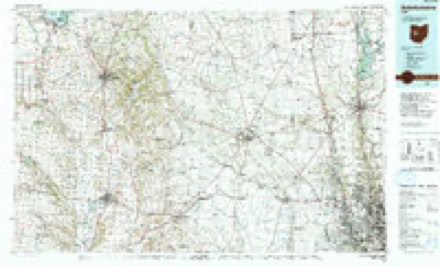
1916 to 1992The same ground, surveyed 76 years apart. Drag the handle to wipe between them. Both sheets are United States Geological Survey originals; neither has been altered.
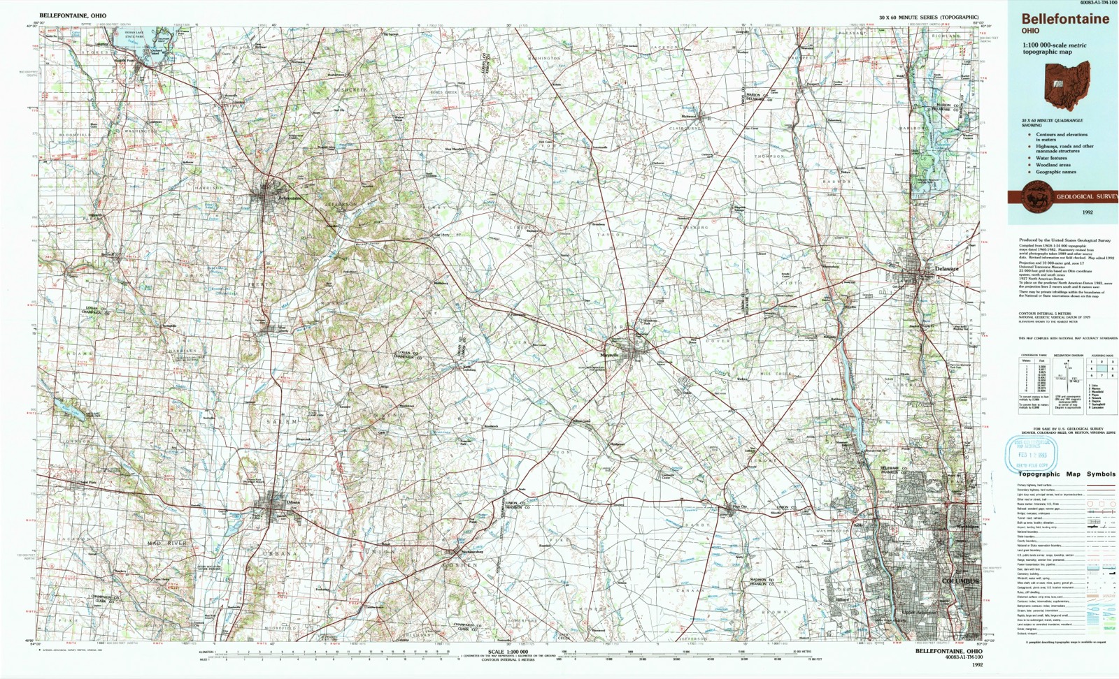
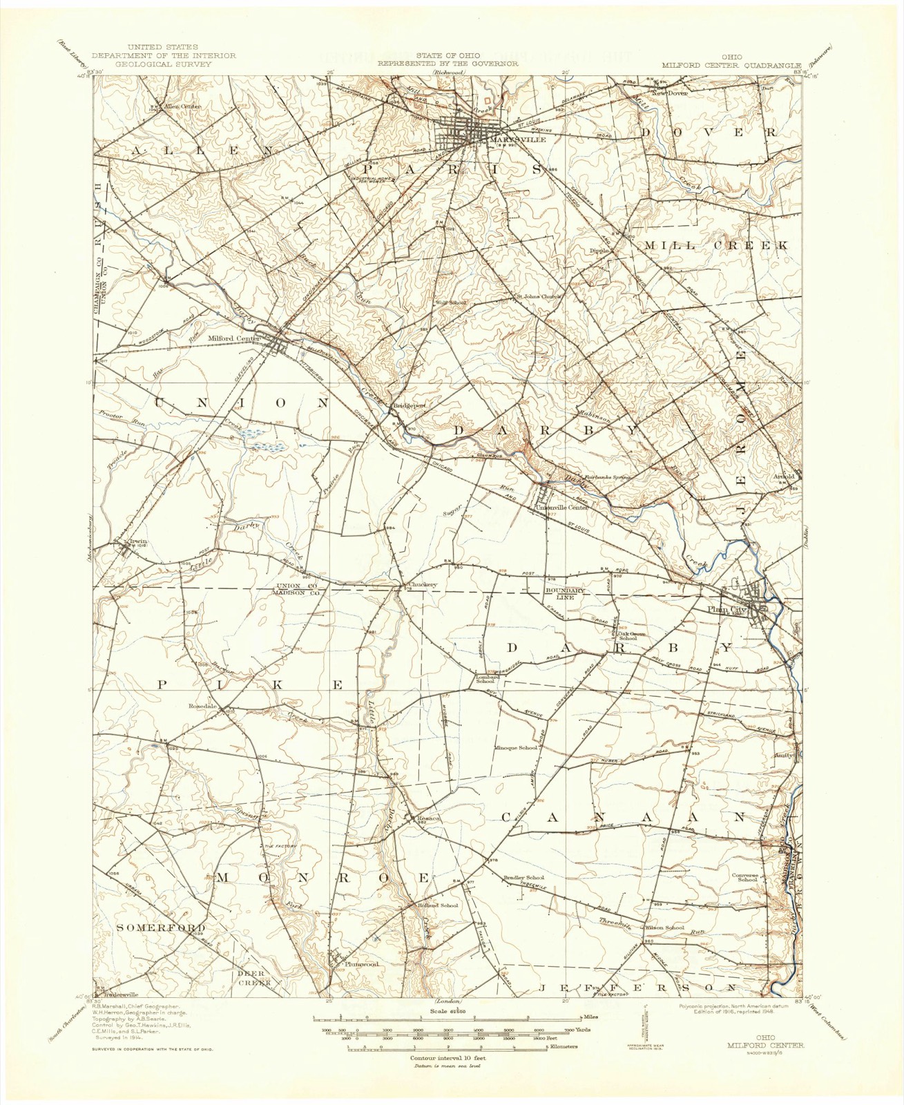
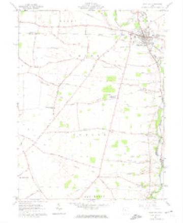
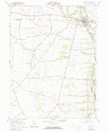
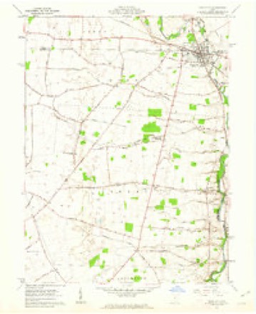
Topographic sheets covering this place
12 sheetsMatched by testing this settlement's coordinate against the published boundary of every sheet in the United States Geological Survey's historical collection. Each opens the scanned sheet at the Survey.
- 1916 USGS Milford Center quadrangle1:62500
- 1944 USGS Milford Center quadrangle1:62500
- 1950 USGS Marion quadrangle1:250000
- 1961 USGS Plain City quadrangle1:24000
- 1961 USGS Plain City quadrangle1:24000
- 1961 USGS Plain City quadrangle1:24000
- 1962 USGS Marion quadrangle1:250000
- 1966 USGS Marion quadrangle1:250000
- 1966 USGS Marion quadrangle1:250000
- 1966 USGS Marion quadrangle1:250000
- 1986 USGS Bellefontaine quadrangle1:100000
- 1992 USGS Bellefontaine quadrangle1:100000





In the county-history sources
15,559 words on this townshipHistory of Madison County, Ohio : Its People, Industries and Institution with Biographical Sketches of Representative Citizens and Genealogical Records of Many of the Old Families, published 1915 names this settlement in its chapter on Darby Township. These are the passages that mention it, exactly as the scans read.
In 1796, as mentioned above, Benjamin Springer, with his wife and two sons, Silas and Thomas, also his son-in-law, Usual Osborn, and wife, settled on Big Darby creek. They were natives of Pennsylvania, and built their cabin on land later owned by John Taylor, close to the north line of Canaan township and just within the limits of the same. But their names are mentioned here because of their close proximity and close relations with the early pioneers of Darby township. In 179S, the Ewing brothers, James and Joshua, emigrated from Kentucky to present Darby township and settled a short distance northeast of the site of Plain City. They bought farms lying on both sides of Big Darby creek. One reason for making their purchases on both sides of the stream was that they might have ready access to the prairie grazing lands, and at the same time have tillable lands on the elevated bottoms along the creek. They supposed, as did many others, that the open prairie land would afford them pasturage for many years to come. In this, however, they were mistaken, for they were in time owned by industrious farmers and inclosed with good fences.
Passage source: History of Madison County, Ohio : Its People, Industries and Institution with Biographical Sketches of Representative Citizens and Genealogical Records of Many of the Old Families, published 1915.
The Taylor brothers. John. Daniel and Richard, natives of New York state, emigrated to Kentucky in 1795 and settled on land they purchased near Lexington. They became discouraged and disgusted because of the constant litigations over titles, and determined to seek new lands. John Taylor, going to the man from whom he had made his purchase, made a trade with him for lands in the then territory of Ohio. By this exchange he became the owner of Ihree hundred acres of land on the banks of Big Derby, now in Union county. He moved to bis new farm in 1800, sold bis first purchase to Frederick Sager, and bought another about one mile south of Plain City, on both sides of Big Darby creek, from John Graham. Here be erected a log cabin, stable and outbuildings, and soon afterward, probably about the year 1804, be married a widow McCullough, sister of Judge Mitchell. Two children blessed this union, a daughter and a son. The daughter died in infancy, but the son, John Taylor, Jr., lived on the old homestead for many years, and is still remembered by the older residents of Darby township.
Passage source: History of Madison County, Ohio : Its People, Industries and Institution with Biographical Sketches of Representative Citizens and Genealogical Records of Many of the Old Families, published 1915.
The other Taylor brothers followed John from Kentucky about 1803. They had lost much of their property in the bogus land titles of Kentucky, and were, like most of the early pioneers, comparatively poor. Daniel Taylor, with his family, went directly to the Indian village above Plain City, where Jonathan Alder was at this time living. Alder surrendered the use of his hut to Taylor and his wife, and they immediately took possession. He, however, soon afterward built another beside this one, the former being used for a kitchen and the latter for bed, parlor and sitting room. There the children of Mr. Taylor and those of the Indians became intimately associated in their plays.
Passage source: History of Madison County, Ohio : Its People, Industries and Institution with Biographical Sketches of Representative Citizens and Genealogical Records of Many of the Old Families, published 1915.
Machine-read from a century-old scan, so expect the errors a machine makes: misspelled names, dropped words, stray characters.
Read the whole chapter on Darby Township - it names this place 10 more 10 times.
Specimens collected near this place
12 of 184 shownRegional context, not property-specific evidence. Museums hold 184 specimens collected within 10 miles of Plain City between 1927 and 1975: 184 Animalia. 12 distinct Species records are shown. Collected by Bowen, C. A. (Charles A.), Cavender, T. M. (Ted M.), Cavender, T. M. (Ted M.) & Class and others. Each is a physical object with a catalogue number, and each entry opens the museum's record. This is what was collected and kept, not a survey of what lives here - nothing can be concluded from a species being absent.
| Image | Species | Year | Collected by | Where, as recorded |
|---|---|---|---|---|
 | Etheostoma caeruleum Storer, 1845 | 1927 | Wickliff, E. L. (Edward L.) | Big Darby Creek, within Darby township, near Plain City, Darby township |
 | Etheostoma flabellare flabellare Rafinesque, 1819 | 1927 | Wickliff, E. L. (Edward L.) | Big Darby Creek, within Darby township, near Plain City, Darby township |
 | Pimephales promelas promelas Rafinesque, 1820 | 1927 | Wickliff, E. L. (Edward L.) | Big Darby Creek, within Darby township, near Plain City, Darby township |
 | Rhinichthys atratulus meleagris Agassiz, 1854 | 1927 | Wickliff, E. L. (Edward L.) | Big Darby Creek, within Darby township, near Plain City, Darby township |
 | Campostoma anomalum anomalum | 1928 | Trautman, M. B. (Milton Bernard) | Big Darby Creek tributary, within Darby township, near Plain City, Darby township |
 | Catostomus commersonii (Lacepède, 1803) | 1928 | Trautman, M. B. (Milton Bernard) | Big Darby Creek tributary, within Canaan township, near Plain City, Canaan township |
 | Ericymba buccata Cope, 1865 | 1928 | Trautman, M. B. (Milton Bernard) | Big Darby Creek tributary, within Darby township, near Plain City, Darby township |
 | Etheostoma spectabile (Agassiz, 1854) | 1928 | Trautman, M. B. (Milton Bernard) | Big Darby Creek tributary, within Darby township, near Plain City, Darby township |
| Hebata esuma (Goding, 1890) | 1928 | not recorded | ||
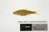 | Notropis chrysocephalus (Rafinesque, 1820) | 1928 | Trautman, M. B. (Milton Bernard) | Big Darby Creek tributary, Canaan Township, near Plain City, Canaan township |
 | Pimephales notatus (Rafinesque, 1820) | 1928 | Trautman, M. B. (Milton Bernard) | Big Darby Creek tributary, within Darby township, near Plain City, Darby township |
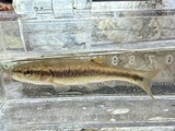 | Semotilus atromaculatus atromaculatus (Mitchill, 1818) | 1928 | Trautman, M. B. (Milton Bernard) | Big Darby Creek tributary, within Canaan township, near Plain City, Canaan township |
All 184 specimens within 10 miles, at the Global Biodiversity Information Facility.
Mines and quarries near this place
2 within 5 milesRegional context, not property-specific evidence. The federal mineral resources record lists 2 workings within 5 miles of Plain City: 2 past producers. None of them still produces. What was taken out: Limestone, General, Stone, Crushed/Broken. Distance is straight-line from the map coordinates, so a quarry counted here may appear on a neighbouring settlement's page as well.
| Where | Site | Commodity | Status | Recorded |
|---|---|---|---|---|
| Darby Number 220 Limestone Quarry | Limestone, General | Past Producer | Sedimentary | |
| Darby Number 220 Limestone Quarry | Stone, Crushed/Broken | Past Producer |
Storms near this place
12 since 1994Regional context, not property-specific evidence. The National Weather Service names Plain City in 12 storm reports between 1994 and 2010: 9 thunderstorm wind, 3 hail. The reports record 1 injury. Each account below is quoted exactly as the forecast office filed it, from the NOAA Storm Events Database, and each date opens the federal record of that event.
| When | Event | Place named | Harm | What the report says |
|---|---|---|---|---|
| June 1994 | Thunderstorm Wind | Plain City | 1 hurt, $5,000 | Trees were downed. A 17-year-old was indoors and was injured when a plate glass window shattered during the strong winds. He was treated for lacerations. |
| July 1997 | Thunderstorm Wind | Plain City | $15,000 | Roof blown off a barn. Several trees and power lines downed. |
| July 1998 | Thunderstorm Wind | Plain City | $10,000 | Numerous trees downed. |
| July 2003 | Thunderstorm Wind | Plain City | $5,000 | Several trees were knocked down. |
| May 2004 | Thunderstorm Wind | Plain City | $3,000 | Trees were downed. |
| July 1999 | Thunderstorm Wind | Plain City | $3,000 | Several large limbs down. |
| August 2003 | Thunderstorm Wind | Plain City | $2,000 | Two trees were knocked down. |
| June 2010 | Thunderstorm Wind | Plain City | $1,000 | Large tree limbs were reported down in the area. |
| May 2006 | Hail | Plain City | - | no account filed |
| May 2002 | Hail | Plain City | - | no account filed |
| May 2002 | Thunderstorm Wind | Plain City | - | no account filed |
| June 1994 | Hail | Plain City | - | no account filed |
Nearest settlements
The eight closest, with where each one stands in the county. Distances are straight-line, computed from the Geographic Names Information System coordinates.
| Map | Place | Distance | Sheets |
|---|---|---|---|
| Amity | 2.8 miles | 12 | |
| Kileville | 3.0 miles | 16 | |
| Resaca | 7.5 miles | 10 | |
| Gillivan | 9.0 miles | 13 | |
| Rosedale | 10.1 miles | 10 | |
| Plumwood | 10.4 miles | 10 | |
| West Jefferson | 11.2 miles | 13 | |
| Oakwood Acres | 11.4 miles | 13 |
Elsewhere
Matched on this settlement's Geographic Names Information System number rather than its name, so it cannot be a different place of the same name in another state.
| Wikipedia article on Plain City | An encyclopaedic summary. Its text is share-alike, so it is linked here rather than copied. |
| Wikidata item Q1816799 | The structured record the population and elevation above come from. Public domain (CC0). |
Provenance
This settlement is recorded in the Geographic Names Information System as feature 1061547. The sheet list is computed by point-in-boundary test against the United States Geological Survey's historical topographic inventory. Both are works of the United States government and carry no copyright under 17 U.S.C. 105.
Specimens. Global Biodiversity Information Facility (GBIF), https://www.gbif.org/. Only records licensed CC0 or CC BY are used. Records licensed CC BY-NC are excluded because this site carries advertising. Images are checked individually and any whose licence is non-commercial, no-derivatives or unreadable is refused.
Mines and quarries. USGS Mineral Resources Data System (MRDS) https://mrdata.usgs.gov/mrds/ A work of the United States government, no copyright under 17 U.S.C. 105.
Storms. NOAA National Centers for Environmental Information, Storm Events Database https://www.ncei.noaa.gov/stormevents/ A work of the United States government, no copyright under 17 U.S.C. 105. Narratives are quoted verbatim from the National Weather Service report and are not edited or summarised.