 Block
Block
Shelby, Ohio
13 topographic sheets cover this place, the earliest surveyed in 1915 and the latest in 1994. It stands in Sharon Township. It lies in ZIP code area 44875. The Survey maps it on the Shelby quadrangle. 9,282 people lived here at the 2020 count. It stands 1,102 feet above sea level.
Population over time
2 figuresShelby fell from 9,317 to 9,282 between 2010 and 2020. These are the recorded population figures Wikidata holds for this place, reached through the Geographic Names Information System number this page is keyed on rather than by name, so they belong to this place and not to another of the same name. Most are census counts, but not all are: an early figure may be a founding or settlement estimate. The change column is computed, and is left blank where more than 20 years separate a figure from the one before it, because a gap that long is not a change between two counts.
| Year | People | Change |
|---|---|---|
| 2010 | 9,317 | |
| 2020 | 9,282 | -35 (-0%) |
Then and now
1915 to 1994The same ground, surveyed 79 years apart. Drag the handle to wipe between them. Both sheets are United States Geological Survey originals; neither has been altered.

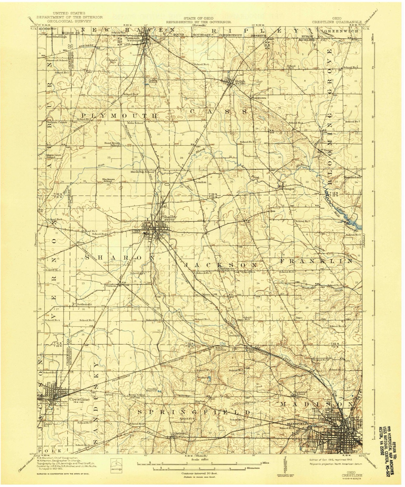
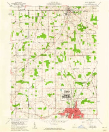
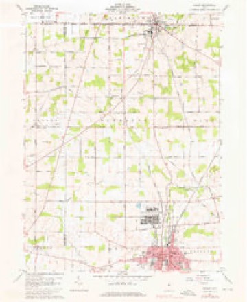
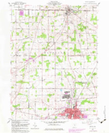
Topographic sheets covering this place
13 sheetsMatched by testing this settlement's coordinate against the published boundary of every sheet in the United States Geological Survey's historical collection. Each opens the scanned sheet at the Survey.
- 1915 USGS Crestline quadrangle1:62500
- 1943 USGS Crestline quadrangle1:62500
- 1943 USGS Crestline quadrangle1:62500
- 1950 USGS Marion quadrangle1:250000
- 1960 USGS Shelby quadrangle1:24000
- 1960 USGS Shelby quadrangle1:24000
- 1960 USGS Shelby quadrangle1:24000
- 1962 USGS Marion quadrangle1:250000
- 1966 USGS Marion quadrangle1:250000
- 1966 USGS Marion quadrangle1:250000
- 1966 USGS Marion quadrangle1:250000
- 1986 USGS Mansfield quadrangle1:100000
- 1994 USGS Mansfield quadrangle1:100000







In the county-history sources
30,550 words on this townshipHistory of Richland County, Ohio : (including the Original Boundaries) ; Its Past and Present, Containing a Condensed Comprehensive History of Ohio, Including an Outline History of the Northwest, a Complete History of Richland County ... Miscellaneous Matter, Map of the County, Biographies and Histories of ... the Most Prominent Families, &c., &c., published 1880 names this settlement in its chapter on Sharon Township. These are the passages that mention it, exactly as the scans read.
Next to Madison, it contains the largest town in the county, Shelby. The land is all tillable and of fine quality. The eastern portion is well watered b}' the Black Fork and its tributaries, which traverse its entire length, from south to north ; and Paramour Run, which passes from east to west across the southwest corner.
Near its center, running north and south, the land is elevated, forming the dividing ridge between the head- waters of the Muskingum and those of the Sandusky River. The larger part of the township slopes gently to the north.
A well-worn Indian trail passed across the township, its general direction being northeast, in the direction of Lower Sandusky (Fremont). The Delaware, Wyandot and Seneca Indians generally used this territory as a huntingground ; and a portion of one of these tril^es had a permanent camp on a branch of the Black Fork, about two miles, a little west of south of the present town of Shelby. This camp, consisting of ten or a dozen Indians, under the lead of Johnnj-cake, remained here until about the year 1828, when the}- left, never to return. A trail passed through this encampment, from Mansfield to a DelaAvare camp (probabl}' Wingenund's) on the head-waters of the Sandusky River, near Leesville. So far as known, this was the only permanent Indian camp within the limits of the township, though evidence exists, here and there, of temporary camps for hunting purposes. The great wave of the sea of civilization has long since l)lotted out all external evidences of Indian occupation, except here and there the plow yet turns up some
Machine-read from a century-old scan, so expect the errors a machine makes: misspelled names, dropped words, stray characters.
Read the whole chapter on Sharon Township - it names this place 39 more 39 times.
Fires near this place
2 since 2020Regional context, not property-specific evidence. The federal wildfire occurrence database lists 2 fires within 5 miles of Shelby between 2020 and 2020, burning about 4 acres in total. None started naturally. None was recorded as arson. Distance is straight-line from the map coordinates, so a fire counted here may appear on a neighbouring settlement's page as well.
| Reported cause | Fires |
|---|---|
| Debris and open burning | 1 |
| Missing data/not specified/undetermined | 1 |
The most recent of them, most recent first, with the day each was reported and the service that recorded it.
| Date | Cause | Size | Reported by | Name on the report |
|---|---|---|---|---|
| 25 July 2020 | Missing data/not specified/undetermined | 2.0 acres | Ohio Department of Natural Resources | 15794 |
| 10 November 2020 | Debris and open burning | 2.0 acres | Ohio Department of Natural Resources | 15952 |
Settlements close enough to share some of these fires:
Specimens collected near this place
12 of 121 shownRegional context, not property-specific evidence. Museums hold 121 specimens collected within 10 miles of Shelby between 1839 and 1975: 63 Animalia, 36 Plantae, 22 Fungi. 12 distinct Species records are shown. Collected by Berra, T. (Tim), Chase, H. (Hazel), Colby, J. and others. Each is a physical object with a catalogue number, and each entry opens the museum's record. This is what was collected and kept, not a survey of what lives here - nothing can be concluded from a species being absent.
| Image | Species | Year | Collected by | Where, as recorded |
|---|---|---|---|---|
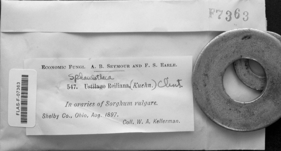 | Sphacelotheca reiliana (J.G.Kühn) G.P.Clinton | 1897 | W. A. Kellerman | |
 | Ustilago reiliana J.G.Kühn | 1897 | Prof. W. A. Kellerman | |
 | Asplenium platyneuron (L.) Oakes | 1839 | J. Wolle | Bethlehem. |
 | Athyrium thelypterioides (Michaux) Desvaux | 1840 | J. Wolle | Bethlehem. |
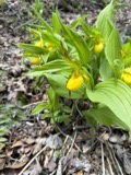 | Cypripedium parviflorum Salisb. | 1869 | N. L. Britton | northern Ohio |
 | Anemonella thalictroides (L.) Spach | 1892 | E. Wilkinson | Richland County |
 | Athyrium filix-femina subsp. angustum (Willd.) R.T.Clausen | 1892 | Wilkinson, E. | Richland County |
 | Campylophyllum hispidulum (Brid.) Hedenäs | 1892 | E. Wilkinson | |
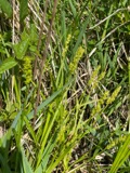 | Carex stipata Muhl. ex Willd. | 1892 | E. Wilkinson | |
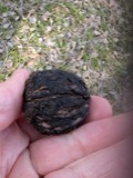 | Juglans nigra L. | 1892 | E. Wilkinson | |
| Lysimachia nummularia L. | 1892 | E. Wilkinson | Richland | |
 | Onoclea sensibilis L. | 1892 | Wilkinson, E. |
All 121 specimens within 10 miles, at the Global Biodiversity Information Facility.
Storms near this place
49 since 1994Regional context, not property-specific evidence. The National Weather Service names Shelby in 49 storm reports between 1994 and 2022: 22 thunderstorm wind, 18 hail, 4 flash flood, 3 flood. The reports record 1 injury. Each account below is quoted exactly as the forecast office filed it, from the NOAA Storm Events Database, and each date opens the federal record of that event.
| When | Event | Place named | Harm | What the report says |
|---|---|---|---|---|
| May 1997 | Lightning | Shelby | 1 hurt, $25,000 | Lightning struck a building complex, causing water and smoke damage. One person was treated and released from the hospital. |
| August 2007 | Flash Flood | Shelby | $70,000,000 | Heavy rain producing thunderstorms affected Richland County during the late evening hours of August 20th and early morning hours of August 21st. Rainfall rates with the strongest storms exceeded three inches per hour. A trained spotter in Mansfield measured a storm total of 7.5 inches. An automated sensor at Mansfield Lahm Airport measured a total of 6.24 inches with 4.09 inches of this total falling between 2 and 8 am. A Cooperative Observer four miles east of Bellville measured a total of 4.30 inches with 4.37 inches measured by an automated gage at Malabar State Park. Runoff from this rain combined with ground already saturated from earlier rains led to catastrophic flooding across portions of Richland County. Local officials stated that the flooding in the county was some of the the worst ever! The Shelby area was especially hard hit as was the northern portion of Mansfield. In Shelby, the Black Fork of the Mohican River left it's banks and flooded most of downtown Shelby. Flood waters in some areas were as much as 8 feet deep. The Municipal Courthouse was a total loss and the Fire Department building was heavily damaged. Damage to city buildings in Shelby topped $1 million. Two schools in Shelby sustained an additional $1.5 million in damages. Dozens of people had to be rescued by boat in Shelby. Water rescue teams from surrounding areas assisted in the rescues. A Coast Guard helicopter from Detroit rescued several people from the roofs of homes. In Mansfield, flood waters heavily damaged the main Post Office on North Main Street. Water inside the building was up to 15 inches deep with flood waters in nearby parking lots as much as five feet deep. Areas surrounding the Post Office were also unindated. Around 20 people had to be rescued from a gas station at the intersection of State Route 13 and U.S. Highway 30. A 74 year old man was killed around 7 am during a fire caused by flooding. The fire was started after flooding knocked over a gas can and a water heater ignited the gas. Around 100 homes in the county were damaged enough to be declared destroyed with at least 250 homes heavily damaged. Another 1500 homes in the county sustained lesser damages. Dozens of business in the county were also damaged by the flooding. Most of these were along Main and North Gamble Streets in Shelby. Dozens of roads and streets had to be closed because of flooding. Damage to roads, bridges and culverts was extensive. Cleanup and overtime costs incurred by local government agencies was substantial. Finally, standing water and erosion from the runoff caused damage to agricultural interests in the county. | |
| July 2013 | Flood | Shelby | $750,000 | As a result of heavy rains overnight up to 3 inches in some areas several roads were closed Tuesday July 9th due to high water. The Richland County Sheriff said that 5th Street in downtown Mansfield had flooded, and the fire department evacuated people from homes using boats. There was also flooding on Park Avenue East where roads and railroad tracks were underwater. Some cars were nearly submerged. The Clear Fork River in Shelby forced the fire department out of their station and put about a foot of water over the main road through town. Residents in Bellville were also flooded, according to the sheriff. |
| December 2013 | Thunderstorm Wind | Shelby | $300,000 | A line of severe thunderstorms moved across the northern half of Richland County and caused widespread damage. The damage was especially bad in the Shelby area where dozens of trees were downed causing widespread power outages. At least four building sustained significant damage from either the strong winds or fallen trees. Dozens of other homes lost roofing or siding. Several barns to the east of Shelby were leveled. A lot of damage was also reported north of the Mansfield Airport in the Ganges Five Points area where at least four farm buildings were destroyed. A large sign was flattened at the intersection of State Route 13 and 96. Dozens of trees were downed elsewhere across northern Richland County. |
| October 2013 | Thunderstorm Wind | Shelby | $150,000 | Thunderstorm winds gusts of at least 60 mph downed many trees and caused scattered power outages. Some homes sustained roof damage and at least two utility poles were snapped. |
| August 2007 | Tornado (EF0) | Shelby | $150,000 | A storm survey was conducted and an EF0 tornado was confirmed in Shelby. The tornado touched down at a factory on the west side of the town. The factory sustained some roof damage and had a masonary wall partially collapse. From the factory, the tornado continued through residential neighborhoods causing only intermittent damage. A couple dozen trees were downed along the damage path which was about three quarters of a mile long and no more than 20 yards in width. |
| April 2013 | Thunderstorm Wind | Shelby | $100,000 | The Emergency Manager relayed a report of damage to a barn and utility poles down. A trained weather spotter also reported that a building had a portion of a roof blown off by strong thunderstorm winds. |
| April 2002 | Thunderstorm Wind | Shelby | $100,000 | Thunderstorm winds toppled and destroyed a large grain bin outside of Shelby. |
| May 2018 | Thunderstorm Wind | Shelby | $75,000 | Thunderstorm wind gusts snapped several poles along State Routes 39 and 96 in Shelby. Widespread power outages were reported. |
| July 2002 | Thunderstorm Wind | Shelby | $40,000 | Thunderstorm winds downed many trees. Fallen trees damaged a parked car and a house. |
| May 2002 | Thunderstorm Wind | Shelby | $30,000 | Thunderstorm winds downed a large tree. The tree struck and severely damaged a house. |
| July 2019 | Flash Flood | Shelby | $20,000 | High water on US 13 and ST RT 603 and 96. 9 PM Multiple cars stranded in high water in West Mansfield. 3.8 inches of rain measured in Shelby in 6 hours. |
| July 2018 | Thunderstorm Wind | Shelby | $20,000 | Thunderstorm winds downed some trees and large limbs along Miller Road northeast of Shelby. A power line was also down in the area. |
| July 2013 | Thunderstorm Wind | Shelby | $20,000 | Thunderstorm winds estimated at 60 mph downed many trees. |
| June 2004 | Thunderstorm Wind | Shelby | $20,000 | Thunderstorm winds downed many trees and large limbs north of Shelby near Plymouth. |
| September 2010 | Hail | Shelby | $15,000 | Thunderstorms produced quarter size hail. |
| July 1997 | Thunderstorm Wind | Shelby | $15,000 | no account filed |
| November 2017 | Flood | Shelby | $10,000 | Rainfall in Richland and Ashland Counties was heaviest south of Mansfield, where the airport reported 3.02 for the event. The flooding impacts were primarily isolated to the central and southern half of the counties. There were reports of high water in Mansfield at Ohio 314 and Millsboro Road and Ohio 314 and Flowers Road. Mansfield police said affected areas included the subway and Longview Avenue at Main Street. The street department was called to put up barricades. By 8 pm there were numerous roads flooded across the county. In Shelby the Black Fork was elevated causing the fire department to relocated out of harms way, but ultimately did not breach the banks. The Black Fork south of Melco and into the confluence with the Mohican River were flooded. In Ashland County, numerous campgrounds, vacant this time of year, were inundated in Loudonville from the Mohican River. Other areas in Ashland County that saw flooding were OH-603 and OH-430, as well as County Road 251, just north of County Road 1302. The Ashland County Sheriffs Office said County Road 1600 between County Road 1575 and County Road 655 in Montgomery Township was closed with high water crossing the road just west of County Road 1575. High water was reported at state Route 603 and state Route 430, and County Road 251 just north of County Road 1302. High water signs went up on County Road 500 west of U.S. Route 250 around 10:30 p.m. Saturday. |
| July 2003 | Thunderstorm Wind | Shelby | $10,000 | Thunderstorm winds downed a few trees. |
| September 2002 | Thunderstorm Wind | Shelby | $10,000 | Thunderstorm winds downed several trees near Shelby. |
| July 1999 | Thunderstorm Wind | Shelby | $10,000 | A barn just south of Shelby suffered damage to its roof. |
| July 1998 | Thunderstorm Wind | Shelby | $10,000 | Trees were downed. |
| July 2012 | Thunderstorm Wind | Shelby | $8,000 | Thunderstorm winds downed a few trees. |
| January 2000 | Thunderstorm Wind | Shelby | $5,000 | Thunderstorm winds downed two trees. |
| May 2021 | Flood | Shelby | $2,000 | Minor flooding along the Black Fork of the Mohican River at Shelby occurred on May 9 after nearly 3 inches of rain fell in the watershed. The flood waters reached the Main Street bridge. Shelby is split in half when the Black Fork spills onto Main Street at a stage of 16.5 feet. The USGS river gage at Shelby reached a crest of 16.2 feet on the early evening of the 9th. Minor flooding impacted the athletic fields and there was some property damage. A portion of Seltzer Park, back roads and low-lying areas were flooded. |
| May 2004 | Hail | Shelby | $2,000 | Quarter size hail was observed. |
| June 2008 | Thunderstorm Wind | Shelby | $1,000 | A few large limbs were reported down. |
| May 2022 | Hail | Shelby | - | Quarter-size hail five-miles ESE of Shelby. |
| June 2022 | Thunderstorm Wind | Shelby | - | Several power poles downed about two-miles east of Shelby. |
| June 2022 | Hail | Shelby | - | Quarter to ping pong ball-size hail in Shelby. |
| July 2021 | Thunderstorm Wind | Shelby | - | Two trees down five-miles ESE of Shelby. |
| July 2019 | Thunderstorm Wind | Shelby | - | There were several trees and large tree branches blown down around the Shelby area. |
| August 2019 | Thunderstorm Wind | Shelby | - | Several trees and power lines were blown down around Jackson Township. |
| May 2016 | Hail | Shelby | - | Penny sized hail was observed. |
| May 2015 | Hail | Shelby | - | The post office reported penny size hail. |
| May 2014 | Hail | Shelby | - | Penny to nickel sized hail was observed. |
| May 2014 | Hail | Shelby | - | Penny to nickel sized hail was observed. |
| June 2013 | Hail | Shelby | - | Penny sized hail was observed. |
| June 2013 | Hail | Shelby | - | Quarter sized hail was observed. |
| May 2012 | Hail | Shelby | - | Quarter sized hail was observed. |
| June 2008 | Hail | Shelby | - | Several thunderstorm cells moved across the area during this time. Numerous trained spotters across the area observed hail ranging in size from penny to quarter size. |
| June 2008 | Hail | Shelby | - | Penny size hail was observed from Shelby to Mansfield by several trained spotters. |
| June 2008 | Hail | Shelby | - | Hail up to quarter size was observed for several minutes. |
| April 2005 | Hail | Shelby | - | Penny size hail was observed near Shelby. |
| May 2004 | Hail | Shelby | - | Penny size hail was observed five miles northeast of Shelby. |
| May 1998 | Flash Flood | Shelby | - | Heavy thunderstorm rain caused flooding of streets. Two feet of standing water accumulated in the low lying area of a local park. |
| April 1998 | Hail | Shelby | - | no account filed |
| June 1996 | Flash Flood | Shelby | - | no account filed |
| April 1994 | Hail | Shelby | - | no account filed |
Nearest settlements
The eight closest, with where each one stands in the county. Distances are straight-line, computed from the Geographic Names Information System coordinates.
| Map | Place | Distance | Sheets |
|---|---|---|---|
| Carefree Estates | 1.0 miles | 13 | |
| Vernon Junction | 2.5 miles | 13 | |
| London | 2.6 miles | 13 | |
| Hines (historical) | 3.1 miles | 13 | |
| Taylortown | 3.2 miles | 14 | |
| Myers (historical) | 3.4 miles | 14 | |
| Bethlehem | 4.3 miles | 13 | |
| Forest (historical) | 5.0 miles | 13 |
Elsewhere
Matched on this settlement's Geographic Names Information System number rather than its name, so it cannot be a different place of the same name in another state.
| Wikipedia article on Shelby | An encyclopaedic summary. Its text is share-alike, so it is linked here rather than copied. |
| Wikidata item Q528189 | The structured record the population and elevation above come from. Public domain (CC0). |
Provenance
This settlement is recorded in the Geographic Names Information System as feature 1065313. The sheet list is computed by point-in-boundary test against the United States Geological Survey's historical topographic inventory. Both are works of the United States government and carry no copyright under 17 U.S.C. 105.
Wildfire. Short, Karen C. 2022. Spatial wildfire occurrence data for the United States, 1992-2020 [FPA_FOD_20221014]. 6th Edition. Fort Collins, CO: Forest Service Research Data Archive. https://doi.org/10.2737/RDS-2013-0009.6 Collected with United States Government funding and usable without additional permissions or fees.
Specimens. Global Biodiversity Information Facility (GBIF), https://www.gbif.org/. Only records licensed CC0 or CC BY are used. Records licensed CC BY-NC are excluded because this site carries advertising. Images are checked individually and any whose licence is non-commercial, no-derivatives or unreadable is refused.
Storms. NOAA National Centers for Environmental Information, Storm Events Database https://www.ncei.noaa.gov/stormevents/ A work of the United States government, no copyright under 17 U.S.C. 105. Narratives are quoted verbatim from the National Weather Service report and are not edited or summarised.