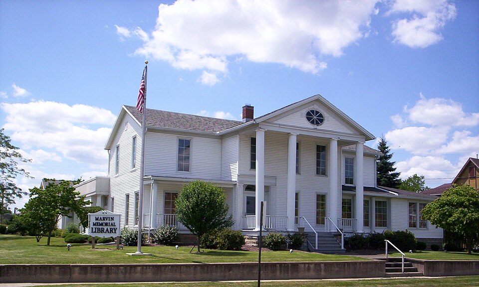
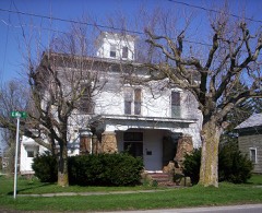
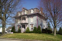
Listed on the National Register of Historic Places in
1987. A historic map-sheet match is not published yet. The record needs a coordinate-quality review before it can be joined to a sheet boundary.
From the record
“Henry Taylor's house was the place of public meetings, elections and militia trainings. About 1815 or a little later, a road was also cut by the early settlers, diverging from Beall's trail near Shenandoah, passing through Trucksville, to the present site of Shelby.”
History of Richland County, Ohio : (including the Original Boundaries) ; Its Past and Present, Containing a Condensed Comprehensive History of Ohio, Including an Outline History of the Northwest, a Complete History of Richland County ... Miscellaneous Matter, Map of the County, Biographies and Histories of ... the Most Prominent Families, &c., &c. (1880). Machine-read text.
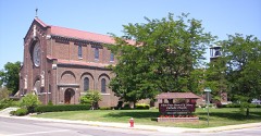
one of 61 National Register listings in Richland County · listed in 1987 · category: Building.
National Register reference number.86003493- the number the National Park Service assigned this property when it was listed, and the key its nomination file is catalogued under at the National Archives.
Next to Madison, it contains the largest town in the county, Shelby. The land is all tillable and of fine quality. The eastern portion is well watered b}' the Black Fork and its tributaries, which traverse its entire length, from south to north ; and Paramour Run, which passes from east to west across the southwest corner.
A well-worn Indian trail passed across the township, its general direction being northeast, in the direction of Lower Sandusky (Fremont). The Delaware, Wyandot and Seneca Indians generally used this territory as a huntingground ; and a portion of one of these tril^es had a permanent camp on a branch of the Black Fork, about two miles, a little west of south of the present town of Shelby. This camp, consisting of ten or a dozen Indians, under the lead of Johnnj-cake, remained here until about the year 1828, when the}- left, never to return. A trail passed through this encampment, from Mansfield to a DelaAvare camp (probabl}' Wingenund's) on the head-waters of the Sandusky River, near Leesville. So far as known, this was the only permanent Indian camp within the limits of the township, though evidence exists, here and there, of temporary camps for hunting purposes. The great wave of the sea of civilization has long since l)lotted out all external evidences of Indian occupation, except here and there the plow yet turns up some
Regional context, not property-specific
evidence. The
federal wildfire occurrence database
lists 2 fires within 5 miles of Marvin Memorial Library between
2020 and 2020, burning about 4 acres in total. None started naturally. None was recorded as arson.
Distance is straight-line from the map coordinates, so a fire counted
here may appear on a neighbouring settlement's page as well.
Reported cause
Fires
Debris and open burning
1
Missing data/not specified/undetermined
1
The most recent of
them, most recent first, with the day each was reported and the service
that recorded it.
Regional context, not property-specific
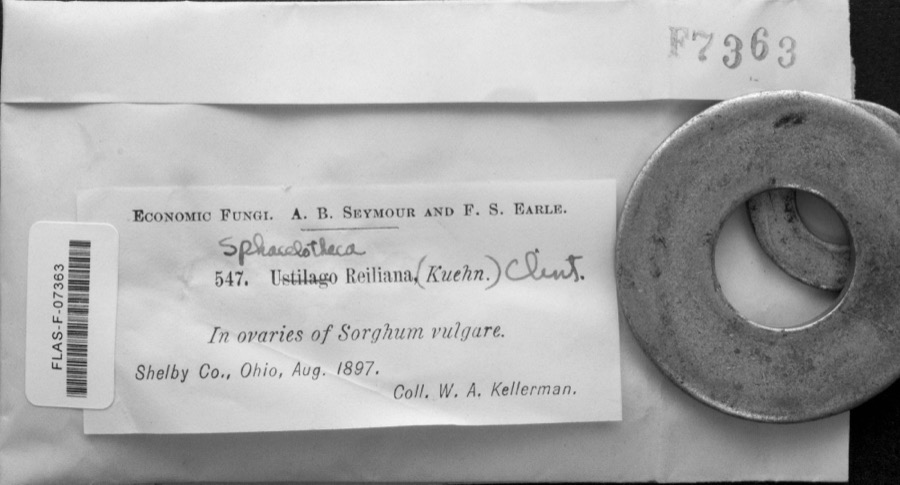
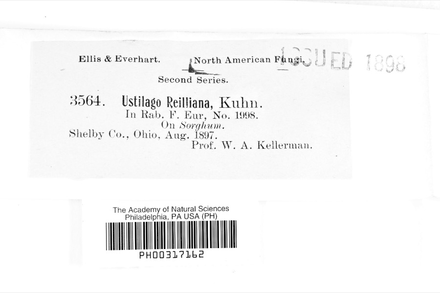
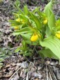
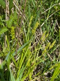
evidence. Museums hold 121 specimens
collected within 10 miles of Marvin Memorial Library between 1839 and
1975: 63 Animalia, 36 Plantae, 22 Fungi. 12 distinct Species records are shown.
Collected by Berra, T. (Tim), Chase, H. (Hazel), Colby, J. and others. Each is a
physical object with a catalogue
number, and each entry opens the museum's record. This is what was
collected and kept, not a survey of what lives here - nothing can be
concluded from a species being absent.
Regional context, not property-specific
evidence. The National Weather Service names
Shelby, the town this property stands in, in 49 storm reports between 1994 and 2022: 22 thunderstorm wind, 18 hail, 4 flash flood, 3 flood.
The reports record 1 injury. Each account below is quoted exactly as the forecast office
filed it, from the NOAA Storm Events Database, and each date
opens the federal record of that event.
Heavy rain producing thunderstorms affected Richland County during the late evening hours of August 20th and early morning hours of August 21st. Rainfall rates with the strongest storms exceeded three inches per hour. A trained spotter in Mansfield measured a storm total of 7.5 inches. An automated sensor at Mansfield Lahm Airport measured a total of 6.24 inches with 4.09 inches of this total falling between 2 and 8 am. A Cooperative Observer four miles east of Bellville measured a total of 4.30 inches with 4.37 inches measured by an automated gage at Malabar State Park. Runoff from this rain combined with ground already saturated from earlier rains led to catastrophic flooding across portions of Richland County. Local officials stated that the flooding in the county was some of the the worst ever! The Shelby area was especially hard hit as was the northern portion of Mansfield. In Shelby, the Black Fork of the Mohican River left it's banks and flooded most of downtown Shelby. Flood waters in some areas were as much as 8 feet deep. The Municipal Courthouse was a total loss and the Fire Department building was heavily damaged. Damage to city buildings in Shelby topped $1 million. Two schools in Shelby sustained an additional $1.5 million in damages. Dozens of people had to be rescued by boat in Shelby. Water rescue teams from surrounding areas assisted in the rescues. A Coast Guard helicopter from Detroit rescued several people from the roofs of homes. In Mansfield, flood waters heavily damaged the main Post Office on North Main Street. Water inside the building was up to 15 inches deep with flood waters in nearby parking lots as much as five feet deep. Areas surrounding the Post Office were also unindated. Around 20 people had to be rescued from a gas station at the intersection of State Route 13 and U.S. Highway 30. A 74 year old man was killed around 7 am during a fire caused by flooding. The fire was started after flooding knocked over a gas can and a water heater ignited the gas. Around 100 homes in the county were damaged enough to be declared destroyed with at least 250 homes heavily damaged. Another 1500 homes in the county sustained lesser damages. Dozens of business in the county were also damaged by the flooding. Most of these were along Main and North Gamble Streets in Shelby. Dozens of roads and streets had to be closed because of flooding. Damage to roads, bridges and culverts was extensive. Cleanup and overtime costs incurred by local government agencies was substantial. Finally, standing water and erosion from the runoff caused damage to agricultural interests in the county. |
As a result of heavy rains overnight up to 3 inches in some areas several roads were closed Tuesday July 9th due to high water. The Richland County Sheriff said that 5th Street in downtown Mansfield had flooded, and the fire department evacuated people from homes using boats. There was also flooding on Park Avenue East where roads and railroad tracks were underwater. Some cars were nearly submerged. The Clear Fork River in Shelby forced the fire department out of their station and put about a foot of water over the main road through town. Residents in Bellville were also flooded, according to the sheriff.
A line of severe thunderstorms moved across the northern half of Richland County and caused widespread damage. The damage was especially bad in the Shelby area where dozens of trees were downed causing widespread power outages. At least four building sustained significant damage from either the strong winds or fallen trees. Dozens of other homes lost roofing or siding. Several barns to the east of Shelby were leveled. A lot of damage was also reported north of the Mansfield Airport in the Ganges Five Points area where at least four farm buildings were destroyed. A large sign was flattened at the intersection of State Route 13 and 96. Dozens of trees were downed elsewhere across northern Richland County.
Thunderstorm winds gusts of at least 60 mph downed many trees and caused scattered power outages. Some homes sustained roof damage and at least two utility poles were snapped.
A storm survey was conducted and an EF0 tornado was confirmed in Shelby. The tornado touched down at a factory on the west side of the town. The factory sustained some roof damage and had a masonary wall partially collapse. From the factory, the tornado continued through residential neighborhoods causing only intermittent damage. A couple dozen trees were downed along the damage path which was about three quarters of a mile long and no more than 20 yards in width.
The Emergency Manager relayed a report of damage to a barn and utility poles down. A trained weather spotter also reported that a building had a portion of a roof blown off by strong thunderstorm winds.
High water on US 13 and ST RT 603 and 96. 9 PM Multiple cars stranded in high water in West Mansfield. 3.8 inches of rain measured in Shelby in 6 hours.
Rainfall in Richland and Ashland Counties was heaviest south of Mansfield, where the airport reported 3.02 for the event. The flooding impacts were primarily isolated to the central and southern half of the counties. There were reports of high water in Mansfield at Ohio 314 and Millsboro Road and Ohio 314 and Flowers Road. Mansfield police said affected areas included the subway and Longview Avenue at Main Street. The street department was called to put up barricades. By 8 pm there were numerous roads flooded across the county. In Shelby the Black Fork was elevated causing the fire department to relocated out of harms way, but ultimately did not breach the banks. The Black Fork south of Melco and into the confluence with the Mohican River were flooded. In Ashland County, numerous campgrounds, vacant this time of year, were inundated in Loudonville from the Mohican River. Other areas in Ashland County that saw flooding were OH-603 and OH-430, as well as County Road 251, just north of County Road 1302. The Ashland County Sheriffs Office said County Road 1600 between County Road 1575 and County Road 655 in Montgomery Township was closed with high water crossing the road just west of County Road 1575. High water was reported at state Route 603 and state Route 430, and County Road 251 just north of County Road 1302. High water signs went up on County Road 500 west of U.S. Route 250 around 10:30 p.m. Saturday.
Minor flooding along the Black Fork of the Mohican River at Shelby occurred on May 9 after nearly 3 inches of rain fell in the watershed. The flood waters reached the Main Street bridge. Shelby is split in half when the Black Fork spills onto Main Street at a stage of 16.5 feet. The USGS river gage at Shelby reached a crest of 16.2 feet on the early evening of the 9th. Minor flooding impacted the athletic fields and there was some property damage. A portion of Seltzer Park, back roads and low-lying areas were flooded.
Several thunderstorm cells moved across the area during this time. Numerous trained spotters across the area observed hail ranging in size from penny to quarter size.
No historic map-sheet match is published
for this property yet. That does not mean no map exists. This record needs
a coordinate-quality review before it can be joined to a sheet boundary.
Browse the county's mapped places while that work is
pending.
From the nomination file
4,647 words on record
When this property was proposed for the
National Register, someone wrote the case for it: what the building is,
and why it matters. That document is a federal record in the public domain.
It is quoted below word for word, never summarised. The text was read off the scanned case file by machine, so the
occasional stray character is the recogniser's and the 1970s
typewriter's.
Description of the property
a foundation of cut sandstone.It is cross shaped in plan with a projecting story wing connects to the older building on the first floor and basement.It differs from the more simple Greek Revival character elsewhere on the Alterations to this building have been.numerous but have general ly.contributed Of particular interest on the interior is the main hallway.An open walnut Greek Revival forms are evident in the building.The main to its architectural character by reinforcing the building's monumentality. lateral wings forming a continuous series of porches across the front.: shingles.The major exterior feature isa two story high front porch Unusual rounded detailing features side lights and transom. recessed slightly and framed.
by pilasters and an entablature..It also new role as a major public facility. Interior rooms were connected through distinction.This main portico is flanked by two one-story porches on the was designed to be subordinant to the main building. appears on the entranceway, suggesting some Italianate influence on this Civil central section and symmetrical lateral wings. craftmanship as it gracefully merges into an ornate newel post. series of posts and archways, yet the original woodwork remains.In 1925a stairway curves and reverses direction as it winds to the second floor. The exterior is covered with building.Yet the portico functions as a means of advertising the byilding's --_landscape architecture._..
religion ._ archeology-historic __ law - science - agriculture --_ literature .- sculpture X. architecture - military X social/ __ music X 1800-1899 .theater - communications - other (specify) Inspired architecture illustrating elements of nineteenth century Greek Revival and early twentieth century Neo-Classical Revival styles. Originally the residence of Dr. W.R.
(in one paragraph) Areas of Significance-Check and justify below details particularly the trabeated entrance with pilasters and full 8. Significance --economics Insurance Company of Shelby.
Room Association, which was organized in 1897 as a separate amd distinct at the time Marvin donated the former Bricker residence the library possessed enactment firmly established the Iibrary's importance in the community and .-engineering pioneer family and under Criterion C as a good local example of classical room was rented in a downtown commercial block and Miss Carrie Marvin was small bond levies and donations, the library's collection grew steadily until After the war, Marvin moved to Watertown, New York, where he rema ined until 1300 books.In 1925 local legislation was passed that assured financial aid The formation of a public library in Shelby was an outgrowth of the #Read ing. practicing law but returned to Shelby to enlist at the start of the Civil War.
.conservation -art ---.education ...invention -- archeology-prehistoric - - community planning -- politics/government in law by studying in nearby Mansfleld. He spent ten years in California shortly after the former residence had been converted into the library it commerce transportation with doric columns.Its most outstanding feature is its two story portico of the First National Bank of Shelby and treasurer of Buckeye Mutual Fire added the monumentality and details characteristic of the early twentieth The Marvin Memorial Library is significant under Criterion A for its role in Shelby's first settler. Specific dates c,1860,1909,1925 Builder/Architect John Hafer OMB Approval No.
1024-0018 Marvin Memorial Library, Shelby, Richland County, Ohio Item number Inventory-Nomination Form Page Revival.
Quoted from the National Register nomination
for reference 86003493, 50 pages, held by the National Archives in Record
Group 79. See the
catalogue record.
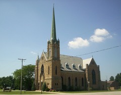
Listed places nearby
6 within 8 miles
Other National Register properties close
enough to walk or drive between, ordered by distance from this one. Both
positions come from the same geocoding pass that matched these properties
to their map sheets.
Listing record. National Park Service National Register of Historic Places, listed-properties dataset, current to 2026-05-22.
Map join. Address geocoded through the United States Census geocoder, then tested against the published boundary of every sheet in the USGS Historical Topographic Map Collection.
How this page is made. Listing fields come from federal records; map-sheet coverage is a labelled coordinate-to-boundary calculation, not a source-field claim.
Wildfire. Short, Karen C. 2022. Spatial wildfire occurrence data for the United States, 1992-2020 [FPA_FOD_20221014]. 6th Edition. Fort Collins, CO: Forest Service Research Data Archive. https://doi.org/10.2737/RDS-2013-0009.6 Collected with United States Government funding and usable without additional permissions or fees.
Specimens. Global Biodiversity Information Facility (GBIF), https://www.gbif.org/. Only records licensed CC0 or CC BY are used. Records licensed CC BY-NC are excluded because this site carries advertising. Images are checked individually and any whose licence is non-commercial, no-derivatives or unreadable is refused.
Storms. NOAA National Centers for Environmental Information, Storm Events Database https://www.ncei.noaa.gov/stormevents/ A work of the United States government, no copyright under 17 U.S.C. 105. Narratives are quoted verbatim from the National Weather Service report and are not edited or summarised.
 Block
Block