 Block
Block
Spencerville, Ohio
14 topographic sheets cover this place, the earliest surveyed in 1911 and the latest in 1986. It stands in Spencer Township. It lies in ZIP code area 45887. The Survey maps it on the Spencerville quadrangle. 2,198 people lived here at the 2020 count. It stands 830 feet above sea level.
Population over time
3 figuresSpencerville fell from 2,223 to 2,198 between 2010 and 2020. These are the recorded population figures Wikidata holds for this place, reached through the Geographic Names Information System number this page is keyed on rather than by name, so they belong to this place and not to another of the same name. Most are census counts, but not all are: an early figure may be a founding or settlement estimate. The change column is computed, and is left blank where more than 20 years separate a figure from the one before it, because a gap that long is not a change between two counts.
| Year | People | Change |
|---|---|---|
| 2010 | 2,223 | |
| 2018 | 516 | -1,707 (-77%) |
| 2020 | 2,198 | +1,682 (+326%) |
Then and now
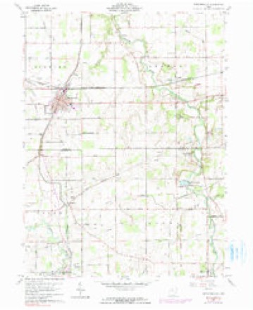
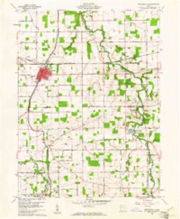
1911 to 1986The same ground, surveyed 75 years apart. Drag the handle to wipe between them. Both sheets are United States Geological Survey originals; neither has been altered.

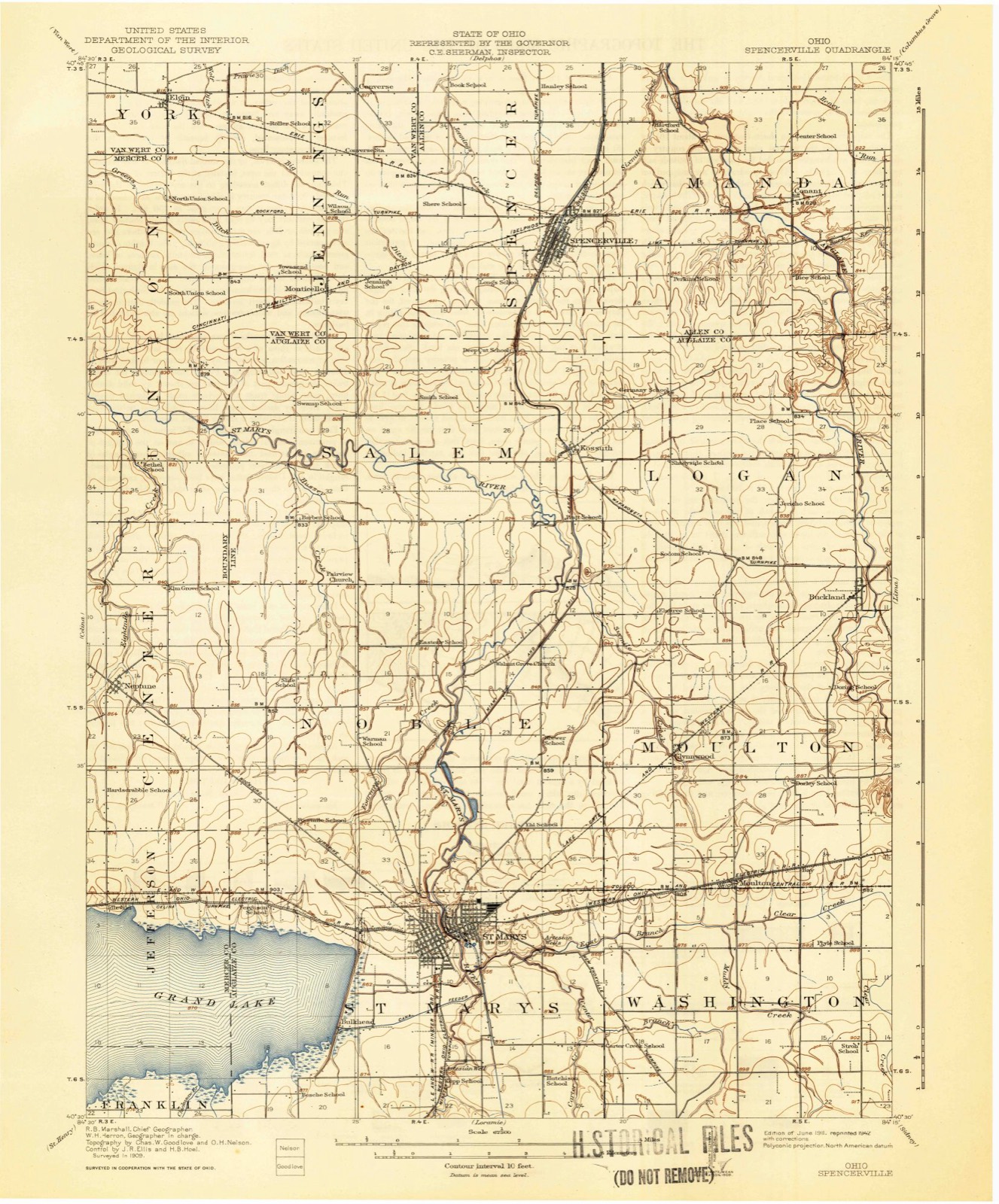
Topographic sheets covering this place
14 sheetsMatched by testing this settlement's coordinate against the published boundary of every sheet in the United States Geological Survey's historical collection. Each opens the scanned sheet at the Survey.
- 1911 USGS Spencerville quadrangle1:62500
- 1944 USGS Spencerville quadrangle1:62500
- 1953 USGS Muncie quadrangle1:250000
- 1953 USGS Muncie quadrangle1:250000
- 1953 USGS Muncie quadrangle1:250000
- 1953 USGS Muncie quadrangle1:250000
- 1953 USGS Muncie quadrangle1:250000
- 1956 USGS Muncie quadrangle1:250000
- 1960 USGS Spencerville quadrangle1:24000
- 1960 USGS Spencerville quadrangle1:24000
- 1960 USGS Spencerville quadrangle1:24000
- 1986 USGS Lima quadrangle1:100000
- 1986 USGS Lima quadrangle1:100000
- 1986 USGS Lima quadrangle1:100000









In the county-history sources
23,566 words on this townshipHistory of Allen County, Ohio. Containing a History of the County, Its Townships, Towns, Villages, Schools, Churches, Industries, Etc; Portraits of Early Settlers and Prominent Men; Biographies; History of the Northwest Territory; History of Ohio; Statistical and Miscellaneous Matter, Etc., Etc, published 1885 names this settlement in its chapter on Spencer Township. These are the passages that mention it, exactly as the scans read.
Previons to 1848 what is now fractional Township 8 and 4 sonth, Bange 4 east, was Tarionsly attached. One part belonged to Jennings, another to Salem and still another to Amanda. Whatever attempts were made to establish a school in the territory now called Spencer were of the faintest character; jet school privileges were not totally wanting to the youth of the district; for along its borders, the subscription school and even the conmion school of our own days, were in existence. The condition of the schools of Spencer and Spencenrille at present is shown in the following abstract of reports for 1884: Spencenrille School Distnct: Receipts for 1884, $2,196.72, expenditures, $1,947.89. There is one schoolhouse valued at $8,000. Four teachers are employed. The number of pupils enrolled is 289 - 148 boys and 141 girls. Spenoer Township Schools: Revenue in 1884 was $8,198.06, expenditure $1,897. There are 212 pupils enrolled, of whom 107 are boys and 105 girls.
Passage source: History of Allen County, Ohio. Containing a History of the County, Its Townships, Towns, Villages, Schools, Churches, Industries, Etc; Portraits of Early Settlers and Prominent Men; Biographies; History of the Northwest Territory; History of Ohio; Statistical and Miscellaneous Matter, Etc., Etc, published 1885.
Spenoerville, in Spencer Township, was platted in 1845-46 by Conover, McGonnell and Tyler of Dayton, Ohio, at the time they built their first mill at the lower lock. Hartford, an old settlement in this tovmship, ceased to exist on the establishment of Spencerville. The population of the village in 1880 was 582. At the close of 1884 the estimated number of inhabitants was 800.
Passage source: History of Allen County, Ohio. Containing a History of the County, Its Townships, Towns, Villages, Schools, Churches, Industries, Etc; Portraits of Early Settlers and Prominent Men; Biographies; History of the Northwest Territory; History of Ohio; Statistical and Miscellaneous Matter, Etc., Etc, published 1885.
Methodist Episcopal Churchy at Spencerville, was attached to the Acadia Circuit On August 1, 1851, the ofScial members of Spencer Mission assembled with William A. Baker, P. 0.; Samuel Dillinger and Charles Post, stewards; Israel Slausson, leader, present In August, 1851, the first quarter meeting was held at Hartford, with Wesley Brock, P. K In addition to the ofScers named above. Nelson Hayes, Alanson Hayes, Silas Myers, William Ehine, Horace Bixby. The names of original members of record in 1857 are Branson J. Miller and wife, William Gamble and wife, Samuel Dillinger and wife, J. G. Young, Alfred Fritz. Jane Nye, Rebecca Dillinger, Benjamin Hall, G. W. Eirkbride, James Lee Gamble and wife, Francis Hall and wife, M Ellen Dibble, Melinda Young, Nancy Young, Horace Bixby and wife, Mary Barker, Catherine Nell, Eliza Heffher, Henry Miller, Margaret Stradley. In 1859, Spencer was attached to Delphoe Circuit In 1868, Messrs. Post, Cochran and Hover were elected a building committee. There are three appointments now in the Spencerrille Circuit Of the 170 members of the circuit, seventy belong to Spencerrille, where also is a church property valued at 14,000.
Passage source: History of Allen County, Ohio. Containing a History of the County, Its Townships, Towns, Villages, Schools, Churches, Industries, Etc; Portraits of Early Settlers and Prominent Men; Biographies; History of the Northwest Territory; History of Ohio; Statistical and Miscellaneous Matter, Etc., Etc, published 1885.
Machine-read from a century-old scan, so expect the errors a machine makes: misspelled names, dropped words, stray characters.
Read the whole chapter on Spencer Township - it names this place 54 more 54 times.
Specimens collected near this place
12 of 223 shownRegional context, not property-specific evidence. Museums hold 223 specimens collected within 10 miles of Spencerville between 1865 and 1975: 221 Animalia, 2 Plantae. 12 distinct Species records are shown. Collected by *ood, Almen N., Buhlman, M. & Buhlman, M., Bureau of Fisheries and others. Each is a physical object with a catalogue number, and each entry opens the museum's record. This is what was collected and kept, not a survey of what lives here - nothing can be concluded from a species being absent.
| Image | Species | Year | Collected by | Where, as recorded |
|---|---|---|---|---|
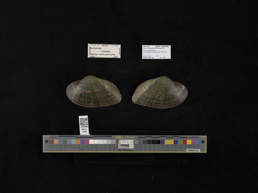 | Alasmidonta marginata Say, 1818 | 1908 | not recorded | Auglaize River, Defiance |
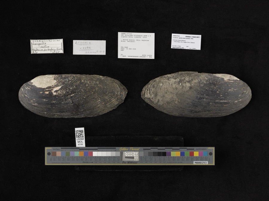 | Ligumia recta (Lamarck, 1819) | 1908 | Bureau of Fisheries | Auglaize River, Defiance |
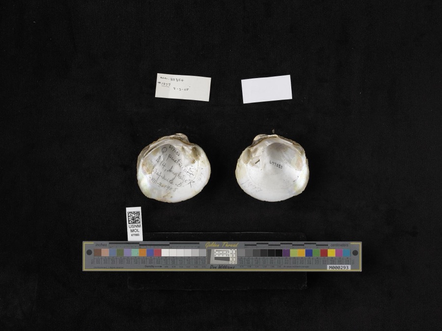 | Quadrula pustulosa (I.Lea, 1831) | 1908 | not recorded | Auglaize River, Defiance |
 | Lophanthus nepetoides (L.) Benth. | 1865 | Holzer, L. | Delphos |
 | Hybopsis biguttatus (Kirtland, 1840) | 1929 | Trautman, M. B. (Milton Bernard) | Auglaize River, within Amanda township, near Spencerville, Amanda township |
 | Moxostoma erythrurum (Rafinesque, 1818) | 1929 | Trautman, M. B. (Milton Bernard) | Auglaize River, within Amanda township, near Spencerville, Amanda township |
 | Notropis boops Gilbert, 1884 | 1929 | Trautman, M. B. (Milton Bernard) | Auglaize River, within Amanda township, near Spencerville, Amanda township |
 | Notropis rubellus (Agassiz, 1850) | 1929 | Trautman, M. B. (Milton Bernard) | Auglaize River, within Amanda township, near Spencerville, Amanda township |
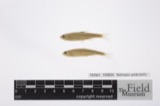 | Notropis umbratilis (Girard, 1856) | 1929 | Trautman, M. B. (Milton Bernard) | Auglaize River, within Amanda township, near Spencerville, Amanda township |
 | Notropis volucellus volucellus | 1929 | Trautman, M. B. (Milton Bernard) | Auglaize River, within Amanda township, near Spencerville, Amanda township |
 | Opsopoeodus emiliae Hay, 1881 | 1929 | Trautman, M. B. (Milton Bernard) | Auglaize River, within Amanda township, near Spencerville, Amanda township |
 | Ambloplites rupestris rupestris (Rafinesque, 1817) | 1941 | Trautman, M. B. (Milton Bernard) | Auglaize River, Sec 22 of Logan township, ~4.3 mi N of Buckland, Logan township |
All 223 specimens within 10 miles, at the Global Biodiversity Information Facility.
Mines and quarries near this place
3 within 5 milesRegional context, not property-specific evidence. The federal mineral resources record lists 3 workings within 5 miles of Spencerville: 1 past producer, 1 producer, 1 plant. 2 still produce. What was taken out: Clay, Stone, Crushed/Broken. Distance is straight-line from the map coordinates, so a quarry counted here may appear on a neighbouring settlement's page as well.
| Where | Site | Commodity | Status | Recorded |
|---|---|---|---|---|
| Suever Stone Quarry & Mill | Stone, Crushed/Broken | Plant | ||
| Sandkuhl Tiie Clay Pit | Clay | Past Producer | Sedimentary | |
| Sandkuhl Tile Co Pit | Clay | Producer |
Storms near this place
16 since 1994Regional context, not property-specific evidence. The National Weather Service names Spencerville in 16 storm reports between 1994 and 2019: 12 thunderstorm wind, 2 hail, 1 flash flood, 1 tornado. No death or injury is recorded in these reports. Each account below is quoted exactly as the forecast office filed it, from the NOAA Storm Events Database, and each date opens the federal record of that event.
| When | Event | Place named | Harm | What the report says |
|---|---|---|---|---|
| June 2006 | Thunderstorm Wind | Spencerville | $10,000 | Barn moved about 2 feet off the foundation. Several trees and power lines blown down. |
| May 2009 | Thunderstorm Wind | Spencerville | $7,500 | Emergency management officials reported a portion of the roofing on a barn was removed. In addition, a power pole and several lines were blown down. Damage is estimated at $7,500. |
| August 2019 | Thunderstorm Wind | Spencerville | - | The public reported a few tree limbs were blown down. |
| March 2017 | Thunderstorm Wind | Spencerville | - | Local media reported trees and power lines were blown down. |
| July 2017 | Hail | Spencerville | - | Local media relayed pictures of hail slightly larger than the size of quarters. |
| July 2014 | Thunderstorm Wind | Spencerville | - | Amateur radio operators reported a four inch diameter tree limb was broken off at State Route 117 and State Route 66. |
| August 2012 | Thunderstorm Wind | Spencerville | - | Amateur radio operators reported several trees down, including one on Mulberry Street in Spencerville. |
| April 2011 | Tornado (EF0) | Spencerville | - | A tornado continued into Allen County from Van Wert County impacting several structures. A large pole barn had roughly one-third of the roof removed, with a older barn being destroyed and debris thrown towards a residence. A piece of board was driven into the side of the home with debris being carried about a half mile to the north and east, being lifted over a tract of trees. The circulation appears to have lifted shortly after depositing the debris. The maximum width of the tornado was around 100 yards and winds were estimated in the 95 to 100 mph range. |
| August 2010 | Thunderstorm Wind | Spencerville | - | Law enforcement officials reported a large tree down. |
| July 2010 | Thunderstorm Wind | Spencerville | - | A trained spotter reported tree limbs down. In addition, a boat and boat trailer were shifted a short distance. |
| May 2006 | Thunderstorm Wind | Spencerville | - | Large tree blown down. |
| August 2005 | Thunderstorm Wind | Spencerville | - | A large tree was blown down. |
| September 2004 | Flash Flood | Spencerville | - | Several county and state roads reported closed due to flash flooding. A foot of water reported flowing over roads. |
| July 2003 | Thunderstorm Wind | Spencerville | - | Law enforcement reported trees down in Spencerville. |
| September 2002 | Thunderstorm Wind | Spencerville | - | Emergency management reported a tree down as a result of the wind gust. |
| September 1994 | Hail | Spencerville | - | ,,,,,,,,Thunderstorm Winds Winds reported at 60 mph combined with large hail damaged crops. |
Nearest settlements
The eight closest, with where each one stands in the county. Distances are straight-line, computed from the Geographic Names Information System coordinates.
| Map | Place | Distance | Sheets |
|---|---|---|---|
| Village Courts II | 0.3 miles | 14 | |
| Village Courts I | 0.7 miles | 14 | |
| Hartford (historical) | 2.8 miles | 14 | |
| Southworth | 3.9 miles | 14 | |
| Conant | 3.9 miles | 14 | |
| Needmore (historical) | 5.4 miles | 14 | |
| Landeck | 6.6 miles | 14 | |
| Kemp | 7.0 miles | 14 |
Elsewhere
Matched on this settlement's Geographic Names Information System number rather than its name, so it cannot be a different place of the same name in another state.
| Wikipedia article on Spencerville | An encyclopaedic summary. Its text is share-alike, so it is linked here rather than copied. |
| Wikidata item Q1873471 | The structured record the population and elevation above come from. Public domain (CC0). |
Provenance
This settlement is recorded in the Geographic Names Information System as feature 1065366. The sheet list is computed by point-in-boundary test against the United States Geological Survey's historical topographic inventory. Both are works of the United States government and carry no copyright under 17 U.S.C. 105.
Specimens. Global Biodiversity Information Facility (GBIF), https://www.gbif.org/. Only records licensed CC0 or CC BY are used. Records licensed CC BY-NC are excluded because this site carries advertising. Images are checked individually and any whose licence is non-commercial, no-derivatives or unreadable is refused.
Mines and quarries. USGS Mineral Resources Data System (MRDS) https://mrdata.usgs.gov/mrds/ A work of the United States government, no copyright under 17 U.S.C. 105.
Storms. NOAA National Centers for Environmental Information, Storm Events Database https://www.ncei.noaa.gov/stormevents/ A work of the United States government, no copyright under 17 U.S.C. 105. Narratives are quoted verbatim from the National Weather Service report and are not edited or summarised.