 Block
Block
Troy, Ohio
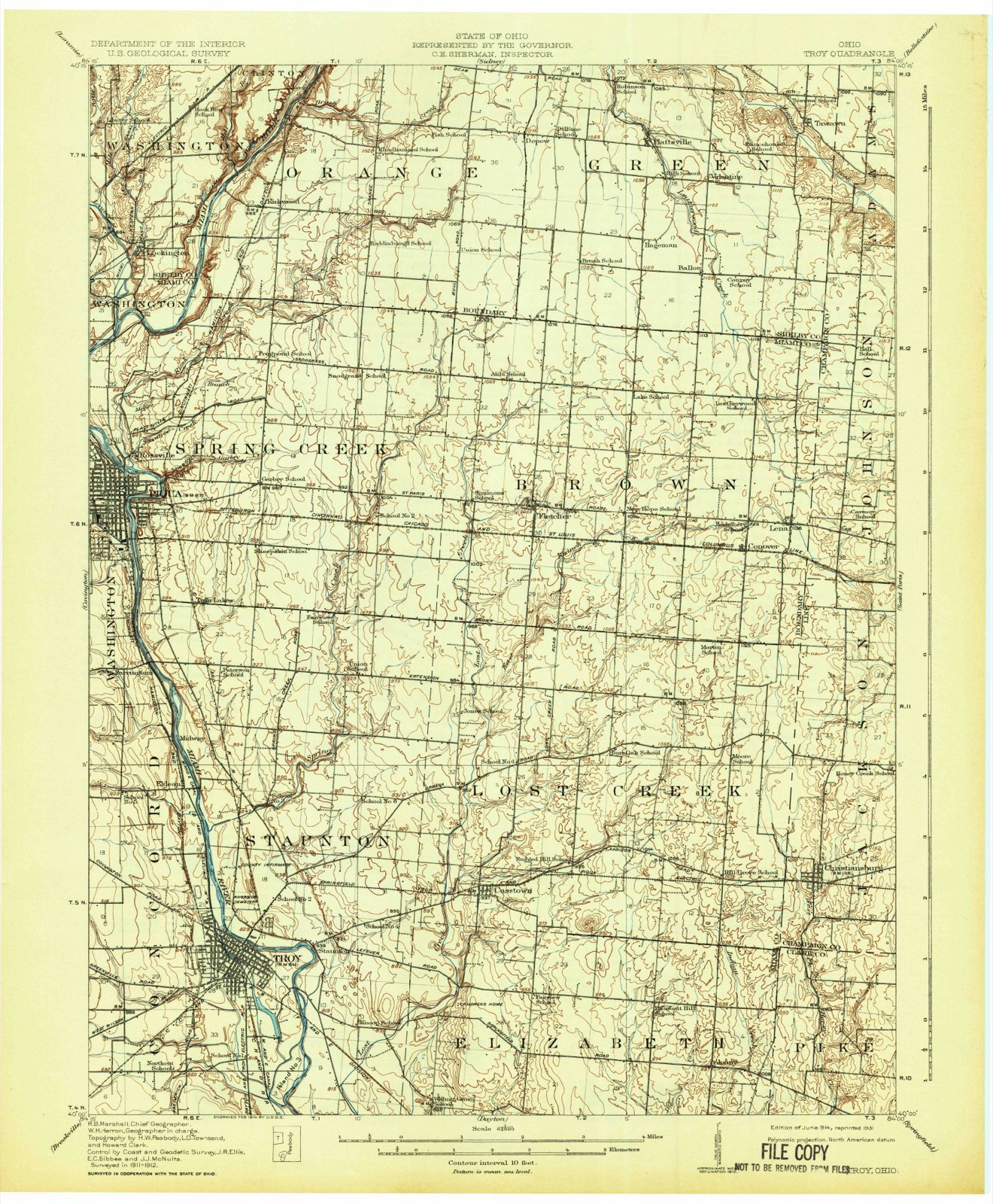
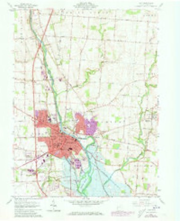
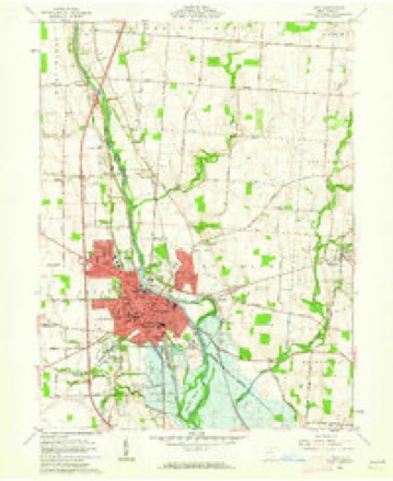
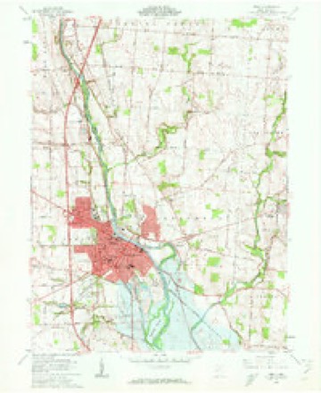
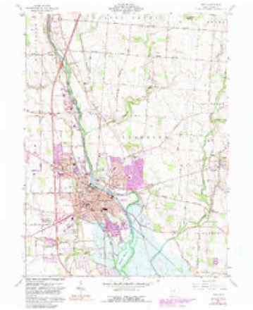
17 topographic sheets cover this place, the earliest surveyed in 1914 and the latest in 1986. It stands in Concord Township. It lies in ZIP code area 45373. The Survey maps it on the Troy quadrangle. 26,305 people lived here at the 2020 count. It stands 827 feet above sea level.
Research this city
This curated hub for Miami County, Ohio brings together the page's documented record links, visible map or image evidence where published, and routes to related local records.
What is documented here?
Use the page's provenance and linked records to distinguish the source material from the site's navigation and summaries.
How should I cite it?
Open the original record, preserve its repository and identifier, then use the citation tool for this page as a path back to the source.
Where should I go next?
Follow the county or state hub for related places and records, then use the guide for a source-aware research sequence.
Population over time
3 figuresTroy grew from 1,222 to 26,305 between 1840 and 2020. These are the recorded population figures Wikidata holds for this place, reached through the Geographic Names Information System number this page is keyed on rather than by name, so they belong to this place and not to another of the same name. Most are census counts, but not all are: an early figure may be a founding or settlement estimate. The change column is computed, and is left blank where more than 20 years separate a figure from the one before it, because a gap that long is not a change between two counts.
| Year | People | Change |
|---|---|---|
| 1840 | 1,222 | |
| 2010 | 25,058 | |
| 2020 | 26,305 | +1,247 (+5%) |
Then and now
1914 to 1986The same ground, surveyed 72 years apart. Drag the handle to wipe between them. Both sheets are United States Geological Survey originals; neither has been altered.

Topographic sheets covering this place
17 sheetsMatched by testing this settlement's coordinate against the published boundary of every sheet in the United States Geological Survey's historical collection. Each opens the scanned sheet at the Survey.
- 1914 USGS Troy quadrangle1:62500
- 1914 USGS Troy quadrangle1:62500
- 1944 USGS Troy quadrangle1:62500
- 1953 USGS Muncie quadrangle1:250000
- 1953 USGS Muncie quadrangle1:250000
- 1953 USGS Muncie quadrangle1:250000
- 1953 USGS Muncie quadrangle1:250000
- 1953 USGS Muncie quadrangle1:250000
- 1956 USGS Muncie quadrangle1:250000
- 1961 USGS Troy quadrangle1:24000
- 1961 USGS Troy quadrangle1:24000
- 1961 USGS Troy quadrangle1:24000
- 1961 USGS Troy quadrangle1:24000
- 1961 USGS Troy quadrangle1:24000
- 1986 USGS Piqua quadrangle1:100000
- 1986 USGS Piqua quadrangle1:100000
- 1986 USGS Piqua quadrangle1:100000










In the county-history sources
64,480 words on this townshipMiami County Ohio Federal Population Census, published 1850; The History of Miami County, Ohio, published 1880 names this settlement in its chapter on Concord Township. These are the passages that mention it, exactly as the scans read.
Bayman, Sophia 2f Hamilton, Alexander 45mB James 14mB Mary A. dene Jerome 11mB Alexander 9mB Biddle, James 46m Hannah 45f Caroline 20f Mary E. 18f Emily 14f Richard 13m Morris 10m Charles 7m Ella Si, Hamilton, Henry 21m Jane 20 More, John 24m Catherine 24f Wm. 2m Mary TA 1S Ross, Hugh 21m Reese, Jeremiah 53m Mary 49f Fisher, Sarah 14f Crouse, John 27m Almeade 2 1F Wm. A. 6m Mary Emily 1f Cole, Edward 28m Rebecca 23n John 2m Smith, Philip A. 41m Jinette B. 30f Sydney 5m Franklin 3m Philip A. 1m Ballow, George 16m Smith, Moses 6m cont.
Passage source: Miami County Ohio Federal Population Census, published 1850.
This township is centrally located, bounded on the north by Washington, on the' east by the Miami River, on the south by Monroe and part of Union, and on the west by Newton ; organized about 1807, and named by the Commissioners appointed for that purpose, Concord, vying with the name given by Samuel Jones to Union. Traversed by excellent turnpikes in all directions, her eastern border laved by the Great Miami, along which runs the canal, drained by numerous streams ; rich and fertile soil, capable, within itself, of perpetual regeneration ^excellent building material, both stone and timber ; central market, in the seat of justice for her produce - she is truly in a happy position to enjoy all the facilities tending to prosperity in every direction. v
Passage source: The History of Miami County, Ohio, published 1880.
Among the early settlers, we may mention Aaron Tullis, who came from Kentucky by way of Dayton, in a wagon, with a family of boys, arriving here in 1805 ; William Barbee, who came about 1804 ; Reuben Shackelford, Alexander Telford. In 1806, John Peck, with eight children, Jacob, John, Joseph, Isaac, and four daughters, came from Kentucky and settled on Boone's place, one and a nau miles from Troy. Mr. Peck came in the winter, selected his land and bought loU acres/ with one acre cleared, for $100. It had a little log-cabin on it, one room 16x18. His stock having been brought from Kentucky, nearly all died the second year, losing eleven horses, besides sheep, hogs and cattle, only leaving him one mare, two or three cows and a few sheep. His land was of the best in the country, having four fine springs and good soil.
Passage source: The History of Miami County, Ohio, published 1880.
Machine-read from a century-old scan, so expect the errors a machine makes: misspelled names, dropped words, stray characters.
Read the whole chapter on Concord Township - it names this place 167 more 167 times.
Photographs
1 photograph,Taken for the Office of War Information and the Farm Security Administration, who photographed the country between 1935 and 1944. Works of United States government photographers, with no known restriction on use. Each opens its catalogue record.
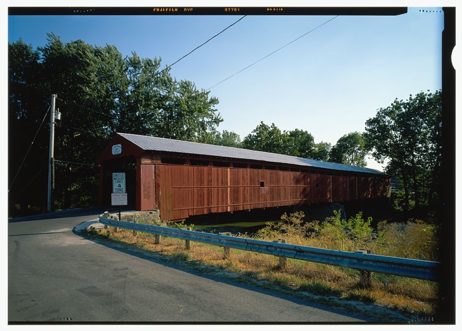
Unattributed, . Library of Congress
Specimens collected near this place
12 of 386 shownRegional context, not property-specific evidence. Museums hold 386 specimens collected within 10 miles of Troy between 1835 and 1975: 353 Animalia, 16 Fungi, 12 Plantae, 3 Protozoa, 1 Unrecorded, 1 Chromista. 12 distinct Species records are shown. Collected by A V DEL, A. Gaufin, A. R. Gaufin and others. Each is a physical object with a catalogue number, and each entry opens the museum's record. This is what was collected and kept, not a survey of what lives here - nothing can be concluded from a species being absent.
| Image | Species | Year | Collected by | Where, as recorded |
|---|---|---|---|---|
 | Quercus macrocarpa Michx. | 1835 | Frank | |
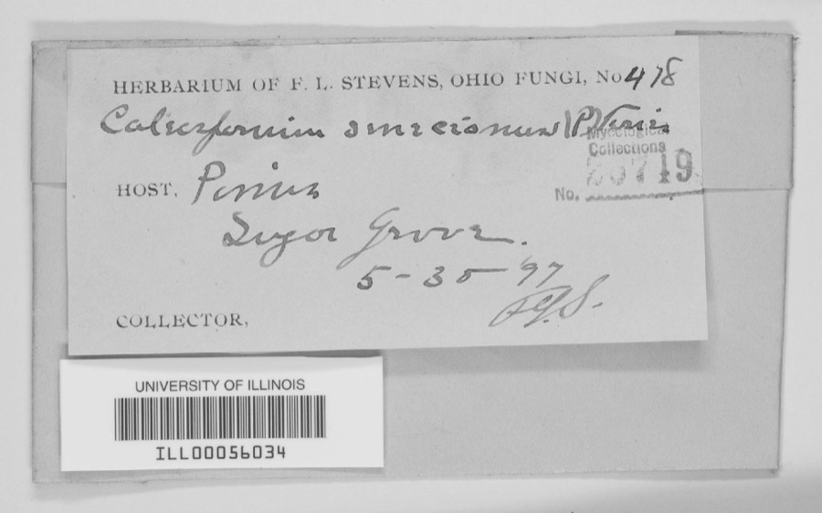 | unnamed | 1897 | F. L. Stevens | Sugar Grove. |
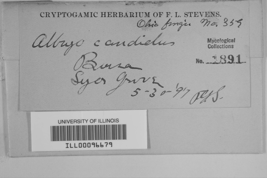 | Albugo candida (Pers. ex J.F.Gmel.) Roussel | 1897 | F.L. Stevens | Sugar Grove |
 | Carex albursina E.Sheld. | 1835 | Collector unknown | |
 | Carex emmonsii var. muhlenbergii (A.Gray ex Torrey) Rettig | 1835 | Collector unspecified | |
 | Gentianella quinquefolia subsp. occidentalis (A.Gray) J.M.Gillett | 1835 | Joseph C. Frank | Ohio, in ditione civitatis Miami |
 | Cercosporina apii (Fresen.) Miura | 1896 | Skinner C. W. | Troy |
| Marssonina panattoniana (Berl.) Magnus | 1896 | Skinner C. W. | Troy | |
 | Ceratiomyxa fruticulosa var. arbuscula (Berk. & Broome) Nann.-Bremek., 1975 | 1897 | Thaxter, R. | USA, Florida, Cocoanut Grove |
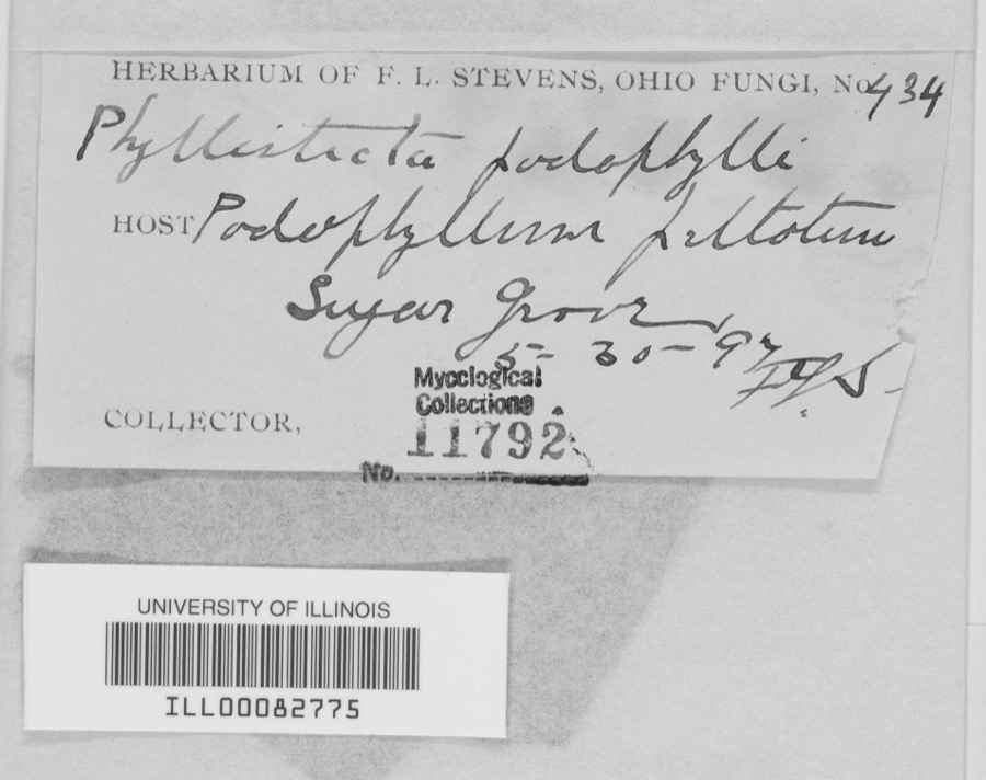 | Phyllosticta podophylli (M.A.Curtis) G.Winter | 1897 | F.L. Stevens | |
 | Lanius ludovicianus Linnaeus, 1766 | 1898 | Collector(s): L. Kumlein | Milton, Ohio |
 | Daedalea confragosa (Bolton) Pers. | 1906 | Fischer G. C. | Troy |
All 386 specimens within 10 miles, at the Global Biodiversity Information Facility.
Mines and quarries near this place
8 within 5 milesRegional context, not property-specific evidence. The federal mineral resources record lists 8 workings within 5 miles of Troy: 5 past producers, 2 producers, 1 plant. 3 still produce. What was taken out: Sand and Gravel, Construction, Stone, Crushed/Broken, Clay, Limestone, General. Distance is straight-line from the map coordinates, so a quarry counted here may appear on a neighbouring settlement's page as well.
| Where | Site | Commodity | Status | Recorded |
|---|---|---|---|---|
| Hanover Pit | Clay | Producer | ||
| Tipp Stone Quarry | Stone, Crushed/Broken | Past Producer | ||
| Tipp Stone Quarry | Limestone, General | Past Producer | Sedimentary | |
| Eldean Pit | Sand and Gravel, Construction | Past Producer | Sedimentary | |
| Eldean Pit | Sand and Gravel, Construction | Producer | ||
| Tipp Pit and Mill | Sand and Gravel, Construction | Past Producer | ||
| Troy Pits | Sand and Gravel, Construction | Past Producer | Sedimentary | |
| Troy Plant & Pit | Sand and Gravel, Construction | Plant |
Storms near this place
60 of 62 shownRegional context, not property-specific evidence. The National Weather Service names Troy in 62 storm reports between 1994 and 2025: 38 thunderstorm wind, 8 hail, 8 flood, 2 lightning. The reports record 4 injuries. Each account below is quoted exactly as the forecast office filed it, from the NOAA Storm Events Database, and each date opens the federal record of that event.
| When | Event | Place named | Harm | What the report says |
|---|---|---|---|---|
| June 2007 | Lightning | Troy | 3 hurt | A man and his two sons were standing underneath a tree when it was struck by lightning at the Troy Strawberry Festival. The three individuals suffered non life-threatening injuries. |
| June 1996 | Lightning | Troy | 1 hurt | no account filed |
| January 2020 | Tornado (EF0) | Troy | $500,000 | The tornado touched down initially in the southwest portions of the city of Troy and moved northeast through the center of the city. It then crossed the Great Miami River before it weakened and lifted in the far northeast portions of the city.||Much of the damage was confined to trees and roofs, both residential and commercial, as the tornado moved through the city. To the west of the Great Miami River, damage was more intermittent and weak in comparison to areas east of the Great Miami River, where more concentrated and significant tree and roof damage was noted. In particular, areas near Troy High School and along and east of North Market Street saw the most concentrated and higher end structural damage to roofing material. This included the far eastern portions of the downtown area which saw several businesses lose all or portions of their roofs.||Damage was tornadic in nature, especially on the east side of the Great Miami River, where convergent tree damage was easily noted before the tornado rapidly weakened as it left the city. Damage along the path was consistent with wind speeds ranging from 65 to 80 mph, again with the highest wind speeds estimated on the east side of the Great Miami River. |
| July 2022 | Tornado (EF1) | Troy | $100,000 | The initial damage occurred near the intersection of Cheshire Road and Dorset Road, where several large tree limbs were downed. Damage became a little more concentrated near the intersection of Armand Drive and McKaig Avenue, where several large tree limbs and a few trees were downed. Tree damage also occurred at an apartment complex along Red Cedar Drive.||The most heavily concentrated area of damage occurred near Drury Lane and Ridge Avenue. Numerous very large, healthy trees were downed, with one trunk snapped at its base, and several other very large branches snapped not far off the ground. A couple of homes also had some minor roof damage. On West Simpson Street, just to|the east, a car was heavily damaged by a falling tree limb.||The damage path became narrower near Terrace Place, Market Street, and West Street. A bank sign was damaged and several more large trees and tree limbs were downed. In the neighborhood south of West Street, a few more homes had minor roof damage, with a fairly consistent area of tree damage observed as far southeast as Walker Street and Dakota Street.||Tree damage was also reported in other locations in Troy, such as Stanfield Road, West Ross Street, and Dakota Street. The rest of this damage is believed to have been caused by straight-line winds with speeds of 60 to 70 MPH. |
| July 1994 | Thunderstorm Wind | Troy | $50,000 | Trees were downed, some on cars and power lines. |
| December 2013 | Flood | Troy | $20,000 | Ten to twelve home evacuations were required near the Great Miami River. Two water rescues occurred from people driving into the flood waters. |
| November 2020 | Thunderstorm Wind | Troy | $15,000 | Numerous trees were downed throughout the county. |
| July 2006 | Thunderstorm Wind | Troy | $15,000 | Numerous trees and powerlines were downed. A building sustained roof damage at the Miami County Fairgrounds. A tree also fell on a vehicle, causing minor damage. |
| July 2000 | Thunderstorm Wind | Troy | $10,000 | Numerous trees and power lines were knocked down, some of them across roads. |
| June 2008 | Hail | Troy | $8,000 | no account filed |
| May 2024 | Thunderstorm Wind | Troy | $5,000 | A tree fell onto a house on South Mulberry Street. |
| July 2024 | Thunderstorm Wind | Troy | $5,000 | Several large trees were downed along Mckaig Avenue just south of Hobart Nature Preserve. |
| July 2013 | Thunderstorm Wind | Troy | $5,000 | Several trees and branches were downed in Troy due to thunderstorm winds. |
| February 2011 | Flood | Troy | $5,000 | Several roads were closed due to heavy rain and snow melt. |
| May 2001 | Thunderstorm Wind | Troy | $5,000 | Two permanent signs blown down. |
| April 1994 | Thunderstorm Wind | Troy | $5,000 | Trees downed. |
| July 1996 | Thunderstorm Wind | Troy | $5,000 | no account filed |
| December 2006 | Thunderstorm Wind | Troy | $4,000 | A tree was knocked down on Swails Road, and a telephone pole was leaning on Ross Road. |
| April 2025 | Thunderstorm Wind | Troy | $3,000 | A few trees were downed at Troy Aquatic Park. |
| July 2024 | Thunderstorm Wind | Troy | $3,000 | A few trees were downed. |
| August 2022 | Thunderstorm Wind | Troy | $3,000 | A power pole was snapped near the intersection of Crestview and Cloverdale Drives. |
| July 2012 | Thunderstorm Wind | Troy | $3,000 | Trees were uprooted and large branches were downed due to damaging thunderstorm winds. |
| January 2008 | Thunderstorm Wind | Troy | $3,000 | Several trees were knocked down. |
| May 2008 | Thunderstorm Wind | Troy | $3,000 | A couple of large tree limbs were knocked down. |
| June 2008 | Thunderstorm Wind | Troy | $3,000 | Large tree limbs were downed across the northeast side of Troy. An amateur radio operator in Piqua measured a 54 mph gust four minutes earlier. |
| March 2007 | Flood | Troy | $3,000 | Several low-lying areas were flooded in various parts of the county. |
| August 2006 | Thunderstorm Wind | Troy | $3,000 | A few large tree limbs were downed. |
| August 2003 | Thunderstorm Wind | Troy | $3,000 | Trees were knocked down. |
| July 2003 | Thunderstorm Wind | Troy | $3,000 | Trees and powerlines were downed. |
| April 2003 | Thunderstorm Wind | Troy | $3,000 | Trees and powerlines were knocked down. |
| July 2002 | Thunderstorm Wind | Troy | $3,000 | Several trees were blown down. |
| May 1998 | Thunderstorm Wind | Troy | $3,000 | Numerous trees downed. |
| July 1997 | Thunderstorm Wind | Troy | $3,000 | Several trees downed. |
| July 1995 | Thunderstorm Wind | Troy | $3,000 | Trees and power lines were downed. |
| June 1996 | Thunderstorm Wind | Troy | $3,000 | no account filed |
| April 2025 | Thunderstorm Wind | Troy | $2,000 | A six foot tall fence was blown into the road. |
| July 2009 | Flash Flood | Troy | $2,000 | Numerous roads were inundated with high water. |
| August 2006 | Hail | Troy | $2,000 | Tree limbs were also knocked down. |
| May 2004 | Thunderstorm Wind | Troy | $2,000 | A few large limbs were knocked down. |
| July 2003 | Thunderstorm Wind | Troy | $2,000 | Large limbs were knocked down. |
| July 2003 | Thunderstorm Wind | Troy | $2,000 | Several large limbs were knocked downed. |
| April 2025 | Thunderstorm Wind | Troy | $1,000 | A large evergreen was downed in Troy Park near Adams Street. |
| May 2020 | Thunderstorm Wind | Troy | $1,000 | A large tree was downed. Several large branches were also downed in the area. |
| June 2020 | Thunderstorm Wind | Troy | $1,000 | A tree was knocked down. |
| June 2017 | Thunderstorm Wind | Troy | $1,000 | A tree was knocked down on Woodcliff Drive. |
| April 2011 | Heavy Rain | Troy | $1,000 | A couple roads were covered with high water. |
| September 2020 | Thunderstorm Wind | Troy | - | The wind gust was measured on a personal weather station. |
| February 2019 | Flood | Troy | - | Numerous roads were still reported under water across the county. |
| February 2019 | Flood | Troy | - | Several roads were closed due to flooding. |
| November 2017 | Flood | Troy | - | High water was reported on several Roads across Miami County. |
| March 2016 | Thunderstorm Wind | Troy | - | Several large limbs were downed at the Troy Country Club. |
| May 2014 | Heavy Rain | Troy | - | Standing water was reported over many roads in the area. |
| December 2013 | Flood | Troy | - | State Route 202 was closed in both directions due to high water caused by earlier heavy rainfall. |
| July 2012 | Thunderstorm Wind | Troy | - | The spotter estimated the speed of the wind gust. |
| July 2006 | Flood | Troy | - | Several roads were flooded and closed. |
| January 1999 | Flash Flood | Troy | - | More than 3 inches of rain fell in only a few hours causing creeks and streams to rise out of their banks. Many roads and neighborhoods were flooded and a few buildings and homes were flooded. |
| June 2020 | Hail | Troy | - | no account filed |
| March 2011 | Hail | Troy | - | no account filed |
| March 2011 | Hail | Troy | - | no account filed |
| April 2006 | Hail | Troy | - | no account filed |
Nearest settlements
The eight closest, with where each one stands in the county. Distances are straight-line, computed from the Geographic Names Information System coordinates.
| Map | Place | Distance | Sheets |
|---|---|---|---|
| Culbertson Heights | 0.6 miles | 17 | |
| Edgehill | 0.7 miles | 17 | |
| Arbar Acres | 0.8 miles | 17 | |
| Cloverdale | 0.8 miles | 17 | |
| Park Place | 0.8 miles | 17 | |
| Westridge | 0.9 miles | 17 | |
| Hylands | 0.9 miles | 17 | |
| Southview Estates | 0.9 miles | 17 |
Elsewhere
Matched on this settlement's Geographic Names Information System number rather than its name, so it cannot be a different place of the same name in another state.
| Wikipedia article on Troy | An encyclopaedic summary. Its text is share-alike, so it is linked here rather than copied. |
| Wikidata item Q473463 | The structured record the population and elevation above come from. Public domain (CC0). |
Provenance
This settlement is recorded in the Geographic Names Information System as feature 1049252. The sheet list is computed by point-in-boundary test against the United States Geological Survey's historical topographic inventory. Both are works of the United States government and carry no copyright under 17 U.S.C. 105.
Specimens. Global Biodiversity Information Facility (GBIF), https://www.gbif.org/. Only records licensed CC0 or CC BY are used. Records licensed CC BY-NC are excluded because this site carries advertising. Images are checked individually and any whose licence is non-commercial, no-derivatives or unreadable is refused.
Mines and quarries. USGS Mineral Resources Data System (MRDS) https://mrdata.usgs.gov/mrds/ A work of the United States government, no copyright under 17 U.S.C. 105.
Storms. NOAA National Centers for Environmental Information, Storm Events Database https://www.ncei.noaa.gov/stormevents/ A work of the United States government, no copyright under 17 U.S.C. 105. Narratives are quoted verbatim from the National Weather Service report and are not edited or summarised.