Listed on the National Register of Historic Places in
1983. A historic map-sheet match is not published yet. The record needs a coordinate-quality review before it can be joined to a sheet boundary.
From the record
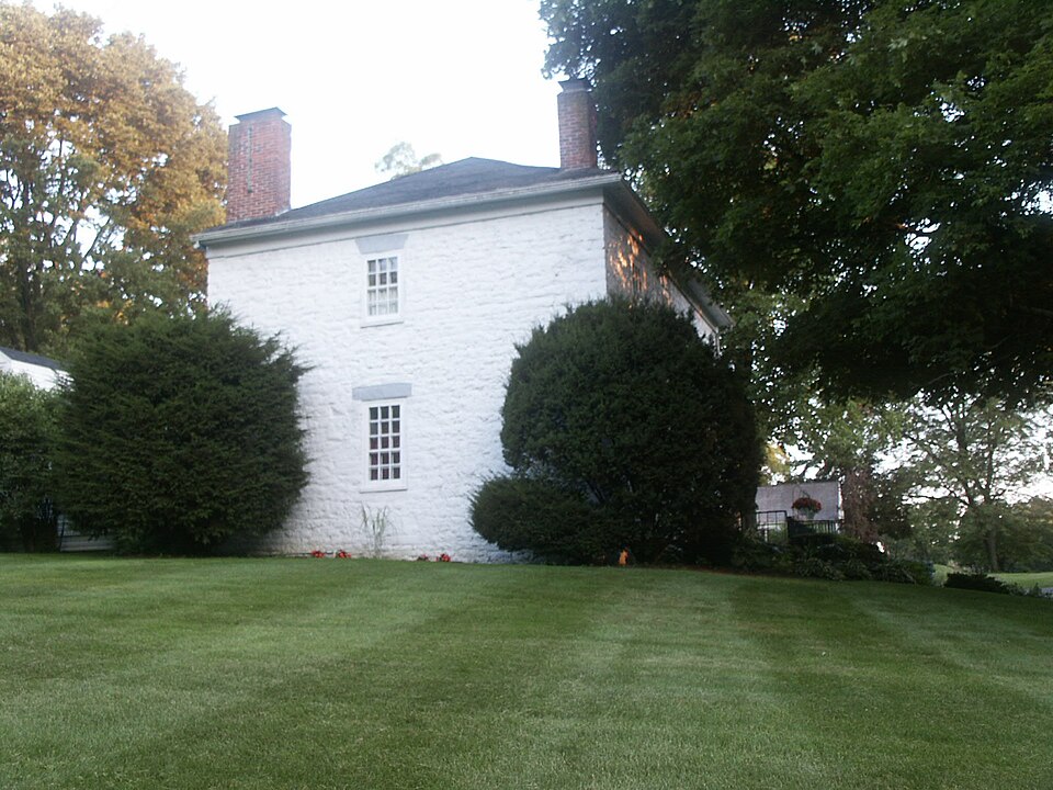
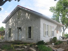
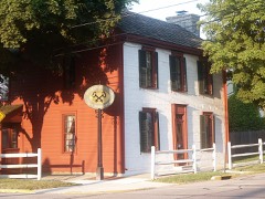
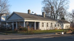
“The John Minor Dye Stone House is located at 9 South Children's Home Road east of Troy in Elizabeth Township, Miami County, Ohio. The property was listed on the National Register on 1983-07-07.”
Wikipedia article John Minor Dye Stone House, CC BY-SA 4.0.
one of 36 National Register listings in Miami County · listed in 1983 · category: Building.
National Register reference number.83002008- the number the National Park Service assigned this property when it was listed, and the key its nomination file is catalogued under at the National Archives.
What happened here
An account from the chapter on Elizabeth township, The inset identifies its exact
source book and publication year.
of 8quirrrfln1h,?t game abounded in the forests. The hunters killed large numbers encountered n Pbeafants' etc- Wolves, bears and panthers were frequently morning Thio* ^atcJ* that ^av*d H. Morris, Sr., killed three panthers in one boys to nw»ns« u.? °^d pioneer was very fond of hunting. He required his the ears was th sbooJ'bl^ daily ; when their record was poor, a general boxing of and difficult, 6 uf8-11*' Ammunition, though in active demand, was expensive every f 0Dtain* obviate all embarrassment, it became customary for sable artinlo his own powder.
The chapter on Elizabeth Township in The History of Miami County, Ohio, published 1880 names Troy. This is what it says, exactly as the scans read.
Jacob Mann erected the first distillery ; in what year we have been unable to ascertain. The next distillery of any magnitude was built by Daniel P. Yoorhis, in 1830. The many private whisky factories throughout the township are not considered worthy of notice. A Dutchman by the name of VanCulen Hampton owned the first saw-mill, situated on the land now owned by M. Hill. Perhaps, a powder-mill erected by Jacob Prillman, on Indian Creek, in 1806, is the first manufacturing establishment ever put up in the township ; the property is now in possession of William Thompson. Some years after, a man named Lusenhall engaged in the manufacturing of hats, on the site of Levi Staley's residence. In 1825, Newman Scarlet operated a turning lathe, on the present Henry Bell property, on Indian Creek. Stores were also established as they were needed. The first store was kept by Conklin, in 1831, father of John Conklin, the Corporation Clerk of Troy. Isaac Sheets and Asa French were also engaged in the sale of merchandise.
For many years, roads were comparatively unknown. The pioneer cut a path to the house of his nearest neighbor, who, in turn cut' his way to the next cabin. Thus, it will be noticed that the roads were very irregular, and traveling was necessarily slow and tedious. The road from Dye's mill to Troy was the first laid out by the County Surveyor. The first pike built through the township was the Troy and Springfield pike. At this writing, the township is traversed by three or four free pikes, intersected by a complete network of roads.
Regional context, not property-specific
evidence. The
federal wildfire occurrence database
lists 2 fires within 5 miles of Dye, John Minor, Stone House between
2002 and 2002, burning about 1 acres in total. None started naturally. None was recorded as arson.
Distance is straight-line from the map coordinates, so a fire counted
here may appear on a neighbouring settlement's page as well.
Reported cause
Fires
Equipment and vehicle use
1
Missing data/not specified/undetermined
1
The most recent of
them, most recent first, with the day each was reported and the service
that recorded it.
Regional context, not property-specific
evidence. Museums hold 212 specimens
collected within 10 miles of Dye, John Minor, Stone House between 1835 and
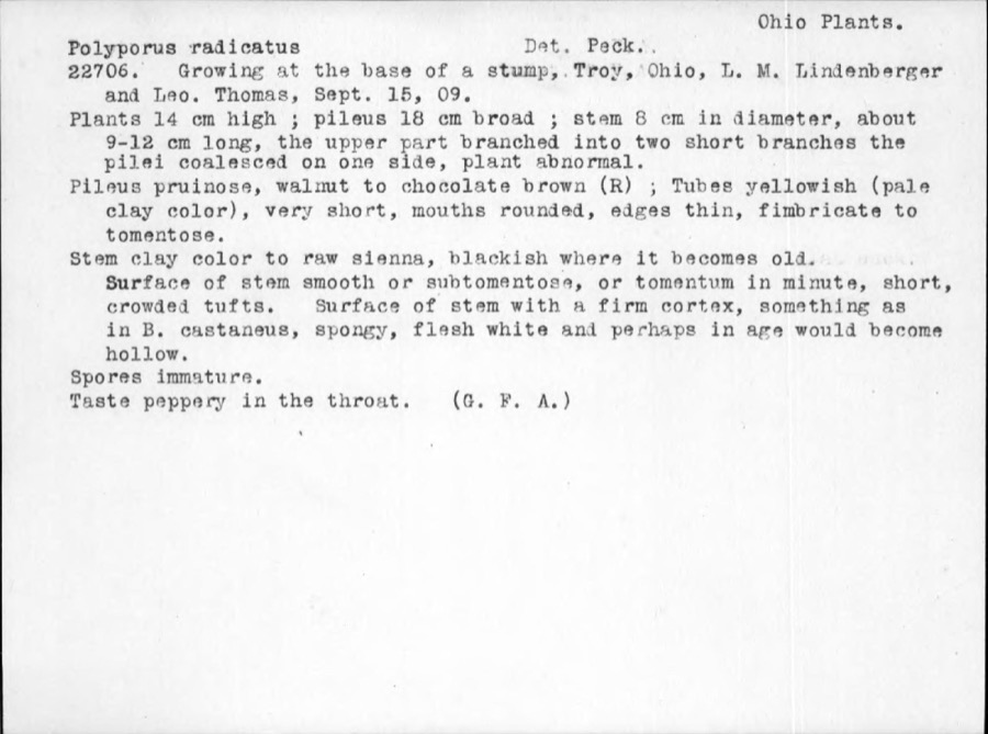
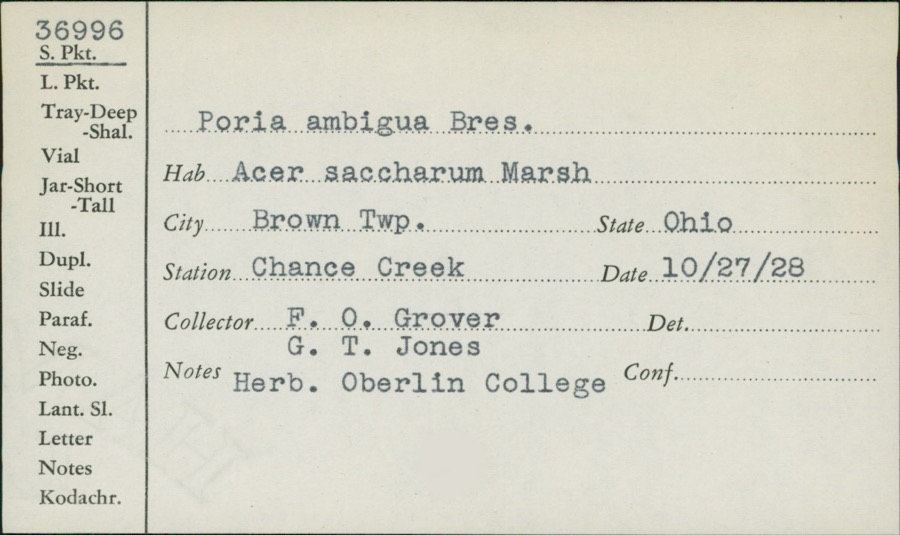
1975: 181 Animalia, 17 Fungi, 11 Plantae, 3 Protozoa. 12 distinct Species records are shown.
Collected by A. R. Gaufin, A.R. Gaufin, H.H. Ross, Adams J. M. R. and others. Each is a
physical object with a catalogue
number, and each entry opens the museum's record. This is what was
collected and kept, not a survey of what lives here - nothing can be
concluded from a species being absent.
Regional context, not property-specific
evidence. The federal mineral resources record lists
5 workings within 5 miles of Dye, John Minor, Stone House: 4 past producers, 1 plant.
1 still produces. What was taken out: Sand and Gravel, Construction, Stone, Crushed/Broken, Limestone, General. Distance is straight-line from the
map coordinates, so a quarry counted here may appear on a neighbouring
settlement's page as well.
Regional context, not property-specific
evidence. The National Weather Service names
Troy, the town this property stands in, in 62 storm reports between 1994 and 2025: 38 thunderstorm wind, 8 hail, 8 flood, 2 lightning.
The reports record 4 injuries. Each account below is quoted exactly as the forecast office
filed it, from the NOAA Storm Events Database, and each date
opens the federal record of that event.
A man and his two sons were standing underneath a tree when it was struck by lightning at the Troy Strawberry Festival. The three individuals suffered non life-threatening injuries.
The tornado touched down initially in the southwest portions of the city of Troy and moved northeast through the center of the city. It then crossed the Great Miami River before it weakened and lifted in the far northeast portions of the city.||Much of the damage was confined to trees and roofs, both residential and commercial, as the tornado moved through the city. To the west of the Great Miami River, damage was more intermittent and weak in comparison to areas east of the Great Miami River, where more concentrated and significant tree and roof damage was noted. In particular, areas near Troy High School and along and east of North Market Street saw the most concentrated and higher end structural damage to roofing material. This included the far eastern portions of the downtown area which saw several businesses lose all or portions of their roofs.||Damage was tornadic in nature, especially on the east side of the Great Miami River, where convergent tree damage was easily noted before the tornado rapidly weakened as it left the city. Damage along the path was consistent with wind speeds ranging from 65 to 80 mph, again with the highest wind speeds estimated on the east side of the Great Miami River.
The initial damage occurred near the intersection of Cheshire Road and Dorset Road, where several large tree limbs were downed. Damage became a little more concentrated near the intersection of Armand Drive and McKaig Avenue, where several large tree limbs and a few trees were downed. Tree damage also occurred at an apartment complex along Red Cedar Drive.||The most heavily concentrated area of damage occurred near Drury Lane and Ridge Avenue. Numerous very large, healthy trees were downed, with one trunk snapped at its base, and several other very large branches snapped not far off the ground. A couple of homes also had some minor roof damage. On West Simpson Street, just to|the east, a car was heavily damaged by a falling tree limb.||The damage path became narrower near Terrace Place, Market Street, and West Street. A bank sign was damaged and several more large trees and tree limbs were downed. In the neighborhood south of West Street, a few more homes had minor roof damage, with a fairly consistent area of tree damage observed as far southeast as Walker Street and Dakota Street.||Tree damage was also reported in other locations in Troy, such as Stanfield Road, West Ross Street, and Dakota Street. The rest of this damage is believed to have been caused by straight-line winds with speeds of 60 to 70 MPH.
Numerous trees and powerlines were downed. A building sustained roof damage at the Miami County Fairgrounds. A tree also fell on a vehicle, causing minor damage.
More than 3 inches of rain fell in only a few hours causing creeks and streams to rise out of their banks. Many roads and neighborhoods were flooded and a few buildings and homes were flooded.
No historic map-sheet match is published
for this property yet. That does not mean no map exists. This record needs
a coordinate-quality review before it can be joined to a sheet boundary.
Browse the county's mapped places while that work is
pending.
From the nomination file
2,552 words on record
When this property was proposed for the
National Register, someone wrote the case for it: what the building is,
and why it matters. That document is a federal record in the public domain.
It is quoted below word for word, never summarised. The text was read off the scanned case file by machine, so the
occasional stray character is the recogniser's and the 1970s
typewriter's.
Description of the property
have served early pioneers before the completion of the National Road of the square-like original portion is the roofline that forms a pyramidal fireplaces.One has been covered up and the other has been changed. because of the removal of the truss. Check one blockhouses built here near the military trail taken in l8l2 by the army The John Minor Dye Stone House is located on the east side of Lost constructed oflogs and found in faded sketches of old forts. was made into a decorative element in the kitchen and all that remains of General William Hull on his way to Detroit.This two-story limestone miles south of an early east-west trail(now State Route 36)reputed to _ deteriorated - unaltered date from from Columbus.
According to local historical publications, there were several original portion. The lower level also has a full length door that opens to the south. Under the landing is an interesting circular staircase to the lower Most of the woodwork in the house is from an early date. and this resulted in the cracking of the first floor ceiling. Exact details can not be determined and are three feet thick. Above the kitchen is space that was used as x good X altered floor. date from the first half of the nineteenth century. The interior of this two-story The walls are of rougher construction 16/6windows. in the attic is the two foot length of lower cord, one bolt and the top The truss This type of roof is more commonly noted on blockhouses portion of the wrought iron rod.
(in one paragraph) Members of the Dye family came from Pennsylvania to settle here which occurred within ten miles to the north on August 18, 1813. house in Miami County still being inhabited." None of the additions or improvements has destroyed the integrity of 1600-1699 1400-1499 1500-1599 1700-1799 1800-1899 humanitarian conservation 8. Significance philosophy literature science agriculture Period 1900- the original blockhouse.
The stone house has architectural significance because of its early from small bands of Indians who were aroused to violence during the War of purchased this land and began construction of the first mill in the According to the l880 county Dye stone house was used for on the east side of the Great Miami River as early as l799.This land, is a rare example of a type of stone fortification used by ohio's pioneer that same month that Captian John Minor soldier in the War of 1812, _ archeology-prehistoric community planning - landscape architecture _ religion _ art The John Minor Dye Stone House is historically significant because it They sought protection in this locally designated "blockhouse" as a blockhouse in the state.
The structural elements in the house state arsenal in Columbus (National Register, 1974). The house has been has only been in the ownership of two different families, which is a settlers. Specific dates truss system in the attic allowed for open unpartitioned spaces in the maintained and used as a private residence by the Curtis family. shelter by the early settlers after the Ferrard and Dilbone massacres The house has undergone some changes through the it part of the original claim made by John Cleves along the C.1813 labeled by the late local "the oldest Sutton, History of Shelby County, 1883.
Quoted from the National Register nomination
for reference 83002008, 17 pages, held by the National Archives in Record
Group 79. See the
catalogue record.
Listed places nearby
6 within 8 miles
Other National Register properties close
enough to walk or drive between, ordered by distance from this one. Both
positions come from the same geocoding pass that matched these properties
to their map sheets.
Listing record. National Park Service National Register of Historic Places, listed-properties dataset, current to 2026-05-22.
Map join. Address geocoded through the United States Census geocoder, then tested against the published boundary of every sheet in the USGS Historical Topographic Map Collection.
How this page is made. Listing fields come from federal records; map-sheet coverage is a labelled coordinate-to-boundary calculation, not a source-field claim.
Wildfire. Short, Karen C. 2022. Spatial wildfire occurrence data for the United States, 1992-2020 [FPA_FOD_20221014]. 6th Edition. Fort Collins, CO: Forest Service Research Data Archive. https://doi.org/10.2737/RDS-2013-0009.6 Collected with United States Government funding and usable without additional permissions or fees.
Specimens. Global Biodiversity Information Facility (GBIF), https://www.gbif.org/. Only records licensed CC0 or CC BY are used. Records licensed CC BY-NC are excluded because this site carries advertising. Images are checked individually and any whose licence is non-commercial, no-derivatives or unreadable is refused.
Mines and quarries. USGS Mineral Resources Data System (MRDS) https://mrdata.usgs.gov/mrds/ A work of the United States government, no copyright under 17 U.S.C. 105.
Storms. NOAA National Centers for Environmental Information, Storm Events Database https://www.ncei.noaa.gov/stormevents/ A work of the United States government, no copyright under 17 U.S.C. 105. Narratives are quoted verbatim from the National Weather Service report and are not edited or summarised.
 Block
Block