 Block
Block
Wooster, Ohio
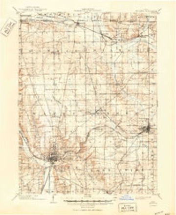
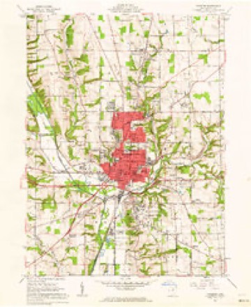
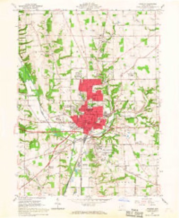
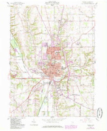
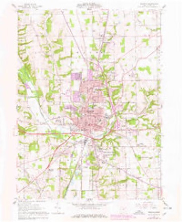
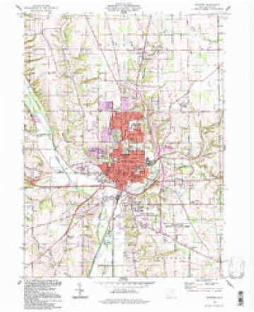
17 topographic sheets cover this place, the earliest surveyed in 1901 and the latest in 1994. It stands in Wooster City. It lies in ZIP code area 44691. It stands on Little Apple Creek. The Survey maps it on the Wooster quadrangle. 27,232 people lived here at the 2020 count. It stands 997 feet above sea level.
Research this city
This curated hub for Wayne County, Ohio brings together the page's documented record links, visible map or image evidence where published, and routes to related local records.
What is documented here?
Use the page's provenance and linked records to distinguish the source material from the site's navigation and summaries.
How should I cite it?
Open the original record, preserve its repository and identifier, then use the citation tool for this page as a path back to the source.
Where should I go next?
Follow the county or state hub for related places and records, then use the guide for a source-aware research sequence.
Population over time
3 figuresWooster grew from 26,119 to 27,232 between 2010 and 2020. These are the recorded population figures Wikidata holds for this place, reached through the Geographic Names Information System number this page is keyed on rather than by name, so they belong to this place and not to another of the same name. Most are census counts, but not all are: an early figure may be a founding or settlement estimate. The change column is computed, and is left blank where more than 20 years separate a figure from the one before it, because a gap that long is not a change between two counts.
| Year | People | Change |
|---|---|---|
| 2010 | 26,119 | |
| 2019 | 26,395 | +276 (+1%) |
| 2020 | 27,232 | +837 (+3%) |
Then and now
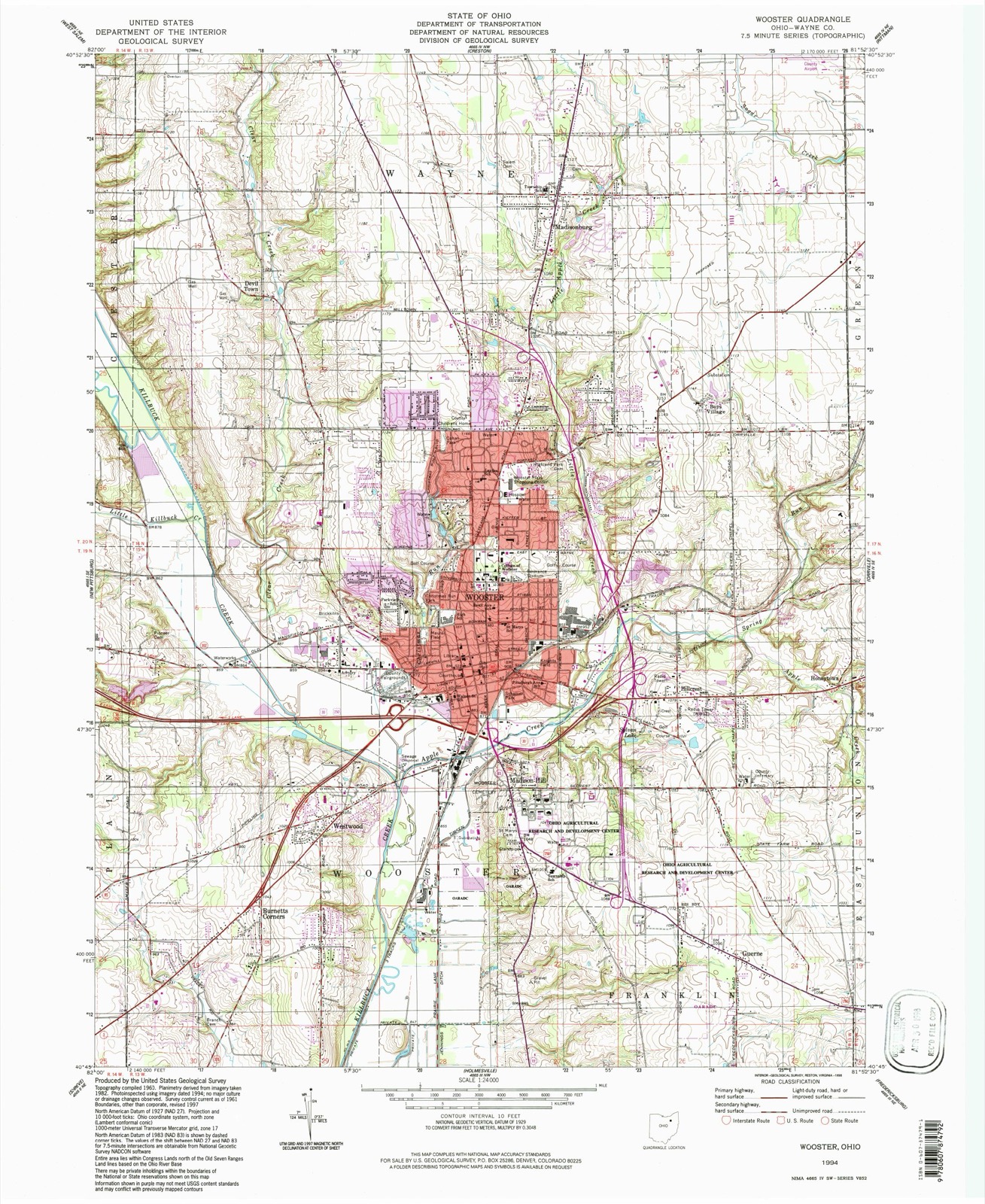
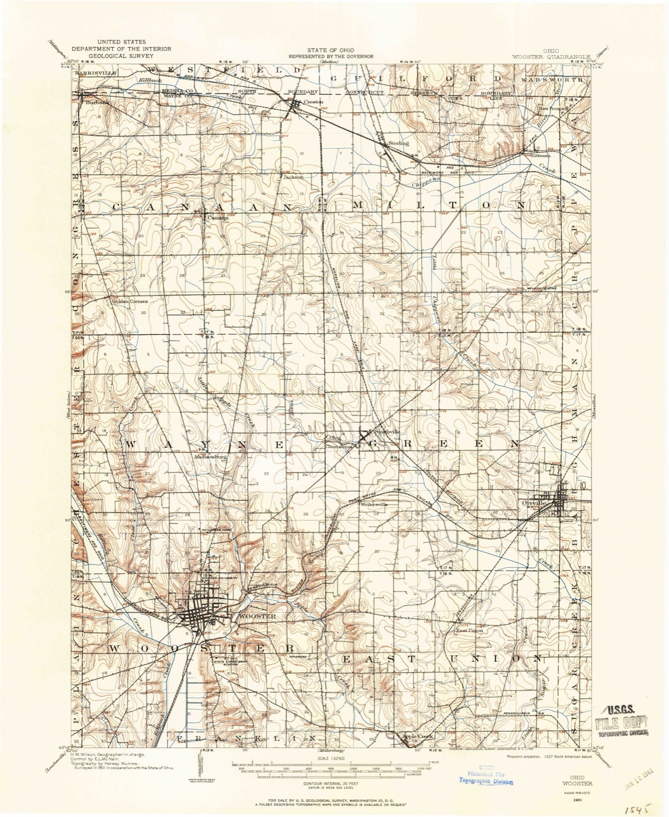
1901 to 1994The same ground, surveyed 93 years apart. Drag the handle to wipe between them. Both sheets are United States Geological Survey originals; neither has been altered.
Topographic sheets covering this place
17 sheetsMatched by testing this settlement's coordinate against the published boundary of every sheet in the United States Geological Survey's historical collection. Each opens the scanned sheet at the Survey.
- 1901 USGS Wooster quadrangle1:62500
- 1903 USGS Wooster quadrangle1:62500
- 1903 USGS Wooster quadrangle1:62500
- 1951 USGS Canton quadrangle1:250000
- 1953 USGS Canton quadrangle1:250000
- 1957 USGS Canton quadrangle1:250000
- 1957 USGS Canton quadrangle1:250000
- 1957 USGS Canton quadrangle1:250000
- 1961 USGS Wooster quadrangle1:24000
- 1961 USGS Wooster quadrangle1:24000
- 1961 USGS Wooster quadrangle1:24000
- 1961 USGS Wooster quadrangle1:24000
- 1962 USGS Canton quadrangle1:250000
- 1962 USGS Canton quadrangle1:250000
- 1986 USGS Canton quadrangle1:100000
- 1986 USGS Canton quadrangle1:100000
- 1994 USGS Wooster quadrangle1:24000







Photographs
1 photograph,Taken for the Office of War Information and the Farm Security Administration, who photographed the country between 1935 and 1944. Works of United States government photographers, with no known restriction on use. Each opens its catalogue record.
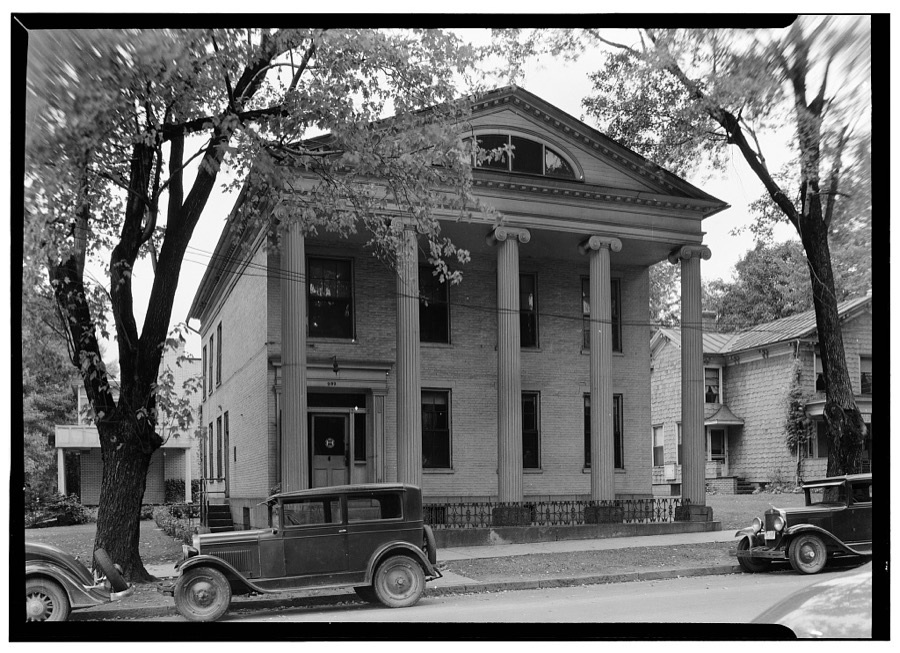
Unattributed, . Library of Congress
Fires nearby
2 since 2002The federal wildfire occurrence database lists 2 fires within 5 miles of Wooster between 2002 and 2002, burning about 25 acres in total. None started naturally. 1 was recorded as arson. Distance is straight-line from the map coordinates, so a fire counted here may appear on a neighbouring settlement's page as well.
| Reported cause | Fires |
|---|---|
| Arson/incendiarism | 1 |
| Recreation and ceremony | 1 |
The most recent of them, most recent first, with the day each was reported and the service that recorded it.
| Date | Cause | Size | Reported by | Name on the report |
|---|---|---|---|---|
| 31 August 2002 | Recreation and ceremony | 25 acres | Ohio State Fire Marshal's Office | not named |
| 25 June 2002 | Arson/incendiarism | under an acre | Ohio State Fire Marshal's Office | not named |
Settlements close enough to share some of these fires:
Specimens collected nearby
12 of 2,553 shownMuseums hold 2,553 specimens collected within 10 miles of Wooster between 1877 and 1975: 2,124 Animalia, 238 Plantae, 152 Fungi, 38 Chromista, 1 Unrecorded. 12 distinct Species records are shown. Collected by A C ALLEN, A. D. Selby, A. E. Good and others. Each is a physical object with a catalogue number, and each entry opens the museum's record. This is what was collected and kept, not a survey of what lives here - nothing can be concluded from a species being absent.
| Image | Species | Year | Collected by | Where, as recorded |
|---|---|---|---|---|
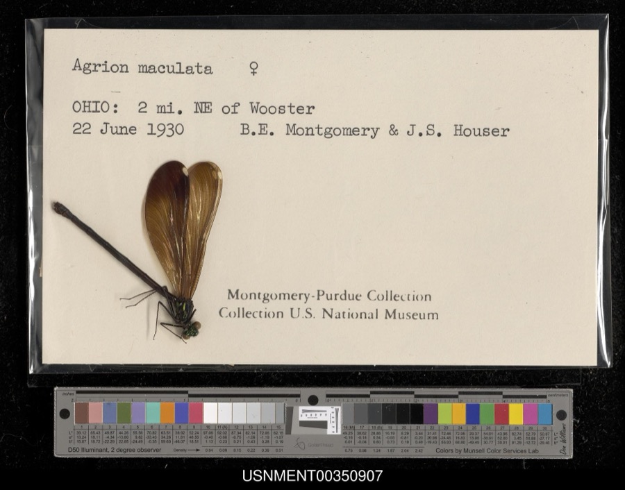 | Calopteryx maculata (Palisot de Beauvois, 1807) | 1930 | B. Montgomery & J. Houser | 2 miles northeast of Wooster |
 | Aster ciliolatus Lindl. | 1877 | Thorne, B.H. | Station Farm, Wooster |
 | Chelidon Forster, 1817 | 1889 | Hine, J. S. (James Stewart) | Wooster, Wayne, Ohio, USA |
 | Eupatorium sessilifolium L. | 1889 | Duvel, J.W.T | Fredericksburg |
 | Agelaius phoeniceus phoeniceus (Linnaeus, 1766) | 1890 | Harry C. Oberholser | Wooster |
 | Baeolophus bicolor (Linnaeus, 1766) | 1890 | Harry C. Oberholser | Wooster |
 | Cardinalis cardinalis cardinalis (Linnaeus, 1758) | 1890 | Harry C. Oberholser | Wooster |
 | Catharus guttatus faxoni (Bangs & T.E.Penard, 1921) | 1890 | Harry C. Oberholser | Wooster |
| Catharus ustulatus swainsoni (Tschudi, 1845) | 1890 | Harry C. Oberholser | Wooster | |
 | Certhia americana americana Bonaparte, 1838 | 1890 | Harry C. Oberholser | Wooster |
| Corthylio calendula calendula | 1890 | Harry C. Oberholser | Wooster | |
 | Cyanocitta cristata bromia Oberholser, 1921 | 1890 | Harry C. Oberholser | Wooster |
All 2,553 specimens within 10 miles, at the Global Biodiversity Information Facility.
Mines and quarries nearby
4 within 5 milesThe federal mineral resources record lists 4 workings within 5 miles of Wooster: 4 producers. All of them still produce. What was taken out: Sand and Gravel, Construction, Stone, Crushed/Broken. Distance is straight-line from the map coordinates, so a quarry counted here may appear on a neighbouring settlement's page as well.
| Where | Site | Commodity | Status | Recorded |
|---|---|---|---|---|
| Jones Limestone Company Pit | Stone, Crushed/Broken | Producer | ||
| Prairie Lane Sand & Gravel Pit | Sand and Gravel, Construction | Producer | ||
| Rodco Mine | Stone, Crushed/Broken | Producer | ||
| Wayne County Hwy Dept. | Sand and Gravel, Construction | Producer |
Storms nearby
60 of 101 shownThe National Weather Service names Wooster in 101 storm reports between 1996 and 2025: 54 thunderstorm wind, 37 hail, 4 flash flood, 3 tornado. The reports record 4 injuries. Each account below is quoted exactly as the forecast office filed it, from the NOAA Storm Events Database, and each date opens the federal record of that event.
| When | Event | Place named | Harm | What the report says |
|---|---|---|---|---|
| November 2003 | Tornado (F2) | Wooster | 3 hurt, $21,000,000 | A tornado touched down southwest of Wooster near the intersection of U.S. Route 250 and Old Lincoln Highway (County Road 30A). Several businesses were heavily damaged near the site of the initial touchdown. The tornado then crossed State Route 302 and moved over open farmland and into a business park on the southwest side of Wooster. Several more business were damaged in this area. The tornado continued east through residential neighborhoods just north of downtown Wooster. The tornado exited the city near the intersection of State Routes 3/83 and 585. A factory near this location was heavily damaged. The tornado continued east into Green Township and strengthened to F2 intensity at it crossed Geyers Road. Two more businesses were heavily damaged in this area. The tornado weakened to F1 intensity just after severely damaging a home on Canal Road near Eby Road. The tornado continued across open farmland for another four miles before finally lifting just southwest of Orrville near the intersection of Back Orrville Road and North Crown Hill Road. The damage path was around 12 miles in length and up to 125 yards in width. Around 15 businesses and over 100 homes were damaged by this tornado. Ten semi trailers were overturned at one factory and over 30 cars heavily damaged at an automobile dealership. Many other automobiles were damaged along the damage path. In addition, hundreds of trees and dozens of power poles were downed. |
| August 2000 | Thunderstorm Wind | Wooster | 1 hurt, $50,000 | Thunderstorm winds estimated at 60 to 80 mph downed dozens of trees in and around Wooster. Over 100 trees were blown down in a park just south of Wooster. A tree also struck a moving car. The 48 year old female occupant of the car was taken to a local hospital and treated for minor injuries. |
| September 2010 | Tornado (EF2) | Wooster | $35,000,000 | A tornado touched down in Wayne County two miles southwest of downtown Wooster around 5:26 pm. This tornado strengthened to EF2 intensity and continued on the ground for over 11 miles before finally lifting two miles west of Dalton. Extensive damage occurred along the damage path with dozens of homes and buildings damaged. After the initial touchdown, the tornado quickly intensified to an EF2 as it continued on the ground to the east northeast. The tornado crossed Prairie Lane and Timken Road and then moved across St. Mary's Cemetery. Damage at the cemetery was extensive with 80 of 81 large trees knocked down and over two hundred gravestones broken or toppled. From the cemetery, the tornado crossed Madison Avenue and moved across the Ohio Agricultural Research and Development Center (OARDC). Significant damage occurred on the OADRC campus with several buildings severely damaged. A laboratory in one the buildings was destroyed. Two historic homes on the property sustained significant roof damage and several greenhouses were destroyed. Two barns and a machine shop were also leveled. The 102 year old Secrest Arboretum on the campus lost over 800 trees and many research projects were damaged or destroyed. The tornado tossed and destroyed several vehicles and a lot of farm machinery was also damaged or destroyed. From the OARDC campus, the tornado continued east along Secrest Road damaging or destroying several homes and buildings. The tornado weakened to EF1 intensity as it crossed Sylvan Road and to an EF0 as it crossed Barnard Road. The tornado then remained either an EF0 or EF1 until it lifted near the intersection of Kidron Road and Old Lincoln Way just west of Dalton. A total of nine homes were either destroyed or sustained major damage. Another 90 homes sustained lesser amounts of damage. In addition, at least 50 barns, garages and other outbuildings were damaged of destroyed. Thousands of trees were also toppled along the damage path which was up to 150 yards in width. Twenty eight utility poles were knocked down in Wooster alone and high tension transmission lines were also torn down by the tornado. The downed transmission lines affected four substations and resulted in around a third of Wayne County loosing power right after the tornado. The OARDC campus was closed for over a week and two local school districts had to close on September 17th because of the power outages. Only one very minor injury was reported. |
| May 2007 | Flash Flood | Wooster | $200,000 | Numerous thunderstorms across the area during the afternoon and evening hours brought heavy rain to the area. As a result, flash flooding occurred across the northern half of the county, with many reports of roads closed throughout Wooster. Some of the roads closed included State Routes 302 and 3. Many other city streets in Wooster, along with county and township roads, were closed. There were numerous reports of surface water flowing into homes in West Salem and Smithville. |
| July 2002 | Thunderstorm Wind | Wooster | $100,000 | Thunderstorm winds downed many trees in Wooster. Several homes were damaged by the fallen trees. |
| May 2006 | Thunderstorm Wind | Wooster | $80,000 | During this time severe winds downed several trees on houses. Trees also were reported to have fallen on several cars also causing damage. |
| May 2005 | Thunderstorm Wind | Wooster | $80,000 | Thunderstorm winds estimated at 70 mph blew a semi-truck over on U.S. Route 30 near Wooster. Several trees were downed in and around Wooster. |
| November 2017 | Tornado (EF1) | Wooster | $75,000 | An EF1 tornado touched down at the Secrest Arboretum on the south side of Wooster. The tornado tore half the roof off of the Frederick Rice historical home with debris thrown north-northwest through southeast. East of the home, trees were snapped and uprooted in a convergent pattern. A couple greenhouses were also damaged. This tornado was on the ground for less than a quarter mile and was no more than 50 yards in width. |
| April 2001 | Hail | Wooster | $75,000 | Golf ball size hail was reported. Many cars were damaged. |
| June 2006 | Lightning | Wooster | $50,000 | A house was struck by lightning causing significant damage. |
| April 2001 | Hail | Wooster | $50,000 | Walnut size hail was reported. A few cars were damaged. |
| August 1998 | Lightning | Wooster | $50,000 | Lightning struck a two story barn starting a fire that destroyed the barn and six thousand to eight thousand bales of hay and straw stored there. |
| July 2001 | Thunderstorm Wind | Wooster | $35,000 | Thunderstorm winds downed 15 to 20 trees along Beall Avenue near University Street. At least one car was damaged by a fallen tree. |
| November 2002 | Thunderstorm Wind | Wooster | $30,000 | Thunderstorm winds downed many trees and large limbs in the Wooster and Smithville areas. |
| August 2024 | Flash Flood | Wooster | $25,000 | Christmas Run flooded out of its banks at Wayne County Fairgrounds in Wooster, flooding portions of West Old Lincoln Way and much of the fairgrounds. Several barns were flooded with one water rescue of a person trapped in a camper. |
| July 2017 | Thunderstorm Wind | Wooster | $25,000 | Thunderstorm winds downed several trees across the central and southern portions of Wooster. |
| July 2006 | Thunderstorm Wind | Wooster | $25,000 | Thunderstorm winds were estimated by a trained spotter to be 60 mph. Numerous trees and large limbs were reported down throughout Wooster. |
| April 2001 | Hail | Wooster | $25,000 | Quarter size hail was reported two miles southeast of Wooster. A few cars were damaged. |
| June 2013 | Thunderstorm Wind | Wooster | $15,000 | Thunderstorm winds downed several trees. |
| December 2013 | Thunderstorm Wind | Wooster | $15,000 | Thunderstorm winds downed a lot of trees across Wayne County. |
| August 2009 | Thunderstorm Wind | Wooster | $15,000 | Trees were reported down across the city and just west of Wooster. |
| November 2002 | Thunderstorm Wind | Wooster | $15,000 | Thunderstorm winds downed several trees near Wooster. |
| April 2001 | Hail | Wooster | $15,000 | Quarter size hail was reported on the north side of Wooster. A few cars were damaged. |
| November 1998 | Thunderstorm Wind | Wooster | $15,000 | Trees and power lines were downed and windows blown out on some buildings. |
| May 2007 | Hail | Wooster | $10,000 | Quarter size hail was observed. |
| June 2006 | Thunderstorm Wind | Wooster | $10,000 | Numerous trees and large limbs were reported down. |
| July 2005 | Thunderstorm Wind | Wooster | $10,000 | Several large trees along with power lines were reported down. |
| June 2005 | Thunderstorm Wind | Wooster | $10,000 | Several trees downed due to thunderstorm winds. |
| June 2005 | Thunderstorm Wind | Wooster | $10,000 | Several trees were reported down. |
| June 2002 | Hail | Wooster | $10,000 | Quarter size hail was observed five miles north of Wooster. |
| June 2002 | Hail | Wooster | $10,000 | Quarter size hail was observed seven miles north of Wooster. |
| April 2001 | Hail | Wooster | $10,000 | Quarter size hail was reported five miles east of Wooster. A few cars were damaged. |
| September 1999 | Thunderstorm Wind | Wooster | $10,000 | A large tree and several power poles were downed. |
| October 1999 | Thunderstorm Wind | Wooster | $10,000 | Two large trees were blown down on the south side of Wooster. One of the trees landed on a house and caused minor roof damage. |
| November 2017 | Thunderstorm Wind | Wooster | $7,000 | Thunderstorm winds downed several trees southwest of Wooster. |
| June 2008 | Thunderstorm Wind | Wooster | $6,000 | Several large trees and large limbs were reported down. |
| April 2023 | Thunderstorm Wind | Wooster | $5,000 | Trees downed in Wooster, one of which caused minor damage to a garage. |
| September 2018 | Thunderstorm Wind | Wooster | $5,000 | Thunderstorm winds downed several trees west of Wooster. |
| June 2011 | Thunderstorm Wind | Wooster | $5,000 | Thunderstorm winds downed several large tree branches in a few locations around the area. |
| June 2010 | Thunderstorm Wind | Wooster | $5,000 | Thunderstorm winds downed a few trees north of Wooster. |
| June 2009 | Thunderstorm Wind | Wooster | $5,000 | Several trees were reported down in the area. |
| June 2007 | Thunderstorm Wind | Wooster | $5,000 | A few large trees were reported down. Penny size hail was also observed. |
| May 2006 | Hail | Wooster | $5,000 | Quarter size hail was observed. |
| July 2003 | Thunderstorm Wind | Wooster | $5,000 | Thunderstorm winds downed two trees five miles north of Wooster. |
| April 2003 | Thunderstorm Wind | Wooster | $5,000 | Thunderstorm winds downed two large trees east of Wooster. |
| April 2002 | Hail | Wooster | $5,000 | Dime size hail was reported. |
| October 2001 | Thunderstorm Wind | Wooster | $5,000 | Thunderstorm winds downed three trees in and around Wooster. |
| August 1998 | Thunderstorm Wind | Wooster | $5,000 | Several trees were downed. |
| June 1998 | Thunderstorm Wind | Wooster | $5,000 | Trees and power lines were downed. |
| December 1996 | Thunderstorm Wind | Wooster | $5,000 | no account filed |
| May 2004 | Thunderstorm Wind | Wooster | $4,000 | Thunderstorm winds downed several large tree limbs. |
| May 2008 | Thunderstorm Wind | Wooster | $3,000 | Two trees were reported down. |
| June 2008 | Thunderstorm Wind | Wooster | $3,000 | Thunderstorm winds downed two trees. |
| June 1998 | Thunderstorm Wind | Wooster | $3,000 | Trees were downed in the southern part of the county. |
| July 2016 | Thunderstorm Wind | Wooster | $2,000 | A large oak trees was knocked down by thunderstorm wind gusts. |
| June 2005 | Thunderstorm Wind | Wooster | $2,000 | Numerous large limbs down along with power lines. |
| August 2003 | Thunderstorm Wind | Wooster | $2,000 | Thunderstorm winds downed a few large tree limbs. |
| June 1998 | Thunderstorm Wind | Wooster | $2,000 | Trees were downed. |
| June 1996 | Thunderstorm Wind | Wooster | $2,000 | no account filed |
| June 2013 | Hail | Wooster | $1,000 | A trained weather spotter reported quarter size hail in Wooster. |
Nearest settlements
The eight closest, with where each one stands in the county. Distances are straight-line, computed from the Geographic Names Information System coordinates.
| Map | Place | Distance | Sheets |
|---|---|---|---|
| Miller Lakes | 1.0 miles | 17 | |
| Ramblewood | 1.1 miles | 17 | |
| Parkview | 1.2 miles | 17 | |
| Christmas Run | 1.4 miles | 17 | |
| Madison Hill | 1.4 miles | 17 | |
| Highland Park | 1.5 miles | 17 | |
| The Meadows | 1.6 miles | 17 | |
| Hillcrest | 1.7 miles | 17 |
Elsewhere
Matched on this settlement's Geographic Names Information System number rather than its name, so it cannot be a different place of the same name in another state.
| Wikipedia article on Wooster | An encyclopaedic summary. Its text is share-alike, so it is linked here rather than copied. |
| Wikidata item Q989567 | The structured record the population and elevation above come from. Public domain (CC0). |
Provenance
This settlement is recorded in the Geographic Names Information System as feature 1049345. The sheet list is computed by point-in-boundary test against the United States Geological Survey's historical topographic inventory. Both are works of the United States government and carry no copyright under 17 U.S.C. 105.
Wildfire. Short, Karen C. 2022. Spatial wildfire occurrence data for the United States, 1992-2020 [FPA_FOD_20221014]. 6th Edition. Fort Collins, CO: Forest Service Research Data Archive. https://doi.org/10.2737/RDS-2013-0009.6 Collected with United States Government funding and usable without additional permissions or fees.
Specimens. Global Biodiversity Information Facility (GBIF), https://www.gbif.org/. Only records licensed CC0 or CC BY are used. Records licensed CC BY-NC are excluded because this site carries advertising. Images are checked individually and any whose licence is non-commercial, no-derivatives or unreadable is refused.
Mines and quarries. USGS Mineral Resources Data System (MRDS) https://mrdata.usgs.gov/mrds/ A work of the United States government, no copyright under 17 U.S.C. 105.
Storms. NOAA National Centers for Environmental Information, Storm Events Database https://www.ncei.noaa.gov/stormevents/ A work of the United States government, no copyright under 17 U.S.C. 105. Narratives are quoted verbatim from the National Weather Service report and are not edited or summarised.