BlockBefore
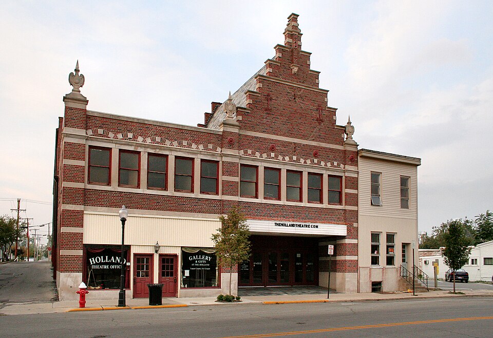
Photograph of Schine Holland Theatre
Photograph by Unknown, Public domain. Via Wikimedia Commons.

Schine's Holland Theatre

Listed on the National Register of Historic Places in 2001. A historic map-sheet match is not published yet. The record needs a coordinate-quality review before it can be joined to a sheet boundary.

From the record

“Holland Theatre opened as a vaudeville and movie palace on February 12, 1931 in Bellefontaine, Ohio, United States. Like many historic theaters, the Holland ultimately went out of business after a newer, more technologically advanced, multi-screen cinema was introduced to the town.”

Wikipedia article Holland Theater, CC BY-SA 4.0.

one of 6 National Register listings in Logan County · listed in 2001 · category: Building.

Sources: the Wikipedia article · the case file at the National Archives · the National Register database, National Park Service

The listing

  • What is counted as historic. The nomination lists 1 building as contributing to the listing.
  • Still standing. The Park Service records this property as extant.
  • Address. 125 E. Columbus St., Bellefontaine, 43311
  • When was it listed? 2001-05-25
  • Category. building
  • Township. Lake township
  • Architectural style. Dutch brick
  • National Register reference number. 01000561 - the number the National Park Service assigned this property when it was listed, and the key its nomination file is catalogued under at the National Archives.

Specimens collected near this property

12 of 929 shown

Regional context, not property-specific evidence. Museums hold 929 specimens collected within 10 miles of Schine's Holland Theatre between 1862 and 1975: 879 Animalia, 27 Fungi, 20 Plantae, 2 Protozoa, 1 Unrecorded. 12 distinct Species records are shown. Collected by A Schwartz, A. D. Selby, A. R. Gaufin and others. Each is a physical object with a catalogue number, and each entry opens the museum's record. This is what was collected and kept, not a survey of what lives here - nothing can be concluded from a species being absent.

Image SpeciesYear Collected by Where, as recorded
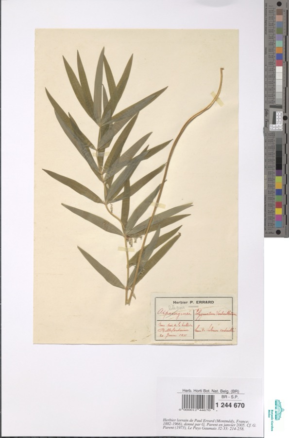
Specimen of Polygonatum verticillatum (L.) All.Polygonatum verticillatum (L.) All.1911Errard P.Bellefontaine
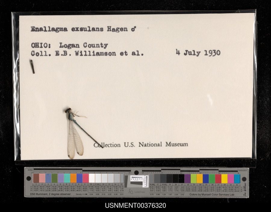
Specimen of Enallagma exsulans (Hagen, 1861)Enallagma exsulans (Hagen, 1861)1930E. Williamson & et al.[Not Stated]
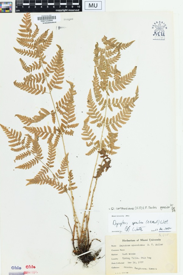
Specimen of Dryopteris spinulosa (O.F.Müll.) WattDryopteris spinulosa (O.F.Müll.) Watt1937Brooks; Barghoorn. Howard.Soringhills, Harison, OH. Ohio bog
A photograph of the species Carex buxbaumii, not of this specimenCarex buxbaumii Wahlenb.1862W. M. CanbyBelfontaine.
A photograph of the species Nasturtium officinale, not of this specimenNasturtium officinale R.Br.1862W. M. CanbyBellefontaine
A photograph of the species Protographium marcellus, not of this specimenProtographium marcellus (Cramer, 1777)1869not recordedBellefontaine
A photograph of the species Otus asio, not of this specimenOtus asio naevius (J.F.Gmelin, 1788)1874Trautman, M. B. (Milton Bernard) & Trautman, M. A. (Mary Auten)Logan, Ohio, USA
A photograph of the species Solenostoma crenuliforme, not of this specimenSolenostoma crenuliforme (Austin) Steph.1877not recorded
A photograph of the species Gallinago delicata, not of this specimenGallinago delicata (Ord, 1825)1889McCormick, L. M.Oberlin, Logan, Ohio, USA
A photograph of the species Gallinago gallinago, not of this specimenGallinago gallinago delicata (Ord, 1825)1889McCormick, L. M.Beaver Creek, Logan, Ohio, USA
A photograph of the species Dendroica virens, not of this specimenDendroica virens virens (J.F.Gmelin, 1789)1891McCormick, L. M.Oberlin, Logan, Ohio, USA
A photograph of the species Lampropeltis triangulum, not of this specimenLampropeltis triangulum (Lacépède, 1789)1893not recordedLogan Co., Ohio

All 929 specimens within 10 miles, at the Global Biodiversity Information Facility.

Mines and quarries near this property

5 within 5 miles

Regional context, not property-specific evidence. The federal mineral resources record lists 5 workings within 5 miles of Schine's Holland Theatre: 3 past producers, 2 producers. 2 still produce. What was taken out: Sand and Gravel, Construction. Distance is straight-line from the map coordinates, so a quarry counted here may appear on a neighbouring settlement's page as well.

Where SiteCommodity StatusRecorded
Johnson Gravel PitSand and Gravel, ConstructionPast ProducerSedimentary
Johnson's Gravel PitSand and Gravel, ConstructionProducer
Logan PitSand and Gravel, ConstructionPast ProducerSedimentary
Logan PitSand and Gravel, ConstructionPast Producer
Ropp PitSand and Gravel, ConstructionProducer

Every working recorded in Logan County

Storms near this property

60 of 73 shown

Regional context, not property-specific evidence. The National Weather Service names Bellefontaine, the town this property stands in, in 73 storm reports between 1994 and 2024: 34 thunderstorm wind, 14 hail, 12 flood, 9 flash flood. The reports record 1 injury. Each account below is quoted exactly as the forecast office filed it, from the NOAA Storm Events Database, and each date opens the federal record of that event.

WhenEvent Place namedHarm What the report says
June 2004LightningBellefontaine1 hurtA 19 year-old boy suffered minor injuries when lightning struck a nearby tree.
June 2022Thunderstorm WindBellefontaine$250,000Numerous trees and power lines were damaged across Logan County.
June 2012Thunderstorm WindBellefontaine$100,000Numerous trees and large branches were downed across the area due to damaging thunderstorm winds. Some of the branches were blocking the Route 33 and 68 exit ramp. Roof damage also occurred to several buildings in the area.
September 2010Thunderstorm WindBellefontaine$60,000Numerous trees were reported down due to damaging thunderstorm winds. Several barns were also damaged or destroyed along with some minor damage to a few homes.
September 2000Flash FloodBellefontaine$50,000Heavy rainfall caused flooded roads in Bellefontaine. Also, part of the road and a bridge were washed out on Township Road 151.
June 1995Thunderstorm WindBellefontaine$40,000Straight-line thunderstorm winds destroyed a large shed and severely damaged two machinery sheds.
February 2011FloodBellefontaine$25,000Flooding is a continuation from earlier flash flooding in the area. Several roads were impassible and evacuations occurred in a trailer park due to the precipitation. Flooding began around 0645 EST on February 28th and continued until around 0900 EST on March 2nd. Damage estimates during March were around twenty-five thousand dollars.
March 2011FloodBellefontaine$25,000Flooding is a continuation from earlier flash flooding in the area on February 28th. Several roads were impassible and evacuations occurred in a trailer park due to the precipitation. Flooding began around 0645 EST on February 28th and continued until around 0900 EST on March 2nd. Damage estimates during February were around twenty-five thousand dollars.
June 2022Thunderstorm WindBellefontaine$20,000A large tree fell onto a house on Wright Street, damaging the house.
June 2019Flash FloodBellefontaine$15,000Mary Rutan Hospital was flooded by water. Also, numerous roads were closed throughout Logan County due to high water.
July 2022Thunderstorm WindBellefontaine$10,000A few power poles were downed along Township Highway 199 West.
March 2011FloodBellefontaine$10,000Numerous roads were flooded across the county due to heavy rainfall.
February 2011Flash FloodBellefontaine$10,000Multiple roads were closed due to flash flooding.
July 2003Thunderstorm WindBellefontaine$10,000Several 2 inch diameter tree limbs downed. A tree fell on an automobile in Bellefontaine, causing some damage.
July 2002Thunderstorm WindBellefontaine$10,000A few trees fell on homes.
July 1998Thunderstorm WindBellefontaine$10,000Many trees downed.
April 2002HailBellefontaine$10,000no account filed
April 2011Thunderstorm WindBellefontaine$7,000A power pole was snapped and a tree fell down on a house due to damaging thunderstorm winds.
August 2024Thunderstorm WindBellefontaine$5,000Several trees were downed in the Bellefontaine area.
June 2022Thunderstorm WindBellefontaine$5,000A large limb fell onto a car.
April 2020Thunderstorm WindBellefontaine$5,000Several trees were knocked down in the city of Bellefontaine.
March 2016Thunderstorm WindBellefontaine$5,000A barn was blown down on Township Road 200.
August 1994Thunderstorm WindBellefontaine$5,000Trees were downed, some on power lines.
October 1996Thunderstorm WindBellefontaine$5,000no account filed
August 2016Heavy RainBellefontaine$3,000Three cars were stranded in high water.
August 2011Thunderstorm WindBellefontaine$3,000Trees and power lines were reported down in the area due to damaging thunderstorm winds.
March 2007FloodBellefontaine$3,000A few roads were flooded across the county.
March 2007HailBellefontaine$3,000A telephone pole was also knocked down.
March 2007FloodBellefontaine$3,000Numerous roads were flooded and closed across the county.
May 2004Thunderstorm WindBellefontaine$3,000Trees and power lines were knocked down.
July 2003Thunderstorm WindBellefontaine$3,000Power poles were knocked down.
October 2001Thunderstorm WindBellefontaine$3,000A tree was blown down onto State Route 508. A large limb was also knocked down on State Route 57.
July 1999Thunderstorm WindBellefontaine$3,000Trees knocked down.
July 1999Thunderstorm WindBellefontaine$3,000Several trees knocked down.
August 2016Thunderstorm WindBellefontaine$2,000Several trees were knocked down between Bellefontaine and West Liberty.
May 2011FloodBellefontaine$2,000Numerous roads were closed due to heavy rainfall.
June 2008Thunderstorm WindBellefontaine$2,000A 60 mph wind gust was estimated near Bellefontaine.
June 2007Thunderstorm WindBellefontaine$2,000A few trees were knocked down.
August 2003Thunderstorm WindBellefontaine$2,000Two trees were downed.
July 2023Thunderstorm WindBellefontaine$1,000A large tree was downed.
April 2020Thunderstorm WindBellefontaine$1,000A very large Alpine spruce was uprooted.
July 2012Thunderstorm WindBellefontaine$1,000A tree was downed in Bellefontaine due to damaging thunderstorm winds.
April 2011Heavy RainBellefontaine$1,000Water was overflowing onto a roadway from a drainage ditch.
August 1995Thunderstorm WindBellefontaine$1Thunderstorm winds toppled two large trees.
June 2024Flash FloodBellefontaine-Water was rushing over the roadway.
May 2019FloodBellefontaine-High water was reported on Troy Street.
June 2019FloodBellefontaine-A road was closed due to high water.
June 2019FloodBellefontaine-Several roads remained closed due to flooding.
June 2019Flash FloodBellefontaine-Video captured extensive flooding on streets up to houses on Washington and Ludlow Streets. The ditches had rapidly moving water.
June 2019FloodBellefontaine-Numerous roads remained closed due to flooding.
June 2017Flash FloodBellefontaine-Water was reported over a portion of U.S. 68 north of Bellefontaine.
July 2017FloodBellefontaine-Several roads were closed throughout Logan County due to high water.
July 2013FloodBellefontaine-There were numerous reports of high water due to heavy rainfall in and around Bellefontaine.
June 2012Thunderstorm WindBellefontaine-An Ohio Department of Transportation Sensor measured the wind gust.
July 2012Heavy RainBellefontaine-There were reports of minor street flooding near the center of Bellefontaine town due to heavy rainfall.
June 2006Flash FloodBellefontaine-A few roads were flooded.
June 2006Thunderstorm WindBellefontaine-A trained spotter estimated a 60 mph wind gust.
April 2002Flash FloodBellefontaine-Numerous roads in town were closed due to high water.
April 1998Flash FloodBellefontaine-Heavy rainfall caused roads to be flooded.

Every storm recorded in Logan County

Newspapers printed here

0 digitised pages

1 paper published in this town, digitised by the Library of Congress and free to read: 0 issues, 0 pages. Every page is searchable, so a name or a street can be looked for directly in what the town printed about itself at the time.

NewspaperPublished
The Bellefontaine Republican1855 to 1905

Map coverage status

No historic map-sheet match is published for this property yet. That does not mean no map exists. This record needs a coordinate-quality review before it can be joined to a sheet boundary. Browse the county's mapped places while that work is pending.

From the nomination file

7,684 words on record

When this property was proposed for the National Register, someone wrote the case for it: what the building is, and why it matters. That document is a federal record in the public domain. It is quoted below word for word, never summarised. The text was read off the scanned case file by machine, so the occasional stray character is the recogniser's and the 1970s typewriter's.

Statement of significance

Areas of Significance (Enter categories from instructions) for National Register listing.) - A Property is associated with events that have made a significant contribution to the broad patterns of Property is associated with the lives of persons significant in our past. X C Property embodies the distinctive characteristics of a type, period, ormethod of construction or represents the work of a master, or possesses high artistic values, or represents a significant and Period of Significance distinguishable entity whose components lack - D Property has yielded, or is likely to yield, information important in prehistory or history. -A owned by a religious institution or used for - B removed from its original location. - C a birthplace or grave. Cultural Affiliation - D a cemetery.

- E a reconstructed building, object, or structure. - F a commemorative property. = G less than 50 years of age or achieved significance within the past 50 years. Peter M. Hulsken, architect, Lima, OH Narrative Statement of Significance 9.

The whole case file for this property - 7,684 words, 61 pages, reproduced complete.

Quoted from the National Register nomination for reference 01000561, 61 pages, held by the National Archives in Record Group 79. See the catalogue record.

Listed places nearby

4 within 8 miles

Other National Register properties close enough to walk or drive between, ordered by distance from this one. Both positions come from the same geocoding pass that matched these properties to their map sheets.

Photograph PropertyDistance Listed
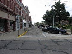
First Concrete Street In U.S.under 500 feet1974
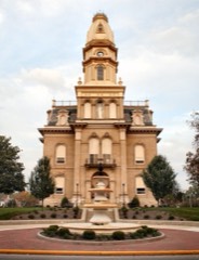
Logan County Courthouseunder 500 feet1973
Lawrence, William, House0.3 miles1979
Marmon, Martin, House5.4 miles1986

Sources for this property

National Archives recordThe nomination case file for reference 01000561 in Record Group 79.
Wikipedia articleCommunity-written account of this property, licensed CC BY-SA.
Logan CountyAll 6 listed properties in this county.

Provenance

  • Listing record. National Park Service National Register of Historic Places, listed-properties dataset, current to 2026-05-22.
  • Map join. Address geocoded through the United States Census geocoder, then tested against the published boundary of every sheet in the USGS Historical Topographic Map Collection.
  • How this page is made. Listing fields come from federal records; map-sheet coverage is a labelled coordinate-to-boundary calculation, not a source-field claim.
  • Specimens. Global Biodiversity Information Facility (GBIF), https://www.gbif.org/. Only records licensed CC0 or CC BY are used. Records licensed CC BY-NC are excluded because this site carries advertising. Images are checked individually and any whose licence is non-commercial, no-derivatives or unreadable is refused.
  • Mines and quarries. USGS Mineral Resources Data System (MRDS) https://mrdata.usgs.gov/mrds/ A work of the United States government, no copyright under 17 U.S.C. 105.
  • Storms. NOAA National Centers for Environmental Information, Storm Events Database https://www.ncei.noaa.gov/stormevents/ A work of the United States government, no copyright under 17 U.S.C. 105. Narratives are quoted verbatim from the National Weather Service report and are not edited or summarised.