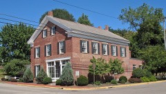
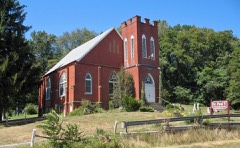
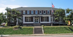
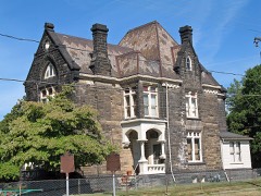
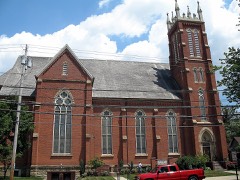
Listed on the National Register of Historic Places in
2005. A historic map-sheet match is not published yet. The record needs a coordinate-quality review before it can be joined to a sheet boundary.
From the record
“The village of Bethlehem was laid out while Stark was j'et a part of Columliiana (!ounty. The original village plat maj* be seen at the county seat of that county.”
History of Stark County, with an Outline Sketch of Ohio (1881). Machine-read text.
one of 81 National Register listings in Stark County · listed in 2005 · category: District.
National Register reference number.05001187- the number the National Park Service assigned this property when it was listed, and the key its nomination file is catalogued under at the National Archives.
The village of Bethlehem was laid out while Stark was j'et a part of Columliiana (!ounty. The original village plat maj* be seen at the county seat of that county. Calcutta was laid out as stated above, in 1819. though the plat thereof does not appear on the i-ecords at Canton. One of two things must be true : either the record of the plat has been lost or destroyed, or the plat was not properly recorded. When the Ohio Canal was built through the township and opened, Bethlehem was re-enforced by population and prosperity. By 1830, there were some twenty dwellings. H. & I). Allman opened a store there in about the year 1828, and had a stock of goods worth probably $4,000. In October, 1833, Nathan JMc(irew laid out thirtysix lots on fractional Section 5, about three hundred yards west of Bethlehem, along the bank of the river, and named the village thus begun Rochester. He immediately ottered the lots for sale, but Bethlehem proved a formidable rival, and he did not succeed very well. In March, 1834, James Duncan laid out nineteen lots on the bank of the canal between Rochester and Bethlehem, and named this village Navarre. The reason for the projection of new villages so near together and so near Bethlehem is not very clear. The latter village was so situated that quite a steep bluff' was between it and the canal. This rendered the shipment of all kinds of productions a troublesome matter, as buildings could not be located on the bank, and, even if they could, teams could not approach to unload grain. And besides this, there was considerable fun thrown at the village on account of its inactivity in the management of the grain trade. People seemed afraid to locate there, and men with capital moved on to localities which pleased them better. This state of things continued until a few years after the opening of the canal, or until the other villages were laid out. Mr. McGrew laid out Rochester on the bank of the canal. I)ut there the approaches were unfavorable to the rapid handling of grain. These facts led Mr. Duncan to lay out Navarre. The Massillon Rolling Mill Company was in existence at that time, and had considerable capital at its command. This was partly invested in land. Mr. Duncan was a member of the company, and was authorized to [)urchase the land upon which the village of Navan-e now stands. This he did. He also laid out the village with the intention of building his up at the expense of the other two. His plan, owing to the imperfect location of the other villages as regards the canal, and the jealousy that had sprung up between them, was in a measure successful. The Allraan Brothers, who were then keeping store in Bethlehem and doing a general warehouse business, wei'e induced to transfer their interests to the new village of Rochester. This movement met with opposition from the Bethlehemites who at first endeavored to persuade them to remain, but finding this course unavailing they made efforts to kill out Rochester. Duncan built a store building in Navarre, and J. & W. Chapman, who were selling goods in Bethlehem, moved to the former place. The withdrawal of the Ciiapmans and the Allmans from Bethlehem was a serious blow to the expectations of that village. McGrew who had been in business there had left and laid out Rochester. Tiiese men saw that, in view of the growing trade at that point, a better location was not onlj- desiralile but, if extensive business on the canal was to be done, it was neeessarj-. This, among other things, led them to break away from Bethlehem. After they left, G-eorge Pfoiitz o|)ened a store where they had been, and bought grain at the old warehouse they had occupied and deserted. This was about the year 1835. Duncan built at Navarre a grist-mill and a saw-mill, besides other buildings, including several dwellings. In short, he did his best to build up the village he had founded. The saw-mill was soon afterward burned down, but was immediately rebuilt. After a few years, it was again burned down, and was then permitted to remain down. Stump & Fisher opened a store at Bethlehem in about the year 1838. The Allman Brothers, when they went to Rochester, built a storehouse and also a large warehouse. From this time forward there was constant rivalry between the three villages. In each there were merchants who were bujnng large" quantities of grain and produce, and as a necessary consequence each was envious of the prosperity of tlie others, ('lose margins were made in consequence, the merchants endeavoring to undersell each otiier in store goods and over pay each other in the trade in grain. The results are easily guessed. Their business soon languished under this pressure, and when the financial troubles of 1837 came on, the merchants failed and made an assignment of their property. From this time onward almost every man who engaged in buying grain at the villages failed in business. As soon as a man opened a store in either of the villages he must dabble in the speculation in wheat. These men did not profit by the experience of those who had failed before them. They, forsooth, were shrewd enough to foresee the future condition of the markets. And another thing : they would not permit the other buyers to do a more extensive business than themselves ; tliat would not do. The facts are curious, yet this was about the condition of affairs for a number of years. Failure after failure succeetled each other, and still a fresh supply of daring capitalists crowded their way to the front. Among the men who have been in business in the villages are the following : Isaac Hawk, Charles Poe (a descendant of the renowned borderer of that name), p]nos Raffensperger. who with Chapman, in 1845, laid out a large addition to Rochester, Hill & Waldron, Martin & Harris, Brobts & Rudey, R. & J. Sprankle, Davidson & Company, Mr. Wertenbergert, D. Mentzer, Bash, Minor & Company, Goodman, Chapman & Company, J. & M. Bash, Goshorn & Rose, Goshorn & Eckrode, Dennius & Draoenstrod, Zerby & Gorgas, H. V. Beeson & Company, Hall & Companj', Loutzenheiser & Company, Hetzler & Company, Thompson & Baxter, J. & J. \V. Raffensberger, G. H. Cross, and others. Among the present business enterprises are, G. H. Cross, John Weidman, Daniel Metzer, Alexander Garver, G. W. Henline, (xrossklaus & Ricksecker, Gnau & Moog, A. Schmidt, J. Loud, Mrs. Donnovan, milliner, and others.
The first public house of entertainment was kept l)y John ."^halter, on the southwest corner of Third and Market streets. The first one in Navarre was opened by J, Yant, opposite Mr, Sisterhen's shoestore, and was known as " Yant's Hotel.' The building is yet standing. He was succeeded by a Mr. Horton. The " Reed House," known first as the " Navarre House." was built by Richard Goe. The present landlord is B. F. Reed, whose good looks are proverbial, and whose knowledge of horse-flesh is almost infinite, >ren named Wingert and Sprankle kept tavern in Bethlehem at an early day. Since the earliest times, as might have been expected, ri\'alry and jealousy have marked all commercial relations between the villages. Nothing serious has transpired, the rivalry usually confining itself to bitter thoughts.
Regional context, not property-specific
evidence. The
federal wildfire occurrence database
lists 9 fires within 5 miles of Rochester Square Historic District between
2005 and 2020, burning about 11 acres in total. None started naturally. None was recorded as arson.
Distance is straight-line from the map coordinates, so a fire counted
here may appear on a neighbouring settlement's page as well.
Reported cause
Fires
Debris and open burning
8
Power generation/transmission/distribution
1
The most recent of
them, most recent first, with the day each was reported and the service
that recorded it.
Regional context, not property-specific
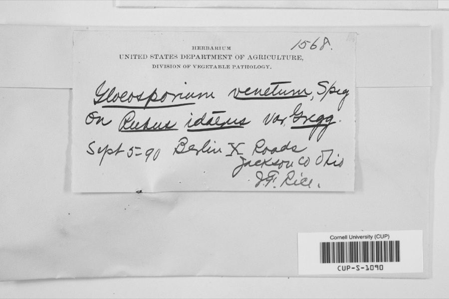
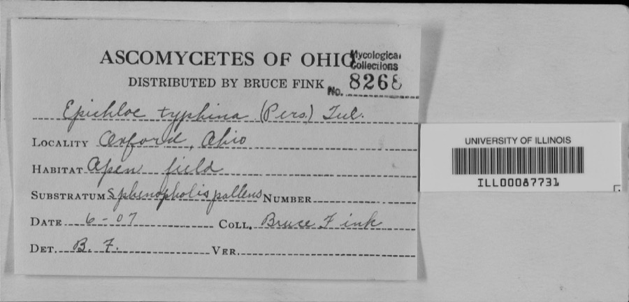
evidence. Museums hold 329 specimens
collected within 10 miles of Rochester Square Historic District between 1836 and
1975: 285 Animalia, 37 Plantae, 3 Fungi, 2 Unrecorded, 1 Protozoa, 1 Chromista. 12 distinct Species records are shown.
Collected by A.M. Rogers, Armbruster, D. C. (Daniel C.), Borror, D.J. and others. Each is a
physical object with a catalogue
number, and each entry opens the museum's record. This is what was
collected and kept, not a survey of what lives here - nothing can be
concluded from a species being absent.
Regional context, not property-specific
evidence. The federal mineral resources record lists
6 workings within 5 miles of Rochester Square Historic District: 3 producers, 2 past producers, 1 plant.
4 still produce. What was taken out: Sand and Gravel, Construction. Distance is straight-line from the
map coordinates, so a quarry counted here may appear on a neighbouring
settlement's page as well.
Regional context, not property-specific
evidence. The National Weather Service names
Navarre, the town this property stands in, in 14 storm reports between 1994 and 2020: 9 thunderstorm wind, 5 hail.
The reports record 1 injury. Each account below is quoted exactly as the forecast office
filed it, from the NOAA Storm Events Database, and each date
opens the federal record of that event.
The fire department reported 8 to 10 trees either sheared or uprooted when thunderstorms came through in the vicinity of Pidgeon Run Avenue Southwest and Poorman Street southwest in Navarre.
Multiple trees down in Navarre. Several dozen pine trees snapped or uprooted at the corner of Beth Avenue and Seeman Street SW in Bethlehem Township (i.e. 2 miles southeast of Navarre).
No historic map-sheet match is published
for this property yet. That does not mean no map exists. This record needs
a coordinate-quality review before it can be joined to a sheet boundary.
Browse the county's mapped places while that work is
pending.
From the nomination file
12,625 words on record
When this property was proposed for the
National Register, someone wrote the case for it: what the building is,
and why it matters. That document is a federal record in the public domain.
It is quoted below word for word, never summarised. The text was read off the scanned case file by machine, so the
occasional stray character is the recogniser's and the 1970s
typewriter's.
Statement of significance
Criteria Considerations (Exceptions): N/A Areas of Significance: Community Development Period(s) of Significance: 1838-1913 Significant Dates: Historic: 1838, 1873, 1913 Cultural Affiliation: N/A Architecture Other: Architect/Builder: Materials: 7. Description Late Victorian/Italianate. Certifying official has considered the significance of this property Store: SpecialtyStore; Other Description: in relation to other properties: Applicable National Register Criteria: Criterion A: Community Development; Criterion C:Architecture Significant Person(s):N/A Describe present and historic physical appearance. X See continuation sheet. Stark County, Ohio State significance of property, and justify criteria, criteria considerations, and areas and periods of significance 9.
Quoted from the National Register nomination
for reference 05001187, 71 pages, held by the National Archives in Record
Group 79. See the
catalogue record.
Listed places nearby
6 within 8 miles
Other National Register properties close
enough to walk or drive between, ordered by distance from this one. Both
positions come from the same geocoding pass that matched these properties
to their map sheets.
Listing record. National Park Service National Register of Historic Places, listed-properties dataset, current to 2026-05-22.
Map join. Address geocoded through the United States Census geocoder, then tested against the published boundary of every sheet in the USGS Historical Topographic Map Collection.
How this page is made. Listing fields come from federal records; map-sheet coverage is a labelled coordinate-to-boundary calculation, not a source-field claim.
Wildfire. Short, Karen C. 2022. Spatial wildfire occurrence data for the United States, 1992-2020 [FPA_FOD_20221014]. 6th Edition. Fort Collins, CO: Forest Service Research Data Archive. https://doi.org/10.2737/RDS-2013-0009.6 Collected with United States Government funding and usable without additional permissions or fees.
Specimens. Global Biodiversity Information Facility (GBIF), https://www.gbif.org/. Only records licensed CC0 or CC BY are used. Records licensed CC BY-NC are excluded because this site carries advertising. Images are checked individually and any whose licence is non-commercial, no-derivatives or unreadable is refused.
Mines and quarries. USGS Mineral Resources Data System (MRDS) https://mrdata.usgs.gov/mrds/ A work of the United States government, no copyright under 17 U.S.C. 105.
Storms. NOAA National Centers for Environmental Information, Storm Events Database https://www.ncei.noaa.gov/stormevents/ A work of the United States government, no copyright under 17 U.S.C. 105. Narratives are quoted verbatim from the National Weather Service report and are not edited or summarised.
 Block
Block