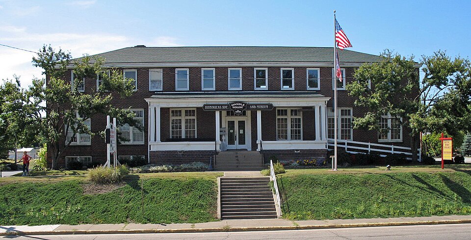
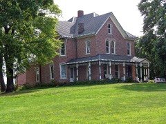
Listed on the National Register of Historic Places in
1985. A historic map-sheet match is not published yet. The record needs a coordinate-quality review before it can be joined to a sheet boundary.
From the record
one of 81 National Register listings in Stark County · listed in 1985 · category: Building.
National Register reference number.85000486- the number the National Park Service assigned this property when it was listed, and the key its nomination file is catalogued under at the National Archives.
Fires near this property
1 since 2018
Regional context, not property-specific
evidence. The
federal wildfire occurrence database
lists 1 fire within 5 miles of Brewster Railroad YMCA/Wandle House between
2018 and 2018, burning about 1 acres in total. None started naturally. None was recorded as arson.
Distance is straight-line from the map coordinates, so a fire counted
here may appear on a neighbouring settlement's page as well.
Reported cause
Fires
Debris and open burning
1
The most recent of
them, most recent first, with the day each was reported and the service
that recorded it.
Regional context, not property-specific
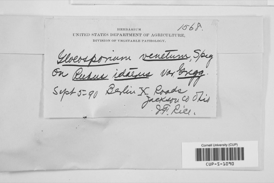
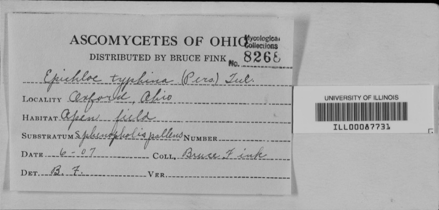
evidence. Museums hold 165 specimens
collected within 10 miles of Brewster Railroad YMCA/Wandle House between 1875 and
1975: 154 Animalia, 7 Plantae, 2 Fungi, 1 Unrecorded, 1 Chromista. 12 distinct Species records are shown.
Collected by Armbruster, D. C. (Daniel C.), Borror, D.J., Bruce Fink and others. Each is a
physical object with a catalogue
number, and each entry opens the museum's record. This is what was
collected and kept, not a survey of what lives here - nothing can be
concluded from a species being absent.
Regional context, not property-specific
evidence. The federal mineral resources record lists
4 workings within 5 miles of Brewster Railroad YMCA/Wandle House: 2 past producers, 1 plant, 1 producer.
2 still produce. What was taken out: Sand and Gravel, Construction. Distance is straight-line from the
map coordinates, so a quarry counted here may appear on a neighbouring
settlement's page as well.
Regional context, not property-specific
evidence. The National Weather Service names
Brewster, the town this property stands in, in 12 storm reports between 1996 and 2019: 5 thunderstorm wind, 4 hail, 2 tornado, 1 lightning.
The reports record 1 death. Each account below is quoted exactly as the forecast office
filed it, from the NOAA Storm Events Database, and each date
opens the federal record of that event.
A F1 tornado touched down just west of Brewster at 5:45 p.m. on June 22nd. This tornado tracked to the east northeast and finally lifted near Navarre. This tornado had a damage path roughly four miles in length and 50 to 75 yards in width. Extensive damage was done in Brewster, especially on the west side of the town. Five houses, two garages and one car were destroyed on West 4th Street with other homes elsewhere in Brewster sustaining lesser damages. Twelve mobile homes were also destroyed or damaged enough to be declared uninhabitable in Brewster. A local utility company had roughly $300,000 in damage and repair costs. The tornado continued to Navarre and finally lifted after damaging a few more homes and buildings. It was estimated that over a thousand trees were downed along the damage path with 400 reported down in Brewster and another 300 down in Navarre. Some of this damage may have been caused by straight line winds associated with the parent thunderstorm. Most of the structural damage along the path was caused by toppled trees. The City of Brewster alone spent $450,000 for clean up costs and repairs to city property.
A NWS storm survey found an EF-0 tornado was on the ground for approximately 8.7 miles with estimated wind speeds up to 80 mph and a path width of 50 yards. Most of the damage associated with this tornado was uprooted trees and broken limbs, along with the occasional structure damage such as shingles and siding missing. The most significant structural damage occurred from at least 2 trees falling on houses.
A line of thunderstorms raced across the county, producing 60mph wind gusts. Multiple reports of downed large trees and tree branches came in during this event. Power outages were reported as a result of the downed trees on power lines.
No historic map-sheet match is published
for this property yet. That does not mean no map exists. This record needs
a coordinate-quality review before it can be joined to a sheet boundary.
Browse the county's mapped places while that work is
pending.
From the nomination file
2,217 words on record
When this property was proposed for the
National Register, someone wrote the case for it: what the building is,
and why it matters. That document is a federal record in the public domain.
It is quoted below word for word, never summarised. The text was read off the scanned case file by machine, so the
occasional stray character is the recogniser's and the 1970s
typewriter's.
Description of the property
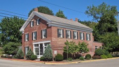
The Wandle House is a two-story building constructed in 1916 by the Wheeling and Lake Erie Railroad as a 65 -room railroad YMCA to house employees on layover at the central junction of the RR system. The building sits on the west side of Wabash Avenue in Brewster, just south of the railroad yards and adjoining Brewster's commercial section. The Wandle House is U-shaped, with two wings extending west from the main block of the building. The southern wing is two stories and the northern wing is one story in height. Other than a change from a stucco to a brick finish in the early 1920s, the exterior is essentially The Wandle House was built as a fifty-four bed dormitory and restaurant.
The foundation is masonry block and brick, with a full basement, and wall construction is framed with - sith running-bond brick. The main two story block is 93 feet long and 34 feet wide, with a 52 foot long central porch facing east onto Wabash Avenue. Entrance to the building is obtained through double wood-framed glass doors surmounted by a five-light transom. The ground floor front facade also features six wood-sash triple hung 6 over 6 windows with three-light upper sashes. Thirteen double hung 1 over 1 windows line the second story. Each connecting wing, 62 feet long by 27 feet wide, also features double hung 1 over 1 windows. The cornice is plain and the hipped roof is shingled.
The interior featured not only sleeping rooms but also a restaurant, a theater room in the north wing, meeting rooms, a shooting gallery, and a two-lane bowling alley in the basement. The railroad later laid a four lane alley running east-west over the old north-south two land facility.
/Architect B1dr: Wheeling & Lake Erie RR Statement of Significance (in one paragraph) The Wandle House is one of the two most prominent railroad buildings in Brewster, a town founded and built by the Wheeling and Lake Erie Railroad as the railroad headquarters and a home for its employees. Within the context of Brewster's development as a railroad town, the Wandle (W and L E) House, is significant under Criterion A as representing the totally interdependent association of Brewster and its development with the 20th century expansion and transformation of the railroads. Development of Brewster began in 1904 when the W & LE RR decided to relocate its major yards to relieve inadequate facilities at Massillon and to provide housing for employees at the central transfer point on the system.
"In most instances, large railroad facilities grew up next door to previously established communities, but such was not the case at Brewster. Here the railroad first appeared, and then the city (sic) was established. As the youngest village in Stark County, Brewster owes its very existence to the Wheeling..." (NKP Magazine: p.5). Shop and engine servicing facilities, a depot/office/headquarters building, and other support facilities were constructed, and "in the heyday of its oper- ations the Brewster facilities provided a drawing card for both employees and the business community to serve them." (Ibid.:3). A growing need for railroader housing led to the construction of the Wandle House in 1916. The Wandle House, first known as the Brewster RR YMCA,was built as a 62 room dormitory.
It was one of only a few known railroad YMCA's in Ohio built specifically for housing employees and officials of a major transfer point as part of the overall development anâ expansion of a complete railroad complex and town.
Quoted from the National Register nomination
for reference 85000486, 12 pages, held by the National Archives in Record
Group 79. See the
catalogue record.
Listed places nearby
6 within 8 miles
Other National Register properties close
enough to walk or drive between, ordered by distance from this one. Both
positions come from the same geocoding pass that matched these properties
to their map sheets.
Listing record. National Park Service National Register of Historic Places, listed-properties dataset, current to 2026-05-22.
Map join. Address geocoded through the United States Census geocoder, then tested against the published boundary of every sheet in the USGS Historical Topographic Map Collection.
How this page is made. Listing fields come from federal records; map-sheet coverage is a labelled coordinate-to-boundary calculation, not a source-field claim.
Wildfire. Short, Karen C. 2022. Spatial wildfire occurrence data for the United States, 1992-2020 [FPA_FOD_20221014]. 6th Edition. Fort Collins, CO: Forest Service Research Data Archive. https://doi.org/10.2737/RDS-2013-0009.6 Collected with United States Government funding and usable without additional permissions or fees.
Specimens. Global Biodiversity Information Facility (GBIF), https://www.gbif.org/. Only records licensed CC0 or CC BY are used. Records licensed CC BY-NC are excluded because this site carries advertising. Images are checked individually and any whose licence is non-commercial, no-derivatives or unreadable is refused.
Mines and quarries. USGS Mineral Resources Data System (MRDS) https://mrdata.usgs.gov/mrds/ A work of the United States government, no copyright under 17 U.S.C. 105.
Storms. NOAA National Centers for Environmental Information, Storm Events Database https://www.ncei.noaa.gov/stormevents/ A work of the United States government, no copyright under 17 U.S.C. 105. Narratives are quoted verbatim from the National Weather Service report and are not edited or summarised.
 Block
Block