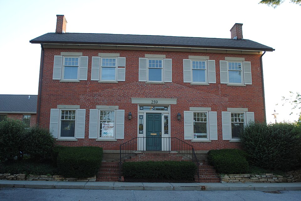
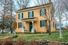
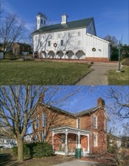
Built in 1849. Listed on the National Register of Historic Places in
1978. A historic map-sheet match is not published yet. The record needs a coordinate-quality review before it can be joined to a sheet boundary.
From the record
“The Alkire House is a historic residence in the Columbus suburb of Westerville, Ohio, United States. Constructed during the middle of the nineteenth century and used both as a residence and as a slave-smuggling safehouse, it retains much of its original fabric, and it has been designated a historic site.”
Wikipedia article Alkire House, CC BY-SA 4.0.
one of 295 National Register listings in Franklin County · listed in 1978 · category: Building · built in 1849 · one of 3 National Historic Landmarks in Franklin County.
National Register reference number.78002068- the number the National Park Service assigned this property when it was listed, and the key its nomination file is catalogued under at the National Archives.
Specimens collected near this property
12 of 2,449 shown
Regional context, not property-specific
evidence. Museums hold 2,449 specimens
collected within 10 miles of Alkire House between 1804 and
1975: 2,377 Animalia, 45 Plantae, 23 Fungi, 3 Unrecorded, 1 Chromista. 12 distinct Species records are shown.
Collected by A C Whitney, A. J. Penniman, A. P. Morgan and others. Each is a
physical object with a catalogue
number, and each entry opens the museum's record. This is what was
collected and kept, not a survey of what lives here - nothing can be
concluded from a species being absent.
Regional context, not property-specific
evidence. The National Weather Service names
Westerville, the town this property stands in, in 36 storm reports between 1994 and 2026: 19 thunderstorm wind, 12 hail, 2 flash flood, 2 flood.
No death or injury is recorded in these reports. Each account below is quoted exactly as the forecast office
filed it, from the NOAA Storm Events Database, and each date
opens the federal record of that event.
Hail up to the size of golf balls affected the north side of the Columbus metro area and southern Delaware county. Hail was extensive from Dublin, through Worthington and Powell, to Westerville. Trees and shrubs were stripped of their foliage and cars and homes sustained significant hail damage. The hail covered the ground in some locations up to six inches deep in Worthington in northern Franklin county and near the Polaris Mall in southern Delaware county.
No historic map-sheet match is published
for this property yet. That does not mean no map exists. This record needs
a coordinate-quality review before it can be joined to a sheet boundary.
Browse the county's mapped places while that work is
pending.
From the nomination file
1,633 words on record
When this property was proposed for the
National Register, someone wrote the case for it: what the building is,
and why it matters. That document is a federal record in the public domain.
It is quoted below word for word, never summarised. The text was read off the scanned case file by machine, so the
occasional stray character is the recogniser's and the 1970s
typewriter's.
Description of the property
with a 1à story west wing. The principal facade is of a five bay design which contains a stair well that leads down to the kitchen. CONDITION erection. windows. UNEXPOSED DESCRIPTION EXCELLENT UNALTERED common bond pattern.All the openings in the building have stone lintels.Foundation bedrooms are two story rooms in the west wing. The first room contains dormer The west elevation consists of an entrance to the wood house and assorted The present gable roof is of asphalt shingles. CHECK ONE Also noted is the chimney to a previously existing kitchen fireplace. The second floor consists of bedrooms flanking the stair hall.Beyond the In the gable section on the south facade are small windows. The gable section of the north facade contains two brick vent patterns. addition to the structure.
The porch is of wood construction of which the outstanding feature is the decorative balustrade at the perimeter of the eaves. shingles and dormer windows are found on both the north and south slopes. The south facade is a frame enclosed porch with an entrance to the kitchen. The north consists of 8/i double hung windows with movable shutters and an entrance door design that was typical of builders The west section is also a brick structure.The gable roof is of asphalt fireplace that was a later addition. Beyond the living room to the west is the of the stair hall is the parlor. To the north is the living room which contains a bearing wall and wood rafters which were hand hewn on the premises at the time of elevation of the west wing has a small porch over the entrance to the dining area.
STATEMENT OF SIGNIFICANCE Due to the prime location of the house and the surrounding property, several 1600-1699 1849 INVENTION ECONOMICS EDUCATION ART COMMERCE AGRICULTURE COMMUNICATIONS PERIOD THEATER LITERATURE SIGNIFICANCE LAW SCIENCE BUILDER/ARCHITECT TRANSPORTATION EXPLORATION/SETTLEMENT ARCHEOLOGY-HISTORIC MILITARY SCULPTURE INDUSTRY XARCHITECTURE MUSIC _POLITICS/GOVERNMENT of the style and type of construction in dwellings that existed during the mid _PHILOSOPHY interested groups of people in Westerville would like to see the Alkire home _CONSERVATION for a planned neighborhood development. the city to be used as a house museum or a historical community center. 1800's.
The house is still in relatively good condition considering its age and _PREHISTORIC possibility of the property being sold is very real. The Alkire Home built in l849 is one of the oldest structures in Westerville.
The building has been owmed by descendents of the original owner and builder up to the present day.The dwelling has been vacant for the last three years and the _ENGINEERING -1700-1799 -1400-1499 -RELIGION option on the property for a developer who would like to see the l7 acres used -1900- ARCHEOLOGY-PREHISTORIC some talk within the Westerville city council that the building be acquired by Others have also been interested in the property.Edison Investments has an preserved and put to a good use for the Westerville community.There has been _COMMUNITYPLANNING it should be considered an asset to the Westerville community. 1. R. E. Miner - A Westerville Sketchbook-1975 2. Harold Handeock - The History of Westerville-1974 0
Quoted from the National Register nomination
for reference 78002068, 11 pages, held by the National Archives in Record
Group 79. See the
catalogue record.
Listed places nearby
6 within 8 miles
Other National Register properties close
enough to walk or drive between, ordered by distance from this one. Both
positions come from the same geocoding pass that matched these properties
to their map sheets.
Listing record. National Park Service National Register of Historic Places, listed-properties dataset, current to 2026-05-22.
Map join. Address geocoded through the United States Census geocoder, then tested against the published boundary of every sheet in the USGS Historical Topographic Map Collection.
How this page is made. Listing fields come from federal records; map-sheet coverage is a labelled coordinate-to-boundary calculation, not a source-field claim.
Specimens. Global Biodiversity Information Facility (GBIF), https://www.gbif.org/. Only records licensed CC0 or CC BY are used. Records licensed CC BY-NC are excluded because this site carries advertising. Images are checked individually and any whose licence is non-commercial, no-derivatives or unreadable is refused.
Storms. NOAA National Centers for Environmental Information, Storm Events Database https://www.ncei.noaa.gov/stormevents/ A work of the United States government, no copyright under 17 U.S.C. 105. Narratives are quoted verbatim from the National Weather Service report and are not edited or summarised.
 Block
Block