BlockBefore
Decorative drawing: a small railway depot with a platform canopy and a water tower. Not a photograph of this place.

Big Four Depot

Listed on the National Register of Historic Places in 2013. A historic map-sheet match is not published yet. The record needs a coordinate-quality review before it can be joined to a sheet boundary.

From the record

“At a regular meeting of the congregation, held August 9, 1828, the name of the society was changed from the Salem Baptist church to the First Baptist church of Middletown, Ohio. In the winter of 1828 it was agreed that a new brick church should be built and the act of incorporation was secured and Jacob Deerdorff, Thomas Royal and David Taylor were chosen as trustees.”

Centennial History of Butler County, Ohio (1905). Machine-read text.

one of 63 National Register listings in Butler County · listed in 2013 · category: Building · one of 3 National Historic Landmarks in Butler County.

Sources: the county history on the Internet Archive · the National Register database, National Park Service

The listing

  • What is counted as historic. The nomination lists 1 building as contributing to the listing.
  • Address. 25 Charles St., Middletown, 45044
  • When was it listed? 2013-12-24
  • Category. building
  • Township. Middletown city
  • National Register reference number. 13000979 - assigned by the National Park Service when the property was listed.

The ground it stands on

55,072 words

The chapter on Middletown City in A History and Biographical Cyclopædia of Butler County, Ohio : with Illustrations and Sketches of Its Representative Men and Pioneers, published 1882 names Middletown. This is what it says, exactly as the scans read.

The original town plat of Middletown, laid out in 1802 by Stephen Vail and James Sutton, reads as follows: "The above town is laid out in the fractional section No. 28, in township and fourth range, between the Miami Rivers. ach lot is six poles one way, agreeably to the plan, except the lots Nos. 43, 46, 47, and 50, which are six poles square. The streets are each four poles wide. The course of those running from the river is south, sixty degrees east. Water and Main Streets cross the other at right angles. North Alley and South Alley are each two poles wide. East Alley and West Alley are each one pole wide. The alleys are parallel with the streets. The streets and alleys to be perpetually kept open for public use. The lots Nos. 10 and 11, which are colored green, are set aside for the public, to be appropriated to county purposes. First, Second, and Third Streets are always to be kept open to the river."

Passage source: A History and Biographical Cyclopædia of Butler County, Ohio : with Illustrations and Sketches of Its Representative Men and Pioneers, published 1882.

In 1816 the first addition was laid out, as follows: 'Tn addition to Middletown, in the county of Butler, the subscribers have laid off fifty-seven lots, of the same dimensions of the whole lots in the old plat, excepting Lot 65, containing one hundred and fifty-six poles and fourfifths. Broad Street is five poles wide. What was called South Alley is made three poles wide and called Fourth Street, and the one south of it three poles wide and called Fifth Street. What is called East Alley, in the old part of the town, between the lots on Broadway Street and Main Street, is continued at one pole wide and called Middle Alley; and the one east of the lots, on the east side of Broadway, is one pole wide and called East Alley. The streets and alleys are parallel with those of the old town plat, as recorded, and are to be opened at any time a majority of the subscribers may think necessary, as witness our hands this the twentyseventh day of March, 1816. Broad Street is to be continued at each end thereof the same course until it intersects the county road to Franklin and the one south to Middletown, leading to Reading and thence to Cincinnati." This is signed by Hugh Vail, Shobal Vail, John Cummings, Daniel Doty, and Abner Enoch.

Passage source: A History and Biographical Cyclopædia of Butler County, Ohio : with Illustrations and Sketches of Its Representative Men and Pioneers, published 1882.

Machine-read from a century-old scan, so expect the errors a machine makes: misspelled names, dropped words, stray characters.

Read the whole chapter on Middletown City - 55,072 words on its settlement, mills, schools and churches.

Specimens collected near this property

12 of 91 shown

Regional context, not property-specific evidence. Museums hold 91 specimens collected within 10 miles of Big Four Depot between 1879 and 1973: 71 Animalia, 13 Fungi, 7 Plantae. 12 distinct Species records are shown. Collected by ?, A. C. Billups, A.R. Gaufin, H.H. Ross and others. Each is a physical object with a catalogue number, and each entry opens the museum's record. This is what was collected and kept, not a survey of what lives here - nothing can be concluded from a species being absent.

Image SpeciesYear Collected by Where, as recorded
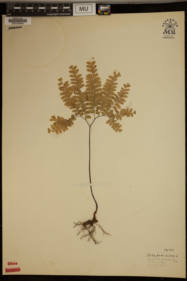
Specimen of Adiantum pedatum L.Adiantum pedatum L.1929?Hueston Woods.
A photograph of the species Coluber constrictor, not of this specimenColuber constrictor Linnaeus, 17581879not recordedHughes
A photograph of the species Diadophis punctatus, not of this specimenDiadophis punctatus arnyi Kennicott, 18591879not recordedHughes
A photograph of the species Lampropeltis triangulum, not of this specimenLampropeltis triangulum (Lacépède, 1789)1879not recordedHughes
A photograph of the species Storeria dekayi, not of this specimenStoreria dekayi (Holbrook, 1839)1879not recordedHughes
A photograph of the species Storeria occipitomaculata, not of this specimenStoreria occipitomaculata Storer, 18391879not recordedHughes
A photograph of the species Tropidoclonion lineatum, not of this specimenTropidoclonion lineatum (Hallowell, 1856)1879not recordedHughes
Liochlorophis vernalis (Harlan, 1827)1880not recordedMonroe
A photograph of the species Thamnophis sirtalis, not of this specimenThamnophis sirtalis (Linnaeus, 1758)1880not recordedMonroe
A photograph of the species Physella gyrina, not of this specimenPhysella gyrina (Say, 1821)1898A. C. BillupsMiddletown
Ascobolus aeruginosus (Oeder) Gillet1920Lloyd C. G.Middletown
Corticium Pers., 17941920Lloyd C. G.Middletown

All 91 specimens within 10 miles, at the Global Biodiversity Information Facility.

Mines and quarries near this property

8 within 5 miles

Regional context, not property-specific evidence. The federal mineral resources record lists 8 workings within 5 miles of Big Four Depot: 3 past producers, 3 producers, 1 unknown, 1 plant. 4 still produce. What was taken out: Sand and Gravel, Construction, Iron. Distance is straight-line from the map coordinates, so a quarry counted here may appear on a neighbouring settlement's page as well.

Where SiteCommodity StatusRecorded
Armco Inc/ Middletown, OhioIronUnknown
Mecco Inc.Sand and Gravel, ConstructionProducer
Mecco, Incorporated PltSand and Gravel, ConstructionPast ProducerSedimentary
Middletown PitSand and Gravel, ConstructionPast ProducerSedimentary
Middletown PitSand and Gravel, ConstructionProducer
Moorman PitSand and Gravel, ConstructionPast ProducerSedimentary
Moorman PitSand and Gravel, ConstructionProducer
Moorman Pit & MillSand and Gravel, ConstructionPlant

Every working recorded in Butler County

Storms near this property

37 since 1994

Regional context, not property-specific evidence. The National Weather Service names Middletown, the town this property stands in, in 37 storm reports between 1994 and 2024: 22 thunderstorm wind, 12 hail, 2 flash flood, 1 lightning. The reports record 2 injuries. Each account below is quoted exactly as the forecast office filed it, from the NOAA Storm Events Database, and each date opens the federal record of that event.

WhenEvent Place namedHarm What the report says
October 2001Thunderstorm WindMiddletown1 hurt, $5,000A woman was injured when a tree fell on her. She suffered a concussion and some cuts and bruises. Numerous trees were downed in the Middletown and in New Miami areas.
July 2006LightningMiddletown1 hurtAn 18 year old girl on a telephone received minor injuries from a lightning strike.
July 1994Thunderstorm WindMiddletown$50,000Trees, signs, and fences were downed along with some power lines.
May 2006HailMiddletown$12,000no account filed
June 2022Thunderstorm WindWest Middletown$10,000A tree fell onto a house on Poplar Street.
July 2011Thunderstorm WindMiddletown$10,000A boat was flipped over, shingles were blown off of a house, crops were bent over, and a tree was reported down due to damaging thunderstorm winds.
June 2004Thunderstorm WindMiddletown$5,000Several trees were downed. One tree fell on a truck, causing minor damage.
June 2002Thunderstorm WindMiddletown$5,000Trees and power lines were kncked down in the city.
July 1996Thunderstorm WindMiddletown$5,000no account filed
June 2015Thunderstorm WindWest Middletown$4,000Numerous large trees uprooted or snapped in Madison Township.
July 2015Thunderstorm WindMiddletown$4,000Numerous large trees were downed across the Middletown area.
January 2008Thunderstorm WindMiddletown$4,000Several trees were downed across the eastern part of the county.
April 2007HailMiddletown$4,000no account filed
May 2017Thunderstorm WindMiddletown$3,000Several trees were downed in the Middletown area.
June 2006Thunderstorm WindMiddletown$3,000A few large tree limbs were knocked down.
June 2001Thunderstorm WindMiddletown$3,000A few trees knocked down
May 1995Thunderstorm WindMiddletown$3,000Several trees downed.
June 2022Thunderstorm WindMiddletown$1,000Numerous large branches were downed.
June 2015Thunderstorm WindWest Middletown$1,000A large tree, approximately 3 feet in diameter at the base, was knocked down.
March 2011Thunderstorm WindMiddletown$1,000Two trees were reported down due to damaging thunderstorm winds.
May 2011Thunderstorm WindMiddletown$1,000A tree was down due to damaging thunderstorm winds.
July 2011Thunderstorm WindMiddletown$1,000A few trees were damaged about 20 to 30 feet above the ground due to damaging thunderstorm winds.
June 2010Thunderstorm WindMiddletown$1,000Large tree limbs and a tree was reported down due to damaging thunderstorm winds.
August 2010Thunderstorm WindMiddletown$1,000Trees were reported down due to damaging thunderstorm winds.
June 2008HailMiddletown$1,000no account filed
March 2006Flash FloodMiddletown-Several roads were flooded in town.
August 2001Flash FloodMiddletown-Heavy rainfall caused flooded streets. Many vehicles were stranded in the high water including an ambulance that was transporting a patient to a hospital.
July 2024HailMiddletown-no account filed
May 2012HailMiddletown-no account filed
June 2012Thunderstorm WindMiddletown-no account filed
March 2011HailMiddletown-no account filed
May 2011HailMiddletown-no account filed
April 2010HailMiddletown-no account filed
August 2010HailMiddletown-no account filed
April 2003HailMiddletown-no account filed
June 1996HailMiddletown-no account filed

Every storm recorded in Butler County

Map coverage status

No historic map-sheet match is published for this property yet. That does not mean no map exists. This record needs a coordinate-quality review before it can be joined to a sheet boundary. Browse the county's mapped places while that work is pending.

Listed places nearby

6 within 8 miles

Other National Register properties close enough to walk or drive between, ordered by distance from this one. Both positions come from the same geocoding pass that matched these properties to their map sheets.

Photograph PropertyDistance Listed
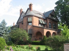
Tytus, John B., House0.2 miles1975
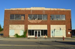
Hotel Manchester0.6 miles2014
Snider, Dan F., Ford Dealership Building0.6 miles2014
Main Street Commercial Historic District0.7 miles2014
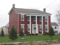
Ehresman, Christian, Farm4.4 miles1984
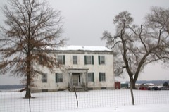
Augspurger, John, Farm No. 14.6 miles1984

Sources for this property

National Archives recordThe nomination case file for reference 13000979 in Record Group 79.
Butler CountyAll 63 listed properties in this county.

Provenance

  • Listing record. National Park Service National Register of Historic Places, listed-properties dataset, current to 2026-05-22.
  • Map join. Address geocoded through the United States Census geocoder, then tested against the published boundary of every sheet in the USGS Historical Topographic Map Collection.
  • How this page is made. Listing fields come from federal records; map-sheet coverage is a labelled coordinate-to-boundary calculation, not a source-field claim.
  • Specimens. Global Biodiversity Information Facility (GBIF), https://www.gbif.org/. Only records licensed CC0 or CC BY are used. Records licensed CC BY-NC are excluded because this site carries advertising. Images are checked individually and any whose licence is non-commercial, no-derivatives or unreadable is refused.
  • Mines and quarries. USGS Mineral Resources Data System (MRDS) https://mrdata.usgs.gov/mrds/ A work of the United States government, no copyright under 17 U.S.C. 105.
  • Storms. NOAA National Centers for Environmental Information, Storm Events Database https://www.ncei.noaa.gov/stormevents/ A work of the United States government, no copyright under 17 U.S.C. 105. Narratives are quoted verbatim from the National Weather Service report and are not edited or summarised.