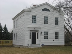
Listed on the National Register of Historic Places in
1969. A historic map-sheet match is not published yet. The record needs a coordinate-quality review before it can be joined to a sheet boundary.
From the record
one of 21 National Register listings in Wood County · listed in 1969 · category: Building · one of 1 National Historic Landmarks in Wood County.
National Register reference number.69000152- the number the National Park Service assigned this property when it was listed, and the key its nomination file is catalogued under at the National Archives.
Regional context, not property-specific
evidence. The
federal wildfire occurrence database
lists 2 fires within 5 miles of Old Wood County Jail between
2002 and 2002, burning about 5 acres in total. None started naturally. None was recorded as arson.
Distance is straight-line from the map coordinates, so a fire counted
here may appear on a neighbouring settlement's page as well.
Reported cause
Fires
Recreation and ceremony
1
Smoking
1
The most recent of
them, most recent first, with the day each was reported and the service
that recorded it.
Regional context, not property-specific
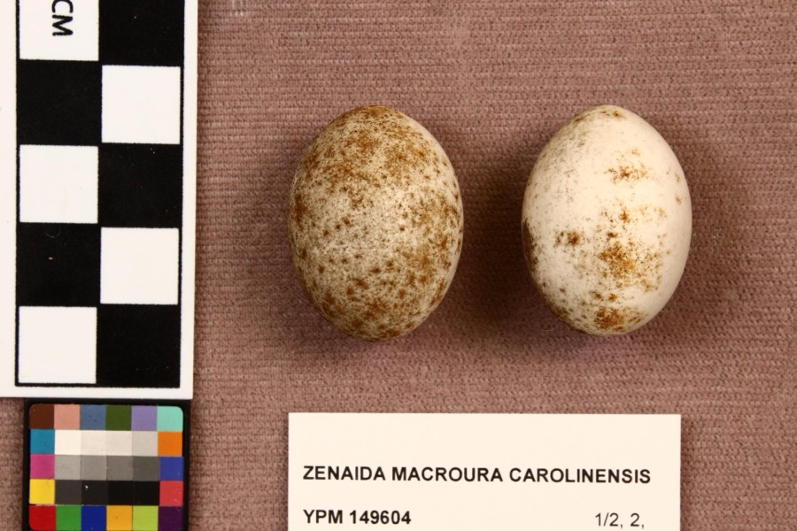
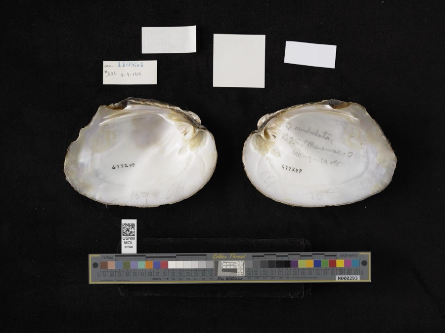
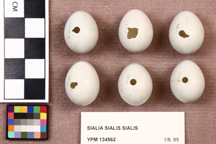
evidence. Museums hold 266 specimens
collected within 10 miles of Old Wood County Jail between 1875 and
1975: 226 Animalia, 34 Plantae, 5 Fungi, 1 Chromista. 12 distinct Species records are shown.
Collected by A. Lose, Aborn, R., Angle, E. (Eric) and others. Each is a
physical object with a catalogue
number, and each entry opens the museum's record. This is what was
collected and kept, not a survey of what lives here - nothing can be
concluded from a species being absent.
Regional context, not property-specific
evidence. The federal mineral resources record lists
3 workings within 5 miles of Old Wood County Jail: 2 plants, 1 past producer.
2 still produce. What was taken out: Stone, Crushed/Broken, Limestone, General. Distance is straight-line from the
map coordinates, so a quarry counted here may appear on a neighbouring
settlement's page as well.
Regional context, not property-specific
evidence. The National Weather Service names
Perrysburg, the town this property stands in, in 65 storm reports between 1995 and 2023: 32 thunderstorm wind, 29 hail, 1 flash flood, 1 lightning.
No death or injury is recorded in these reports. Each account below is quoted exactly as the forecast office
filed it, from the NOAA Storm Events Database, and each date
opens the federal record of that event.
Hail to tennis ball size fell for several minutes and accumulated on the ground to a depth of over six inches at some locations. The hail plugged many storm sewers causing water to back up into the basements of several homes. Dozens of vehicles and many homes were damaged and hundreds of trees were completely stripped of leaves.
Thunderstorm downburst winds estimated to be as much as 70 mph caused considerable damage in Perrysburg. Dozens of trees and at least three utility poles were toppled. A few homes were damaged by fallen trees. Scattered power outages were reported.
Thunderstorm winds blew over two fully loaded semi trucks six miles east of Perrysburg near the intersection of Interstates 80/90 and 280. Both trucks were severely damaged. The roof of a large building nearby was also torn off.
On March 12th an ice jam formed on the Maumee River. By the 14th the ice had backed in the town of Perrysburg. A farm sustained damages when about two feet of topsoil was removed in an area farm with thousands of dollars in economic loss. The Buttonwood Park in Perrysburg also sustained damages but no buildings were impacted.
A funnel cloud was observed along Interstate 75 near Perrysburg. Trained spotters tracked the funnel for several minutes as it drifted slowly northeast. Although persistent rotation was observed, the funnel did not come in contact with the ground at any time. The funnel may have been a cold air funnel.
1 paper published in this town,
digitised by the Library of Congress and free to read: 0 issues,
0 pages. Every page is searchable, so a name or a street can be
looked for directly in what the town printed about itself at the time.
No historic map-sheet match is published
for this property yet. That does not mean no map exists. This record needs
a coordinate-quality review before it can be joined to a sheet boundary.
Browse the county's mapped places while that work is
pending.
From the nomination file
1,822 words on record
When this property was proposed for the
National Register, someone wrote the case for it: what the building is,
and why it matters. That document is a federal record in the public domain.
It is quoted below word for word, never summarised. The text was read off the scanned case file by machine, so the
occasional stray character is the recogniser's and the 1970s
typewriter's.
Description of the property
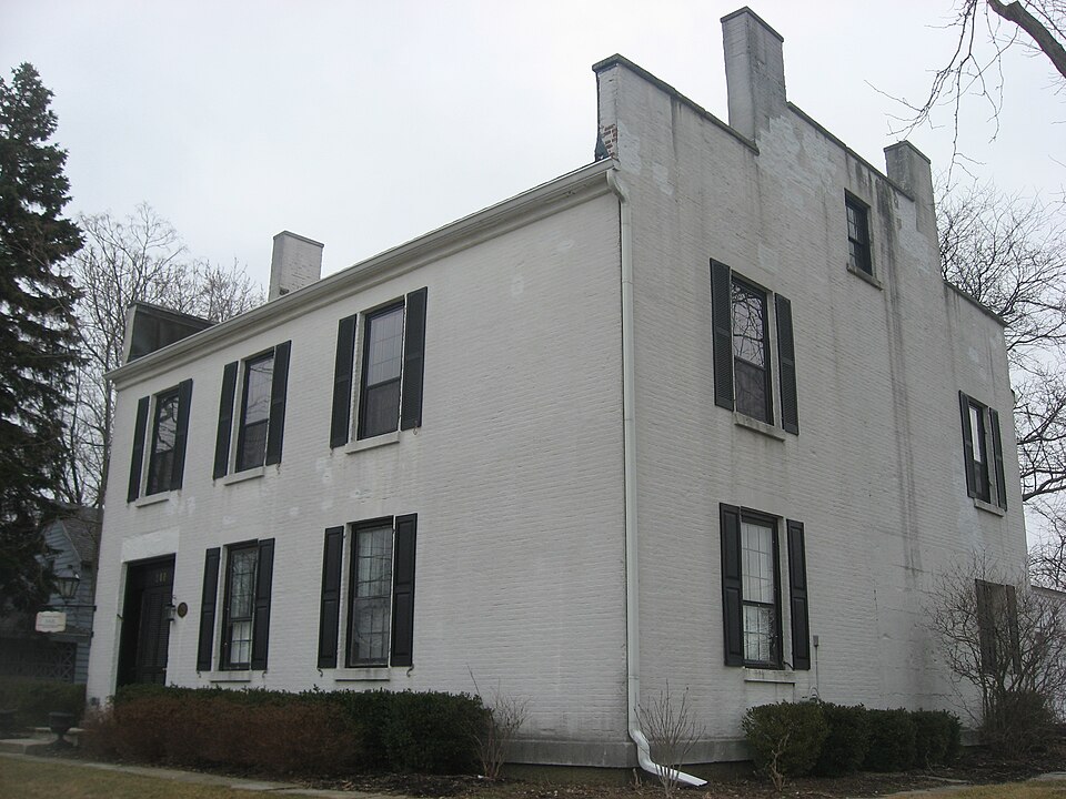
The basic cube shape of the brick building, its symmetrical facade fenestration scheme, attenuated window proportions, brick eave courses, Warner House, Portsmouth, N.H., but this convention was brought to the Mid- Time, weather and usage have been kind to the jail. Its rigid construc- with a sheet of lead between, hundreds of large iron rivets hold them to- of 1½" plank flooring below that are 16" by 18" black walnut beams laid solid side by side, below which is a layer of solid concrete and under this more walnut planks and then plaster, thus making escape from the "bull pen" walls and floors, remains intact. DEC 1 1969 CONDITION Revival. NATIONAL bear hallmarks of the Greek Revival influence.
period.Earlier similar uses are known on such structures as the McPhedris- native stone lintels and sills recall the Federal style in this country. chimmeys is reflective of a Midwestern style used during the Greek Revival combines architectural details of the American Federal period and the Greek making a change in the original architecture, other than adding three parti- However the carrying up of the end walls as parapets between the end floors have been refinished throughout; old plastered walls and ceilings have All of the restoration has been done without demolishing a wall or of the second floor forms the ceiling of the cells below and has two layers Built in 1847,this structure is of particular
Statement of significance
The custody of prisoners was turned over to George E.Crook in 1847, and iron doors) amounted to $l50.The Hubbel Brick Yard in Maumee made Wood County to Guliep Walton,Dr.Feb.15,1853.To sawing and pil- Some papers dated from 1849 to 1867 consist of summons of prisoners, is the way a few of those documents read: Sheriffs who served in the jail were:John Webb, 1848;Peleg of Dec.1854 to Jan.31,1855; thirty-one days at thirty-seven cents Industry 1861;Charles W.Evers,1865; John W. Brownsberger,1869; Thomas L.Webb, with an 18"wide doorway equipped with a 400lb.iron-mesh door.
For boarding James A.Henry in the jail of the county from the 3lst estimated at $800 and other work at $l,022;iron work over windows Art Opening off the 8'by 30'bull pen were six cells each measuring5'by 6' and one-half (37*¢) per day, $11.62½. Feb. 2, 1855-P. Chappel, ing 10 cords of wood for jail. $5.00 - I certify the above amount day for each prisoner housed within.The jail was well constructed with bills and receipts for keeping prisoners and their apprehension; also thick.They were secured by three cannon ball keys between each stone. The whole cost was estimated at $2,150.The masonry work was Lindsay.T who was given free residence in the front part of the jail and 75 cents a RECEIVED
Quoted from the National Register nomination
for reference 69000152, 12 pages, held by the National Archives in Record
Group 79. See the
catalogue record.
Listed places nearby
6 within 8 miles
Other National Register properties close
enough to walk or drive between, ordered by distance from this one. Both
positions come from the same geocoding pass that matched these properties
to their map sheets.
Listing record. National Park Service National Register of Historic Places, listed-properties dataset, current to 2026-05-22.
Map join. Address geocoded through the United States Census geocoder, then tested against the published boundary of every sheet in the USGS Historical Topographic Map Collection.
How this page is made. Listing fields come from federal records; map-sheet coverage is a labelled coordinate-to-boundary calculation, not a source-field claim.
Wildfire. Short, Karen C. 2022. Spatial wildfire occurrence data for the United States, 1992-2020 [FPA_FOD_20221014]. 6th Edition. Fort Collins, CO: Forest Service Research Data Archive. https://doi.org/10.2737/RDS-2013-0009.6 Collected with United States Government funding and usable without additional permissions or fees.
Specimens. Global Biodiversity Information Facility (GBIF), https://www.gbif.org/. Only records licensed CC0 or CC BY are used. Records licensed CC BY-NC are excluded because this site carries advertising. Images are checked individually and any whose licence is non-commercial, no-derivatives or unreadable is refused.
Mines and quarries. USGS Mineral Resources Data System (MRDS) https://mrdata.usgs.gov/mrds/ A work of the United States government, no copyright under 17 U.S.C. 105.
Storms. NOAA National Centers for Environmental Information, Storm Events Database https://www.ncei.noaa.gov/stormevents/ A work of the United States government, no copyright under 17 U.S.C. 105. Narratives are quoted verbatim from the National Weather Service report and are not edited or summarised.
 Block
Block