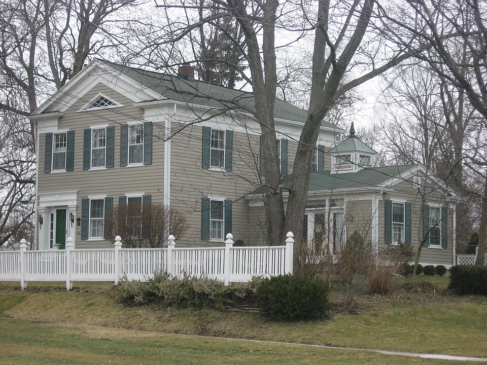
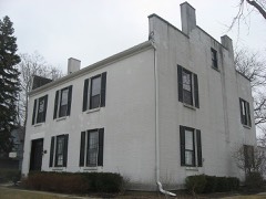
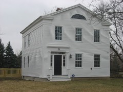
Built in 1840 in the Greek Revival architecture. Listed on the National Register of Historic Places in
1985. A historic map-sheet match is not published yet. The record needs a coordinate-quality review before it can be joined to a sheet boundary.
From the record
one of 21 National Register listings in Wood County · listed in 1985 · category: Building · built in 1840, Greek Revival architecture · one of 1 National Historic Landmarks in Wood County.
National Register reference number.85000619- the number the National Park Service assigned this property when it was listed, and the key its nomination file is catalogued under at the National Archives.
Regional context, not property-specific
evidence. The
federal wildfire occurrence database
lists 2 fires within 5 miles of Yeager, John J., House between
2002 and 2002, burning about 5 acres in total. None started naturally. None was recorded as arson.
Distance is straight-line from the map coordinates, so a fire counted
here may appear on a neighbouring settlement's page as well.
Reported cause
Fires
Recreation and ceremony
1
Smoking
1
The most recent of
them, most recent first, with the day each was reported and the service
that recorded it.
Regional context, not property-specific
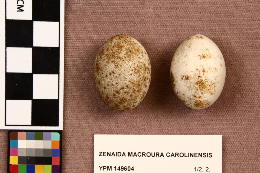
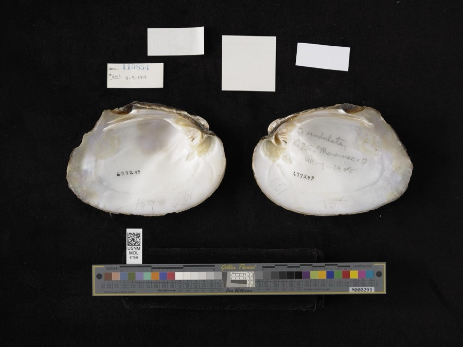
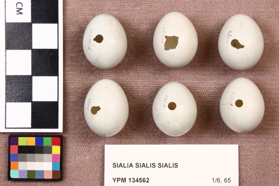
evidence. Museums hold 277 specimens
collected within 10 miles of Yeager, John J., House between 1875 and
1975: 235 Animalia, 36 Plantae, 5 Fungi, 1 Chromista. 12 distinct Species records are shown.
Collected by A. Lose, Aborn, R., Angle, E. (Eric) and others. Each is a
physical object with a catalogue
number, and each entry opens the museum's record. This is what was
collected and kept, not a survey of what lives here - nothing can be
concluded from a species being absent.
Regional context, not property-specific
evidence. The federal mineral resources record lists
3 workings within 5 miles of Yeager, John J., House: 2 plants, 1 past producer.
2 still produce. What was taken out: Stone, Crushed/Broken, Limestone, General. Distance is straight-line from the
map coordinates, so a quarry counted here may appear on a neighbouring
settlement's page as well.
Regional context, not property-specific
evidence. The National Weather Service names
Perrysburg, the town this property stands in, in 65 storm reports between 1995 and 2023: 32 thunderstorm wind, 29 hail, 1 flash flood, 1 lightning.
No death or injury is recorded in these reports. Each account below is quoted exactly as the forecast office
filed it, from the NOAA Storm Events Database, and each date
opens the federal record of that event.
Hail to tennis ball size fell for several minutes and accumulated on the ground to a depth of over six inches at some locations. The hail plugged many storm sewers causing water to back up into the basements of several homes. Dozens of vehicles and many homes were damaged and hundreds of trees were completely stripped of leaves.
Thunderstorm downburst winds estimated to be as much as 70 mph caused considerable damage in Perrysburg. Dozens of trees and at least three utility poles were toppled. A few homes were damaged by fallen trees. Scattered power outages were reported.
Thunderstorm winds blew over two fully loaded semi trucks six miles east of Perrysburg near the intersection of Interstates 80/90 and 280. Both trucks were severely damaged. The roof of a large building nearby was also torn off.
On March 12th an ice jam formed on the Maumee River. By the 14th the ice had backed in the town of Perrysburg. A farm sustained damages when about two feet of topsoil was removed in an area farm with thousands of dollars in economic loss. The Buttonwood Park in Perrysburg also sustained damages but no buildings were impacted.
A funnel cloud was observed along Interstate 75 near Perrysburg. Trained spotters tracked the funnel for several minutes as it drifted slowly northeast. Although persistent rotation was observed, the funnel did not come in contact with the ground at any time. The funnel may have been a cold air funnel.
1 paper published in this town,
digitised by the Library of Congress and free to read: 0 issues,
0 pages. Every page is searchable, so a name or a street can be
looked for directly in what the town printed about itself at the time.
No historic map-sheet match is published
for this property yet. That does not mean no map exists. This record needs
a coordinate-quality review before it can be joined to a sheet boundary.
Browse the county's mapped places while that work is
pending.
From the nomination file
2,018 words on record
When this property was proposed for the
National Register, someone wrote the case for it: what the building is,
and why it matters. That document is a federal record in the public domain.
It is quoted below word for word, never summarised. The text was read off the scanned case file by machine, so the
occasional stray character is the recogniser's and the 1970s
typewriter's.
Description of the property
Overall the house appears sound and almost unaltered; with moderate repairs hand pump and goldfish pond of unknown age can be seen. In the northwest corner is a second stairway which runs from the basement to are two parlors,one behind the other in the traditional style.The west of the second Wood County Courthouse the site of the The shutters which were removed about l982 are available and restorable. The 6/6 double hung sash windows still contain much of the original glass. The building is a two and a half story wood frame,temple style Greek Revival _ deteriorated .ruins Revival style. At the center of the pediment is a distinctive triangular The interior is also plain.
The front entrance, located at the southwest corner, gives access to a stair hall where the finest woodwork in the house is - good and maintenance it could become an outstanding showpiece of the period. two small separate bedrooms leading into a larger bedroom.The northeast the attic in three separate flights.The stairs from the ground floor to the over the years.The original kitchen is believed to have been in the native stone.A cellar door leads directly outside to the east yard where a side by side doors..lt.was possible that the northeast bedroom may have been Areas of Significance - Check and justify below . archeology-historic _ music X_ 1800-1899 X.
politics government .transportation politics/government because it was the residence of the Yeager.family, three While there are approximately 9 (Ted Ligibel and Lee Comer, Lights Along The River, 1983) fine examples of Greek Revival architecture in the It was originally built as a farmhouse which for a home of that style was not shutters and stair treds are found on Plate 56 and Plate 3l respectively, in Minard Lafever's, Ihe Modern Builder's Guide, published in 1833.
(in one paragraph) has a triangular tympanum window in it's front pediment. Perrysburg/Maumee area, the John J.Yeager House is the only one we have Ohio) the John J. Yeager home has remained in its original form. reappraisal records for 1924 and 1943 show no differences in the exterior Criteria A and C (i.e.,House of Four Pillars, Maumee, Ohio; The James Hood House, Perrysburg, the dimensions for a door and its moldings with a drawing of both are shown on - archeology-prehistoric - community planning .religion - philosophy features being the full entablature and cornice returns along roof line and magnificent entrance. In addition, it is significant under There are a couple of other distinctive features of the Yeager House.
First of the original doors, windows and moldings are still in use in the house. example of the Greek Revival style so ubiquitous and popular in northern Ohio landscape architecture common during the period.Second is the triangular tympanum window in the is also the same number mentioned in the reappraisal records. So while many homes inthe area have later additions, such as summer kitchens or columns during the quarter century preceding the Civil War.Its most outstanding guide.In Asher Benjamin's Practice of Architecture,published in 1835, p. 566. - state 11.
Quoted from the National Register nomination
for reference 85000619, 16 pages, held by the National Archives in Record
Group 79. See the
catalogue record.
Listed places nearby
6 within 8 miles
Other National Register properties close
enough to walk or drive between, ordered by distance from this one. Both
positions come from the same geocoding pass that matched these properties
to their map sheets.
Listing record. National Park Service National Register of Historic Places, listed-properties dataset, current to 2026-05-22.
Map join. Address geocoded through the United States Census geocoder, then tested against the published boundary of every sheet in the USGS Historical Topographic Map Collection.
How this page is made. Listing fields come from federal records; map-sheet coverage is a labelled coordinate-to-boundary calculation, not a source-field claim.
Wildfire. Short, Karen C. 2022. Spatial wildfire occurrence data for the United States, 1992-2020 [FPA_FOD_20221014]. 6th Edition. Fort Collins, CO: Forest Service Research Data Archive. https://doi.org/10.2737/RDS-2013-0009.6 Collected with United States Government funding and usable without additional permissions or fees.
Specimens. Global Biodiversity Information Facility (GBIF), https://www.gbif.org/. Only records licensed CC0 or CC BY are used. Records licensed CC BY-NC are excluded because this site carries advertising. Images are checked individually and any whose licence is non-commercial, no-derivatives or unreadable is refused.
Mines and quarries. USGS Mineral Resources Data System (MRDS) https://mrdata.usgs.gov/mrds/ A work of the United States government, no copyright under 17 U.S.C. 105.
Storms. NOAA National Centers for Environmental Information, Storm Events Database https://www.ncei.noaa.gov/stormevents/ A work of the United States government, no copyright under 17 U.S.C. 105. Narratives are quoted verbatim from the National Weather Service report and are not edited or summarised.
 Block
Block