BlockBefore
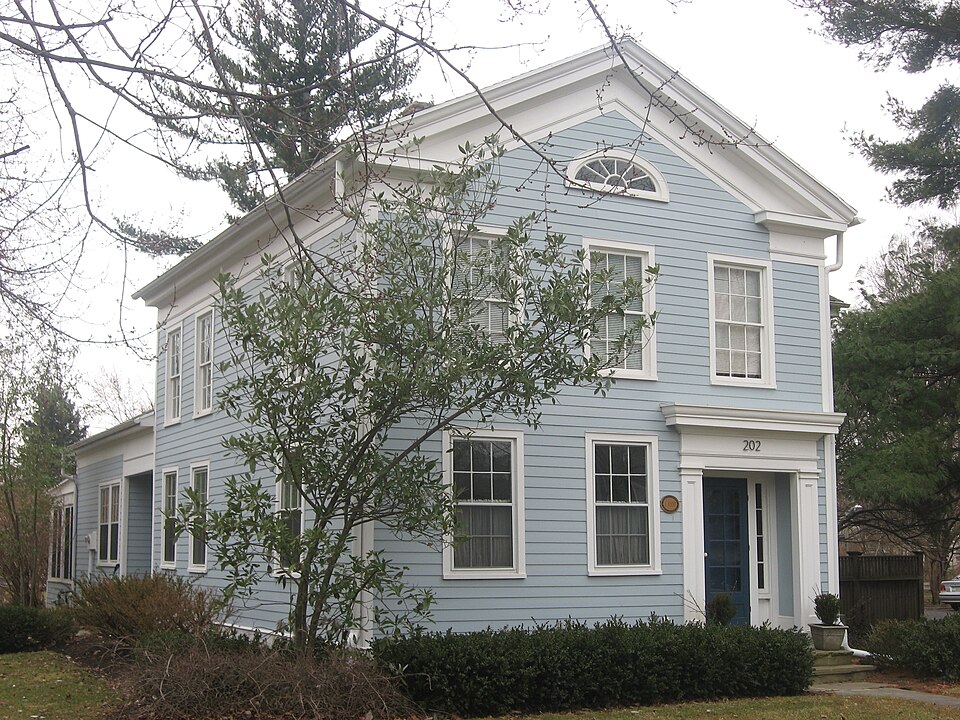
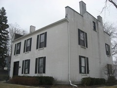
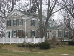
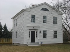
Photograph of Hood-Simmons House
Photograph by Nyttend, Public domain. Via Wikimedia Commons.

Hood-Simmons House

Listed on the National Register of Historic Places in 1974. A historic map-sheet match is not published yet. The record needs a coordinate-quality review before it can be joined to a sheet boundary.

From the record

one of 21 National Register listings in Wood County · listed in 1974 · category: Building · one of 1 National Historic Landmarks in Wood County.

Sources: the case file at the National Archives · the National Register database, National Park Service

The listing

  • What is counted as historic. The nomination lists 1 building as contributing to the listing.
  • Address. 202 W. 5th St., Perrysburg, 43551
  • When was it listed? 1974-12-30
  • Category. building
  • Township. Perrysburg city
  • Architectural style. Greek Revival architecture
  • National Register reference number. 74001652 - the number the National Park Service assigned this property when it was listed, and the key its nomination file is catalogued under at the National Archives.

The ground it stands on

68 words

This property stands in Perrysburg Township. Commemorative Historical and Biographical Record of Wood County, Ohio; Its Past and Present, published 1897 gives that township a chapter of its own.

The chapter covers establishment of the township, its early history, justices of waynesfield, perrysburg township, officials, pioneer reminiscences.

Machine-read from a century-old scan, so expect the errors a machine makes: misspelled names, dropped words, stray characters.

Read the whole chapter on Perrysburg Township - 68 words on its settlement, mills, schools and churches.

Fires near this property

2 since 2002

Regional context, not property-specific evidence. The federal wildfire occurrence database lists 2 fires within 5 miles of Hood-Simmons House between 2002 and 2002, burning about 5 acres in total. None started naturally. None was recorded as arson. Distance is straight-line from the map coordinates, so a fire counted here may appear on a neighbouring settlement's page as well.

Reported cause Fires
Recreation and ceremony1
Smoking1

The most recent of them, most recent first, with the day each was reported and the service that recorded it.

DateCause SizeReported by Name on the report
11 June 2002Smokingunder an acreOhio State Fire Marshal's Officenot named
18 October 2002Recreation and ceremony5.0 acresOhio State Fire Marshal's Officenot named

Every fire recorded in Wood County

Specimens collected near this property

12 of 266 shown

Regional context, not property-specific evidence. Museums hold 266 specimens collected within 10 miles of Hood-Simmons House between 1875 and 1975: 226 Animalia, 34 Plantae, 5 Fungi, 1 Chromista. 12 distinct Species records are shown. Collected by A. Lose, Aborn, R., Angle, E. (Eric) and others. Each is a physical object with a catalogue number, and each entry opens the museum's record. This is what was collected and kept, not a survey of what lives here - nothing can be concluded from a species being absent.

Image SpeciesYear Collected by Where, as recorded
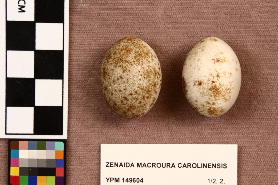
Specimen of Zenaida macroura carolinensis (Linnaeus, 1766)Zenaida macroura carolinensis (Linnaeus, 1766)1907L. L. RedickPerrysburg
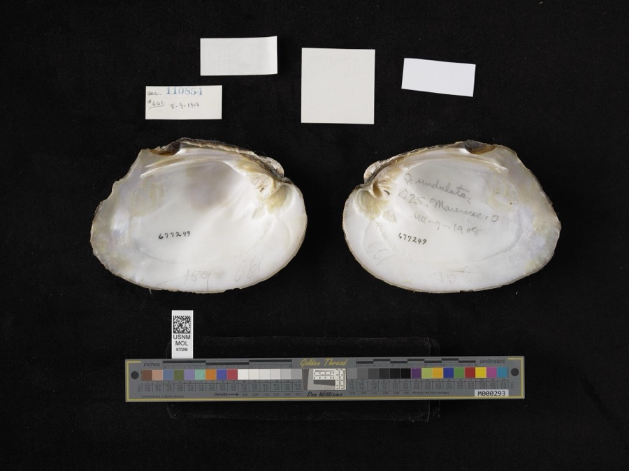
Specimen of Amblema plicata (Say, 1817)Amblema plicata (Say, 1817)1908not recordedMaumee
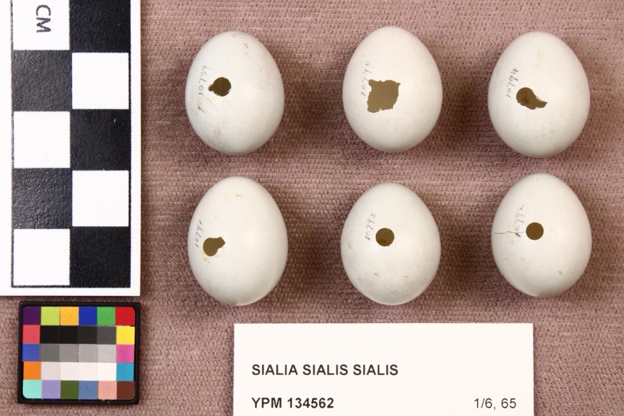
Specimen of Sialia sialis sialis (Linnaeus, 1758)Sialia sialis sialis (Linnaeus, 1758)1920L. L. RedickPerrysburg
A photograph of the species Cardinalis cardinalis, not of this specimenCardinalis cardinalis cardinalis (Linnaeus, 1758)1875LangdonIndian Hill, Kane County
A photograph of the species Aplodinotus grunniens, not of this specimenAplodinotus grunniens Rafinesque, 18191893P. KirschMaumee River, Waterville, Ohio
A photograph of the species Catostomus commersonii, not of this specimenCatostomus commersonii (Lacepède, 1803)1893P. KirschMaumee River, Waterville, Ohio
A photograph of the species Ericymba buccata, not of this specimenEricymba buccata Cope, 18651893P. KirschMaumee River, Waterville, Ohio
A photograph of the species Etheostoma blennioides, not of this specimenEtheostoma blennioides Rafinesque, 18191893not recordedMaumee River, Waterville, Ohio
A photograph of the species Etheostoma nigrum, not of this specimenEtheostoma nigrum Rafinesque, 18201893not recordedMaumee River, Waterville, Ohio
A photograph of the species Lepisosteus osseus, not of this specimenLepisosteus osseus (Linnaeus, 1758)1893P. KirschMaumee River, Waterville, Ohio
A photograph of the species Micropterus dolomieu, not of this specimenMicropterus dolomieu Lacepède, 18021893P. KirschMaumee River, Waterville, Ohio
A photograph of the species Notropis cornutus, not of this specimenNotropis cornutus (Mitchill, 1817)1893P. KirschMaumee River, Waterville, Ohio

All 266 specimens within 10 miles, at the Global Biodiversity Information Facility.

Mines and quarries near this property

3 within 5 miles

Regional context, not property-specific evidence. The federal mineral resources record lists 3 workings within 5 miles of Hood-Simmons House: 2 plants, 1 past producer. 2 still produce. What was taken out: Stone, Crushed/Broken, Limestone, General. Distance is straight-line from the map coordinates, so a quarry counted here may appear on a neighbouring settlement's page as well.

Where SiteCommodity StatusRecorded
Maumee QuarryLimestone, GeneralPast ProducerSedimentary
Lime City PlantStone, Crushed/BrokenPlant
Maumee PlantStone, Crushed/BrokenPlant

Every working recorded in Wood County

Storms near this property

60 of 65 shown

Regional context, not property-specific evidence. The National Weather Service names Perrysburg, the town this property stands in, in 65 storm reports between 1995 and 2023: 32 thunderstorm wind, 29 hail, 1 flash flood, 1 lightning. No death or injury is recorded in these reports. Each account below is quoted exactly as the forecast office filed it, from the NOAA Storm Events Database, and each date opens the federal record of that event.

WhenEvent Place namedHarm What the report says
May 2002HailPerrysburg$600,000Hail to tennis ball size fell for several minutes and accumulated on the ground to a depth of over six inches at some locations. The hail plugged many storm sewers causing water to back up into the basements of several homes. Dozens of vehicles and many homes were damaged and hundreds of trees were completely stripped of leaves.
July 2012Thunderstorm WindPerrysburg$250,000Thunderstorm downburst winds estimated to be as much as 70 mph caused considerable damage in Perrysburg. Dozens of trees and at least three utility poles were toppled. A few homes were damaged by fallen trees. Scattered power outages were reported.
May 2002Thunderstorm WindPerrysburg$250,000Thunderstorm winds blew over two fully loaded semi trucks six miles east of Perrysburg near the intersection of Interstates 80/90 and 280. Both trucks were severely damaged. The roof of a large building nearby was also torn off.
July 1998LightningPerrysburg$250,000Lightning struck and nearly destroyed a house in Perrysburg Township.
May 2004HailPerrysburg$125,000Quarter to golf ball size hail was observed. Many cars were damaged.
May 2010HailPerrysburg$75,000Golf ball size hail was reported. A few vehicles sustained minor damage from the hail.
June 2006Thunderstorm WindPerrysburg$75,000Several trees were uprooted causing damage to several homes. Utility poles and wires were also reported down from the thunderstorms.
October 2010Thunderstorm WindPerrysburg$50,000Thunderstorm winds overturned a moving semi truck on Interstate 75.
May 2002HailPerrysburg$35,000Golf ball size hail was reported six miles east of Perrysburg near the intersection of Interstates 80/90 and 280.
June 2007Thunderstorm WindPerrysburg$30,000Thunderstorm winds downed several large trees. One of the trees heavily damaged a car and a second caused minor damage to a home.
June 2006Thunderstorm WindPerrysburg$30,000A few trees were reported down. One tree landed on a house and caused some minor damage.
March 2015FloodPerrysburg$25,000On March 12th an ice jam formed on the Maumee River. By the 14th the ice had backed in the town of Perrysburg. A farm sustained damages when about two feet of topsoil was removed in an area farm with thousands of dollars in economic loss. The Buttonwood Park in Perrysburg also sustained damages but no buildings were impacted.
July 2008Thunderstorm WindPerrysburg$25,000Thunderstorm winds downed several trees and power lines.
July 2002Thunderstorm WindPerrysburg$25,000Thunderstorm winds downed several trees and damaged a house.
May 2010Thunderstorm WindPerrysburg$20,000Thunderstorm winds snapped a couple power poles and large tree limbs.
June 2007Thunderstorm WindPerrysburg$20,000A tree and several large limbs were reported down. Numerous power lines were also reported down.
July 2011Thunderstorm WindPerrysburg$15,000Thunderstorm winds downed a lot of trees.
May 2010HailPerrysburg$15,000Half dollar size hail was observed.
June 2008Thunderstorm WindPerrysburg$15,000Several large tree limbs and power poles were reported down. Siding was also blown off a house nearby.
June 2013Thunderstorm WindPerrysburg$10,000Thunderstorm winds downed trees and large limbs.
July 2003Thunderstorm WindPerrysburg$10,000Thunderstorm winds downed many large tree limbs across the county.
August 2000Thunderstorm WindPerrysburg$10,000Thunderstorm winds downed many trees.
June 1997Thunderstorm WindPerrysburg$10,000no account filed
April 2015HailPerrysburg$7,000Ping pong ball size hail reported in Perrysburg.
June 2009Thunderstorm WindPerrysburg$5,000Several large limbs were reported down throughout Perrysburg.
June 2009Thunderstorm WindPerrysburg$5,000Several large trees were reported down.
October 2000Thunderstorm WindPerrysburg$5,000Thunderstorm winds downed two trees.
August 2000Thunderstorm WindPerrysburg$5,000Thunderstorm winds downed a tree and one large limb.
June 2008Thunderstorm WindPerrysburg$3,000Two large trees were reported down.
June 2004Thunderstorm WindPerrysburg$3,000Thunderstorm winds downed a few large tree limbs.
May 1999Thunderstorm WindPerrysburg$3,000Trees were downed.
March 2011HailPerrysburg$2,000Quarter sized hail was reported with this storm. The duration of the hail event lasted nearly a minute.
September 2002Thunderstorm WindPerrysburg$2,000Thunderstorm winds downed one large tree limb.
May 2018Thunderstorm WindPerrysburg$1,000Thunderstorm winds downed a tree on Willow Lane in Perrysburg.
September 2014Thunderstorm WindPerrysburg$1,000Thunderstorm winds downed a large tree limb along Indiana Avenue.
June 2013Thunderstorm WindPerrysburg$1,000Thunderstorm winds uprooted a large tree.
April 2011Thunderstorm WindPerrysburg$1,000Thunderstorm winds ripped three rows of shingles off a two-story family home.
July 2003Thunderstorm WindPerrysburg$1,000Thunderstorm winds measured at 42 mph downed one large tree limb.
April 2023Thunderstorm WindPerrysburg-Numerous utility poles downed from Perrysburg to Millbury.
July 2020Thunderstorm WindPerrysburg-Several trees and branches down in Perrysburg.
November 2020Thunderstorm WindPerrysburg-Semi blown over on I-75 two miles SE of Perrysburg.
March 2017HailPerrysburg-Penny sized hail was observed.
March 2016HailPerrysburg-Quarter sized hail was observed.
April 2016HailPerrysburg-Nickel sized hail was reported.
May 2016HailPerrysburg-Penny sized hail was observed.
May 2015HailPerrysburg-Penny sized hail was observed.
June 2013HailPerrysburg-Quarter sized hail was observed.
July 2012HailPerrysburg-Nickel to quarter sized hail was reported.
November 2011HailPerrysburg-Penny sized hail was observed.
May 2010HailPerrysburg-Penny to nickel size hail was observed.
May 2010HailPerrysburg-Quarter size hail was observed.
May 2010HailPerrysburg-Nickel to quarter size hail was observed.
August 2010HailPerrysburg-Penny sized hail occurred with this thunderstorm.
May 2006HailPerrysburg-Nickel size hail was observed.
May 2006HailPerrysburg-Penny size hail was observed.
August 1999Funnel CloudPerrysburg-A funnel cloud was observed along Interstate 75 near Perrysburg. Trained spotters tracked the funnel for several minutes as it drifted slowly northeast. Although persistent rotation was observed, the funnel did not come in contact with the ground at any time. The funnel may have been a cold air funnel.
September 1997Flash FloodPerrysburg-Heavy thunderstorm rain caused flooding of roads in Perrysburg and nearby Northwood.
June 2019HailPerrysburg-no account filed
May 2010HailPerrysburg-no account filed

Every storm recorded in Wood County

Newspapers printed here

0 digitised pages

1 paper published in this town, digitised by the Library of Congress and free to read: 0 issues, 0 pages. Every page is searchable, so a name or a street can be looked for directly in what the town printed about itself at the time.

NewspaperPublished
The Perrysburg Journal1853 to 1861

Map coverage status

No historic map-sheet match is published for this property yet. That does not mean no map exists. This record needs a coordinate-quality review before it can be joined to a sheet boundary. Browse the county's mapped places while that work is pending.

From the nomination file

1,513 words on record

When this property was proposed for the National Register, someone wrote the case for it: what the building is, and why it matters. That document is a federal record in the public domain. It is quoted below word for word, never summarised. The text was read off the scanned case file by machine, so the occasional stray character is the recogniser's and the 1970s typewriter's.

Description of the property

A simple window is in the pediment.The broad fascia PERIOD (Check One or More as Appropriate) X] 19th Century SPECIFIC DATE(S) (If Applicable and Known) 1857 - Political - Urban Planning - Other (Specify) - Invention - Science - Landscape STATEMENT OF

Statement of significance

Platted in 1816, Perrysburg became the county seat During the height of Perrysburg's prosperity, James of Julia Simmons, who had lived in it for sixty years. House, but the house is so isolated from the district by Commerce Conservation Communications losophy Transportation Architecture Aboriginal Engineering REGISTER Theater Education SIGNIFICANCE RECEIVED Art Literature Music itarian Agriculture Prehistoric Pre-Columbian NATIONAL Religion/Phi- Industry on its shipbuilding activities and its prominence The Perrysburg Historic District is near the Hood-Simmons Sculpture Social/Human- terminus nearer Toledo signaled the end of Perrysburg non-conforming buildings that it cannot be considered part The present owners have begun much-needed repairs on the of the district. asa commercial center.

Hood operated a successful dry goods store at #1 and in 1870 the county seat was moved to Bowling The building is a very fine example of Greek revival Military of Wood County in 1824. Its growth depended largely 1857 and had this fine home built for him. Green.The building of the Miami-Erie canal with its asa shipping center.Cholera struck a blow in 1854 Illinois, 1896. Publishing Committee, Historical Society, Toledo, Ohio.

The whole case file for this property - 1,513 words, 11 pages, reproduced complete.

Quoted from the National Register nomination for reference 74001652, 11 pages, held by the National Archives in Record Group 79. See the catalogue record.

Listed places nearby

6 within 8 miles

Other National Register properties close enough to walk or drive between, ordered by distance from this one. Both positions come from the same geocoding pass that matched these properties to their map sheets.

Photograph PropertyDistance Listed
Schaller Memorial Buildingunder 500 feet1990
Old Wood County Jail0.1 miles1969
Perrysburg Water Maintenance Building0.1 miles1990
Yeager, John J., House0.2 miles1985
Spafford House0.4 miles1974
Fort Meigs1.2 miles1969

Sources for this property

National Archives recordThe nomination case file for reference 74001652 in Record Group 79.
Wood CountyAll 21 listed properties in this county.

Provenance

  • Listing record. National Park Service National Register of Historic Places, listed-properties dataset, current to 2026-05-22.
  • Map join. Address geocoded through the United States Census geocoder, then tested against the published boundary of every sheet in the USGS Historical Topographic Map Collection.
  • How this page is made. Listing fields come from federal records; map-sheet coverage is a labelled coordinate-to-boundary calculation, not a source-field claim.
  • Wildfire. Short, Karen C. 2022. Spatial wildfire occurrence data for the United States, 1992-2020 [FPA_FOD_20221014]. 6th Edition. Fort Collins, CO: Forest Service Research Data Archive. https://doi.org/10.2737/RDS-2013-0009.6 Collected with United States Government funding and usable without additional permissions or fees.
  • Specimens. Global Biodiversity Information Facility (GBIF), https://www.gbif.org/. Only records licensed CC0 or CC BY are used. Records licensed CC BY-NC are excluded because this site carries advertising. Images are checked individually and any whose licence is non-commercial, no-derivatives or unreadable is refused.
  • Mines and quarries. USGS Mineral Resources Data System (MRDS) https://mrdata.usgs.gov/mrds/ A work of the United States government, no copyright under 17 U.S.C. 105.
  • Storms. NOAA National Centers for Environmental Information, Storm Events Database https://www.ncei.noaa.gov/stormevents/ A work of the United States government, no copyright under 17 U.S.C. 105. Narratives are quoted verbatim from the National Weather Service report and are not edited or summarised.