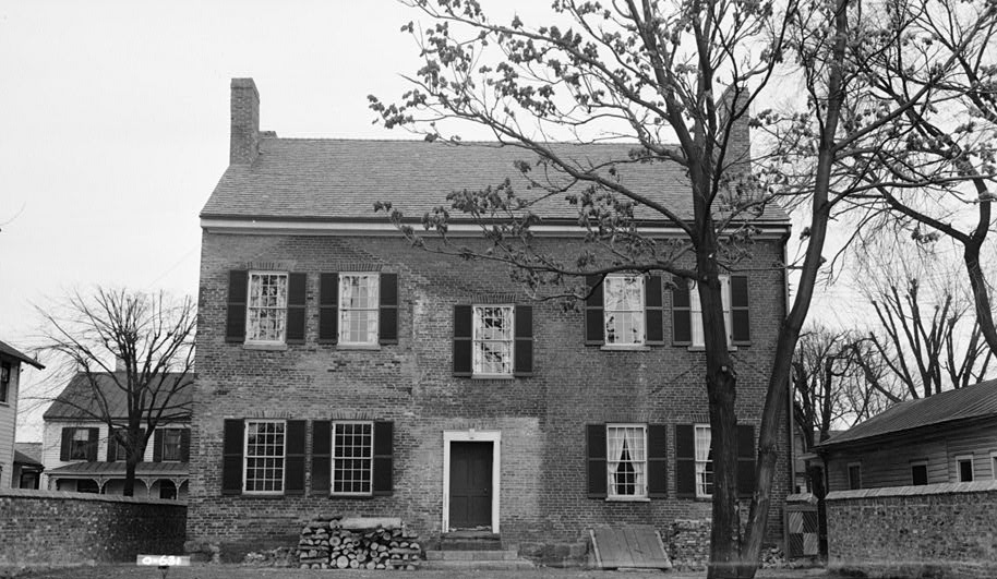
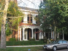
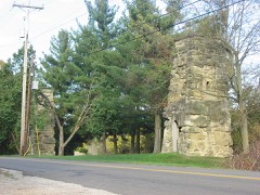
Photograph by E.F. Schrand and A.R. Arend, Public domain. Via
Wikimedia Commons.
Our House
Listed on the National Register of Historic Places in
1970. A historic map-sheet match is not published yet. The record needs a coordinate-quality review before it can be joined to a sheet boundary.
From the record
one of 7 National Register listings in Gallia County · listed in 1970 · category: Building.
National Register reference number.70000494- the number the National Park Service assigned this property when it was listed, and the key its nomination file is catalogued under at the National Archives.
Fires near this property
70 since 1992
Regional context, not property-specific
evidence. The
federal wildfire occurrence database
lists 70 fires within 5 miles of Our House between
1992 and 2020, burning about 329 acres in total. None started naturally. 15 were recorded as arson.
Distance is straight-line from the map coordinates, so a fire counted
here may appear on a neighbouring settlement's page as well.
Reported cause
Fires
Debris and open burning
35
Arson/incendiarism
15
Missing data/not specified/undetermined
7
Smoking
5
Equipment and vehicle use
4
Misuse of fire by a minor
2
Fireworks
2
The most recent of
them, most recent first, with the day each was reported and the service
that recorded it.
Regional context, not property-specific
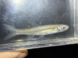
evidence. Museums hold 390 specimens
collected within 10 miles of Our House between 1888 and
1973: 215 Animalia, 118 Fungi, 43 Plantae, 12 Chromista, 2 Unrecorded. 12 distinct Species records are shown.
Collected by Archer, W. A., Babcocks D. O., Bartley, F. and others. Each is a
physical object with a catalogue
number, and each entry opens the museum's record. This is what was
collected and kept, not a survey of what lives here - nothing can be
concluded from a species being absent.
Regional context, not property-specific
evidence. The federal mineral resources record lists
4 workings within 5 miles of Our House: 2 past producers, 2 producers.
2 still produce. What was taken out: Sand and Gravel, Construction. Distance is straight-line from the
map coordinates, so a quarry counted here may appear on a neighbouring
settlement's page as well.
Regional context, not property-specific
evidence. The National Weather Service names
Gallipolis, the town this property stands in, in 51 storm reports between 1994 and 2026: 26 thunderstorm wind, 20 hail, 2 flash flood, 2 flood.
No death or injury is recorded in these reports. Each account below is quoted exactly as the forecast office
filed it, from the NOAA Storm Events Database, and each date
opens the federal record of that event.
The Ohio River at Point Pleasant rose above its 40 foot flood stage on the evening of March 1st. The river would remain out of its banks through March 4th and crested at 46.23 feet. While the river was above its banks, low lying areas surrounding Point Pleasant flooded due to backwater.
Rains of 2 to 3.5 inches fell over saturated ground. Roads flooded and forced campers to higher ground at the fairground in Green Township. The cooperative observe in Gallipolis measured 2.3 inches of rain.
A few downed tree limbs were observed near Gallipolis. Part of the city lost power as a result of the downed trees. Pea size hail and localized street flooding were also reported within the city.
Ironton police reported many large trees were blown down and a utility trailer was overturned at a construction site. The Corps of Engineers said one of their trailers was blown off its foundation at Gallipolis.
Small trees were downed onto Vine Street in Gallipolis. Several inches of water also covered Vine Street Bridge between Chillicothe Road and State Route 141.
1 paper published in this town,
digitised by the Library of Congress and free to read: 0 issues,
0 pages. Every page is searchable, so a name or a street can be
looked for directly in what the town printed about itself at the time.
No historic map-sheet match is published
for this property yet. That does not mean no map exists. This record needs
a coordinate-quality review before it can be joined to a sheet boundary.
Browse the county's mapped places while that work is
pending.
From the nomination file
1,606 words on record
When this property was proposed for the
National Register, someone wrote the case for it: what the building is,
and why it matters. That document is a federal record in the public domain.
It is quoted below word for word, never summarised. The text was read off the scanned case file by machine, so the
occasional stray character is the recogniser's and the 1970s
typewriter's.
Description of the property
Fair The tavern and kitchen were completely restored in 1966.A walnut bar, UNITED STATES DEPARTMENT OF THE INTERIOR NATIONAL PARK SERVICE NATIONAL REGISTER OF HISTORIC PLACES INVENTORY - NOMINATION FORM FOR NPS USE ONLY ENTRY NUMBER 6. Historic American Buildings Survey- District of Columbia 40,11,39L APR 13 1971 1936-1937 Washington COUNTY Federal Ohio NATIONAL Gallia STATE REGISTER (Continuation Sheet) Library of Congress Our House (Number all entrlea) 0139
Statement of significance
Compagnie du Scioto, which was to buy the Scioto Company's holdings By this time the French Revolution had begun, and many royalists, anxious to get away, were attracted by the false advertising of the land company. Five hundred people, all from the middle and upper The Ohio Company, based at Marietta up the river, agreed to settle the French on its lands, which were east of the Scioto Company's original arrived. However, most French families moved away because they felt they could not survive the hardships of frontier life, but in 1807 settlers General Lafayette, on his triumphant tour of America, was entertained Mrs Charles E.
Holzer began to restore and furnish the old tavern, and 1819 Communications Engineering Architecture Commerce Conservation Aboriginal losophy Transportation Science Literature Art itarian Music Theater Landscape Military Social/Human- NATIONAL Invention Sculpture REGISTER Religion/Phi- completely restored the structure and refurnished it appropriately from Massachusetts and Virginia came to settle at Gallipolis. discovered that the Scioto Company had failed to meet its contract with Political Urban Planning and resell them to Frenchmen. Congress and the lands were not theirs. The settlement of Gallipolis had its origin in a land speculation tract.Maj.
Burnham was sent to the future site of Gallipolis to Our House remained in the Cushing family until 1865.In 1933 Dr.and classes, set out for America in January,1790.When they arrived they In Paris in 1789 Duer's agent and an Englishman teamed up to form the in 1966.It is now open to the public as a State Memorial. at Our House on May 22,1825.The Cushings were a prominent family in After 1819 village social life centered around Our House, the brick then moved to Belpre. of 3.5 million acres of land east of the Scioto River in southern Ohio.
Quoted from the National Register nomination
for reference 70000494, 14 pages, held by the National Archives in Record
Group 79. See the
catalogue record.
Listed places nearby
2 within 8 miles
Other National Register properties close
enough to walk or drive between, ordered by distance from this one. Both
positions come from the same geocoding pass that matched these properties
to their map sheets.
Listing record. National Park Service National Register of Historic Places, listed-properties dataset, current to 2026-05-22.
Map join. Address geocoded through the United States Census geocoder, then tested against the published boundary of every sheet in the USGS Historical Topographic Map Collection.
How this page is made. Listing fields come from federal records; map-sheet coverage is a labelled coordinate-to-boundary calculation, not a source-field claim.
Wildfire. Short, Karen C. 2022. Spatial wildfire occurrence data for the United States, 1992-2020 [FPA_FOD_20221014]. 6th Edition. Fort Collins, CO: Forest Service Research Data Archive. https://doi.org/10.2737/RDS-2013-0009.6 Collected with United States Government funding and usable without additional permissions or fees.
Specimens. Global Biodiversity Information Facility (GBIF), https://www.gbif.org/. Only records licensed CC0 or CC BY are used. Records licensed CC BY-NC are excluded because this site carries advertising. Images are checked individually and any whose licence is non-commercial, no-derivatives or unreadable is refused.
Mines and quarries. USGS Mineral Resources Data System (MRDS) https://mrdata.usgs.gov/mrds/ A work of the United States government, no copyright under 17 U.S.C. 105.
Storms. NOAA National Centers for Environmental Information, Storm Events Database https://www.ncei.noaa.gov/stormevents/ A work of the United States government, no copyright under 17 U.S.C. 105. Narratives are quoted verbatim from the National Weather Service report and are not edited or summarised.
 Block
Block