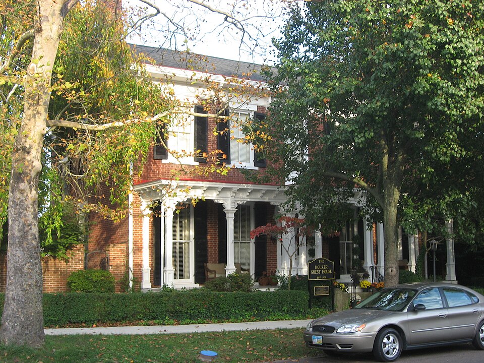
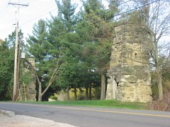
Listed on the National Register of Historic Places in
1986. A historic map-sheet match is not published yet. The record needs a coordinate-quality review before it can be joined to a sheet boundary.
From the record
one of 7 National Register listings in Gallia County · listed in 1986 · category: Building.
National Register reference number.86002877- the number the National Park Service assigned this property when it was listed, and the key its nomination file is catalogued under at the National Archives.
Fires near this property
69 since 1992
Regional context, not property-specific
evidence. The
federal wildfire occurrence database
lists 69 fires within 5 miles of Gatewood between
1992 and 2020, burning about 328 acres in total. None started naturally. 15 were recorded as arson.
Distance is straight-line from the map coordinates, so a fire counted
here may appear on a neighbouring settlement's page as well.
Reported cause
Fires
Debris and open burning
34
Arson/incendiarism
15
Missing data/not specified/undetermined
7
Smoking
5
Equipment and vehicle use
4
Misuse of fire by a minor
2
Fireworks
2
The most recent of
them, most recent first, with the day each was reported and the service
that recorded it.
Regional context, not property-specific
evidence. Museums hold 390 specimens
collected within 10 miles of Gatewood between 1888 and
1973: 215 Animalia, 118 Fungi, 43 Plantae, 12 Chromista, 2 Unrecorded. 12 distinct Species records are shown.
Collected by Archer, W. A., Babcocks D. O., Bartley, F. and others. Each is a
physical object with a catalogue
number, and each entry opens the museum's record. This is what was
collected and kept, not a survey of what lives here - nothing can be
concluded from a species being absent.
Regional context, not property-specific
evidence. The federal mineral resources record lists
4 workings within 5 miles of Gatewood: 2 past producers, 2 producers.
2 still produce. What was taken out: Sand and Gravel, Construction. Distance is straight-line from the
map coordinates, so a quarry counted here may appear on a neighbouring
settlement's page as well.
Regional context, not property-specific
evidence. The National Weather Service names
Gallipolis, the town this property stands in, in 51 storm reports between 1994 and 2026: 26 thunderstorm wind, 20 hail, 2 flash flood, 2 flood.
No death or injury is recorded in these reports. Each account below is quoted exactly as the forecast office
filed it, from the NOAA Storm Events Database, and each date
opens the federal record of that event.
The Ohio River at Point Pleasant rose above its 40 foot flood stage on the evening of March 1st. The river would remain out of its banks through March 4th and crested at 46.23 feet. While the river was above its banks, low lying areas surrounding Point Pleasant flooded due to backwater.
Rains of 2 to 3.5 inches fell over saturated ground. Roads flooded and forced campers to higher ground at the fairground in Green Township. The cooperative observe in Gallipolis measured 2.3 inches of rain.
A few downed tree limbs were observed near Gallipolis. Part of the city lost power as a result of the downed trees. Pea size hail and localized street flooding were also reported within the city.
Ironton police reported many large trees were blown down and a utility trailer was overturned at a construction site. The Corps of Engineers said one of their trailers was blown off its foundation at Gallipolis.
Small trees were downed onto Vine Street in Gallipolis. Several inches of water also covered Vine Street Bridge between Chillicothe Road and State Route 141.
1 paper published in this town,
digitised by the Library of Congress and free to read: 0 issues,
0 pages. Every page is searchable, so a name or a street can be
looked for directly in what the town printed about itself at the time.
No historic map-sheet match is published
for this property yet. That does not mean no map exists. This record needs
a coordinate-quality review before it can be joined to a sheet boundary.
Browse the county's mapped places while that work is
pending.
From the nomination file
3,141 words on record
When this property was proposed for the
National Register, someone wrote the case for it: what the building is,
and why it matters. That document is a federal record in the public domain.
It is quoted below word for word, never summarised. The text was read off the scanned case file by machine, so the
occasional stray character is the recogniser's and the 1970s
typewriter's.
Description of the property
Gatewood is located on the eastside of State Street in a residential area with a wooden entablature and brackets supporting a box gutter.A segmental are still capped ina similar fashion.About 1877 the cornice was replaced Gatewood hasa 5-bay gable roofed front block with paired chimneys at each Those on the first floor are full length, extending from floor to ceiling. the rear in the mid-1930s. around the entire lot.
house built in 1847,remodeled in the late 1870s and had a new wing added at near north rear of the house.In addition a brick garden wall was erected 0.o.Mclntyrels associates.A winding staircase is at the rear of the central _ moved date cast iron arch was added to the central front door and cast Tron hood molds Mantels and woodwork are intact and several rooms are'furnished with photos of The interior of the front block dates largely to the late 19th century. hall. On the second floor is a bathroom designed by Maybelle for her husband.
The rear wing was apparently added after the house was acquired by the It has green tile throughout and a walk-in shower that has three showerheads Check one A two-story gable roofed brick garage for two cars was also built near the was removed and a new brick wing was built near the center of the rear wall. several blocks north of the downtown.It is a two-story rectangular brick -- archeology-prehistoric .._ community planning _ landscape architecture... religion - archeology-historic . science . agriculture _ economics X._ literature . sculpture X architecture - social/ X 1800-1899 X. 1900- - politics/government - transportation - other (specify) Specific dates 1847, 1877, 1933-38 Garden Lots H.D., NR 1/8/80).
(in one paragraph) Areas of Significance-Check and justify below The house was built about 1847 for Julius Regnier,a merchant of fine fabrics .conservation and was the wheelhorse of the company until his retirement in 1922.His early 2oth century.Andrew W.Allemong and Fred M.
Bovie were both extremely was also president of the Gallipolis Gas Company in the 1880s and served four Iamented throughout the city.The house remained the home of his wife and The house was purchased by the famous newspaper columnist O.o.Mclntyre asa death in 1930 was a front page headline event complete with photo.The success of the downtown of this county seat (Gallipolis Public Square and 0.0.Mclntyre, a nationally syndicated columnist of.the early 20th century, the highly successful Allemong & Henking in the city.He as the home of major commercial leaders of Gallipolis in the late 19th and military .invention in the early 20th century.
....education law - music - exploration/settlement successful grocery merchants .in the city who lived in the house for ten and 30 influential business leader and-his death in-1886 at-the age of 53 was much : article noted his presidency of the Buckeye Building and Loan Association and suggested he was one of the leading businessmen of southeastern Ohio.In detailed residence whose elaborate wooden porch across the facade makes it a Gatewood is significant under criteria B and C.It was built for and served integrity.Finally the house isa locally important example of an Italianate -philosophy as their retirement home and named Gatewood after his mother's maiden name.
Quoted from the National Register nomination
for reference 86002877, 23 pages, held by the National Archives in Record
Group 79. See the
catalogue record.
Listed places nearby
2 within 8 miles
Other National Register properties close
enough to walk or drive between, ordered by distance from this one. Both
positions come from the same geocoding pass that matched these properties
to their map sheets.
Listing record. National Park Service National Register of Historic Places, listed-properties dataset, current to 2026-05-22.
Map join. Address geocoded through the United States Census geocoder, then tested against the published boundary of every sheet in the USGS Historical Topographic Map Collection.
How this page is made. Listing fields come from federal records; map-sheet coverage is a labelled coordinate-to-boundary calculation, not a source-field claim.
Wildfire. Short, Karen C. 2022. Spatial wildfire occurrence data for the United States, 1992-2020 [FPA_FOD_20221014]. 6th Edition. Fort Collins, CO: Forest Service Research Data Archive. https://doi.org/10.2737/RDS-2013-0009.6 Collected with United States Government funding and usable without additional permissions or fees.
Specimens. Global Biodiversity Information Facility (GBIF), https://www.gbif.org/. Only records licensed CC0 or CC BY are used. Records licensed CC BY-NC are excluded because this site carries advertising. Images are checked individually and any whose licence is non-commercial, no-derivatives or unreadable is refused.
Mines and quarries. USGS Mineral Resources Data System (MRDS) https://mrdata.usgs.gov/mrds/ A work of the United States government, no copyright under 17 U.S.C. 105.
Storms. NOAA National Centers for Environmental Information, Storm Events Database https://www.ncei.noaa.gov/stormevents/ A work of the United States government, no copyright under 17 U.S.C. 105. Narratives are quoted verbatim from the National Weather Service report and are not edited or summarised.
 Block
Block