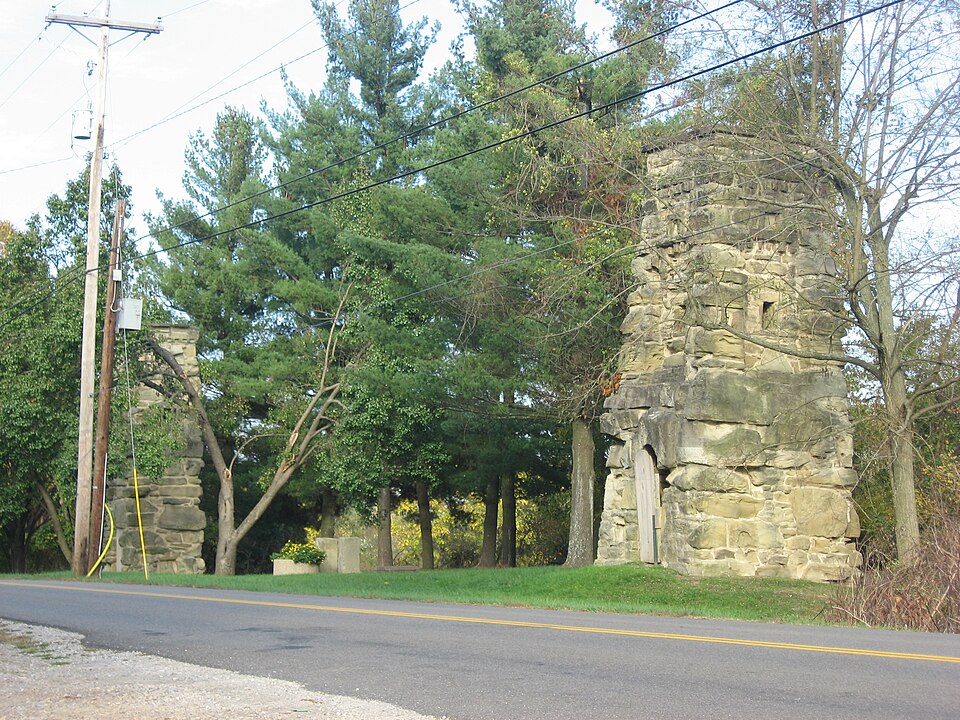
Listed on the National Register of Historic Places in
1978. A historic map-sheet match is not published yet. The record needs a coordinate-quality review before it can be joined to a sheet boundary.
From the record
one of 7 National Register listings in Gallia County · listed in 1978 · category: Building.
National Register reference number.78002069- the number the National Park Service assigned this property when it was listed, and the key its nomination file is catalogued under at the National Archives.
Fires near this property
68 since 1992
Regional context, not property-specific
evidence. The
federal wildfire occurrence database
lists 68 fires within 5 miles of Ohio Hospital For Epileptics Stone Water Towers between
1992 and 2020, burning about 305 acres in total. None started naturally. 16 were recorded as arson.
Distance is straight-line from the map coordinates, so a fire counted
here may appear on a neighbouring settlement's page as well.
Reported cause
Fires
Debris and open burning
34
Arson/incendiarism
16
Smoking
6
Missing data/not specified/undetermined
4
Equipment and vehicle use
3
Misuse of fire by a minor
3
Fireworks
2
The most recent of
them, most recent first, with the day each was reported and the service
that recorded it.
Regional context, not property-specific
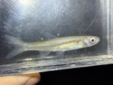
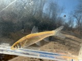
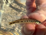
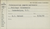
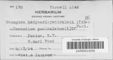
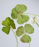
evidence. Museums hold 397 specimens
collected within 10 miles of Ohio Hospital For Epileptics Stone Water Towers between 1862 and
1973: 221 Animalia, 118 Fungi, 44 Plantae, 12 Chromista, 2 Unrecorded. 12 distinct Species records are shown.
Collected by Archer, W. A., Babcocks D. O., Bartley, F. and others. Each is a
physical object with a catalogue
number, and each entry opens the museum's record. This is what was
collected and kept, not a survey of what lives here - nothing can be
concluded from a species being absent.
Regional context, not property-specific
evidence. The federal mineral resources record lists
4 workings within 5 miles of Ohio Hospital For Epileptics Stone Water Towers: 2 past producers, 2 producers.
2 still produce. What was taken out: Sand and Gravel, Construction. Distance is straight-line from the
map coordinates, so a quarry counted here may appear on a neighbouring
settlement's page as well.
Regional context, not property-specific
evidence. The National Weather Service names
Gallipolis, the town this property stands in, in 51 storm reports between 1994 and 2026: 26 thunderstorm wind, 20 hail, 2 flash flood, 2 flood.
No death or injury is recorded in these reports. Each account below is quoted exactly as the forecast office
filed it, from the NOAA Storm Events Database, and each date
opens the federal record of that event.
The Ohio River at Point Pleasant rose above its 40 foot flood stage on the evening of March 1st. The river would remain out of its banks through March 4th and crested at 46.23 feet. While the river was above its banks, low lying areas surrounding Point Pleasant flooded due to backwater.
Rains of 2 to 3.5 inches fell over saturated ground. Roads flooded and forced campers to higher ground at the fairground in Green Township. The cooperative observe in Gallipolis measured 2.3 inches of rain.
A few downed tree limbs were observed near Gallipolis. Part of the city lost power as a result of the downed trees. Pea size hail and localized street flooding were also reported within the city.
Ironton police reported many large trees were blown down and a utility trailer was overturned at a construction site. The Corps of Engineers said one of their trailers was blown off its foundation at Gallipolis.
Small trees were downed onto Vine Street in Gallipolis. Several inches of water also covered Vine Street Bridge between Chillicothe Road and State Route 141.
1 paper published in this town,
digitised by the Library of Congress and free to read: 0 issues,
0 pages. Every page is searchable, so a name or a street can be
looked for directly in what the town printed about itself at the time.
No historic map-sheet match is published
for this property yet. That does not mean no map exists. This record needs
a coordinate-quality review before it can be joined to a sheet boundary.
Browse the county's mapped places while that work is
pending.
From the nomination file
2,163 words on record
When this property was proposed for the
National Register, someone wrote the case for it: what the building is,
and why it matters. That document is a federal record in the public domain.
It is quoted below word for word, never summarised. The text was read off the scanned case file by machine, so the
occasional stray character is the recogniser's and the 1970s
typewriter's.
Description of the property
1. The most southwestern tower stands 32 feet from Mill Creek Road. plain wooden door surmounted by a large semicircular lintel, which is stead, it has a cavetto cornice over a smooth stone denticulated frieze The third tower is 69 feet to the northeast of the middle tower There is no building.attached to the tower, although a pumping shed 1g CONDITION MOVED UNEXPOSED DATE EXCELLENT FAIR CHECK ONE The interior of the towers are hollow with roughly finished stone half of the cornice is missing and there is no denticulation. courses decorated by rock faced stone dentils.A blind rectangular and is near the intersection of Mill Creek Road and Buckeye Ave.It is XALTERED They are two stories high and are constructed of coursed rubble. most southwestern and middle towers. or architrave.
The Ohio Hospital for Epileptics Stone Water Towers stand approxi- walls and stout horizontal timber bracing.A single large rusted side pipes are no longer in evidence, except at the very top of the up corners or the denticulated stringcourses of the first tower. with narrow horizontal siding.It was built to house the pumping station ners of the tower are constructed of noticeably larger stones. The For purposes of description the towers are as follows: situated approximately 40 feet to the east. circular arch with a single large rock serving as the lintel. The cor- identical to that of the first tower.
2.The middle tower stands 72 feet from the first tower and 35 feet are ll feet & 9 inches in width.A ground level entrance has a semi- _UNALTERED Attached to the rear of the tower is a one story frame building when the pumps were electrified about l940.
patients, November 30, 1893. The stone water towers were built at that John Andrew Stirling, with possible assistance from his father, David trade, who had moved from Richmond, Virginia, to Gallipolis, Ohio, Ior the rehabilitation of the towers and to implement a plan to in- The towers are isolated from the main hospital complex which is not nominated. 1700-1799 1500-1599 ART LAW EDUCATION ARCHEOLOGY-HISTORIC RELIGION PERIOD SIGNIFICANCE EXPLORATION/SETTLEMENT X1800-1899 AGRICULTURE MILITARY XARCHITECTURE POLITICS/GOVERNMENT INDUSTRY SCIENCE PHILOSOPHY Southern Ohio. _COMMUNICATIONS _CONSERVATION SCULPTURE prisoners of the Ohio Penitentiary.
Architecturally,the towers have an unusually classical,though been the result of on the spot decisions and crafted in the course of The towers were built over artesian wells.A pumping system of ber of years. corporate the towers into the Gallipolis city park system. frame bandstand in the Gallipolis City Park as well as many other local X_ENGINEERING _1600-1699 time or shortly thereafter, of sandstone quarried from nearby hills by The three stone water towers are significant examples of l9th -1400-1499 _ECONOMICS water ran by gravity flow to a large cistern near the power house with his family about l872.John and David Stirling built.the ornate _TRANSPORTATION - LITERATURE -COMMERCE have not been used at all.
-THEATER -MUSIC work of John Andrew Stirling local builder and craftsman. -1900- -INVENTION Stirling (born 1835 in Duntoher, Scotland), built or supervised the In 1977, mental health authorities judged the towers to be unsafe BUILDER/ARCHITECT John Andrew Stirling Century engineering and architecture. The cornerstone of the first building was Stirling was a carpenter and builder by They also represent the handi- titute as being the first institution for epileptics in America to be buildings. They also worked for the Gallipolis.State Institute for a num- building of the water towers.
Quoted from the National Register nomination
for reference 78002069, 14 pages, held by the National Archives in Record
Group 79. See the
catalogue record.
Listed places nearby
2 within 8 miles
Other National Register properties close
enough to walk or drive between, ordered by distance from this one. Both
positions come from the same geocoding pass that matched these properties
to their map sheets.
Listing record. National Park Service National Register of Historic Places, listed-properties dataset, current to 2026-05-22.
Map join. Address geocoded through the United States Census geocoder, then tested against the published boundary of every sheet in the USGS Historical Topographic Map Collection.
How this page is made. Listing fields come from federal records; map-sheet coverage is a labelled coordinate-to-boundary calculation, not a source-field claim.
Wildfire. Short, Karen C. 2022. Spatial wildfire occurrence data for the United States, 1992-2020 [FPA_FOD_20221014]. 6th Edition. Fort Collins, CO: Forest Service Research Data Archive. https://doi.org/10.2737/RDS-2013-0009.6 Collected with United States Government funding and usable without additional permissions or fees.
Specimens. Global Biodiversity Information Facility (GBIF), https://www.gbif.org/. Only records licensed CC0 or CC BY are used. Records licensed CC BY-NC are excluded because this site carries advertising. Images are checked individually and any whose licence is non-commercial, no-derivatives or unreadable is refused.
Mines and quarries. USGS Mineral Resources Data System (MRDS) https://mrdata.usgs.gov/mrds/ A work of the United States government, no copyright under 17 U.S.C. 105.
Storms. NOAA National Centers for Environmental Information, Storm Events Database https://www.ncei.noaa.gov/stormevents/ A work of the United States government, no copyright under 17 U.S.C. 105. Narratives are quoted verbatim from the National Weather Service report and are not edited or summarised.
 Block
Block