Built in 1690 in the First Period. Listed on the National Register of Historic Places in
1971. A historic map-sheet match is not published yet. The record needs a coordinate-quality review before it can be joined to a sheet boundary.
From the record
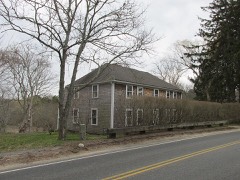
“Barnstable's Old Gaol is a historic colonial jail in Barnstable, Massachusetts. Built c.1690, it is the oldest wooden jail in the United States of America.”
Wikipedia article Old Jail (Barnstable, Massachusetts), CC BY-SA 4.0.
one of 145 National Register listings in Barnstable County · listed in 1971 · category: Building · built in 1690, First Period.
Architectural style. First Period, colonial architecture
National Register reference number.71000078- the number the National Park Service assigned this property when it was listed, and the key its nomination file is catalogued under at the National Archives.
Fires near this property
153 since 2003
Regional context, not property-specific
evidence. The
federal wildfire occurrence database
lists 153 fires within 5 miles of Old Jail between
2003 and 2020, burning about 51 acres in total. 6 started naturally. 10 were recorded as arson.
Distance is straight-line from the map coordinates, so a fire counted
here may appear on a neighbouring settlement's page as well.
Reported cause
Fires
Missing data/not specified/undetermined
78
Debris and open burning
43
Arson/incendiarism
10
Equipment and vehicle use
7
Natural
6
Recreation and ceremony
4
Smoking
4
Misuse of fire by a minor
1
The most recent of
them, most recent first, with the day each was reported and the service
that recorded it.
Regional context, not property-specific
evidence. Museums hold 3,079 specimens
collected within 10 miles of Old Jail between 1866 and
1975: 2,153 Animalia, 664 Plantae, 139 Fungi, 113 Chromista, 8 Protozoa, 1 Bacteria, 1 Unrecorded. 12 distinct Species records are shown.
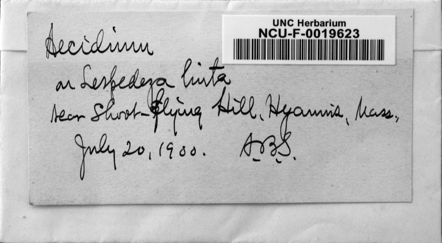
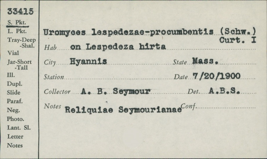
Collected by A. B. Seymour, A. R. Hodgdon, A. R. Hodgdon; E. J. Hehre and others. Each is a
physical object with a catalogue
number, and each entry opens the museum's record. This is what was
collected and kept, not a survey of what lives here - nothing can be
concluded from a species being absent.
Regional context, not property-specific
evidence. The federal mineral resources record lists
2 workings within 5 miles of Old Jail: 1 past producer, 1 producer.
1 still produces. What was taken out: Sand and Gravel, Construction. Distance is straight-line from the
map coordinates, so a quarry counted here may appear on a neighbouring
settlement's page as well.
Regional context, not property-specific
evidence. The National Weather Service names
Barnstable, the town this property stands in, in 14 storm reports between 1998 and 2023: 5 thunderstorm wind, 4 hail, 2 heavy rain, 2 flood.
No death or injury is recorded in these reports. Each account below is quoted exactly as the forecast office
filed it, from the NOAA Storm Events Database, and each date
opens the federal record of that event.
The Cape Cod Times reported a twenty five foot section of a retaining wall at Barnstable Harbor collapsed. Heavy rainfall throughout the day, combined with strong winds and heavy surf, all contributed to the collapse of the wooden structure.
At 117 PM EST, half of Cedar Street in West Barnstable was reported flooded and washed out. West Barnstable Emergency Management reported 4.74 inches of rain.
No historic map-sheet match is published
for this property yet. That does not mean no map exists. This record needs
a coordinate-quality review before it can be joined to a sheet boundary.
Browse the county's mapped places while that work is
pending.
From the nomination file
2,801 words on record
When this property was proposed for the
National Register, someone wrote the case for it: what the building is,
and why it matters. That document is a federal record in the public domain.
It is quoted below word for word, never summarised. The text was read off the scanned case file by machine, so the
occasional stray character is the recogniser's and the 1970s
typewriter's.
Description of the property
Architectural evidence confirms the tradition associated with the Old Barn- - The a hiton of an 1st coetuy. jail. The addition of ani18th century, 2 story, 5 bay building created an "L" shaped structure of which the early building formed the wing. Later, the eastern 2 bays of the 18th century structure were removed, leaving the present rectangular shaped building. The Jail is located about 120 feet south of Route 6A, about 60 feet west of Old Jail Lane. There is noreason to doubt that this is the original location. The building is shingle covered. The 17th century structure is 2 stories high with a ridge roof. The gable ends face north and south; the gable ends of the 18th century addition face east and west.
Although this section was originally 2 stories high, the second floor has been removed. On the east facade of the early building is the main entrance. One window to the right of the door and two windows on the upper floor are apparent from the interior. The south facade contains a window in the loft which appeats to have been cut at a later date and is shingled over. On the west facade there are four symmetrically placed window openings (2 on each floor). Two of these are visible from the exterion. Only the framing of the north facade remains, since the wall was removed when the later portion of the building was added. The shingles on the three exposed sides and the roof, though not original, are so old that many have rotted off.
20th Century 'Urban' Planning Other (Specity) government nia1 ar The Old Jail in Barnstable is the earliest known jail of Plymouth Colony and one of the oldest wooden structures of its kind extant in New England. Though no exact date can be given, it is believed that the Jail was constructed between 1690 and 1700. In 1686, the building of a jail for the newly formed Barnstable County was ordered. By 1702 prisoners were being held in the Jail while awaiting trial at the Court Sessions held in Barnstable, the shire town of the Plymouth Colony. Construction methods also date the Old Jail to the late seventeenth century. The heavy oak post and plank construction of the building is typical of seventeenth cen- tury colonial architecture.
Interior walls bear the designs of ships and schooners and broad arrow markings scratched there by prisoners. RECEIVEU APR 12 1971 NATIONAL REGISTER
Quoted from the National Register nomination
for reference 71000078, 15 pages, held by the National Archives in Record
Group 79. See the
catalogue record.
Listed places nearby
6 within 8 miles
Other National Register properties close
enough to walk or drive between, ordered by distance from this one. Both
positions come from the same geocoding pass that matched these properties
to their map sheets.
Listing record. National Park Service National Register of Historic Places, listed-properties dataset, current to 2026-05-22.
Map join. Address geocoded through the United States Census geocoder, then tested against the published boundary of every sheet in the USGS Historical Topographic Map Collection.
How this page is made. Listing fields come from federal records; map-sheet coverage is a labelled coordinate-to-boundary calculation, not a source-field claim.
Wildfire. Short, Karen C. 2022. Spatial wildfire occurrence data for the United States, 1992-2020 [FPA_FOD_20221014]. 6th Edition. Fort Collins, CO: Forest Service Research Data Archive. https://doi.org/10.2737/RDS-2013-0009.6 Collected with United States Government funding and usable without additional permissions or fees.
Specimens. Global Biodiversity Information Facility (GBIF), https://www.gbif.org/. Only records licensed CC0 or CC BY are used. Records licensed CC BY-NC are excluded because this site carries advertising. Images are checked individually and any whose licence is non-commercial, no-derivatives or unreadable is refused.
Mines and quarries. USGS Mineral Resources Data System (MRDS) https://mrdata.usgs.gov/mrds/ A work of the United States government, no copyright under 17 U.S.C. 105.
Storms. NOAA National Centers for Environmental Information, Storm Events Database https://www.ncei.noaa.gov/stormevents/ A work of the United States government, no copyright under 17 U.S.C. 105. Narratives are quoted verbatim from the National Weather Service report and are not edited or summarised.
 Block
Block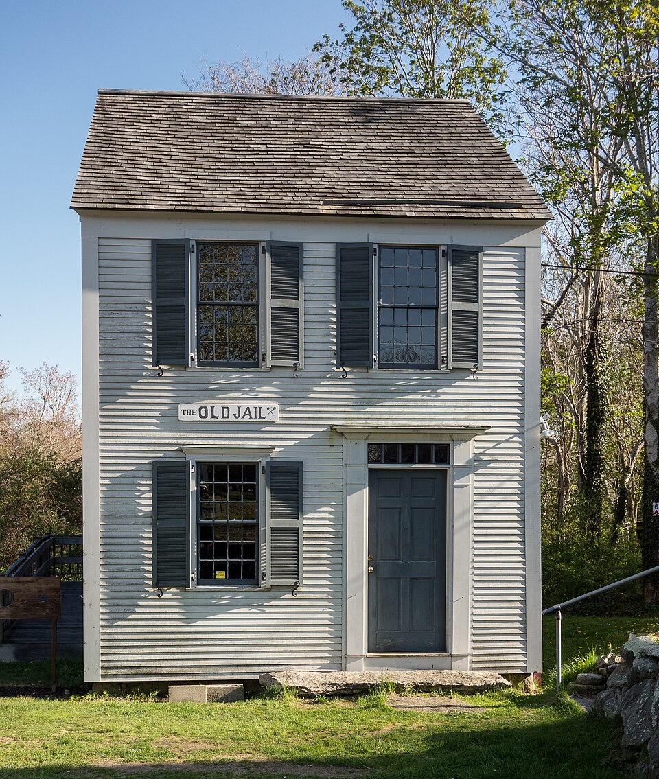






_002.jpeg)