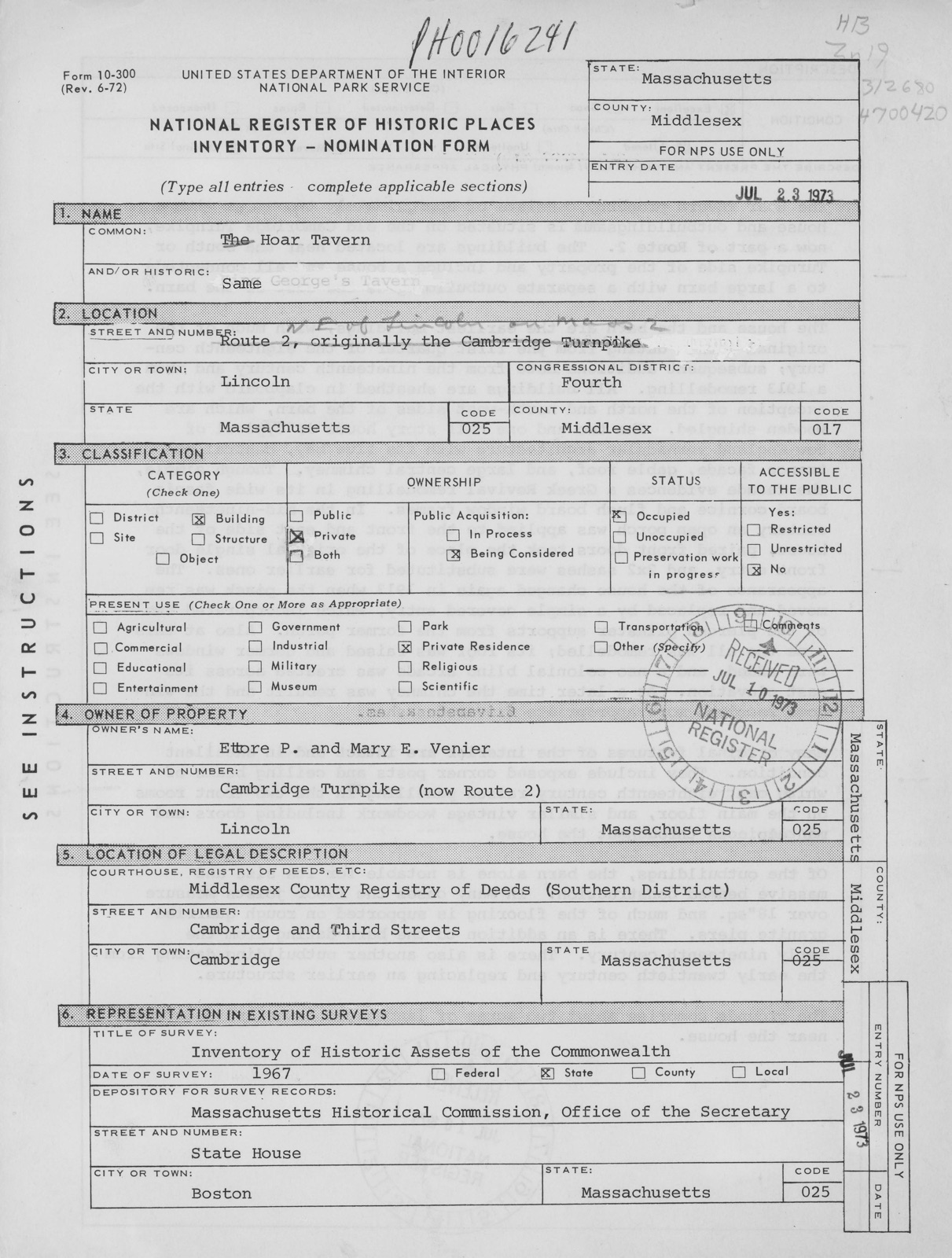
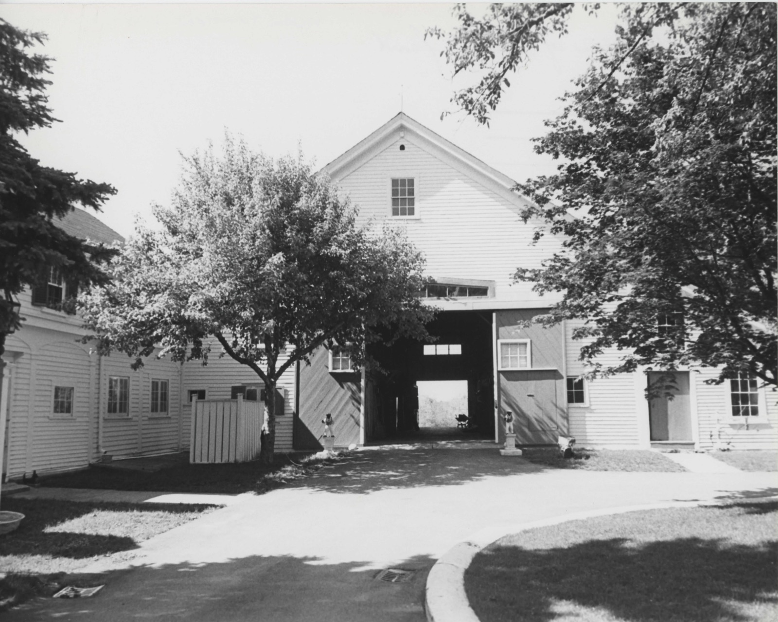
Photographs from the nomination case file, National Park Service records.
Hoar Tavern
Listed on the National Register of Historic Places in
1973. A historic map-sheet match is not published yet. The record needs a coordinate-quality review before it can be joined to a sheet boundary.
From the record
“The main road from Lexington to Concord, called in early times " the Bay-road,'* passed through the northerly part of Lincoln and by Captain Smith's house. Probably he was the first to receive intelligence that the royal forces were in motion.”
History of Middlesex County, Massachusetts (1880). Machine-read text.
one of 1100 National Register listings in Middlesex County · listed in 1973 · category: Building · one of 3 National Historic Landmarks in Middlesex County.
National Register reference number.73000301- the number the National Park Service assigned this property when it was listed, and the key its nomination file is catalogued under at the National Archives.
HE town of Lincoln is a collection of hills in the heart of Middlesex County. Its centre is about thirteen and one half miles west-northwest from the state house, and its territory is bounded nortli by Bedford, easterly by Lexington and Waltham, southerly by Weston and Wayland, and northwesterly by Concord. Its greatest length is upwards of five, and its greatest breadth about three and one half, miles, and it embraces about eight thousand five hundred acres. The hill on which the meetinghouse stands is four hundred and seventy feet above high-water mark at Boston, and though there are other hills of greater altitude, it is believed to be the highest land in the county whereon men have built themselves habitations. From the summit of this hill, in fine weather, the prospect extends from the seminary buildings in Andover to the churches in Hopkinton, and from Bunker Hill Monument to the New Hampshire hills.
Sandy Pond, a beautiful sheet of water, lies on the western side of the town, and a fine tract of arable land extends from the centre of Lincoln to the borders of Wayland, the quality of which was well known to the Indians, and they repeatedly petitioned to have a town on the easterly shore of Sandy Pond, or the westerly side of Beaver Swamp. The southwestern border of the town is washed for more than a mile by the sluggish waters of Concord River. Brooks which are tributaries to the Concord, Charles, and Shawshiiic rise and flow out, but not a tubful of water comes into the town from any source except the rains and dews of heaven. Two of these brooks acquire sufficient force and volume before leaving the town to furnish water-power for saw and grist mills, and a small mill for sawing marble taken from a quarry near by existed here many years ago ; but the business was not remunerative. Tlie inhabitants of Lmcoln are occupied witli
Regional context, not property-specific
evidence. The
federal wildfire occurrence database
lists 42 fires within 5 miles of Hoar Tavern between
1992 and 2020, burning about 32 acres in total. 1 started naturally. 2 were recorded as arson.
Distance is straight-line from the map coordinates, so a fire counted
here may appear on a neighbouring settlement's page as well.
Reported cause
Fires
Debris and open burning
17
Missing data/not specified/undetermined
15
Railroad operations and maintenance
3
Arson/incendiarism
2
Equipment and vehicle use
1
Other causes
1
Misuse of fire by a minor
1
Natural
1
Recreation and ceremony
1
The most recent of
them, most recent first, with the day each was reported and the service
that recorded it.
Regional context, not property-specific
evidence. Museums hold 1,662 specimens
collected within 10 miles of Hoar Tavern between 1898 and
1975: 657 Animalia, 554 Plantae, 404 Fungi, 16 Bacteria, 13 Protozoa, 9 Unrecorded, 9 Chromista. 12 distinct Species records are shown.
Collected by ?, A B Seymour, A. B. Seymour and others. Each is a
physical object with a catalogue
number, and each entry opens the museum's record. This is what was
collected and kept, not a survey of what lives here - nothing can be
concluded from a species being absent.
Regional context, not property-specific
evidence. The federal mineral resources record lists
11 workings within 5 miles of Hoar Tavern: 8 past producers, 3 producers.
3 still produce. What was taken out: Sand and Gravel, Construction, Stone, Crushed/Broken. Distance is straight-line from the
map coordinates, so a quarry counted here may appear on a neighbouring
settlement's page as well.
Regional context, not property-specific
evidence. The National Weather Service names
Lincoln, the town this property stands in, in 6 storm reports between 2000 and 2022: 4 thunderstorm wind, 2 lightning.
No death or injury is recorded in these reports. Each account below is quoted exactly as the forecast office
filed it, from the NOAA Storm Events Database, and each date
opens the federal record of that event.
In Lincoln, two large trees were down with wires down on Old Concord Road. A tree was down on Route 126. A tree was down on wires at the intersection of Huntley Lane and Farrar Road. A large branch was down on the 1400 block of Concord Road.
No historic map-sheet match is published
for this property yet. That does not mean no map exists. This record needs
a coordinate-quality review before it can be joined to a sheet boundary.
Browse the county's mapped places while that work is
pending.
From the nomination file
2,447 words on record
When this property was proposed for the
National Register, someone wrote the case for it: what the building is,
and why it matters. That document is a federal record in the public domain.
It is quoted below word for word, never summarised. The text was read off the scanned case file by machine, so the
occasional stray character is the recogniser's and the 1970s
typewriter's.
Description of the property
Moved [X Original Site The Hoar Tavern property consists of approximately two acres with a house and outbuildings and is situated on the old Cambridge Turnpike, now a part of Route 2. The buildings are located near the south or Turnpike side of the property and include a house and ell connected to a large barn with a separate outbuilding to the east of the barn. The house and the barn are the earliest buildings, with much of the original fabric dating from the first quarter of the eighteenth cen- tury; subsequent additions date from the nineteenth century and from a 1913 remodelling. All buildings are sheathed in clapboard with the exception of the north and north-west sides of the barn, which are wooden shingled.
The two and one half story house is typical of New England vernacular architecture with its five bay, central en- trance facade, gable roof, and large central chimney. Though simple, the facade evidences a Greek Revival remodelling in its wide fascia board cornice and flush board window frames. In the mid-nineteenth century an open porch was applied to the front and east side of the house, paired front doors took the place of the original single door front entry, and 2x2 sashes were substituted for earlier ones. The appearance of the house changed again in 1913 when the porch was re- moved and replaced by a simple covered entry, which incorporated two of the pierced pilaster supports from the former porch.
Also at this time the ell was remodelled; its roof was raised and dormer windows were added, and a neo-colonial blind arcade was created across its east elevation.
The Hoar Tavern was a well known local tavern in Revolutionary times, and was for almost two hundred years the home of one of Lincoln's most distinguished families. Possibly built, in part, as early as the 1680's, the house and its adjoining property were originally included in the town of Concord. Between 1713 and 1754 it was part of Lexington, and at the latter date it became part of the newly incorporated town of Lincoln. John Hoar, the son of the original owner, Daniel Hoar, inherited the property in 1734. He fought in the French and Indian War and was a selectman of both Lexington and Lincoln. Sometime before the Revolution, John operated a tavern on the property, and it served men returning from the Concord Bridge skirmish of April 19, 1775.
John and his son, Samuel, were among the men of the Lincoln Militia Company when they made their historic stand at the bridge. John was also a signer of the deposition to England relating the events of the day, and which reached London before the official news came from the British commander. Lt. Samuel Hoar con- tinued the family's interest in town affairs, serving as town moderator His son, Samuel Jr., was a renowned lawyer and U. S. Congressman and grandfather of U. S. Senator, George "Frisbee" Hoar. Leonard Hoar, another son of John, was one of the orig- inal incorporators of the Cambridge and Concord Turnpike Association in 1803.
The turnpike, completed in 1807, passed in front of the tavern on its route from the West Boston Bridge to Old Lexington Road in Concord, and one of the two toll stations was located near the Hoar's public house. Today the old turnpike is incorporated into Route 2.
Quoted from the National Register nomination
for reference 73000301, 14 pages, held by the National Archives in Record
Group 79. See the
catalogue record.
Listed places nearby
6 within 8 miles
Other National Register properties close
enough to walk or drive between, ordered by distance from this one. Both
positions come from the same geocoding pass that matched these properties
to their map sheets.
Listing record. National Park Service National Register of Historic Places, listed-properties dataset, current to 2026-05-22.
Map join. Address geocoded through the United States Census geocoder, then tested against the published boundary of every sheet in the USGS Historical Topographic Map Collection.
How this page is made. Listing fields come from federal records; map-sheet coverage is a labelled coordinate-to-boundary calculation, not a source-field claim.
Wildfire. Short, Karen C. 2022. Spatial wildfire occurrence data for the United States, 1992-2020 [FPA_FOD_20221014]. 6th Edition. Fort Collins, CO: Forest Service Research Data Archive. https://doi.org/10.2737/RDS-2013-0009.6 Collected with United States Government funding and usable without additional permissions or fees.
Specimens. Global Biodiversity Information Facility (GBIF), https://www.gbif.org/. Only records licensed CC0 or CC BY are used. Records licensed CC BY-NC are excluded because this site carries advertising. Images are checked individually and any whose licence is non-commercial, no-derivatives or unreadable is refused.
Mines and quarries. USGS Mineral Resources Data System (MRDS) https://mrdata.usgs.gov/mrds/ A work of the United States government, no copyright under 17 U.S.C. 105.
Storms. NOAA National Centers for Environmental Information, Storm Events Database https://www.ncei.noaa.gov/stormevents/ A work of the United States government, no copyright under 17 U.S.C. 105. Narratives are quoted verbatim from the National Weather Service report and are not edited or summarised.
 Block
Block