Listed on the National Register of Historic Places in
1973. A historic map-sheet match is not published yet. The record needs a coordinate-quality review before it can be joined to a sheet boundary.
From the record
“In the spring of this year (1807) General Granger induced eight families, then residing in Maryland, on the borders of the Chesapeake, where they had been successful tobacco-growers, to emigrate to Jefferson, for the purpose of establishing here a tobacco colony for the cultivation of the weed. The names of these families were Lisle Asque, Christopher Randall, James Legg, James Mace, Gilbert Nowell, James Ireland, Thomas Johnson, and George Fowler.”
History of Ashtabula County, Ohio (1878). Machine-read text.
one of 36 National Register listings in Ashtabula County · listed in 1973 · category: Building · one of 1 National Historic Landmarks in Ashtabula County.
National Register reference number.73001385- the number the National Park Service assigned this property when it was listed, and the key its nomination file is catalogued under at the National Archives.
The ground it stands on
16,765 words
The chapter on Ashtabula Township in Baker's Map of Ashtabula Co. Ohio, published 1856 names Ashtabula. This is what it says, exactly as the scans read.
The following compiled group of maps has been published for the benefit of persons wishing to know who owned certain properties in Ashtabula County, Ohio, in 1856, according to the five-by-five foot wall map drawn and published by the Baker Company.
Regional context, not property-specific
evidence. The
federal wildfire occurrence database
lists 1 fire within 5 miles of Hubbard, Col. William, House between
2020 and 2020, burning about 0 acres in total. None started naturally. None was recorded as arson.
Distance is straight-line from the map coordinates, so a fire counted
here may appear on a neighbouring settlement's page as well.
Reported cause
Fires
Missing data/not specified/undetermined
1
The most recent of
them, most recent first, with the day each was reported and the service
that recorded it.
Regional context, not property-specific
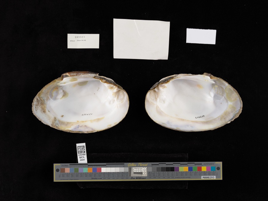
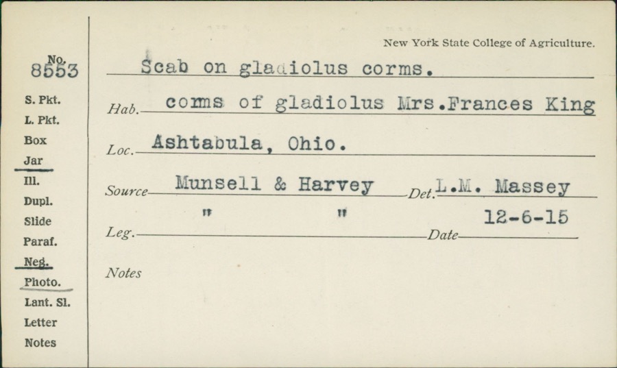
evidence. Museums hold 779 specimens
collected within 10 miles of Hubbard, Col. William, House between 1872 and
1975: 629 Animalia, 135 Plantae, 13 Fungi, 1 Unrecorded, 1 Chromista. 12 distinct Species records are shown.
Collected by A. A. Bill, A. B. Fuller, A. Burhanna and others. Each is a
physical object with a catalogue
number, and each entry opens the museum's record. This is what was
collected and kept, not a survey of what lives here - nothing can be
concluded from a species being absent.
Regional context, not property-specific
evidence. The federal mineral resources record lists
8 workings within 5 miles of Hubbard, Col. William, House: 4 past producers, 2 plants, 1 producer, 1 unknown.
3 still produce. What was taken out: Sand and Gravel, Construction, Titanium, Metal, Iron, Titanium, Pigment. Distance is straight-line from the
map coordinates, so a quarry counted here may appear on a neighbouring
settlement's page as well.
Regional context, not property-specific
evidence. The National Weather Service names
Ashtabula, the town this property stands in, in 48 storm reports between 1994 and 2025: 30 thunderstorm wind, 14 hail, 4 flash flood.
No death or injury is recorded in these reports. Each account below is quoted exactly as the forecast office
filed it, from the NOAA Storm Events Database, and each date
opens the federal record of that event.
Widespread basement and street flooding in Ashtabula, with several videos of flowing water of six inches or more across roadways. Radar estimated 2.75 to 3.5 inches of rainfall in a two to three hour period, which roughly equates to a 50 year recurrence interval.
Several roads closed due to flowing high water. Vehicles stranded in high water at West Avenue and West 34th Street, West 58th Street and Jefferson Road. Underpass on Main Avenue inundated with 5 to 6 feet of water, stranding a vehicle. Several reports of flooded basements in the area.
An ice jam on the Ashtabula River at Northcoast Marina and Yacht Club broke loose and snapped the docks apart like twigs. The river also flooded bottom land and at least one road. Other rural roads were flooded by melting piles of snow.
Widespread road flooding in Ashtabula and Plymouth areas. Some reports of basement flooding as well. Many of the roads flooded due to creeks coming out of their banks. A few cars stranded in a flooded underpass on Main Avenue in Ashtabula. Radar estimated 4 to 5.5 inches of rainfall in a 1.5 to 3 hour period. Two rain gauge reports in Plymouth reported nearly 6 inches of rainfall over a three hour period.
Trees and large limbs were downed. Hard hit was the west side of Conneaut where several roads were closed from downed trees. Utility poles were also downed along with some signs and awnings.
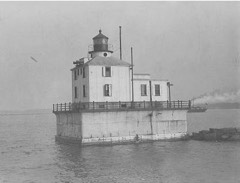
A 86 mph thunderstorm wind gust was measured at the Ashtabula Light House. Several dozen trees were downed in the City of Ashtabula. At least two homes were damaged by fallen trees. Other trees were downed to the west of Ashtabula in Saybrook Township.
Trained spotters estimated 60 mph winds in Ashtabula. A few trees were downed in an around the City of Ashtabula. One of the trees landed on a house trailer and caused some structural damage.
3 papers published in this town,
digitised by the Library of Congress and free to read: 0 issues,
0 pages. Every page is searchable, so a name or a street can be
looked for directly in what the town printed about itself at the time.
No historic map-sheet match is published
for this property yet. That does not mean no map exists. This record needs
a coordinate-quality review before it can be joined to a sheet boundary.
Browse the county's mapped places while that work is
pending.
From the nomination file
1,507 words on record
When this property was proposed for the
National Register, someone wrote the case for it: what the building is,
and why it matters. That document is a federal record in the public domain.
It is quoted below word for word, never summarised. The text was read off the scanned case file by machine, so the
occasional stray character is the recogniser's and the 1970s
typewriter's.
Description of the property
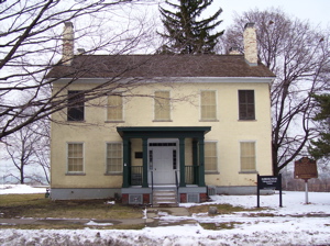
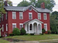
The Hubbard House as originally constructed by the owner, Col. William Hubbard, was a two-story, brick, five-bay, simple, country Greek Revival Walnut Blvd. was an unpaved country lane. At some point in the history of the house, two ells were added, then Throughout time, the interior has been altered considerably. Fireplaces have been blocked, partitioning altered, and other changes made for house was adapted to private club purposes, and still more recently, the overall present condition of the building is fair to good. accommodate escaping slaves. CONDITION residence.
REGISTER Ruins NATIONAL Asphalt shingles have replaced the original wooden shakes.Fenestration Hubbard built his barn, long since demolished.Prior to the Civil War, city's Recreation Department has utilized the interior for offices. A number of traditions have been repeated for generations about secret The exterior of the house today exhibits considerable alteration as well. (Check One) credence can be given to these features of the dwelling and there is It was built in 1834 near the Lake Erie shore on the outskirts of what provides a fairly compatible setting with respect to that of the original MAR 6 rooms and a tunnel from the basement of the house to the lake shore for RECEIVED - Good removed. Only the original, rectangular building remains today. are apparently original.
The original four chimneys remain intact. The The present location of the house at the corner of Walnut Beach Park to have been located under the kitchen ell (now demolished). Little has been altered.The front porch was added at some time after the con- was then a small Lake Erie port town.Immediately south of the house,
Statement of significance
the Civil War, slaves escaping from the south by way of the ohio River William Hubbard migrated from Holland Patent, New York, to Ashtabula 1787. Prior to his move to Ohio, Hubbard served in the War of 1812 as a captain in a New York Regiment, and was, after the war, a colonel of Hubbard joined the enterprise and became, very shortly, a substantial member of the community, earning the sobriquet "Deacon." He had married in the anti-slavery movement and made his home near the Lake Shore, a Some restoration work was performed in the late 1950's. In the 1834 Commerce militia. Architecture Conservation Communications Engineering REGISTER Religion/Phi Military Prehistoric Aboriginal Literature Music anti-slavery society.
NATIONAL "conductors landed passengers in his (Hubbard's) cellar or hayloft... itarian Agriculture for Recreation Department offices until recent months. Industry Landscape From this refuge, arrangements were made with co-operative ship captains Invention members of the family who owned and operated a lumber yard and warehouses, Hubbard occupied his home until his death in 1863.For many years second Education brick home upon his arrival.Having been preceded to the town by other to transport at night the escapees across the lake to Canada. Hubbard constructed his substantial and large (by early Ashtabula standards) losophy and Wheeling to the north prior to the transport of the slaves by boat Sculpture Wilbur H. Siebert wrote in his exhaustive study of the Underground, to Canada.
The old Western Reserve of Ohio was a hotbed of anti-slavery activity the former Catherine Hulbert in 18l0.Hubbard served his community in 1960's, it was transferred to the City of Ashtabula which used the house PERIOD (Check One or More as Appropriate) about 1834.
Quoted from the National Register nomination
for reference 73001385, 10 pages, held by the National Archives in Record
Group 79. See the
catalogue record.
Listed places nearby
6 within 8 miles
Other National Register properties close
enough to walk or drive between, ordered by distance from this one. Both
positions come from the same geocoding pass that matched these properties
to their map sheets.
Listing record. National Park Service National Register of Historic Places, listed-properties dataset, current to 2026-05-22.
Map join. Address geocoded through the United States Census geocoder, then tested against the published boundary of every sheet in the USGS Historical Topographic Map Collection.
How this page is made. Listing fields come from federal records; map-sheet coverage is a labelled coordinate-to-boundary calculation, not a source-field claim.
Wildfire. Short, Karen C. 2022. Spatial wildfire occurrence data for the United States, 1992-2020 [FPA_FOD_20221014]. 6th Edition. Fort Collins, CO: Forest Service Research Data Archive. https://doi.org/10.2737/RDS-2013-0009.6 Collected with United States Government funding and usable without additional permissions or fees.
Specimens. Global Biodiversity Information Facility (GBIF), https://www.gbif.org/. Only records licensed CC0 or CC BY are used. Records licensed CC BY-NC are excluded because this site carries advertising. Images are checked individually and any whose licence is non-commercial, no-derivatives or unreadable is refused.
Mines and quarries. USGS Mineral Resources Data System (MRDS) https://mrdata.usgs.gov/mrds/ A work of the United States government, no copyright under 17 U.S.C. 105.
Storms. NOAA National Centers for Environmental Information, Storm Events Database https://www.ncei.noaa.gov/stormevents/ A work of the United States government, no copyright under 17 U.S.C. 105. Narratives are quoted verbatim from the National Weather Service report and are not edited or summarised.
 Block
Block