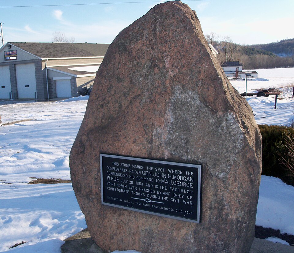
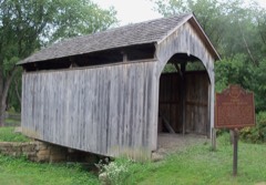
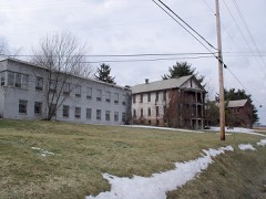
Photograph by Roseohioresident, Public domain. Via
Wikimedia Commons.
Morgan, John H., Surrender Site
Listed on the National Register of Historic Places in
1973. A historic map-sheet match is not published yet. The record needs a coordinate-quality review before it can be joined to a sheet boundary.
From the record
“Morgan Surrender Site is the place where, during the American Civil War, Brig. John Hunt Morgan, the leader of Confederate troops responsible for Morgan's Raid, surrendered to Union troops following the Battle of Salineville.”
Wikipedia article John H. Morgan Surrender Site, CC BY-SA 4.0.
one of 35 National Register listings in Columbiana County · listed in 1973 · category: Site · one of 1 National Historic Landmarks in Columbiana County.
National Register reference number.73001401- the number the National Park Service assigned this property when it was listed, and the key its nomination file is catalogued under at the National Archives.
What happened here
An account from the chapter on Wayne township, The inset identifies its exact
source book and publication year.
(Grim) Thompson. I lis grandfather was also named William Thompson and kept a hotel in Calcutta in the long ago when that village was in its palmiest days as a trading jx>st. His father was horn October jS. 1S13. and met his death by drowning at Smith's Kerry in 1839, when his son was two years old. ilis mother was a daughter of Michael (irim and was lxim in 1818 in Columbiana County.
W illiam Wells, on July 15. 1797, received a commission as justice of the peace signed by "Arthur St. Clair, governor and commanderin-chief of the territory northwest of the Ohio." Daniel T. I^awson. a pioneer citizen of Wellsville - -still living in 1905 at the age of 87 - in 1873 wrote a sketch of the early days of Wellsville from which a paragraph is quoted: "William Wells lived to see the town which l>ears his name enjoy a large and growing trade. He died in April. 1852. leaving a large number of descendants. For a number of years he lived in a log house that stood near the old stone mansion erected by him. and but recently torn down. He was a member of the justices' court that tried the lad Cartienter for the murder of the Indian chief. White Lyes, at West Point, about eight miles north of Wellsville. ; White Eyes, a Delaware chief, was a scholar, ' educated by the government. He understood Hebrew. Greek and Latin, and intended living with the whites: but some time after receiving his education he attended a dance at Georgetown, I ). ('.. at which he acquitted himself with extraordinary agility, which caused one of the ladies present to remark. 'Just see that yellow dog. Why. he is the best dancer in the room!' Overhearing this left-handed compliment, he felt insulted, and determined to rejoin his trilic, saying he "would rather be a chief with his own people than a yellow dog among the whites.' The trial of the Carpenter lad took place while Mr. Wells resided in the blockhouse At this time, and for many years after, he went to Georgetown, Pennsylvania, to get his bl icksmithing, and to Cross Creek. ab'Ut 1 j miles from the river, to get his milling done. He took his grain in a canoe to the mouth of
Cartney) Marquis. His father was born in Beaver County, Pennsylvania, where he was reared and in early life followed the trade of a carpenter, thereby earning the necessary funds to take him through school. He was wholly a self-made man and gained a |»lace of prominence in his professional work. He was graduated from the Ohio Medical College at Cincinnati, March 6, 1845, and soon after entered into practice, locating at West Point in 1846. Two or three years later he was married and in 1849 went West overland to Pike's Peak and Sacramento City to seek his fortune. After spending two years in the West, he returned to Ohio subsequent to the destruction of Sacramento by fire and resumed practice at West Point. Amid the tragedies of Morgan's raid through Ohio, an amusing incident befell Dr. David Marquis. He was captured by General Shackelford and his men, while riding horseback near West Heaver Church on his way to see a patient. Not knowing him personally, the General thought possibly he was a spy and would accept no explanation of his presence there. At the point of a pistol he was made to retrace his steps, but soon was able to establish his identity and bis loyalty to the Union cause. He continued in practice at West Point until April, 1867. and then moved with his family to Lisbon, where he lived until his death, which occurred January _>i. 1881. when he was alxmt 67 years old. Dr. David Marquis was joined in marriage with Margaret McCartney, who was bom 011 a farm near West Point, Columbiana. County, Ohio, and died in Lisbon in 189J, aged 08 years. Five sons and three daughters blessed this union, all but one of whom are living.
Regional context, not property-specific
evidence. The
federal wildfire occurrence database
lists 39 fires within 5 miles of Morgan, John H., Surrender Site between
2004 and 2020, burning about 52 acres in total. None started naturally. 1 was recorded as arson.
Distance is straight-line from the map coordinates, so a fire counted
here may appear on a neighbouring settlement's page as well.
Reported cause
Fires
Debris and open burning
28
Missing data/not specified/undetermined
6
Recreation and ceremony
2
Arson/incendiarism
1
Equipment and vehicle use
1
Smoking
1
The most recent of
them, most recent first, with the day each was reported and the service
that recorded it.
Regional context, not property-specific
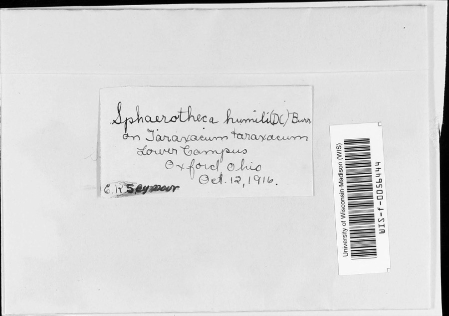
evidence. Museums hold 541 specimens
collected within 10 miles of Morgan, John H., Surrender Site between 1889 and
1975: 428 Animalia, 92 Plantae, 20 Fungi, 1 Unrecorded. 12 distinct Species records are shown.
Collected by A. D. Mac Gillivroy, Adler, K. K., Albert Peyron and others. Each is a
physical object with a catalogue
number, and each entry opens the museum's record. This is what was
collected and kept, not a survey of what lives here - nothing can be
concluded from a species being absent.
Regional context, not property-specific
evidence. The federal mineral resources record lists
1 working within 5 miles of Morgan, John H., Surrender Site: 1 occurrence.
None of them still produces. What was taken out: Titanium, Silica, Iron, Aluminum. Distance is straight-line from the
map coordinates, so a quarry counted here may appear on a neighbouring
settlement's page as well.
Regional context, not property-specific
evidence. The National Weather Service names
West Point, the town this property stands in, in 3 storm reports between 1994 and 1995: 2 hail, 1 thunderstorm wind.
No death or injury is recorded in these reports. Each account below is quoted exactly as the forecast office
filed it, from the NOAA Storm Events Database, and each date
opens the federal record of that event.
No historic map-sheet match is published
for this property yet. That does not mean no map exists. This record needs
a coordinate-quality review before it can be joined to a sheet boundary.
Browse the county's mapped places while that work is
pending.
From the nomination file
1,242 words on record
When this property was proposed for the
National Register, someone wrote the case for it: what the building is,
and why it matters. That document is a federal record in the public domain.
It is quoted below word for word, never summarised. The text was read off the scanned case file by machine, so the
occasional stray character is the recogniser's and the 1970s
typewriter's.
Description of the property
and one tenth miles west of West Point, Ohio. Immediately to the north one tenth miles west of the junction of old Ohio 45 and 518. The point At the present time the site is in a road side park owned by the State Moved On July 26,1863,when John Hunt Morgan surrendered to the Union Army, the northern most progress of any large body of Confederate troops. in 1908, is set on a cement slab and is partially surrounded by RECEIVED Fair
Statement of significance
and Ohio. On July 20, 1863, Morgan attempted to cross the Ohio River and return to Confederate territory at Buffington, Ohio. The attempted On July 26, 1863, with Union forces closing in from three sides, Morgan surrendered to Captain Burbick, commander of a local militia unit. Morgan chose to surrender to Burbick, hoping to obtain more favorable surrender and taken to Columbus, Ohio, where they were imprisoned in More important, Morgan diverted a large number of (some 28,000) Gettysburg.
Commerce Architecture Communications Conservation Engineering Transportation losophy Science Aboriginal Education NATIONAL Landscape Music Prehistoric REGISTER itarian Agriculture Theater Sculpture deeper into Union territory than any other Confederate officer.Morgan's Social/Human- Religion/Phi- who marched around General McClellan's army during the Peninsula bringing the war to an area heretofore untouched by the hostilities. he wished to join Lee's army which was marching into Pennsylvania at Invention Campaign in 1862.Morgan did succeed in disrupting communications and troops from the Eastern Tennessee front.Finally, Morgan marched surrender site is approximately 60 miles farther north than the Ohio Penitentiary.
and his officers were removed from West Point on the day after the party marched north along a path roughly parallel to the Ohio River. the next i8 days Morgan and his troops marched through Southern Indiana have insured a lasting fame for Morgan comparable to that of J.E.B. Stuart Political Industry X Military AREAS OF SIGNIFICANCE (Check One or More as Appropriate) On July 8, 1863, General John Hunt Morgan, a Confederate cavalry officer, JAN 3 Art rather favorable surrender terms which were later revoked.Morgan RECEIVED crossed the Ohio River at Brandenberg, Indiana with 2400 men.During Morgan's objective in conducting the Ohio raid is not clear.Apparently, escape was foiled by Union troops guarding the Buffington ford.
Quoted from the National Register nomination
for reference 73001401, 9 pages, held by the National Archives in Record
Group 79. See the
catalogue record.
Listed places nearby
4 within 8 miles
Other National Register properties close
enough to walk or drive between, ordered by distance from this one. Both
positions come from the same geocoding pass that matched these properties
to their map sheets.
Listing record. National Park Service National Register of Historic Places, listed-properties dataset, current to 2026-05-22.
Map join. Address geocoded through the United States Census geocoder, then tested against the published boundary of every sheet in the USGS Historical Topographic Map Collection.
How this page is made. Listing fields come from federal records; map-sheet coverage is a labelled coordinate-to-boundary calculation, not a source-field claim.
Wildfire. Short, Karen C. 2022. Spatial wildfire occurrence data for the United States, 1992-2020 [FPA_FOD_20221014]. 6th Edition. Fort Collins, CO: Forest Service Research Data Archive. https://doi.org/10.2737/RDS-2013-0009.6 Collected with United States Government funding and usable without additional permissions or fees.
Specimens. Global Biodiversity Information Facility (GBIF), https://www.gbif.org/. Only records licensed CC0 or CC BY are used. Records licensed CC BY-NC are excluded because this site carries advertising. Images are checked individually and any whose licence is non-commercial, no-derivatives or unreadable is refused.
Mines and quarries. USGS Mineral Resources Data System (MRDS) https://mrdata.usgs.gov/mrds/ A work of the United States government, no copyright under 17 U.S.C. 105.
Storms. NOAA National Centers for Environmental Information, Storm Events Database https://www.ncei.noaa.gov/stormevents/ A work of the United States government, no copyright under 17 U.S.C. 105. Narratives are quoted verbatim from the National Weather Service report and are not edited or summarised.
 Block
Block