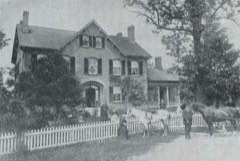
Listed on the National Register of Historic Places in
1973. A historic map-sheet match is not published yet. The record needs a coordinate-quality review before it can be joined to a sheet boundary.
From the record
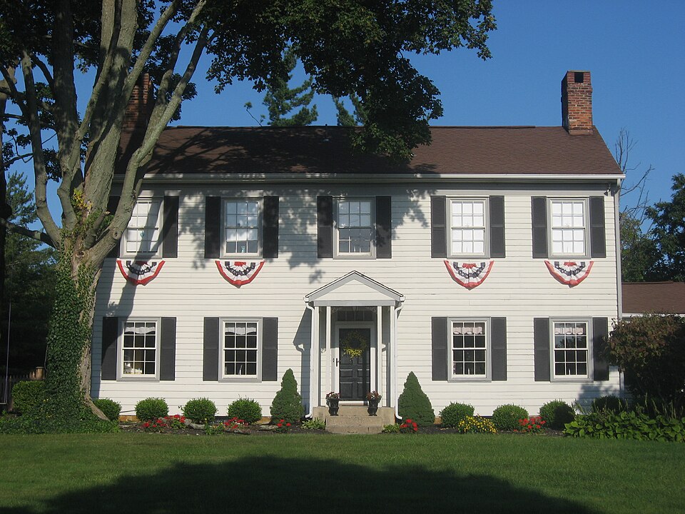
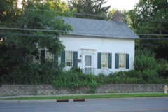
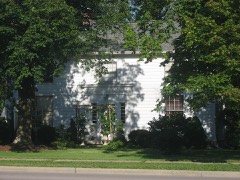
“The Gideon Hart House is the oldest home in Westerville, Ohio, United States. Built in 1820, the home is listed on the National Register of Historic Places.”
Wikipedia article Gideon Hart House, CC BY-SA 4.0.
one of 295 National Register listings in Franklin County · listed in 1973 · category: Building · one of 3 National Historic Landmarks in Franklin County.
National Register reference number.73001442- the number the National Park Service assigned this property when it was listed, and the key its nomination file is catalogued under at the National Archives.
Specimens collected near this property
12 of 3,066 shown
Regional context, not property-specific
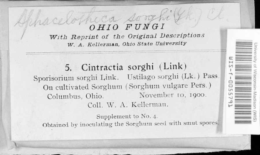
evidence. Museums hold 3,066 specimens
collected within 10 miles of Hart, Gideon, House between 1804 and
1975: 2,802 Animalia, 192 Plantae, 55 Fungi, 16 Chromista, 1 Unrecorded. 12 distinct Species records are shown.
Collected by A C Whitney, A. J. Basinger, A. J. Penniman and others. Each is a
physical object with a catalogue
number, and each entry opens the museum's record. This is what was
collected and kept, not a survey of what lives here - nothing can be
concluded from a species being absent.
Regional context, not property-specific
evidence. The National Weather Service names
Westerville, the town this property stands in, in 36 storm reports between 1994 and 2026: 19 thunderstorm wind, 12 hail, 2 flash flood, 2 flood.
No death or injury is recorded in these reports. Each account below is quoted exactly as the forecast office
filed it, from the NOAA Storm Events Database, and each date
opens the federal record of that event.
Hail up to the size of golf balls affected the north side of the Columbus metro area and southern Delaware county. Hail was extensive from Dublin, through Worthington and Powell, to Westerville. Trees and shrubs were stripped of their foliage and cars and homes sustained significant hail damage. The hail covered the ground in some locations up to six inches deep in Worthington in northern Franklin county and near the Polaris Mall in southern Delaware county.
No historic map-sheet match is published
for this property yet. That does not mean no map exists. This record needs
a coordinate-quality review before it can be joined to a sheet boundary.
Browse the county's mapped places while that work is
pending.
From the nomination file
1,221 words on record
When this property was proposed for the
National Register, someone wrote the case for it: what the building is,
and why it matters. That document is a federal record in the public domain.
It is quoted below word for word, never summarised. The text was read off the scanned case file by machine, so the
occasional stray character is the recogniser's and the 1970s
typewriter's.
Description of the property
are seen throughout the exterior, and the front entrance. The portico has been added during a recent renovation, but does not greatly conveniences in the form of central heating, electricity, and and renovations in its life, but in each case the various owners the house, but they have more recent origins. JUN 2 9 1973 CONDITION REGISTER NATIONAL Ruins the twentieth century. the house. Admittedly, the Gideon Hart House has seen some modifications First floor features include the rectangular sash windows which The interior is graced with wide, ash board flooring which is have been careful not to destroy the early nineteenth century The two wings seen on the house have been added sometime during pediment shape.
Other features include the clapboard siding bays by two bays.Certain additions and improvements have been imately equal proportions of walnut and butternut woods. Modern made to the structure, but it still retains its early nineteenth from lumber sawed at Gideon Hart's own sawmill. which has been replaced at least once during the life of the (Check One) century appearance. RECEIVED building.Two interior end chimneys sprout from the gable roof.
running water were added during several 1928 modifications to serving this fine home.There are several outbuildings around Gideon Hart.The house rests on a stone foundation, and is five pegged to the sub-flooring.The woodwork is composed of approx- its original portion) forty feet by twenty feet.It was built The house measures approximately (that is, This two story frame house was built circa 1820 bya man named Good PERIOD (Check One or More as Appropriate) SPECIFIC DATE(S) (If Applicable and Known) - Urban Planning - Prehistoric - Other (Specify) - Industry - Invention - Landscape STATEMENT OF
Statement of significance
Revolutionary War, Hart's mother, who resided in Farmington, Connecticut, was given one hundred fifty acres of land in Ohio (now Blendon). Hart was a surveyor, and soon he increased his also a Colonel in the local militia, and he served for many His son, Henry Clay Hart, and a daughter, Candace, ran the of owners, some of whom have tried to preserve the Gideon Hart portant, early settler of Franklin County, and because of its fine, early nineteenth century architecture should be placed JUN 2 9 1973 Transportation Conservation Engineering Theater Commerce Architecture Communications Aboriginal SIGNIFICANCE Religion/Phi losophy Music Agriculture Science itarian REGISTER Literature NATIONAL Education Social/Human- Sculpture House and its nineteenth century character.
land holdings to approximately four hundred acres.Hart built Political Pre-Columbian! grove of sugar maples. Gideon Hart died in 1859,and was The Gideon Hart House because of its association with this im- years as area Justice of the Peace. the National Register of Historic Places. from his mother.Widowed when her husband was killed in the Hart was also a prosperous farmer as well as a good surveyor. Military survived by his wife until 1875.
Records indicate that Gideon platted the nearby town of The Harts located their land in what was then Harrison Township fight the War of 1812,he and his wife Nancy Langton Hart moved 16th Century lumber for this house which he erected in 1820.Gideon was by the government in 1800.After Gideon grew up and helped to Gideon Hart received the land on which he built this house built 1820 the third sawmill in Franklin County in 18l9,and sawed the to Ohio. AREAS OF SIGNIFICANCE (Check One or More as Appropriate) Art
Quoted from the National Register nomination
for reference 73001442, 9 pages, held by the National Archives in Record
Group 79. See the
catalogue record.
Listed places nearby
6 within 8 miles
Other National Register properties close
enough to walk or drive between, ordered by distance from this one. Both
positions come from the same geocoding pass that matched these properties
to their map sheets.
Listing record. National Park Service National Register of Historic Places, listed-properties dataset, current to 2026-05-22.
Map join. Address geocoded through the United States Census geocoder, then tested against the published boundary of every sheet in the USGS Historical Topographic Map Collection.
How this page is made. Listing fields come from federal records; map-sheet coverage is a labelled coordinate-to-boundary calculation, not a source-field claim.
Specimens. Global Biodiversity Information Facility (GBIF), https://www.gbif.org/. Only records licensed CC0 or CC BY are used. Records licensed CC BY-NC are excluded because this site carries advertising. Images are checked individually and any whose licence is non-commercial, no-derivatives or unreadable is refused.
Storms. NOAA National Centers for Environmental Information, Storm Events Database https://www.ncei.noaa.gov/stormevents/ A work of the United States government, no copyright under 17 U.S.C. 105. Narratives are quoted verbatim from the National Weather Service report and are not edited or summarised.
 Block
Block