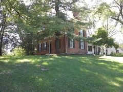
Listed on the National Register of Historic Places in
1980. A historic map-sheet match is not published yet. The record needs a coordinate-quality review before it can be joined to a sheet boundary.
From the record
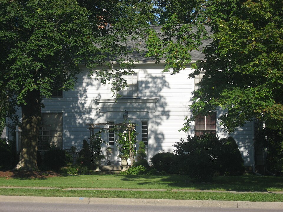
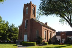
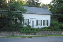
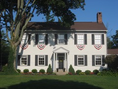
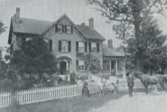
“The Presbyterian Parsonage is a historic parsonage in the Central College neighborhood of Westerville, Ohio, United States. Constructed in the 1840s, when Central College was a separate community, it has been named a historic site.”
Wikipedia article Presbyterian Parsonage (Westerville, Ohio), CC BY-SA 4.0.
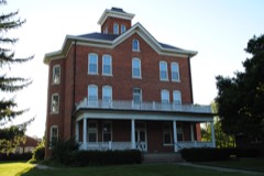
one of 295 National Register listings in Franklin County · listed in 1980 · category: Building · one of 3 National Historic Landmarks in Franklin County.
National Register reference number.80004246- the number the National Park Service assigned this property when it was listed, and the key its nomination file is catalogued under at the National Archives.
Specimens collected near this property
12 of 3,071 shown
Regional context, not property-specific
evidence. Museums hold 3,071 specimens
collected within 10 miles of Presbyterian Parsonage between 1804 and
1975: 2,803 Animalia, 194 Plantae, 57 Fungi, 16 Chromista, 1 Unrecorded. 12 distinct Species records are shown.
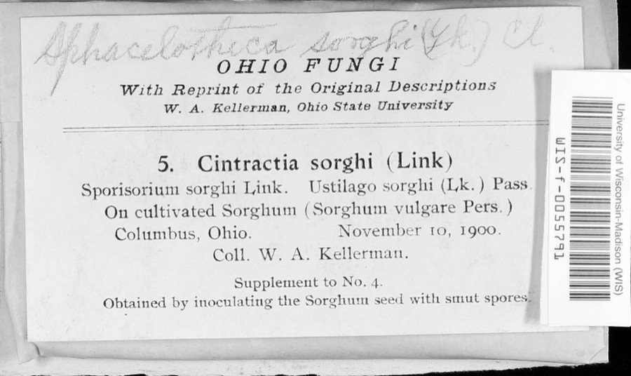
Collected by A C Whitney, A. J. Basinger, A. J. Penniman and others. Each is a
physical object with a catalogue
number, and each entry opens the museum's record. This is what was
collected and kept, not a survey of what lives here - nothing can be
concluded from a species being absent.
Regional context, not property-specific
evidence. The National Weather Service names
Westerville, the town this property stands in, in 36 storm reports between 1994 and 2026: 19 thunderstorm wind, 12 hail, 2 flash flood, 2 flood.
No death or injury is recorded in these reports. Each account below is quoted exactly as the forecast office
filed it, from the NOAA Storm Events Database, and each date
opens the federal record of that event.
Hail up to the size of golf balls affected the north side of the Columbus metro area and southern Delaware county. Hail was extensive from Dublin, through Worthington and Powell, to Westerville. Trees and shrubs were stripped of their foliage and cars and homes sustained significant hail damage. The hail covered the ground in some locations up to six inches deep in Worthington in northern Franklin county and near the Polaris Mall in southern Delaware county.
No historic map-sheet match is published
for this property yet. That does not mean no map exists. This record needs
a coordinate-quality review before it can be joined to a sheet boundary.
Browse the county's mapped places while that work is
pending.
From the nomination file
779 words on record
When this property was proposed for the
National Register, someone wrote the case for it: what the building is,
and why it matters. That document is a federal record in the public domain.
It is quoted below word for word, never summarised. The text was read off the scanned case file by machine, so the
occasional stray character is the recogniser's and the 1970s
typewriter's.
Description of the property
Road in 1927.The house was used as a parsonage during the mid-19th century UNITED STATES DEPARTMENT OF THE INTERIOR HERITAGE CONSERVATION AND RECREATION SERVICE RECEIVED OCT 14 1990 NATIONAL REGISTER OF HISTORIC PLACES INVENTORY -- NOMINATION FORM Historic Resources of Central College, Westerville, Franklin County CONTINUATION SHEET ITEM NUMBER Central College Presbyterian Central College Presbyterian Church Westerville, Ohio Ms. J. V. Zimmer Mrs. Sarah Ballard Ohio School for the Deaf Alumni 43081 Association Property Director Pastor PAGE Church Central College Owner FHR-8-300A DATE ENTERED 6891 Sunbury Road Fairchild Building (11/78) 7121 Sunbury Road FOR HCRS USE ONLY 6972 Sunbury Road Form No. 10-300a (Rev.
10-74) UNITED STATES DEPARTMENT OF THE INTERIOR NATIONAL PARK SERVICE NATIONAL REGISTER OF HISTORIC PLACES INVENTORY -- NOMINA TION FORM Central College Multiple Resource Area, Franklin County, Ohio ITEM NUMBER Sunbury Rd A. Rev. Washburn Residence B. Fairchild Building C. Presbyterian Parsonage D. Central College Presbyterian Church Verbal Boundary Description 400' north of the village limits and measuring 100' by 150' as recorded in the Franklin County Map Room, Map Book M-1. GPO 892 455 PAGE South St. DATE ENTERED The boundaries of the nominated properties include Lot #8,Lot southeast FOR NPS USE ONLY North St.
NOV 2 5 1980 corner of Lot #35 measuring 99' by 330' and the lot on the west side of Sunbury Rd., RECEIVED0CT 141980 Photos - Inventory - NOV 25 1980 Federal Register Entry KEEPER CONTROL Entered HAER Maps Send-back HISTORIAN Re-submit Review National Register Write-up United States Department of the Interior -Heritage Conservation and Recreation Service BRANCH CHIEF REVIEW UNIT CHIEF .2.82 DUE ARCHEOLOGIST OTHER TECHNICAL OCT 1 4 1980 CENTRAL COLLEGE PRESBYTERIAN PARSONAGE VIRGINIA M. WOLF NOV 2 5 1980 1/80 6972 SUNBURY RD.
Quoted from the National Register nomination
for reference 80004246, 6 pages, held by the National Archives in Record
Group 79. See the
catalogue record.
Listed places nearby
6 within 8 miles
Other National Register properties close
enough to walk or drive between, ordered by distance from this one. Both
positions come from the same geocoding pass that matched these properties
to their map sheets.
Listing record. National Park Service National Register of Historic Places, listed-properties dataset, current to 2026-05-22.
Map join. Address geocoded through the United States Census geocoder, then tested against the published boundary of every sheet in the USGS Historical Topographic Map Collection.
How this page is made. Listing fields come from federal records; map-sheet coverage is a labelled coordinate-to-boundary calculation, not a source-field claim.
Specimens. Global Biodiversity Information Facility (GBIF), https://www.gbif.org/. Only records licensed CC0 or CC BY are used. Records licensed CC BY-NC are excluded because this site carries advertising. Images are checked individually and any whose licence is non-commercial, no-derivatives or unreadable is refused.
Storms. NOAA National Centers for Environmental Information, Storm Events Database https://www.ncei.noaa.gov/stormevents/ A work of the United States government, no copyright under 17 U.S.C. 105. Narratives are quoted verbatim from the National Weather Service report and are not edited or summarised.
 Block
Block