Listed on the National Register of Historic Places in
1979. A historic map-sheet match is not published yet. The record needs a coordinate-quality review before it can be joined to a sheet boundary.
From the record
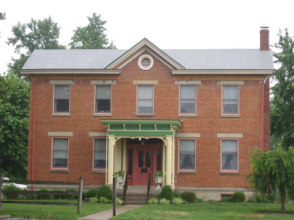
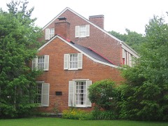
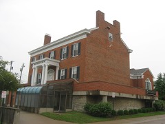
“The Martin House is a historic residence in the Mount Washington neighborhood of Cincinnati, Ohio, United States. Built in 1847, the house is composed of two pieces: the original section, located in the back; and the front, built in 1852.”
Wikipedia article Martin House (Cincinnati, Ohio), CC BY-SA 4.0.
one of 314 National Register listings in Hamilton County · listed in 1979 · category: Building · one of 9 National Historic Landmarks in Hamilton County.
Architectural style. Greek Revival architecture, Federal architecture
National Register reference number.79001859- the number the National Park Service assigned this property when it was listed, and the key its nomination file is catalogued under at the National Archives.
What happened here
An account from the chapter on Newtown village, The inset identifies its exact
source book and publication year.
of Colerain township, was born on St. Patrick's day, the seventeenth of March, 1808; is of Welsh and English descent on his father's side and of French descent on that of his mother. Mason Jones Cloud, his grandfather, came from Virginia about the year 1778, and settled in Boone county, Kentucky. Unfortunately for the fate of Mason, he was required to return to Virginia for a sum of money there due him, and after only a three days' stay in his new home, in company with two others, set out on his perilous trip, and, with his companions, was massacred on Licking river by the hostile Indians.
The advantages of this locality, as a suburban residence for business men of Cincinnati, were early apparent. It occupies one of the highest tracts of land in the county, and at some points commands views stretching along the river valleys five miles in each direction. The highland reaches westward almost to the banks of the Little Miami. King's Pocket-book of Cincinnati says of this place:
Mr. Dunham was also one of the early school-teachers in this region, having taught in a country school-house upon the site of the present public school building, as long ago as 1836. While postmaster he did also a general merchandizing business, and is still living, retired from business, at his old home in Mount Washington. One of his sons, Mr. J. H. Dunham, perpetuates in a manner his services to education, by printing the Public School Journal, an educational monthly magazine edited in Cincinnati by Professor Wilson, of the public schools, and published by Messrs. Henley & Chadwick, of that city. Mr. Dunham's printing-office and the Mount Washington Canning company, a large establishment previously mentioned in these notes, now furnish the chief industries of the place.
Regional context, not property-specific
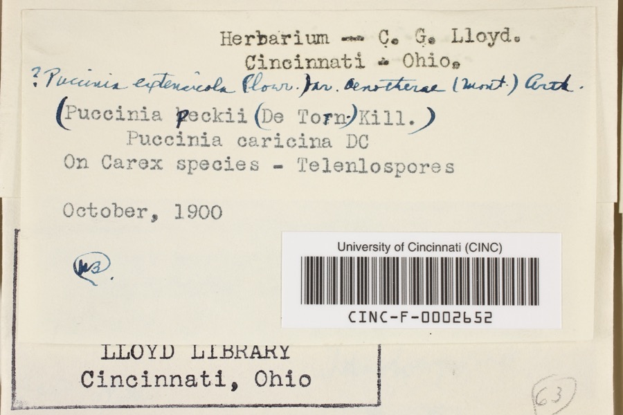
evidence. Museums hold 6,370 specimens
collected within 10 miles of Martin House between 1819 and
1975: 3,638 Fungi, 1,465 Animalia, 857 Plantae, 370 Protozoa, 27 Unrecorded, 13 Chromista. 12 distinct Species records are shown.
Collected by 14753, A. Braun, A. F. Braun and others. Each is a
physical object with a catalogue
number, and each entry opens the museum's record. This is what was
collected and kept, not a survey of what lives here - nothing can be
concluded from a species being absent.
Regional context, not property-specific
evidence. The federal mineral resources record lists
6 workings within 5 miles of Martin House: 3 past producers, 2 unknowns, 1 producer.
1 still produces. What was taken out: Sand and Gravel, Construction, Zirconium, Titanium, Zirconium. Distance is straight-line from the
map coordinates, so a quarry counted here may appear on a neighbouring
settlement's page as well.
Regional context, not property-specific
evidence. The National Weather Service names
Cincinnati, the town this property stands in, in 70 storm reports between 1994 and 2025: 25 thunderstorm wind, 17 hail, 14 flash flood, 7 flood.
The reports record 1 injury. Each account below is quoted exactly as the forecast office
filed it, from the NOAA Storm Events Database, and each date
opens the federal record of that event.
Numerous roads were flooded throughout the Cincinnati area and some basements were flooded. Flooding also caused some damage at Reading High School and Whitaker Elementary School.
Lightning struck a home causing a fire in the attic, which spread toward the second floor before being extinguished. Significant fire and water damage occurred to the home.
High water was reported on several roads in the downtown Cincinnati area and the near West Side. A retaining wall collapsed onto a roadway near the intersection of State Avenue and Ernst Street and a building was flooded on Poplar Street. Also, an apartment basement flooded on Linn Street and one resident needed to be rescued.
14 papers published in this town,
digitised by the Library of Congress and free to read: 0 issues,
0 pages. Every page is searchable, so a name or a street can be
looked for directly in what the town printed about itself at the time.
No historic map-sheet match is published
for this property yet. That does not mean no map exists. This record needs
a coordinate-quality review before it can be joined to a sheet boundary.
Browse the county's mapped places while that work is
pending.
From the nomination file
4,378 words on record
When this property was proposed for the
National Register, someone wrote the case for it: what the building is,
and why it matters. That document is a federal record in the public domain.
It is quoted below word for word, never summarised. The text was read off the scanned case file by machine, so the
occasional stray character is the recogniser's and the 1970s
typewriter's.
Description of the property
The Martin House consists of an original residence, built c. 1847-1852, composed of two beveled glass panels with beveled glass sidelights and transo table, cellar windows. One of the building additions is a kitchen, which is attached to the Door, and window, interior trim is fully detailed with six inch wide CONDITION MOVED DETERIORATED DATE XALTERED UNALTERED the exterior composition. XEXCELLENT lustrous beauty. The four original units have ornamental iron surrounds which are in remark- of the added rooms have fireplaces with well-detailed casings and mantels. influence.A fairly generous entrance hall separates two parlors on the first well proportioned entablature with corner supported by paired brackets. and circular window.
The overall cornice treatment is molded, supported by The later building additions project to the north of the main building paired and individual brackets and form a return under all gabled ends. The Delicate supports further accentuate the portico.The entrance treatment is the kitchen and the original house and the rear shed-roofed segment complete The side elevations on the east and west are quite simple with no fenes- isreinforced bya heavy round-topped stair rail supported by turned spindle a variety of species from poplar to walnut.
The four original rooms and one CHECK ONE taller on the first floor than on the second.Because of deterioration these paneled.The original windows were six over six wood mortised double hung, stair, carried the only probable north window in the original house. This has The gable roof is pierced by a center gable with 18 inch molded cornice ably good condition.They have recently been polished and laquered toa The wall treatment is common bond and of red brick with a rassed water- main roof hasa 7/l2 pitch which produces alow gable roofline.
the few remaining houses of its style in the area. Guardian Angels Parish was located directly across the street and the 1400-1499 SIGNIFICANCE 1700-1799 ART ECONOMICS THEATER AGRICULTURE PERIOD EDUCATION ARCHEOLOGY-HISTORIC POLITICS/GOVERNMENT SCIENCE PREHISTORIC MUSIC XARCHITECTURE PHILOSOPHY _COMMUNICATIONS COMMERCE _TRANSPORTATION request of Archbishop Karl McNicholas High School.McNicholas Ezekiel Rigdon.
The Rigdon's owned a ninety-eight acre farm that adjoined the was the first and remains to this day the only Catholic coeducational inter- original beauty and furnish it accordingly.Work on the house was finally -CONSERVATION LITERATURE The house was built on property which belonged to Mrs.Martin's father, elements.The house is a good example of Transitional architecture and is one Mrs. Sallie Martin lived here for three years after the death of her - ENGINEERING started in May,1977,and completed in November of the same year. INVENTION Sisters used the house and a frame house behind it asa school building until _SCULPTURE _RELIGION -1500-1599 _1900- structed between 1951 and 1970. -_1600-1699 COMMUNITY PLANNING The Martin House, built c. 1847-1852, by John C.
Martin, is significant among others the Columbia School, the rairview school and the Mt. Auburn Guardian Angels maintained its own school. Later, the Sisters used the Martin MILITARY ARCHEOLOGY-PREHISTORIC present day Mt.Washington Presbyterian Church now stands.A narrow road that divided the two parcels of property was among the most important roads in the husband and following her death, the property was sold to H. E. and Charolotte players did not have a locker room so the Martin House was used for that parochial high school in the city.The remainder of the buildings were con- for the Cincinnati Public Schools from 1891-1898,designed Corbly Road just east of Eastern Hills School. JNDUSTRY House as a convent and then as a novitiate.
September 20,1890,for the sum of fifty-seven hundred dollars.Mr.
Quoted from the National Register nomination
for reference 79001859, 27 pages, held by the National Archives in Record
Group 79. See the
catalogue record.
Listed places nearby
6 within 8 miles
Other National Register properties close
enough to walk or drive between, ordered by distance from this one. Both
positions come from the same geocoding pass that matched these properties
to their map sheets.
Listing record. National Park Service National Register of Historic Places, listed-properties dataset, current to 2026-05-22.
Map join. Address geocoded through the United States Census geocoder, then tested against the published boundary of every sheet in the USGS Historical Topographic Map Collection.
How this page is made. Listing fields come from federal records; map-sheet coverage is a labelled coordinate-to-boundary calculation, not a source-field claim.
Specimens. Global Biodiversity Information Facility (GBIF), https://www.gbif.org/. Only records licensed CC0 or CC BY are used. Records licensed CC BY-NC are excluded because this site carries advertising. Images are checked individually and any whose licence is non-commercial, no-derivatives or unreadable is refused.
Mines and quarries. USGS Mineral Resources Data System (MRDS) https://mrdata.usgs.gov/mrds/ A work of the United States government, no copyright under 17 U.S.C. 105.
Storms. NOAA National Centers for Environmental Information, Storm Events Database https://www.ncei.noaa.gov/stormevents/ A work of the United States government, no copyright under 17 U.S.C. 105. Narratives are quoted verbatim from the National Weather Service report and are not edited or summarised.
 Block
Block