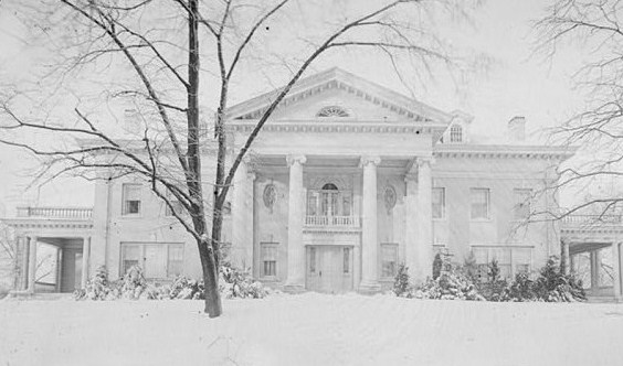
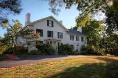
Photograph by Glass negatives from the Papers of Wilbur and Orville Wright, Public domain. Via
Wikimedia Commons.
Hawthorn Hill
A National Historic Landmark. Listed on the National Register of Historic Places in
1974. A historic map-sheet match is not published yet. The record needs a coordinate-quality review before it can be joined to a sheet boundary.
From the record
“Hawthorn Hill is the house that served as the post-1914 home of Orville, Milton and Katharine Wright. Located in Oakwood, Ohio, Wilbur and Orville Wright intended for it to be their joint home, but Wilbur died in 1912, before the home's 1914 completion.”
Wikipedia article Hawthorn Hill, CC BY-SA 4.0.
one of 117 National Register listings in Montgomery County · listed in 1974 · category: Building · one of 4 National Historic Landmarks in Montgomery County.
National Register reference number.74001585- the number the National Park Service assigned this property when it was listed, and the key its nomination file is catalogued under at the National Archives.
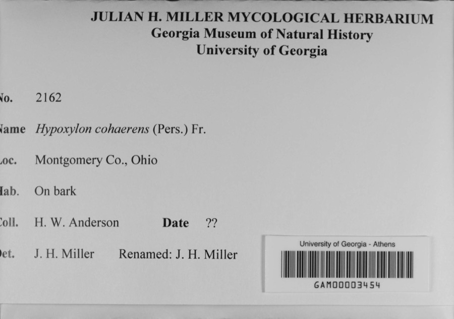
Specimens collected near this property
12 of 616 shown
Regional context, not property-specific
evidence. Museums hold 616 specimens
collected within 10 miles of Hawthorn Hill between 1836 and
1975: 463 Animalia, 88 Plantae, 56 Fungi, 4 Protozoa, 4 Chromista, 1 Unrecorded. 12 distinct Species records are shown.
Collected by A JOHN, A JOHN AND W E DUELLMAN, A. E. Foeerste and others. Each is a
physical object with a catalogue
number, and each entry opens the museum's record. This is what was
collected and kept, not a survey of what lives here - nothing can be
concluded from a species being absent.
Regional context, not property-specific
evidence. The federal mineral resources record lists
18 workings within 5 miles of Hawthorn Hill: 12 past producers, 6 producers.
6 still produce. What was taken out: Sand and Gravel, Construction. Distance is straight-line from the
map coordinates, so a quarry counted here may appear on a neighbouring
settlement's page as well.
Regional context, not property-specific
evidence. The National Weather Service names
Oakwood, the town this property stands in, in 10 storm reports between 2002 and 2025: 6 thunderstorm wind, 3 flood, 1 hail.
No death or injury is recorded in these reports. Each account below is quoted exactly as the forecast office
filed it, from the NOAA Storm Events Database, and each date
opens the federal record of that event.
An approximately 4.5 mile swath of intermittent wind damage, mainly to trees, was surveyed. In the Oakwood area, damage was broad and sporadic in nature, centered on Forrer Boulevard but extending several blocks north and south of the boulevard, over a half mile wide at times. Tree damage in this area was mostly comprised of small and large limb breaks, but a few uprooted trees were noted. Tree damage was not determined to be convergent or to have a particularly strong cross-path component when taken in sum, and pointed more to being non-tornadic in nature.||Gaps of more consistent wind damage were evident before another area of more concentrated wind damage in Kettering along Aragon Avenue and Vale Drive, including an apartment complex which had several trees heavily damaged. Like with the Oakwood area damage, little evidence of a concentrated tornadic circulation existed in the tree damage, which again consisted of large broken limbs and a couple uprooted trees.
A tree was downed on Shroyer Road and Wonderly Avenue and another was downed on a car near the intersection of Oakdale Avenue and White Oak Drive due to thunderstorm winds.
No historic map-sheet match is published
for this property yet. That does not mean no map exists. This record needs
a coordinate-quality review before it can be joined to a sheet boundary.
Browse the county's mapped places while that work is
pending.
From the nomination file
3,613 words on record
When this property was proposed for the
National Register, someone wrote the case for it: what the building is,
and why it matters. That document is a federal record in the public domain.
It is quoted below word for word, never summarised. The text was read off the scanned case file by machine, so the
occasional stray character is the recogniser's and the 1970s
typewriter's.
Description of the property
large white house of rectangular plan is located on a hilltop on a Moved doorway.The east and west sides feature one-story porches with bal- The Dayton architectural firm of Schenk and Fair with sidelights and a fanlight above.This door has pilasters to ends of the portico.There are oval windows on either side of the seventeen acre estate.T Good
Statement of significance
lifetime of work in aeronautics.It was while he was living at Hawthorne Hill that Orville constructed a wind tunnel which was an The Company uses the house asa guest house for international visitors Landscape December 17,1903 with the first successful flight of an airplane. Hawthorn Hill was purchased in February,1912 by Orville and Wilbur Industry Hawthorne Hill is significant asa typical example of the large Political begun. The house was completed in 1914 and Orville lived there Art Wright.They intended it to be the site of their future home but The National Cash Register Company bought the property soon after Wright Brothers' boyhood home was located.The property for NATIONAI Wilbur died on May 30,1912 before construction on the house was
Quoted from the National Register nomination
for reference 74001585, 18 pages, held by the National Archives in Record
Group 79. See the
catalogue record.
Listed places nearby
6 within 8 miles
Other National Register properties close
enough to walk or drive between, ordered by distance from this one. Both
positions come from the same geocoding pass that matched these properties
to their map sheets.
Listing record. National Park Service National Register of Historic Places, listed-properties dataset, current to 2026-05-22.
Map join. Address geocoded through the United States Census geocoder, then tested against the published boundary of every sheet in the USGS Historical Topographic Map Collection.
How this page is made. Listing fields come from federal records; map-sheet coverage is a labelled coordinate-to-boundary calculation, not a source-field claim.
Specimens. Global Biodiversity Information Facility (GBIF), https://www.gbif.org/. Only records licensed CC0 or CC BY are used. Records licensed CC BY-NC are excluded because this site carries advertising. Images are checked individually and any whose licence is non-commercial, no-derivatives or unreadable is refused.
Mines and quarries. USGS Mineral Resources Data System (MRDS) https://mrdata.usgs.gov/mrds/ A work of the United States government, no copyright under 17 U.S.C. 105.
Storms. NOAA National Centers for Environmental Information, Storm Events Database https://www.ncei.noaa.gov/stormevents/ A work of the United States government, no copyright under 17 U.S.C. 105. Narratives are quoted verbatim from the National Weather Service report and are not edited or summarised.
 Block
Block