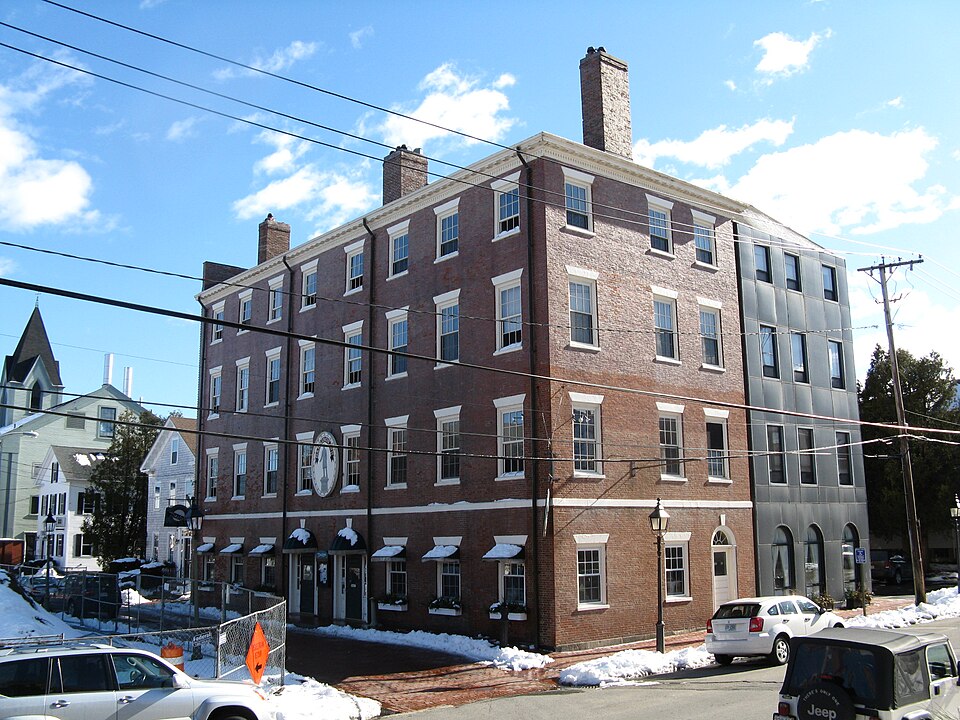
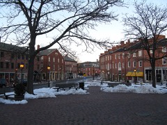
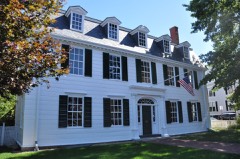
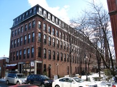
Built in 1800 in the Federal architecture. Listed on the National Register of Historic Places in
1975. A historic map-sheet match is not published yet. The record needs a coordinate-quality review before it can be joined to a sheet boundary.
From the record
“The Brown Square House, now the Garrison Inn, is a historic pair of rowhouses at 11 Brown Square in Newburyport, Massachusetts. Built in 1809-10, they form the largest surviving brick building from the Federal period in the city.”
Wikipedia article Brown Square House, CC BY-SA 4.0.
one of 350 National Register listings in Essex County · listed in 1975 · category: Building · built in 1800, Federal architecture, by Moses Brown · one of 2 National Historic Landmarks in Essex County.
National Register reference number.75000284- the number the National Park Service assigned this property when it was listed, and the key its nomination file is catalogued under at the National Archives.
Fires near this property
79 since 2007
Regional context, not property-specific
evidence. The
federal wildfire occurrence database
lists 79 fires within 5 miles of Brown Square House between
2007 and 2020, burning about 33 acres in total. None started naturally. 9 were recorded as arson.
Distance is straight-line from the map coordinates, so a fire counted
here may appear on a neighbouring settlement's page as well.
Reported cause
Fires
Debris and open burning
18
Missing data/not specified/undetermined
10
Equipment and vehicle use
10
Arson/incendiarism
9
Recreation and ceremony
8
Fireworks
7
Power generation/transmission/distribution
6
Smoking
5
Misuse of fire by a minor
4
Railroad operations and maintenance
1
Other causes
1
The most recent of
them, most recent first, with the day each was reported and the service
that recorded it.
Regional context, not property-specific
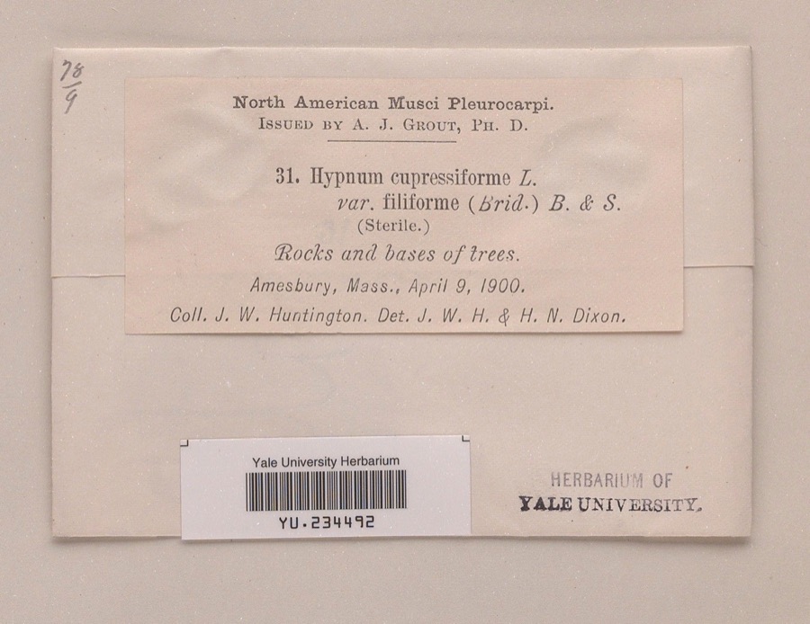
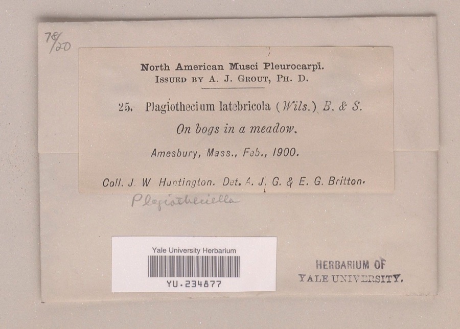
evidence. Museums hold 2,352 specimens
collected within 10 miles of Brown Square House between 1800 and
1975: 1,402 Plantae, 660 Animalia, 190 Fungi, 88 Chromista, 6 Unrecorded, 4 Protozoa, 2 Bacteria. 12 distinct Species records are shown.
Collected by A A Eaton, A Brown, A. A. Eaton and others. Each is a
physical object with a catalogue
number, and each entry opens the museum's record. This is what was
collected and kept, not a survey of what lives here - nothing can be
concluded from a species being absent.
Regional context, not property-specific
evidence. The federal mineral resources record lists
4 workings within 5 miles of Brown Square House: 4 past producers.
None of them still produces. What was taken out: Lead, Sand and Gravel, Construction, Silver, Zinc, Copper, Gold, Silver. Distance is straight-line from the
map coordinates, so a quarry counted here may appear on a neighbouring
settlement's page as well.
Regional context, not property-specific
evidence. The National Weather Service names
Newburyport, the town this property stands in, in 13 storm reports between 1997 and 2023: 8 thunderstorm wind, 3 hail, 1 heavy rain, 1 lightning.
No death or injury is recorded in these reports. Each account below is quoted exactly as the forecast office
filed it, from the NOAA Storm Events Database, and each date
opens the federal record of that event.
The Weatherflow reporting station at Plum Island recorded a wind gust of 69 mph. Wires were downed onto Sunset Drive in Newburyport from these thunderstorm winds.
1 paper published in this town,
digitised by the Library of Congress and free to read: 0 issues,
0 pages. Every page is searchable, so a name or a street can be
looked for directly in what the town printed about itself at the time.
No historic map-sheet match is published
for this property yet. That does not mean no map exists. This record needs
a coordinate-quality review before it can be joined to a sheet boundary.
Browse the county's mapped places while that work is
pending.
From the nomination file
2,355 words on record
When this property was proposed for the
National Register, someone wrote the case for it: what the building is,
and why it matters. That document is a federal record in the public domain.
It is quoted below word for word, never summarised. The text was read off the scanned case file by machine, so the
occasional stray character is the recogniser's and the 1970s
typewriter's.
Description of the property
The buildings comprising the Garrison Inn in Newburyport, Massachusetts, were originally constructed in 1801-1810 as two mirror-image attached town houses for Moses Brown and his brother. The initial intention was for an entire terrace of these houses facing what became Brown Square, a long rectangular green just off State Street. The scheme was apparently far too grand and urban even for one of the major eastern ports and only these two dwellings, which would have tied down one end of the row, were completed. The appearance, today, is of one large and imposing brick structure. The townhouses, conceived on the grand scale of the early Republic, were four-story brick structures on a granite foundation completely below ground. The brick was laid in flemish bond.
The two "I" structures combine to form a "T" in plan, the top of which represents the principal facade and faces due north. It has eight windows across it on each floor, four for each of the two houses. The fan-lit main entries, with double doors and side lights, replace the two innermost windows on the first floor. All windows are 6/6 with brown sandstone sills and skew-back lintels, with the exception of the fourth floor where the windows are 6/3. A string course of brown sandstone runs the perimeter of the entire building at the second floor. The west elevation of the main block, facing Pitcomb Street, is three bays wide; the two northern windows flank a chimney flush with the wall. A single fan-lit door, now closed, replaces the southern-most window on the first floor.
/ARCHITECT Moses Brown, builder STATEMENT OF SIGNIFICANCE The Brown Square House is a four story brick Federal building looking out over Brown Square and built in 1809-1810 by Moses Brown. It was designed to be part of a row of elegant town houses, facing a square given to the town by Moses Brown for the "public enjoyment." For various reasons, including the illness of the contractor and Brown's financial setbacks caused by the fire of 1811 and the War of 1812, the block was not finished, and alternating protruding bricks in the northeast wall were left exposed, waiting for a connecting building. Even so, these two interconnected resi- dences constitute the largest remaining brick building in Newburyport.
Moses Brown was a leading Newburyport merchant and philanthropist and the houses remain as a symbol of his industry and maritime success. Although the structure was built to contain private residences, its long use as a boarding house, hotel and inn has enriched its historical value. Moses Brown's reasons for building the town houses are not certain; possibly they were built as an investment. At the time the houses on Brown Square were built, Brown was already living in a fine house on Dalton Street, one he had coveted from his earliest days as a chaisemaker. In 1813 Brown's newly married daughter and her husband, William B. Bannister, were listed in a town directory as residing in one of the houses.
William Bannister, who was a member of the General Court, first as a Representative, then a Senator, necessarily spent a good deal of his time in Boston, and by 1813 part of the Brown Square House had been converted into shops.
Quoted from the National Register nomination
for reference 75000284, 10 pages, held by the National Archives in Record
Group 79. See the
catalogue record.
Listed places nearby
6 within 8 miles
Other National Register properties close
enough to walk or drive between, ordered by distance from this one. Both
positions come from the same geocoding pass that matched these properties
to their map sheets.
Listing record. National Park Service National Register of Historic Places, listed-properties dataset, current to 2026-05-22.
Map join. Address geocoded through the United States Census geocoder, then tested against the published boundary of every sheet in the USGS Historical Topographic Map Collection.
How this page is made. Listing fields come from federal records; map-sheet coverage is a labelled coordinate-to-boundary calculation, not a source-field claim.
Wildfire. Short, Karen C. 2022. Spatial wildfire occurrence data for the United States, 1992-2020 [FPA_FOD_20221014]. 6th Edition. Fort Collins, CO: Forest Service Research Data Archive. https://doi.org/10.2737/RDS-2013-0009.6 Collected with United States Government funding and usable without additional permissions or fees.
Specimens. Global Biodiversity Information Facility (GBIF), https://www.gbif.org/. Only records licensed CC0 or CC BY are used. Records licensed CC BY-NC are excluded because this site carries advertising. Images are checked individually and any whose licence is non-commercial, no-derivatives or unreadable is refused.
Mines and quarries. USGS Mineral Resources Data System (MRDS) https://mrdata.usgs.gov/mrds/ A work of the United States government, no copyright under 17 U.S.C. 105.
Storms. NOAA National Centers for Environmental Information, Storm Events Database https://www.ncei.noaa.gov/stormevents/ A work of the United States government, no copyright under 17 U.S.C. 105. Narratives are quoted verbatim from the National Weather Service report and are not edited or summarised.
 Block
Block