Listed on the National Register of Historic Places in
1978. A historic map-sheet match is not published yet. The record needs a coordinate-quality review before it can be joined to a sheet boundary.
From the record
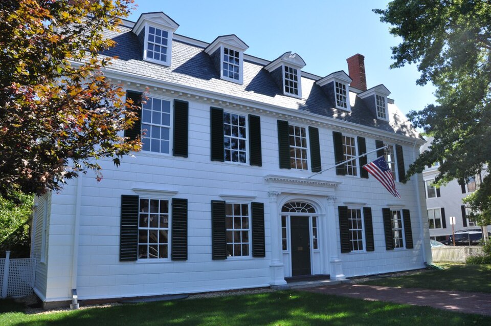
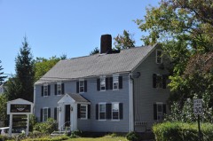
“The Dalton House is a historic colonial house in Newburyport, Massachusetts. The wood-frame house was built c. 1746, and is one of the best preserved Georgian houses in the city.”
Wikipedia article Dalton House (Newburyport, Massachusetts), CC BY-SA 4.0.
one of 350 National Register listings in Essex County · listed in 1978 · category: Building · one of 2 National Historic Landmarks in Essex County.
National Register reference number.78000464- the number the National Park Service assigned this property when it was listed, and the key its nomination file is catalogued under at the National Archives.
Fires near this property
78 since 2007
Regional context, not property-specific
evidence. The
federal wildfire occurrence database
lists 78 fires within 5 miles of Dalton House between
2007 and 2020, burning about 33 acres in total. None started naturally. 9 were recorded as arson.
Distance is straight-line from the map coordinates, so a fire counted
here may appear on a neighbouring settlement's page as well.
Reported cause
Fires
Debris and open burning
18
Missing data/not specified/undetermined
10
Equipment and vehicle use
10
Arson/incendiarism
9
Recreation and ceremony
8
Power generation/transmission/distribution
6
Fireworks
6
Smoking
5
Misuse of fire by a minor
4
Railroad operations and maintenance
1
Other causes
1
The most recent of
them, most recent first, with the day each was reported and the service
that recorded it.
Regional context, not property-specific
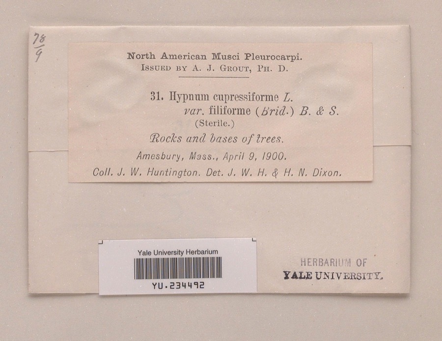
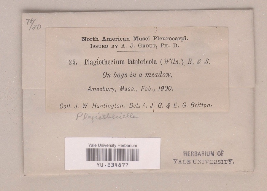
evidence. Museums hold 2,352 specimens
collected within 10 miles of Dalton House between 1800 and
1975: 1,403 Plantae, 658 Animalia, 190 Fungi, 88 Chromista, 7 Unrecorded, 4 Protozoa, 2 Bacteria. 12 distinct Species records are shown.
Collected by A A Eaton, A Brown, A. A. Eaton and others. Each is a
physical object with a catalogue
number, and each entry opens the museum's record. This is what was
collected and kept, not a survey of what lives here - nothing can be
concluded from a species being absent.
Regional context, not property-specific
evidence. The federal mineral resources record lists
4 workings within 5 miles of Dalton House: 4 past producers.
None of them still produces. What was taken out: Lead, Sand and Gravel, Construction, Silver, Zinc, Copper, Gold, Silver. Distance is straight-line from the
map coordinates, so a quarry counted here may appear on a neighbouring
settlement's page as well.
Regional context, not property-specific
evidence. The National Weather Service names
Newburyport, the town this property stands in, in 13 storm reports between 1997 and 2023: 8 thunderstorm wind, 3 hail, 1 heavy rain, 1 lightning.
No death or injury is recorded in these reports. Each account below is quoted exactly as the forecast office
filed it, from the NOAA Storm Events Database, and each date
opens the federal record of that event.
The Weatherflow reporting station at Plum Island recorded a wind gust of 69 mph. Wires were downed onto Sunset Drive in Newburyport from these thunderstorm winds.
1 paper published in this town,
digitised by the Library of Congress and free to read: 0 issues,
0 pages. Every page is searchable, so a name or a street can be
looked for directly in what the town printed about itself at the time.
No historic map-sheet match is published
for this property yet. That does not mean no map exists. This record needs
a coordinate-quality review before it can be joined to a sheet boundary.
Browse the county's mapped places while that work is
pending.
From the nomination file
2,889 words on record
When this property was proposed for the
National Register, someone wrote the case for it: what the building is,
and why it matters. That document is a federal record in the public domain.
It is quoted below word for word, never summarised. The text was read off the scanned case file by machine, so the
occasional stray character is the recogniser's and the 1970s
typewriter's.
Description of the property
CHECK ONE XORIGINAL SITE _MOVED DATE. The Dalton House occupies the northeast corner of State and Garden Streets in the commercial district of Newburyport. Slightly less than one acre, the property is bordered by a white fence with Colonial motif flat sawn balusters and capped posts along State Street and a picket fence with cap rail along Garden Street. Michael Dalton purchased three acres of land from Gideon Bartlett of Amesbury in May of 1746. The parcel, located in what was then Newbury, cost 1600 pounds (old tenor). Michael constructed the present house, a spacious barn and a courtyard sometime during the next two years. The barn was removed and most of the property subdivided in 1883 when Garden Street was laid out as a public way.
The high style Georgian structure was built circa 1747 and retains its original inte- grity of design. It is a three story, L-plan house capped by a gambrel roof. This slate tiled roof has two tall inside end chimneys on the main section of the house with a third chimney at the eastern end of the ell. Fenestration is 6/6 with pro- jecting cornices, plain sills and black louvered shutters. The distinguished Georgian facade looks west over State Street. The facade is rusticated woodblock. The other elevations are clapboarded. The five bay wide facade is dominated by the elaborate center entrance. The six panel wooden door with elliptical fan and sidelights are framed by engaged Corinthian columns on panelled bases and capped by a projecting cornice.
The overhanging roof eaves are ornamented by a modillioned cornice. Five dormers crown the facade in a typically Georgian pattern. The center dormer is headed by a broken pediment; the flanking dormers have triangular pediments.
/ARCHITECT Michael Dalton STATEMENT OF SIGNIFICANCE The Dalton House is significant for its elegant architectural style and for the socially and politically prominent persons associated with it. Situated at the head of State Street in the heart of commercial Newburyport, the house has been a part of town, state and national affairs for over 200 years. Michael Dalton was born in February 1709, the great-grandson of Philemon Dalton who arrived in New England in 1635. Michael left his father's home in Hampton, New Hampshire and came to Newbury to engage in seafaring. He quickly became a master mariner. After his marriage to Mary Little in 1735, he became a merchant and built this house c. 1747.
Dalton was interested in agricultural pursuits and purchased a 200 acre farm in West Newbury as a country estate. This farm was later occupied by his son, Tristram. Michael owned" a wharf and a distillery and was involved in the import/export business. In 1764, Michael deeded the house to Tristram, born in May 1738. Tristram graduated from Harvard in 1755. His portrait now hanging in the east drawing room is believed to have been painted at that time. He was married in 1758 to Ruth Hooper, daughter of a successful Marblehead merchant. Tristram then studied law in Salem and entered business with his father. Upon his father's death, Tristram inherited his large estate.
He was an influential member of numerous town committees, was a delegate to the Provincial Congress, a representative to the state General Court, a speaker of the Massachusetts House, a member of the State Senate, and a delegate to the ratifying convention of 1788 in Massachusetts. He was a classmate of John Adams'. at Harvard and remained a close friend for life.
Quoted from the National Register nomination
for reference 78000464, 18 pages, held by the National Archives in Record
Group 79. See the
catalogue record.
Listed places nearby
6 within 8 miles
Other National Register properties close
enough to walk or drive between, ordered by distance from this one. Both
positions come from the same geocoding pass that matched these properties
to their map sheets.
Listing record. National Park Service National Register of Historic Places, listed-properties dataset, current to 2026-05-22.
Map join. Address geocoded through the United States Census geocoder, then tested against the published boundary of every sheet in the USGS Historical Topographic Map Collection.
How this page is made. Listing fields come from federal records; map-sheet coverage is a labelled coordinate-to-boundary calculation, not a source-field claim.
Wildfire. Short, Karen C. 2022. Spatial wildfire occurrence data for the United States, 1992-2020 [FPA_FOD_20221014]. 6th Edition. Fort Collins, CO: Forest Service Research Data Archive. https://doi.org/10.2737/RDS-2013-0009.6 Collected with United States Government funding and usable without additional permissions or fees.
Specimens. Global Biodiversity Information Facility (GBIF), https://www.gbif.org/. Only records licensed CC0 or CC BY are used. Records licensed CC BY-NC are excluded because this site carries advertising. Images are checked individually and any whose licence is non-commercial, no-derivatives or unreadable is refused.
Mines and quarries. USGS Mineral Resources Data System (MRDS) https://mrdata.usgs.gov/mrds/ A work of the United States government, no copyright under 17 U.S.C. 105.
Storms. NOAA National Centers for Environmental Information, Storm Events Database https://www.ncei.noaa.gov/stormevents/ A work of the United States government, no copyright under 17 U.S.C. 105. Narratives are quoted verbatim from the National Weather Service report and are not edited or summarised.
 Block
Block